
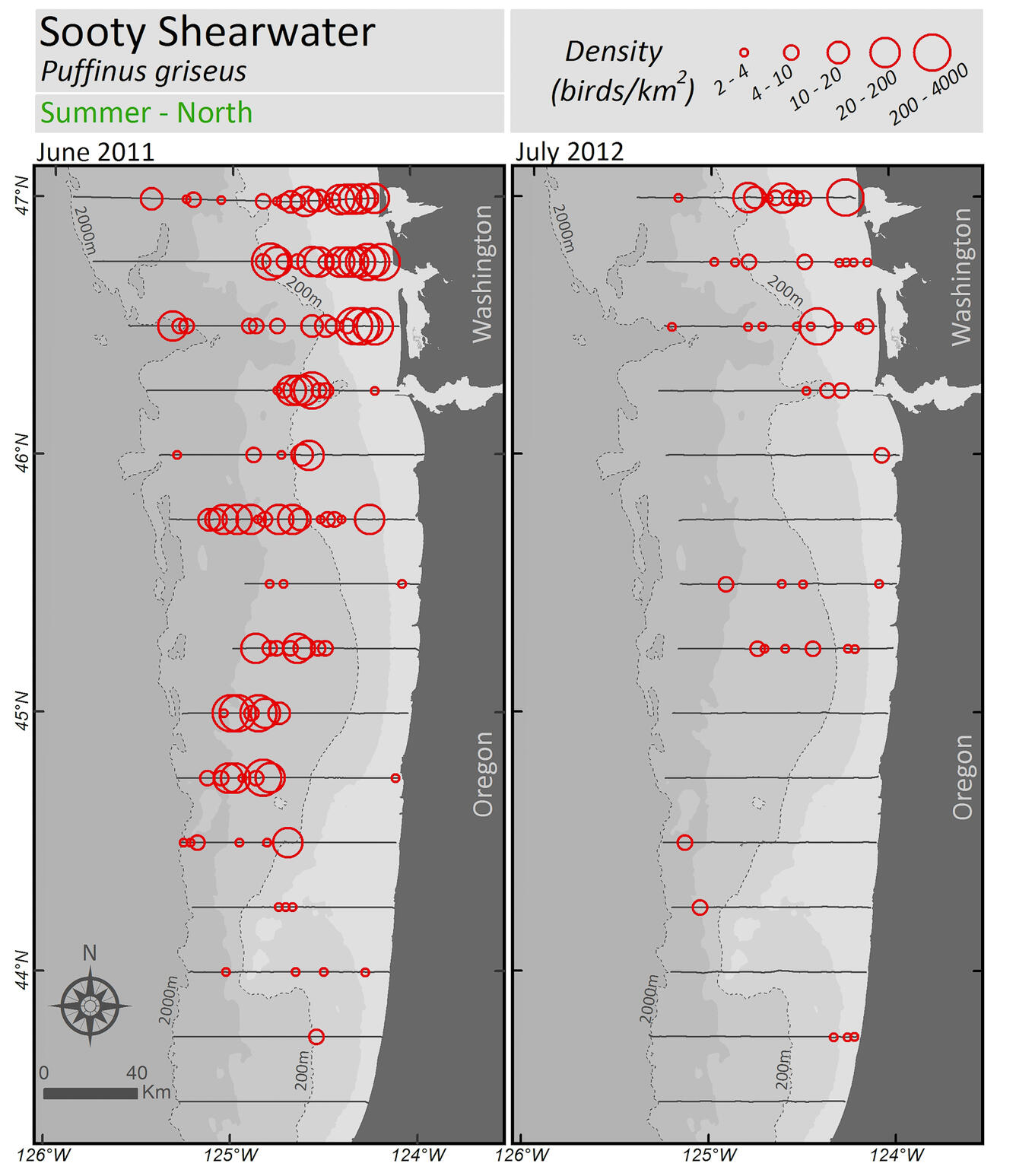
WERC Sooty Shearwater Density map (birds/sq km) Summer - north
Detailed Description
The Pacific Continental Shelf Environmental Assessment (PaCSEA) is an aerial survey project of seabird and marine mammal biodiversity and ocean habitats spanning northern California, Oregon and southern Washington coasts.
Sooty Shearwater (Puffinus griseus) Density map (birds/sq km) Summer - north
Project contacts: Josh Adams josh_adams@usgs.gov, John Takekawa john_takekawa@usgs.gov, Jonathan Felis jfelis@usgs.gov
Partner partners: National Oceanic and Atmospheric Administration and U.S. Bureau of Ocean Energy Management