
Learn more about USGS flood activities related to the 2016 Southern Spring Floods. These floods were caused by significant amounts of tropical moisture that was funneled through a narrow zone across East Texas, Louisiana, Arkansas, and Mississippi, creating severe flood conditions.

March 2016 Louisiana Flood Event Viewer: USGS technicians and hydrologists, in partnership with FEMA, have collected hundreds of high-water marks and produce flood inundation maps. Click the image to enter the USGS Flood Event Viewer for this event.
March Rainfall: Large areas across the southern midwest experienced cumulative rainfall amounts of 10 to 20 inches or more.
Regional Flooding: Flash floods and longer-duration flooding quickly spread through large portions of East Texas, Louisiana, Mississippi, and Southern Arkansas.
FEMA disaster declaration: Incident period: March 8, 2016. Major Disaster Declaration declared on March 13, 2016.
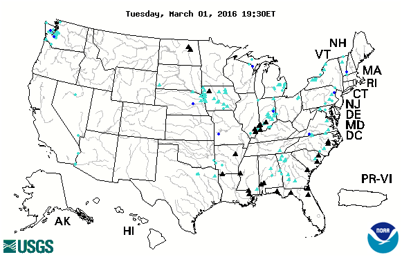
Visit the National Water Prediction Service website for more precipitation maps and river forecasts.
Check out the publication Identifying and Preserving High-Water Mark Data to learn more about how USGS personnel collect high-water data.
Visit the USGS National Water Dashboard for current flood conditions and other tools to explore flood and drought.
USGS Activities in the News:
- USGS Tracks Louisiana Floods to Help Guide Emergency Relief (3/24/2016) U.S. Geological Survey water science specialists are in the field assisting flood relief work in Louisiana by documenting the extent of historic, long-lasting flooding this month.
- KSLA News: Area waterways pushed to flood stages, still rising.
- WDAM News: Forrest County prepares for rising rivers, floods. See how USGS flood inundation mapping products help residents prepare for floods.
Below are other science projects associated with this flood event.

Historical Flooding

September 2016 Northern Plains Floods

August 2016 Louisiana Floods

January 2016 Noreaster

2015/2016 Winter Floods

Hurricane Matthew: Flood Resources and Tools
Learn more about USGS flood activities related to the 2016 Southern Spring Floods. These floods were caused by significant amounts of tropical moisture that was funneled through a narrow zone across East Texas, Louisiana, Arkansas, and Mississippi, creating severe flood conditions.
March 2016 Louisiana Flood Event Viewer: USGS technicians and hydrologists, in partnership with FEMA, have collected hundreds of high-water marks and produce flood inundation maps. Click the image to enter the USGS Flood Event Viewer for this event.
March Rainfall: Large areas across the southern midwest experienced cumulative rainfall amounts of 10 to 20 inches or more.
Regional Flooding: Flash floods and longer-duration flooding quickly spread through large portions of East Texas, Louisiana, Mississippi, and Southern Arkansas.
FEMA disaster declaration: Incident period: March 8, 2016. Major Disaster Declaration declared on March 13, 2016.
Visit the National Water Prediction Service website for more precipitation maps and river forecasts.
Check out the publication Identifying and Preserving High-Water Mark Data to learn more about how USGS personnel collect high-water data.
Visit the USGS National Water Dashboard for current flood conditions and other tools to explore flood and drought.
USGS Activities in the News:
- USGS Tracks Louisiana Floods to Help Guide Emergency Relief (3/24/2016) U.S. Geological Survey water science specialists are in the field assisting flood relief work in Louisiana by documenting the extent of historic, long-lasting flooding this month.
- KSLA News: Area waterways pushed to flood stages, still rising.
- WDAM News: Forrest County prepares for rising rivers, floods. See how USGS flood inundation mapping products help residents prepare for floods.
Below are other science projects associated with this flood event.
Historical Flooding
September 2016 Northern Plains Floods
August 2016 Louisiana Floods
January 2016 Noreaster
2015/2016 Winter Floods