U.S. flag

An official website of the United States government

Images

Images intro.
Filter Total Items: 60
Walking Stick at Barton Fen – Ozark Trail
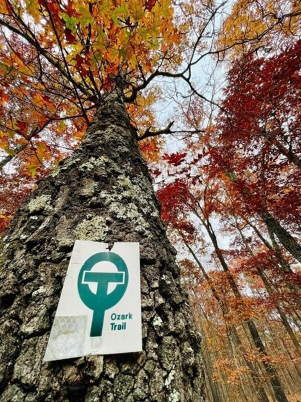
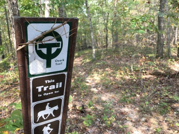
NDT Summer 2023 - Walking Stick at Barton Fen – Ozark Trail

 Walking Stick (insect) on an Ozark Trail sign at Barton Fen, Mark Twain National Forest, Missouri. The sign shows the trail is open to hikers and horseback riding. In the background, there is a trail winding through the forest.

 Walking Stick (insect) on an Ozark Trail sign at Barton Fen, Mark Twain National Forest, Missouri. The sign shows the trail is open to hikers and horseback riding. In the background, there is a trail winding through the forest.

2022 SAG Award Recipients-Fall 2022

A large group of people on-stage, smiling, with thumbs up. Sign on the stages says, “Welcome to the 2022 Esri Awards Ceremony.” This is a group picture of the Special Achievement in GIS winners from 2022.

A large group of people on-stage, smiling, with thumbs up. Sign on the stages says, “Welcome to the 2022 Esri Awards Ceremony.” This is a group picture of the Special Achievement in GIS winners from 2022.

ParkServe mapping platform
ParkServe2
ParkServe2
ParkServe2

ParkServe mapping application screenshot showing Dallas, TX as an example. Parks, their 10-minute walk services areas, and the Priority areas for new parks are shown on the map. The 10-minute walk statistics for Dallas are shown on the right. 

ParkServe mapping application screenshot showing Dallas, TX as an example. Parks, their 10-minute walk services areas, and the Priority areas for new parks are shown on the map. The 10-minute walk statistics for Dallas are shown on the right. 

Data and tools website

USGS Trail Data Portal is a web application that will help streamline trail data submission and integration into the USGS nationwide trail dataset. 

USGS Trail Data Portal is a web application that will help streamline trail data submission and integration into the USGS nationwide trail dataset. 

Endpoints2
Endpoints with border

The image shows the National Map Service Endpoints website with Theme Overlays and Web Feature Services highlighted.

The image shows the National Map Service Endpoints website with Theme Overlays and Web Feature Services highlighted.

Partnership for National Trail System will be holding a live webinar
Trails Mgmt Webinar.png

Partnership for National Trail System will be holding a live webinar called “A Comprehensive Approach to Inform User Management on Trails and Public Lands”.

Partnership for National Trail System will be holding a live webinar called “A Comprehensive Approach to Inform User Management on Trails and Public Lands”.

Trail Data Portal – Data Submission
Trail Data Portal – Data Submission-Fall 2022

The image shows a metadata and schema mapping wizards of the Trail Data Portal data submission pages.

Trail Data Portal
Trail Data Portal.jpg

The image shows a metadata and schema mapping wizards of the Trail Data Portal data submission pages.

The image shows a metadata and schema mapping wizards of the Trail Data Portal data submission pages.

State Trail Contributions to USGS Database

A national map displays distribution of USGS trails data received from state sources.

Disc storage stack
Disc Storage Stack.png

An image of a CD, DVD or disc storage stack representing the USGS Trails Dataset.

An image of a CD, DVD or disc storage stack representing the USGS Trails Dataset.

Training NDT2
NDT2 training.png
NDT2 training.png
NDT2 training.png

The image above shows an example of what a project might look like. There are a series of existing trails shown by black dashed lines on a topographic basemap. Protected Lands of the US are highlighted by color.

The image above shows an example of what a project might look like. There are a series of existing trails shown by black dashed lines on a topographic basemap. Protected Lands of the US are highlighted by color.

ParkServe mapping platform

Planners and community members can use the ParkServe mapping platform to influence decisions about parks.

Planners and community members can use the ParkServe mapping platform to influence decisions about parks.

State Collaborators
State Collaborators
State Collaborators
State Collaborators

Current U.S. State Collaborators of the count of trails shown in a table - from 2021

Current U.S. State Collaborators of the count of trails shown in a table - from 2021

ParkServe® mapping platform
ParkServe.png
ParkServe.png
ParkServe.png

ParkServe® mapping platform uses USGS trails dataset as one of their data sources. 

ParkServe® mapping platform uses USGS trails dataset as one of their data sources. 

Data and Tools
Data and Tools.png
Data and Tools.png
Data and Tools.png

The image shows the National Digital Trails Website with Data and Tools section highlighted.

The image shows the National Digital Trails Website with Data and Tools section highlighted.

Status of the Nationwide Digital Trails Dataset
State trail contributors to USGS Nationwide Trails Database, large, cropped

The image above shows nationwide distribution of USGS trails data received from over 36 state agencies. The trails that are in the USGS dataset are displayed in yellow.  States that have contributed trails data are displayed in black and states with no trails data in the USGS dataset are displayed in gray.

The image above shows nationwide distribution of USGS trails data received from over 36 state agencies. The trails that are in the USGS dataset are displayed in yellow.  States that have contributed trails data are displayed in black and states with no trails data in the USGS dataset are displayed in gray.

Cross Country Ski Trail in Granby, Colorado (more information in description)
Granby Cross-Country Trail, by T. Dimascio (NDT Photo of the Month - March 2021)

A photograph taking while looking down the Granby Cross-Country Trail in Colorado. The sun shines bright on the snow-covered ground of a hill leading into tall pine trees. The trail itself is packed snow wide enough for a snow vehicle. Snow-capped mountains line the horizon against a blue sky with a few white clouds.

A photograph taking while looking down the Granby Cross-Country Trail in Colorado. The sun shines bright on the snow-covered ground of a hill leading into tall pine trees. The trail itself is packed snow wide enough for a snow vehicle. Snow-capped mountains line the horizon against a blue sky with a few white clouds.

Fall Along the Ozark Trail in Missouri
NDT Summer 2023 - Fall Along the Ozark Trail in Missouri

Looking up into a tall tree showing fall colors of red, orange, green, and yellow. Fall along the Middle Fork-John Roth Memorial section of the Ozark Trail in Mark Twain National Forest

Looking up into a tall tree showing fall colors of red, orange, green, and yellow. Fall along the Middle Fork-John Roth Memorial section of the Ozark Trail in Mark Twain National Forest

Nederland trail
Nederland trail
Nederland trail
Nederland trail

Easy loop trail near Nederland, Colorado taking you through several Aspen groves.

Easy loop trail near Nederland, Colorado taking you through several Aspen groves.

NDTc - Trail in the Indian Peaks Wilderness area located in Colorado

A scenic view of the Indian Peaks Wilderness Area located in Colorado. The hike begins at the Long Lake Trail-head and guides to Lake Isabelle at 10,868 ft  (3313 m).

NDTc - Winter Solace

A popular hiking trail on the North side of the Anaconda valley in Montana is blanketed in snow.

A popular hiking trail on the North side of the Anaconda valley in Montana is blanketed in snow.

Was this page helpful?