Search Earthquake Catalog
online search by time window, area, magnitude, and more
online search by time window, area, magnitude, and more
2025 USGS and ANSS Earthquake Monitoring Report
A geonarrative exploring domestic and global earthquake monitoring efforts in 2025
A geonarrative exploring domestic and global earthquake monitoring efforts in 2025
Significant Earthquakes, Past 30 days
Significant Earthquakes, Past 30 days
7.3
58 km WSW of Puerto Madero, Mexico
2026-07-17 14:48:40 (UTC)
Pager Alert Level: Yellow
MMI: VII (Very Strong Shaking)
18.6 km
6.2
32 km WSW of Sarangani, Philippines
2026-07-14 15:49:39 (UTC)
Pager Alert Level: Green
MMI: VI (Strong Shaking)
46.4 km
4.3
18 km WSW of Johannesburg, CA
2026-07-13 16:40:55 (UTC)
Pager Alert Level: Green
MMI: V (Moderate Shaking)
7.6 km
6.3
10.0 km
6.4
191 km SE of Lorengau, Papua New Guinea
2026-07-13 08:53:28 (UTC)
Pager Alert Level: Green
MMI: IV (Light Shaking)
10.0 km
4.1
2 km ESE of Frazier Park, CA
2026-07-12 10:38:05 (UTC)
Pager Alert Level: Green
MMI: IV (Light Shaking)
13.1 km
6.4
South Sandwich Islands region
2026-07-11 10:26:43 (UTC)
Pager Alert Level: Green
MMI: IV (Light Shaking)
26.0 km
3.8
2 km E of Oak Harbor, Washington
2026-07-02 06:35:48 (UTC)
Pager Alert Level: Gray (Null)
MMI: III (Weak Shaking)
25.4 km
5.3
272 km SSE of Dunhuang, China
2026-06-30 23:44:55 (UTC)
Pager Alert Level: Yellow
MMI: VI (Strong Shaking)
10.0 km
4.2
27 km WNW of Hope, Alaska
2026-06-27 05:25:52 (UTC)
Pager Alert Level: Green
MMI: IV (Light Shaking)
47.9 km
6.5
34 km WSW of Sarangani, Philippines
2026-06-26 11:34:41 (UTC)
Pager Alert Level: Green
MMI: VII (Very Strong Shaking)
42.0 km
6.9
33 km ENE of Noda, Japan
2026-06-24 22:30:13 (UTC)
Pager Alert Level: Yellow
MMI: VII (Very Strong Shaking)
34.0 km
7.5
20 km ESE of Yumare, Venezuela
2026-06-24 22:05:12 (UTC)
Pager Alert Level: Red
MMI: IX (Violent Shaking)
10.0 km
7.2
21 km ENE of San Felipe, Venezuela
2026-06-24 22:04:34 (UTC)
Pager Alert Level: Red
MMI: IX (Violent Shaking)
27.6 km
Earthquake Hazards Program
The USGS monitors and reports on earthquakes, assesses earthquake impacts and hazards, and conducts targeted research on the causes and effects of earthquakes. We undertake these activities as part of the larger National Earthquake Hazards Reduction Program (NEHRP), a four-agency partnership established by Congress.
Latest Earthquakes
Latest Earthquakes

Latest earthquakes map and list (past 24 hours, M2.5+) from the ANSS (Advanced National Seismic System).
Search Earthquake Catalog
Search Earthquake Catalog

Find an earthquake or a list of earthquakes by time window, magnitude, area, and more, and choose the output format - map and list, CVS, and others.
News
The Loneliest Seismometers on Earth
The Loneliest Seismometers on Earth
Updates for ShakeAlert False Alert for M5.9 Earthquake near Carson City, NV (Dec. 2025)
Updates for ShakeAlert False Alert for M5.9 Earthquake near Carson City, NV (Dec. 2025)
USGS releases aftershock forecast for M8.8 Russian Kamchatka Peninsula Earthquake
USGS releases aftershock forecast for M8.8 Russian Kamchatka Peninsula Earthquake
Publications
The digital archivist: Automating legacy macroseismic data processing using large language models The digital archivist: Automating legacy macroseismic data processing using large language models
Macroseismic data are a key resource to investigate shaking and damage from preinstrumental and early instrumental eras. However, data are often stored as inconsistently formatted reports describing observed shaking and damage, making manually parsing and interpreting accounts labor‐intensive. We introduce a novel workflow using Google’s Gemini 2.5 Pro large language model (LLM) to...
Cascadia Subduction Zone science: Call for the next generation community seismic velocity model Cascadia Subduction Zone science: Call for the next generation community seismic velocity model
The Cascadia subduction zone (CSZ) hosts major seismic and tsunami hazards, yet key questions persist about the relationship between margin structure, fluid distribution, episodic tremor and slip, shallow megathrust behavior, shaking and tsunamigenesis, and the resulting hazard estimates. Addressing these problems requires an empirically grounded, three‐dimensional seismic velocity model...
A ground-motion model derived using a generalized mean rupture distance for large slab interface earthquakes A ground-motion model derived using a generalized mean rupture distance for large slab interface earthquakes
Source–station distance is a central input to ground‐motion models (GMMs) for predicting seismic shaking. GMM development uses distance metrics including the Joyner–Boore distance, which is the shortest distance from an observation point to the surface projection of the earthquake rupture, and Rrup the shortest distance to the rupture in three dimensions. Thompson and Baltay (2018)...
Science
Challenges and Advances in Stable Continental Region Paleoseismology
Thursday and Friday, September 17-18, 2026 8:30 am - 4:30 pm CDT A Hybrid Event at The University of Memphis FedEx Institute of Technology

Geologic Mapping for Landscape Resiliency in California, Oregon, and Washington
This project uses geologic and geomorphic mapping in the context of societally relevant problems in the Earth’s critical zone. Leveraging interdisciplinary research ties and interagency collaborations, it utilizes remote sensing data, corroborated with field observations, to determine i) the spatial distribution of geomorphic processes and ages of Quaternary deposits in the context of active...
By
Earthquake Hazards Program, Landslide Hazards Program, National Cooperative Geologic Mapping Program, Earthquake Science Center, Geologic Hazards Science Center, Geology, Minerals, Energy, and Geophysics Science Center, Geosciences and Environmental Change Science Center, Pacific Coastal and Marine Science Center, Big Sur Landslides

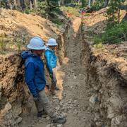
Mapping the grid: The United States Magnetotelluric Array
The United States has been mapped from space to the ground across its surface; however never from the perspective of the planet’s own electrical heartbeat. Over nearly two decades, the United States Magnetotelluric Array quietly marched across the country, station by station, building the first-ever electrical portrait of the crust and upper mantle beneath the contiguous U.S. An ambitious, multi...