Geomagnetism Program
Geomagnetism Program
We monitor the Earth's magnetic field. Using ground-based observatories, we provide continuous records of magnetic field variations; disseminate magnetic data to various governmental, academic, and private institutions; and conduct research into the nature of geomagnetic variations for purposes of scientific understanding and hazard mitigation.
Magnetic Disturbance Event Summaries
Magnetic Disturbance Event Summaries

Summaries of extreme geomagnetic events caused by solar flares.
5 Geomagnetic Storms that Shaped Society
5 Geomagnetic Storms that Shaped Society

While our attention turns toward the upcoming solar peak, we thought it would be a good time to reflect on …five geomagnetic storms that have reshaped society.
The Solar Cycle, Geology, and Geoelectric Hazards for Power Grids
The Solar Cycle, Geology, and Geoelectric Hazards for Power Grids

A new fact sheet... Magnetic storms can generate electric fields in the Earth that can interfere with electric power transmission grids.
News
What a Solar Superstorm Could Mean for the US
What a Solar Superstorm Could Mean for the US
Recently completed geophysical survey will help protect critical infrastructure from geomagnetic storms and space weather
Recently completed geophysical survey will help protect critical infrastructure from geomagnetic storms and space weather
5 Geomagnetic Storms That Reshaped Society
5 Geomagnetic Storms That Reshaped Society
Publications
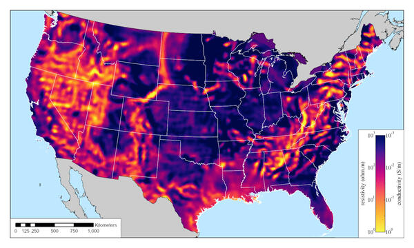
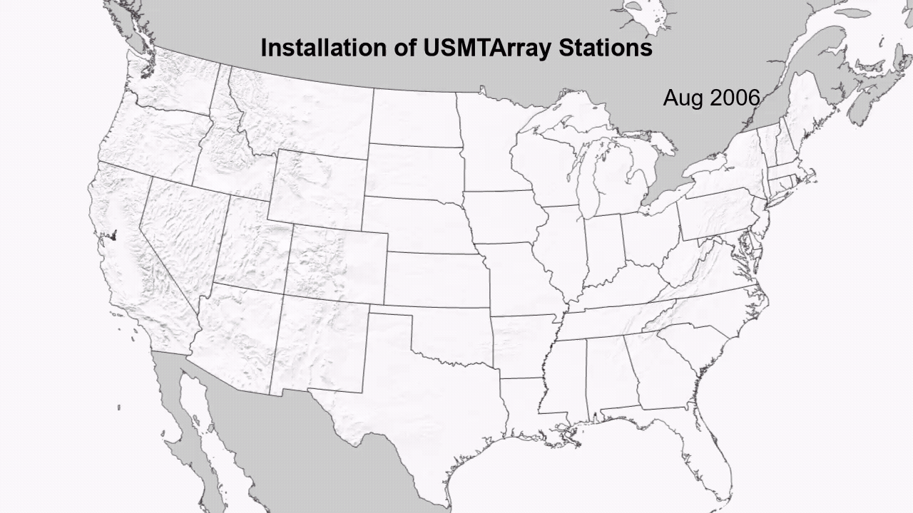
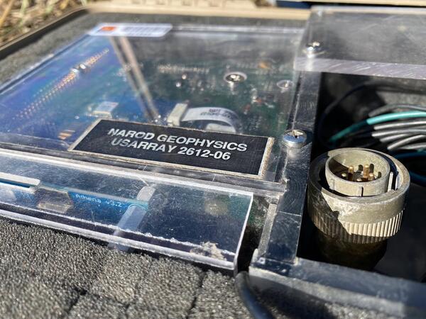
The United States Magnetotelluric Array and the National Impedance Map The United States Magnetotelluric Array and the National Impedance Map
The United States Magnetotelluric Array (USMTArray) data set, collected in the years 2006–2024, consists of more than 1,700 long-period magnetotelluric stations covering the entirety of the contiguous United States on a quasi-regular 70 km grid. Funding across multiple federal agencies was critical to sustaining this effort to its completion. Important components of the project included...
The solar cycle, geology, and geoelectric hazards for power grids The solar cycle, geology, and geoelectric hazards for power grids
When sunspots are large and numerous, intense magnetic storms are likely to occur on the Earth. Magnetic storms can generate electric fields in the Earth, and these fields can, in turn, interfere with electric power transmission grids that are grounded at the Earth’s surface. Across the contiguous United States, geoelectric hazards are highest in the Upper Midwest and in the East. These...
Challenging ring-current models of the Carrington storm Challenging ring-current models of the Carrington storm
A detailed analysis is made of horizontal-component geomagnetic-disturbance data acquired at the Colaba observatory in India recording the Carrington magnetic storm of September 1859. Prior to attaining its maximum absolute value, disturbance at Colaba increased with an e-folding timescale of 0.46 hr (28 min). Following its maximum, absolute disturbance at Colaba decreased as a trend...
Science

Mapping the grid: The United States Magnetotelluric Array
The United States has been mapped from space to the ground across its surface; however never from the perspective of the planet’s own electrical heartbeat. Over nearly two decades, the United States Magnetotelluric Array quietly marched across the country, station by station, building the first-ever electrical portrait of the crust and upper mantle beneath the contiguous U.S. An ambitious, multi...
Severe Magnetic Storm - November 11, 2025
November 11, 2025, 22:00 Eastern Standard Time

Severe Magnetic Storm -January 6, 2025
January 6, 2025: 16:00 Eastern Time