
DOI Remote Sensing Activities 2017 Includes FRESC Research on Lidar to Study Forest Habitat
By Forest and Rangeland Ecosystem Science Center
February 2, 2018
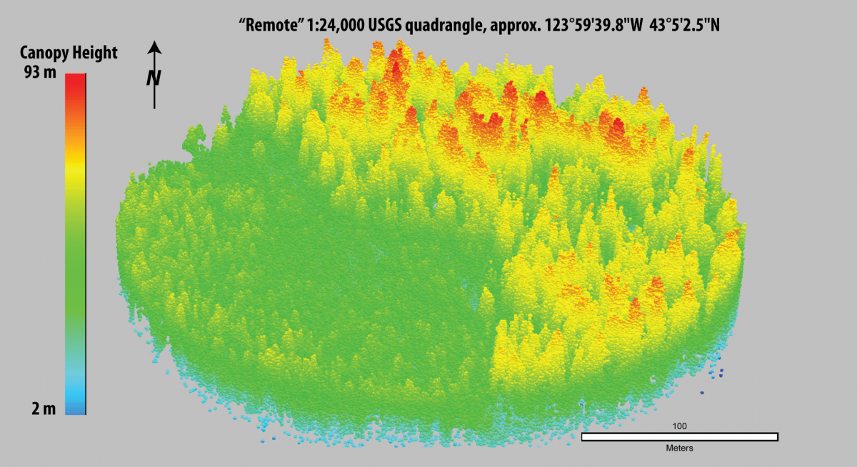
The Department of the Interior has released a report of the DOI Remote Sensing Activities for 2017, which includes a summary of research that uses Lidar to study forest canopy.
The report was compiled by the DOI Remote Sensing Working Group and is parceled into sections based on individual Bureau activities. The section describing USGS activities contains information about how using Lidar can provide fine-scale, three-dimensional measurements of forest canopy. This information is useful for studying habitat required by wildlife species, such as the marbled murrelet. A synopsis of this research by USGS researchers Joan Hagar and Patti Haggerty can be found here: https://eros.usgs.gov/doi-remote-sensing-activities/2017/lidar-quantifi….
Media
Sources/Usage: Public Domain. View Media Details