
Pecora Awards Honor Excellence in Earth Observation
Images of Earth are so common these days that it’s easy to forget that these illuminating visuals are actually grounded in remote sensing data that relies on advanced technology.
This week, the U.S. Department of the Interior (DOI), the U.S. Geological Survey (USGS) and the National Aeronautics and Space Administration (NASA) recognized outstanding contributors to the field of Earth observation and remote sensing. On Wednesday, October 26, individuals and groups were recognized when the past three years of William T. Pecora Awards were conferred in a ceremony at the 22nd William T. Pecora Memorial Remote Sensing Symposium in Denver. The recipients include visionaries who designed long-lasting satellites, educated users on the scientific data available, and supported decision-makers who apply remote sensing technologies to real-world issues. Other innovators advanced the use of remote sensing in plant biodiversity and invasive species, helped track algae and red tide events in our oceans, and led the way to understanding global carbon cycles at the margins of continents.
Here’s our homage to the Earth observation experts whose contributions make this blue-green planet an even better place to call home.
2022 Individual Award: Dr. Susan L. Ustin
Dr. Ustin was recognized for her remarkable contributions to ecology and environmental management through pioneering the development and application of imaging spectroscopy. Dr. Ustin is a true pioneer in advancing the application of remote sensing in understanding biodiversity, plant community characteristics, invasive species, and land use in the United States and beyond. She has served tirelessly on several NASA mission science teams and was an invaluable lead on both the 2007 and 2017 NASA Decadal Survey teams. She has trained a generation of leading scientists at distinguished institutions in the United States and around the world, helping to diversify the community using spectroscopy for ecological research and application. She is a Fellow of the American Geophysical Union for her lifetime contributions and an Ecological Society of America Fellow. Her academic accomplishments include nearly 300 publications with more than 25,000 citations.
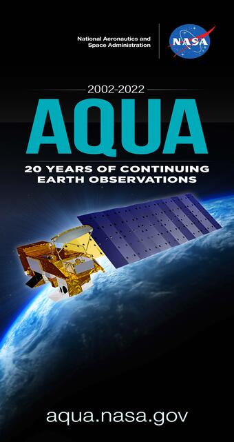
2022 Group Award: The Aqua Mission Team
The Aqua Mission Team was honored for its significant contributions to scientific studies of the Earth over two decades and related applications of the Aqua satellite observations . Since its launch more than two decades ago, the Aqua mission has delivered observations essential to improving our understanding of global dynamics and processes occurring on the land and cryosphere, the oceans, and the atmosphere. Furthermore, the Aqua mission has addressed topics of national priority such as weather forecasting, homeland security and defense, and natural resource management. The astonishing performance of the Aqua satellite is attributed to the well-designed and operated Aqua mission, and the collective efforts by the instrument and science teams. Aqua is one of the most highly successful Earth observing satellites ever to have orbited our planet. The mission’s free and open data policy has enabled a variety of application areas that generate societal value and support decision-makers. Aqua Moderate-Resolution Imaging Spectroradiometer (MODIS) data products have been integrated operationally by many agencies, groups, and the public to meet their specific needs, including for the tracking of Sargassum macroalgae, red tides, and water-quality events. Furthermore, the MODIS instrument onboard the Aqua satellite has enabled water-quality data services to citizens of more than 60 countries worldwide. As the Aqua satellite celebrates its 20th year in space, its contributions continue to advance our knowledge of Earth’s systems for the benefit of humanity.

2021 Individual Award: Dr. Frank Muller-Karger
Dr. Muller-Karger was honored for his extraordinary contributions and leadership in furthering our understanding of the Earth, and in particular the ocean, using remote sensing. His significant achievements have laid the groundwork for the use of multi- and hyperspectral sensors for the observation of ocean biology, biogeochemistry, and biodiversity. His work has greatly advanced our knowledge of the role of continental margins, including areas of upwelling and river discharge, in the global carbon budget. Dr. Muller-Karger’s leadership has led to breakthroughs and accelerated the adoption of remote sensing for biodiversity applications across marine habitats and trophic levels.

2021 Group Award: AmericaView
The AmericaView consortium was recognized for advancing Earth observation education through remote sensing science, applied research, workforce development, technology transfer, and community outreach. AmericaView is a nationwide, university-based and State-implemented consortium with 41 member States that are dedicated to the timely development of applied research techniques to integrate knowledge about the Earth, expand access to remote sensing data and derived information, and establish strategic partnerships across disciplines, bridging the gap between scientific data and the public. The AmericaView principal investigators and co-investigators continue to remove barriers and strengthen the understanding and use of rapidly evolving remote sensing technology and data access.

2020 Individual Award: Ms. Kass Green
Ms. Green was being recognized for her outstanding contributions as a scientist and entrepreneur to improve decision-making using remote sensing. Ms. Green has influenced Federal, State, local government, and the private sector in their use of remote sensing, especially Landsat, for a broad range of applications including water management, forestry, wildlife habitat and wildfire risk management, ecosystem evaluation, agricultural monitoring, and land use/land cover change detection and analysis. She played an important role in crafting language for the 1992 Land Remote Sensing Policy Act, which provided for Landsat observations continuity and enabled the effective long-term archiving and distribution of land-imaging data to a wide range of users. She has provided valuable policy insights through her service on the National Satellite Land Remote Sensing Data Archive Advisory Committee, the National Geospatial Advisory Committee and NASA’s Applied Sciences Advisory Committee. Notably, Ms. Green is the first woman to have received the highest honor, the Lifetime Achievement Award, from the American Society of Photogrammetry and Remote Sensing (ASPRS). Ms. Green has also served as president of ASPRS and the Management Association for Private Photogrammetric Surveyors.
2020 Group Award: The Landsat 5 Flight Operations Team
The Landsat 5 Flight Operations Team was recognized for its engineering excellence and problem-solving ingenuity, which enabled long-term, continued Earth observations that significantly advanced the Landsat program and greatly benefited humankind. The Landsat 5 success story is a culmination of many factors, chief among them the extraordinary talent and dedication of the Landsat 5 Flight Operations Team (Team). The Landsat 5 mission was launched on March 1, 1984, managed in partnership by USGS and NASA. No one could anticipate at that time that this mission would eventually enter the Guinness Book of World Records as the longest-running Earth observation satellite, finally decommissioned after more than 29 years on June 5, 2013. Such an extraordinarily successful record was achieved thanks to the men and women of the Team. In its lifetime, Landsat 5 was the first satellite to image the Chernobyl nuclear accident in 1986, to detail the extent of tropical deforestation, and to make the critical connection between the first Landsat images of the 1970s to those taken in the 2000s. Throughout its life, the satellite and payloads battled numerous anomalies which put the mission at risk. However, the Team found novel, creative approaches to resolve the issues, allowing Landsat 5 to continue operations into its third decade. In so doing, the Team enabled the establishment and continuation of a worldwide “gold standard” for image quality and coverage that has come to epitomize the Landsat satellites.
About the Pecora Awards
Sponsored by the DOI, USGS, and NASA, the annual award has been presented since 1974 and honors the memory of Dr. William T. Pecora, former USGS Director and DOI Undersecretary. Dr. Pecora was a motivating force behind establishing a program for civil remote sensing of the Earth from space. His early vision and support helped launch what we know today as the Landsat program, currently in its 50th year providing continued observations of the Earth’s land surface. For more information on the Pecora Awards and honored recipients, please visit usgs.gov/pecora.