
May is Wildfire Awareness Month
Learn how USGS scientists provide information, work with partners, and develop tools to help make decisions before, during, and after wildfires in desert, grassland, tundra, wetland, and forest ecosystems across the United States.
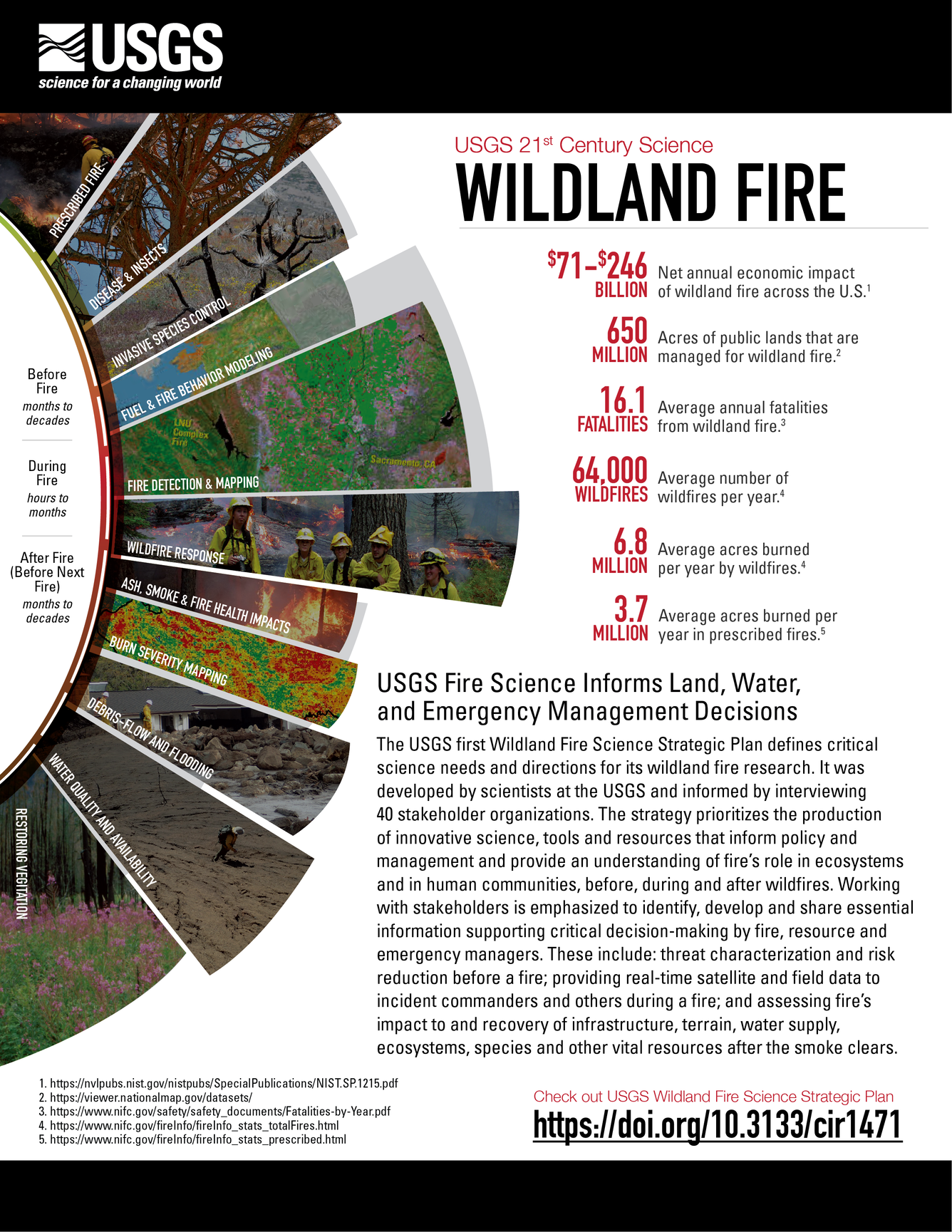
Wildland fires are increasing in size and intensity and addressing fire issues is complicated by invasive species, insects and disease outbreaks, human build-out into the wildlands, and changes in climate and weather patterns such as warming temperatures, periods of drought, and erratic rains. The USGS has researchers studying the impacts of wildland fires from Florida to Alaska. In 2020 there were 58,950 wildfires across the US, according to the National Interagency Fire Center. About 10.1 million acres were burned in 2020, compared with 4.7 million acres in 2019. Studying pre- and post-fire measurements of fire help ecologists, fire scientists, management agencies, states, tribes, landowners, and communities determine how the severity of wildfires affects plants, animal habitat, archaeological sites, and ecosystem services. To address future research questions, many USGS scientists, including Rachel Loehman with the Alaska Science Center, contributed to the U.S. Geological Survey Wildland Fire Science Strategic Plan, 2021–26.
U.S. Geological Survey Wildland Fire Science Strategic Plan, 2021–26
Wildland Fire Science
Fast Fire Facts from USGS
Wildland Fire Science—Supporting Wildland Fire and Land Management
Related

Ecosystems on the Edge: Landscape and Fire Ecology of Forests, Deserts, and Tundra
Related