
Moving Mountains: Elwha River Still Changing Five Years After World’s Largest Dam-Removal Project: More than 20 million tons of sediment flushed to the sea
Starting in 2011, the National Park Service removed two obsolete dams from the Elwha River in Olympic National Park, Washington. It was the world’s largest dam-removal project. Over the next five years, water carrying newly freed rocks, sand, silt and old tree trunks reshaped more than 13 miles of river and built a larger delta into the Pacific Ocean.
Scientists from the U.S. Geological Survey and six research partners recently published a paper summarizing a half-decade of changes to the shape and sediment of the Elwha River after dam removal.


Of the 33 million tons of sediment trapped behind the dams, about 8 million tons resettled along the river or at the mouth, and another 14 million dispersed into the ocean. It would take more than 70 dump trucks running 24 hours a day for five years to move that much dirt and debris downstream. Piled up, the sediment would form a cone about one-third of a mile in diameter and taller than a 50-story building.

“It really emphasizes the power of water to move mountains,” said USGS geomorphologist Andy Ritchie, lead author on the peer-reviewed article in the journal Scientific Reports. “Five years later, the Elwha was more like an undammed river than a river choked with sediment. Even without exceptional flows, a river can recover very rapidly after removing a dam or two.”

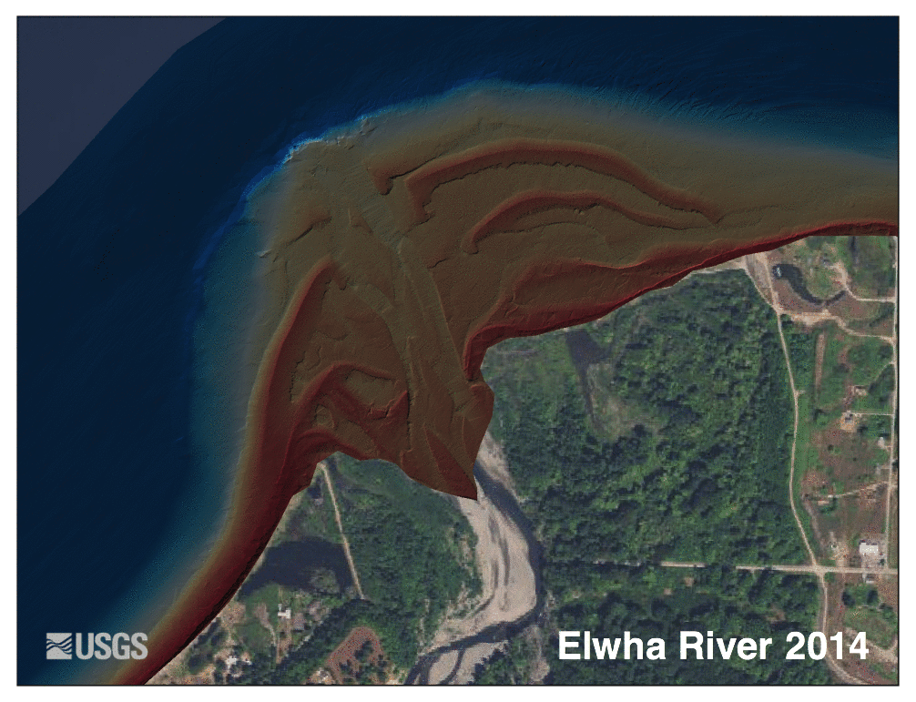
Ritchie said 90 percent of the sediment released by the project flowed downstream to the river delta and into the ocean. Even after the main pulse of sediment had passed two years after demolition started, the shoreline near the river’s mouth continued changing.
“I think it surprised everybody that the sediment moved out of the river as fast as it did,” said USGS research geologist and co-author Amy East. “We thought we'd be seeing major changes for 10 years or so. Instead, the peak disturbance only lasted about five months.” Yet the river continued to transform. A few years later there was a large flood on the Elwha; the river changed course in one area and heavily damaged a road and two campgrounds.

Researchers measured changes in the shape of and location of sediment in the Elwha River and in the ocean offshore using a variety of techniques, including pre-dam survey records, GPS and 3D-lidar (laser pulse) surveys, air photos and river gages. Scientists from the USGS, the National Park Service, the U.S. Bureau of Reclamation, Washington Sea Grant, NOAA Fisheries, the University of Washington and the Lower Elwha Klallam Tribe worked together to collect, process and analyze mountains of river data.

“The Elwha project has been one of the greatest examples of collaboration that I’ve ever been a part of,” said Ritchie. “But there’s still a tremendous amount to learn from the river.”
The new paper, “Morphodynamic evolution following sediment release from the world’s largest dam removal,” is online. Other recent USGS-led publications on the impacts of Elwha dam removal include “Coastal habitat and biological community response to dam removal on the Elwha River,” and “Increased sediment load during a large-scale dam removal changes nearshore subtidal communities.” For more information on USGS Elwha River research, visit our website.