TRAILS Decision Support Tool – Tips and Tricks: What services does TRAILS rely on and how can I tell if a service downtime is causing an error?
Learn new tips and tricks for using TRAILS application. Today we discuss errors associated with web service downtimes.
TRAILS incorporates a cost surface or terrain constraint analysis to help rank candidate trails. The analysis incorporates transportation data, including existing trails from the USGS National Transportation Dataset (another aggerated dataset), water features from the National Hydrography Dataset, the Protected Areas Database of the US, called PAD-US, which shows federal and other boundaries for protected lands, and lastly the 3D Elevation Dataset which is used to provide information about slope.
Thus, the application relies on several web services to be up and running in order for analysis and display to function successfully. If all services are functioning properly, the user should be able to run scenarios successfully and get a “Trail Connection succeeded” message as shown in the graphic below.

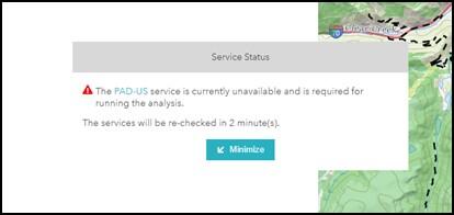
If any services are down, the user will not be able to run the analysis and should see a notification indicating the service is down. If you encounter this message, please notify trails@usgs.gov and return to the application at a later time.