



7.5-Minute OnDemand Topo Cartographic Specifications - Geographic Names
7.5-Minute OnDemand Topo cartographic specifications including feature symbology and labels for Geographic Names including Landforms and Populated Places.
Geographic Names Feature Types
Table of Contents
Landforms
Populated Places (PPL) - Point
Populated Places (PPL) - Polygon
- PPL - Polygon - Population: 1-1,000
- PPL - Polygon - Population: 1,001-2,500
- PPL - Polygon - Population: 2,501-5,000
- PPL - Polygon - Population: 5,001-10,000
- PPL - Polygon - Population: 10,001 - 25,000
- PPL - Polygon - Population: 25,001-250,000
- PPL - Polygon - Population: 250,001-1,000,000+
LANDFORMS
Arroyo
Subtype of Landforms
- FType: Not applicable
- FCode: 15006
- Feature Description: Watercourse or channel through which water may occasionally flow (coulee, draw, gully, wash).
- Feature Geometry: Not applicable
Graphic Depiction
- Linear Graphic Depiction: Not applicable
- Point Graphic Depiction: Not applicable
- Polygon Graphic Depiction: Not applicable
Symbology Specifications
- Not applicable
Labeling
Media

Sources/Usage: Public Domain. View Media Details
- Labeling Graphic Depiction:
- Label: Arroyo - Label
- Label Description: Black text with an italic font and a light gray halo.
- Font Style: Segoe UI, Italic
- Font Size: 9.00 pt
- Font Color (R,G,B): 0,0,0
- Font Halo Size: 0.80 pt
- Font Halo Color (R,G,B): 240,240,240
- Placement Properties: Regular placement or placed straight inside the feature's polygon. NOTE: Characters may be spaced out for larger features.
Range
Subtype of Landforms
- FType: Not applicable
- FCode: 15042
- Feature Description: A single mass of hills or mountains; a complex, interconnected series of mountain ranges having a well-defined longitudinal trend (cordillera, mountain belt, sierra).
- Feature Geometry: Not applicable
Graphic Depiction
- Linear Graphic Depiction: Not applicable
- Point Graphic Depiction: Not applicable
- Polygon Graphic Depiction: Not applicable
Symbology Specifications
- Not applicable
Labeling
Media
Sources/Usage: Public Domain. View Media Details
- Labeling Graphic Depiction:
- Label: Range - Label
- Label Description: Black text with an italic font and a light gray halo.
- Font Style: Segoe UI, Italic
- Font Size: 9.00 pt
- Font Color (R,G,B): 0,0,0
- Font Halo Size: 0.80 pt
- Font Halo Color (R,G,B): 240,240,240
- Placement Properties: Regular placement or placed straight inside the feature's polygon. NOTE: Characters may be spaced out for larger features.
Ridge
Subtype of Landforms
- FType: Not applicable
- FCode: 15044
- Feature Description: Elevation with a narrow, elongated crest that can be part of a hill or mountain (arête, crest, chenier, cuesta, divide, esker, hogback, mogote, lae, ridge, spur).
- Feature Geometry: Not applicable
Graphic Depiction
- Linear Graphic Depiction: Not applicable
- Point Graphic Depiction: Not applicable
- Polygon Graphic Depiction: Not applicable
Symbology Specifications
- Not applicable
Labeling
Media
Sources/Usage: Public Domain. View Media Details
- Labeling Graphic Depiction:
- Label: Ridge - Label
- Label Description: Black text with an italic font and a light gray halo.
- Font Style: Segoe UI, Italic
- Font Size: 9.00 pt
- Font Color (R,G,B): 0,0,0
- Font Halo Size: 0.80 pt
- Font Halo Color (R,G,B): 240,240,240
- Placement Properties: Regular placement or placed straight inside the feature's polygon. NOTE: Characters may be spaced out for larger features.
Summit
Subtype of Landforms
- FType: Not applicable
- FCode: 15048
- Feature Description: Prominent elevation rising above the surrounding level of the Earth's surface; does not include pillars, ridges, or ranges; can occur as a single isolated mass or in a group (ahu, ballon, berg, bald, butte, cerro, colina, cone, cumbre, dome, head, hill, horn, knob, knoll, mauna, mesa, mesita, mound, mount, mountain, peak, puʻu, rock, sugarloaf, table, volcano).
- Feature Geometry: Not applicable
Graphic Depiction
- Linear Graphic Depiction: Not applicable
- Point Graphic Depiction: Not applicable
- Polygon Graphic Depiction: Not applicable
Symbology Specifications
- Not applicable
Labeling
Media

Sources/Usage: Public Domain. View Media Details
- Labeling Graphic Depiction:
- Label: Summit - Label
- Label Description: Black text with an italic font and a light gray halo.
- Font Style: Segoe UI, Italic
- Font Size: 9.00 pt
- Font Color (R,G,B): 0,0,0
- Font Halo Size: 0.80 pt
- Font Halo Color (R,G,B): 240,240,240
- Placement Properties: Regular placement; Horizontal within the polygon. NOTE: Characters may be spaced out for larger features.
Valley
Subtype of Landforms
- FType: Not applicable
- FCode: 15050
- Feature Description: Linear depression in the Earth's surface that generally slopes from one end to the other (barranca, canyon, chasm, cove, draw, glen, gorge, gulch, gulf, hollow, ravine).
- Feature Geometry: Not applicable
Graphic Depiction
- Linear Graphic Depiction: Not applicable
- Point Graphic Depiction: Not applicable
- Polygon Graphic Depiction: Not applicable
Symbology Specifications
- Not applicable
Labeling
Media
Sources/Usage: Public Domain. View Media Details
- Labeling Graphic Depiction:
- Label: Valley - Label
- Label Description: Black text with an italic font.
- Font Style: Segoe UI, Italic
- Font Size: 9.00 pt
- Font Color (R,G,B): 0,0,0
- Font Halo Size: 0.80 pt
- Font Halo Color (R,G,B): 240,240,240
- Placement Properties: Regular placement or placed straight inside the feature's polygon. NOTE: Characters may be spaced out for larger features.
POPULATED PLACES (PPL) – POINT
PPL - Point
Subtype of Populated Places (PPL) - Point
- FType: Not applicable
- FCode: Not applicable
- Feature Description: Place labels include populated place, civil, and census features. A populated place is a place or area with clustered or scattered buildings and a permanent human population (city, settlement, town, village). A populated place is usually not incorporated and by definition has no legal boundaries. However, a populated place may have a corresponding "civil" record, the legal boundaries of which may or may not coincide with the perceived populated place. A civil feature is political division formed for administrative purposes (borough, county, incorporated place, municipio, parish, town, township). A census feature is a statistical area delineated locally specifically for the tabulation of Census Bureau data (census-designated place, census county division, unorganized territory, various types of American Indian/Alaska Native statistical areas).
- Feature Geometry: Not applicable
Graphic Depiction
- Linear Graphic Depiction: Not applicable
- Point Graphic Depiction: Not applicable
- Polygon Graphic Depiction: Not applicable
Symbology Specifications
- Not applicable
Labeling
Media

Sources/Usage: Public Domain. View Media Details
- Labeling Graphic Depiction:
- Label: PPL - Point - Label
- Label Description: Black text with a light gray halo showing official name.
- Font Style: Charis SIL
- Font Size: 10.00 pt
- Font Color (R,G,B): 0,0,0
- Font Halo Size: 0.80 pt
- Font Halo Color (R,G,B): 240,240,240
- Placement Properties: Best position around point.
POPULATED PLACES (PPL) – POLYGON
PPL - Polygon - Population: 1-1,000
Subtype of Populated Places (PPL) - Polygon
- FType: Not applicable
- FCode: Not applicable
- Feature Description: Place labels include populated place, civil, and census features. A populated place is a place or area with clustered or scattered buildings and a permanent human population (city, settlement, town, village). A populated place is usually not incorporated and by definition has no legal boundaries. However, a populated place may have a corresponding "civil" record, the legal boundaries of which may or may not coincide with the perceived populated place. A civil feature is political division formed for administrative purposes (borough, county, incorporated place, municipio, parish, town, township). A census feature is a statistical area delineated locally specifically for the tabulation of Census Bureau data (census-designated place, census county division, unorganized territory, various types of American Indian/Alaska Native statistical areas).
- Feature Geometry: Not applicable
Graphic Depiction
- Linear Graphic Depiction: Not applicable
- Point Graphic Depiction: Not applicable
- Polygon Graphic Depiction: Not applicable
Symbology Specifications
- Not applicable
Labeling
Media

Sources/Usage: Public Domain. View Media Details
- Labeling Graphic Depiction:
- Label: PPL - Polygon - Population: 1-1,000 - Label
- Label Description: Black text with a light gray halo showing official name.
- Font Style: Charis SIL, Bold
- Font Size: 10.00 pt
- Font Color (R,G,B): 0,0,0
- Font Halo Size: 0.80 pt
- Font Halo Color (R,G,B): 240,240,240
- Placement Properties: Regular - horizontal in polygon; May place outside polygon boundary
PPL - Polygon - Population: 1,001-2,500
Subtype of Populated Places (PPL) - Polygon
- FType: Not applicable
- FCode: Not applicable
- Feature Description: Place labels include populated place, civil, and census features. A populated place is a place or area with clustered or scattered buildings and a permanent human population (city, settlement, town, village). A populated place is usually not incorporated and by definition has no legal boundaries. However, a populated place may have a corresponding "civil" record, the legal boundaries of which may or may not coincide with the perceived populated place. A civil feature is political division formed for administrative purposes (borough, county, incorporated place, municipio, parish, town, township). A census feature is a statistical area delineated locally specifically for the tabulation of Census Bureau data (census-designated place, census county division, unorganized territory, various types of American Indian/Alaska Native statistical areas).
- Feature Geometry: Not applicable
Graphic Depiction
- Linear Graphic Depiction: Not applicable
- Point Graphic Depiction: Not applicable
- Polygon Graphic Depiction: Not applicable
Symbology Specifications
- Not applicable
Labeling
Media
Sources/Usage: Public Domain. View Media Details
- Labeling Graphic Depiction:
- Label: PPL - Polygon - Population: 1,001-2,500 - Label
- Label Description: Black text with a light gray halo showing official name.
- Font Style: Charis SIL, Bold
- Font Size: 10.00 pt
- Font Color (R,G,B): 0,0,0
- Font Halo Size: 0.80 pt
- Font Halo Color (R,G,B): 240,240,240
- Placement Properties: Regular - horizontal in polygon; May place outside polygon boundary
PPL - Polygon - Population: 2,501-5,000
Subtype of Populated Places (PPL) - Polygon
- FType: Not applicable
- FCode: Not applicable
- Feature Description: Place labels include populated place, civil, and census features. A populated place is a place or area with clustered or scattered buildings and a permanent human population (city, settlement, town, village). A populated place is usually not incorporated and by definition has no legal boundaries. However, a populated place may have a corresponding "civil" record, the legal boundaries of which may or may not coincide with the perceived populated place. A civil feature is political division formed for administrative purposes (borough, county, incorporated place, municipio, parish, town, township). A census feature is a statistical area delineated locally specifically for the tabulation of Census Bureau data (census-designated place, census county division, unorganized territory, various types of American Indian/Alaska Native statistical areas).
- Feature Geometry: Not applicable
Graphic Depiction
- Linear Graphic Depiction: Not applicable
- Point Graphic Depiction: Not applicable
- Polygon Graphic Depiction: Not applicable
Symbology Specifications
- Not applicable
Labeling
Media
Sources/Usage: Public Domain. View Media Details
- Labeling Graphic Depiction:
- Label: PPL - Polygon - Population: 2,501-5,000 - Label
- Label Description: Black text with a light gray halo showing official name.
- Font Style: Charis SIL, Bold
- Font Size: 10.00 pt
- Font Color (R,G,B): 0,0,0
- Font Halo Size: 0.80 pt
- Font Halo Color (R,G,B): 240,240,240
- Placement Properties: Regular - horizontal in polygon; May place outside polygon boundary
PPL - Polygon - Population: 5,001-10,000
Subtype of Populated Places (PPL) - Polygon
- FType: Not applicable
- FCode: Not applicable
- Feature Description: Place labels include populated place, civil, and census features. A populated place is a place or area with clustered or scattered buildings and a permanent human population (city, settlement, town, village). A populated place is usually not incorporated and by definition has no legal boundaries. However, a populated place may have a corresponding "civil" record, the legal boundaries of which may or may not coincide with the perceived populated place. A civil feature is political division formed for administrative purposes (borough, county, incorporated place, municipio, parish, town, township). A census feature is a statistical area delineated locally specifically for the tabulation of Census Bureau data (census-designated place, census county division, unorganized territory, various types of American Indian/Alaska Native statistical areas).
- Feature Geometry: Not applicable
Graphic Depiction
- Linear Graphic Depiction: Not applicable
- Point Graphic Depiction: Not applicable
- Polygon Graphic Depiction: Not applicable
Symbology Specifications
- Not applicable
Labeling
Media

Sources/Usage: Public Domain. View Media Details
- Labeling Graphic Depiction:
- Label: PPL - Polygon - Population: 5,001-10,000 - Label
- Label Description: Uppercase black text with a light gray halo showing official name.
- Font Style: Charis SIL, Bold, Uppercase
- Font Size: 11.00 pt
- Font Color (R,G,B): 0,0,0
- Font Halo Size: 0.80 pt
- Font Halo Color (R,G,B): 240,240,240
- Placement Properties: Regular - horizontal in polygon; May place outside polygon boundary
PPL - Polygon - Population: 10,001 - 25,000
Subtype of Populated Places (PPL) - Polygon
- FType: Not applicable
- FCode: Not applicable
- Feature Description: Place labels include populated place, civil, and census features. A populated place is a place or area with clustered or scattered buildings and a permanent human population (city, settlement, town, village). A populated place is usually not incorporated and by definition has no legal boundaries. However, a populated place may have a corresponding "civil" record, the legal boundaries of which may or may not coincide with the perceived populated place. A civil feature is political division formed for administrative purposes (borough, county, incorporated place, municipio, parish, town, township). A census feature is a statistical area delineated locally specifically for the tabulation of Census Bureau data (census-designated place, census county division, unorganized territory, various types of American Indian/Alaska Native statistical areas).
- Feature Geometry: Not applicable
Graphic Depiction
- Linear Graphic Depiction: Not applicable
- Point Graphic Depiction: Not applicable
- Polygon Graphic Depiction: Not applicable
Symbology Specifications
- Not applicable
Labeling
Media

Sources/Usage: Public Domain. View Media Details
- Labeling Graphic Depiction:
- Label: PPL - Polygon - Population: 10,001 - 25,000 - Label
- Label Description: Uppercase black text with a light gray halo showing official name.
- Font Style: Charis SIL, Bold, Uppercase
- Font Size: 12.00 pt
- Font Color (R,G,B): 0,0,0
- Font Halo Size: 0.80 pt
- Font Halo Color (R,G,B): 240,240,240
- Placement Properties: Regular - horizontal in polygon; May place outside polygon boundary
PPL - Polygon - Population: 25,001-250,000
Subtype of Populated Places (PPL) - Polygon
- FType: Not applicable
- FCode: Not applicable
- Feature Description: Place labels include populated place, civil, and census features. A populated place is a place or area with clustered or scattered buildings and a permanent human population (city, settlement, town, village). A populated place is usually not incorporated and by definition has no legal boundaries. However, a populated place may have a corresponding "civil" record, the legal boundaries of which may or may not coincide with the perceived populated place. A civil feature is political division formed for administrative purposes (borough, county, incorporated place, municipio, parish, town, township). A census feature is a statistical area delineated locally specifically for the tabulation of Census Bureau data (census-designated place, census county division, unorganized territory, various types of American Indian/Alaska Native statistical areas).
- Feature Geometry: Not applicable
Graphic Depiction
- Linear Graphic Depiction: Not applicable
- Point Graphic Depiction: Not applicable
- Polygon Graphic Depiction: Not applicable
Symbology Specifications
- Not applicable
Labeling
Media

Sources/Usage: Public Domain. View Media Details
- Labeling Graphic Depiction:
- Label: PPL - Polygon - Population: 25,001-250,000 - Label
- Label Description: Uppercase black text with a light gray halo showing official name.
- Font Style: Charis SIL, Bold, Uppercase
- Font Size: 14.00 pt
- Font Color (R,G,B): 0,0,0
- Font Halo Size: 0.80 pt
- Font Halo Color (R,G,B): 240,240,240
- Placement Properties: Regular - horizontal in polygon; May place outside polygon boundary
PPL - Polygon - Population: 250,001-1,000,000+
Subtype of Populated Places (PPL) - Polygon
- FType: Not applicable
- FCode: Not applicable
- Feature Description: Place labels include populated place, civil, and census features. A populated place is a place or area with clustered or scattered buildings and a permanent human population (city, settlement, town, village). A populated place is usually not incorporated and by definition has no legal boundaries. However, a populated place may have a corresponding "civil" record, the legal boundaries of which may or may not coincide with the perceived populated place. A civil feature is political division formed for administrative purposes (borough, county, incorporated place, municipio, parish, town, township). A census feature is a statistical area delineated locally specifically for the tabulation of Census Bureau data (census-designated place, census county division, unorganized territory, various types of American Indian/Alaska Native statistical areas).
- Feature Geometry: Not applicable
Graphic Depiction
- Linear Graphic Depiction: Not applicable
- Point Graphic Depiction: Not applicable
- Polygon Graphic Depiction: Not applicable
Symbology Specifications
- Not applicable
Labeling
Media

Sources/Usage: Public Domain. View Media Details
- Labeling Graphic Depiction:
- Label: PPL - Polygon - Population: 250,001-1,000,000+ - Label
- Label Description: Uppercase black text with a light gray halo showing official name.
- Font Style: Charis SIL, Bold, Uppercase
- Font Size: 16.00 pt
- Font Color (R,G,B): 0,0,0
- Font Halo Size: 0.80 pt
- Font Halo Color (R,G,B): 240,240,240
- Placement Properties: Regular - horizontal in polygon; May place outside polygon boundary
Related Information
Related Information
-
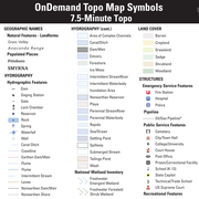
7.5-Minute OnDemand Topo Cartographic Specifications - Map Symbol Guide 7.5-Minute OnDemand Topo Cartographic Specifications - Map Symbol Guide
7.5-Minute OnDemand Topo cartographic specifications map symbol guide.
7.5-Minute OnDemand Topo Cartographic Specifications 7.5-Minute OnDemand Topo Cartographic Specifications
This page and associated links define the U.S. Geological Survey (USGS) 7.5-Minute OnDemand Topo cartographic specifications including feature symbology and labels. The specifications are organized by data sets and themes listed within.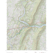
7.5-Minute OnDemand Topo Cartographic Specifications - Version History 7.5-Minute OnDemand Topo Cartographic Specifications - Version History
This page highlights version history and details the refinements made to the published 7.5-Minute Topo Cartographic Specifications.
7.5-Minute OnDemand Topo Cartographic Specifications - Elevation 7.5-Minute OnDemand Topo Cartographic Specifications - Elevation
7.5-Minute OnDemand Topo cartographic specifications including feature symbology and labels for elevation generated contours.
7.5-Minute OnDemand Topo Cartographic Specifications - Hydrography 7.5-Minute OnDemand Topo Cartographic Specifications - Hydrography
7.5-Minute OnDemand Topo cartographic specifications including feature symbology and labels for Hydrography including NHDArea, NHDFlowline, NHDLine, NHDPoint, NHDWaterbody, and National Wetland Inventory (NWI).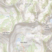
7.5-Minute OnDemand Topo Cartographic Specifications - Geographic Names 7.5-Minute OnDemand Topo Cartographic Specifications - Geographic Names
7.5-Minute OnDemand Topo cartographic specifications including feature symbology and labels for Geographic Names including Landforms and Populated Places.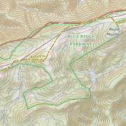
7.5-Minute OnDemand Topo Cartographic Specifications - Government Units 7.5-Minute OnDemand Topo Cartographic Specifications - Government Units
7.5-Minute OnDemand Topo cartographic specifications including feature symbology and labels for Government Units (Boundaries) including County or Equivalent, Designated Areas, Federally Managed Lands, International, Military, Native American Area, Public Land Survey System (PLSS), and State.
7.5-Minute OnDemand Topo Cartographic Specifications - Land Cover 7.5-Minute OnDemand Topo Cartographic Specifications - Land Cover
7.5-Minute OnDemand Topo cartographic specifications including feature symbology and labels for Land Cover including Barren, Cropland, Grassland, Sedge, Shrubland, and Woodland.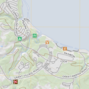
7.5-Minute OnDemand Topo Cartographic Specifications - Structures 7.5-Minute OnDemand Topo Cartographic Specifications - Structures
7.5-Minute OnDemand Topo cartographic specifications including feature symbology and labels for Structures including Emergency Service, Pipeline, Public Service, and Recreation.
7.5-Minute OnDemand Topo Cartographic Specifications - Transportation 7.5-Minute OnDemand Topo Cartographic Specifications - Transportation
7.5-Minute OnDemand Topo cartographic specifications including feature symbology and labels for Transportation including Airport, Rail, Route, and Trail.