



7.5-Minute OnDemand Topo Cartographic Specifications - Hydrography
7.5-Minute OnDemand Topo cartographic specifications including feature symbology and labels for Hydrography including NHDArea, NHDFlowline, NHDLine, NHDPoint, NHDWaterbody, and National Wetland Inventory (NWI).
Hydrography Feature Names
Table of Contents
NHDArea
- Area of Complex Channels (No attributes)
- BayInlet
- CanalDitch (All)
- DamWeir (All)
- Flume (No attributes)
- Foreshore (No attributes)
- Inundation Area (All)
- Levee (No attributes)
- Rapids (No attributes)
- SeaOcean (No attributes)
- Spillway (No attributes)
- StreamRiver (All)
- Submerged Stream (No attributes)
- Wash (No attributes)
NHDFlowline
- Artificial Path (No attributes)
- CanalDitch (All)
- Coastline (No attributes)
- Pipeline (By symbol and label type)
- StreamRiver (All)
- Underground Conduit (Positional Accuracy = null)
NHDLine
- DamWeir (All)
- Flume (No attributes)
- Levee (No attributes)
- Nonearthen Shore (No attributes)
- Rapids (No attributes)
- Reef (No attributes)
- Tunnel (No attributes)
- Waterfall (No attributes)
NHDPoint
- DamWeir (All)
- Gaging Station (No attributes)
- Rapids (No attributes)
- Rock (All)
- SpringSeep (No attributes)
- Waterfall (No attributes)
- Well (No attributes)
NHDWaterbody
- Estuary (No attributes)
- Ice Mass (No attributes)
- LakePond (All)
- Playa (No attributes)
- Reservoir (By symbol and label type)
National Wetland Inventory
NHDArea
Area of Complex Channels (No attributes)
Subtype of NHDArea
- FType: Area of Complex Channels
- FCode: 53700
- Feature Description: An area where a stream or river flows in an intricate network of sediment-driven interlacing channels. Not named features.
- Feature Geometry: Polygon
Graphic Depiction

- Point Graphic Depiction: Not applicable
- Linear Graphic Depiction: Not applicable
- Polygon Graphic Depiction:
- Symbol: Area of Complex Channels (No attributes)
- Symbol Description: Blue outline with lighter blue marker fill. Fill consists of multiple layers of varying marker types, sizes, angles and/or offsets.
Polygon Symbology Specifications
- Layer 1 (Shape Marker - Fill):
- Size: 7.00 pt
- Color (R,G,B): 137,172,224
- Transparency: 0%
- Layer 2 (Shape Marker - Fill):
- Size: 7.00 pt
- Color (R,G,B): 137,172,224
- Transparency: 0%
- Layer 3 (Shape Marker - Fill):
- Size: 7.00 pt
- Color (R,G,B): 137,172,224
- Transparency: 0%
- Layer 4 (Shape Marker - Fill):
- Size: 7.00 pt
- Color (R,G,B): 137,172,224
- Transparency: 0%
- Layer 5 (Shape Marker - Fill):
- Size: 7.00 pt
- Color (R,G,B): 137,172,224
- Transparency: 0%
- Layer 6 (Shape Marker - Fill):
- Size: 6.00 pt
- Color (R,G,B): 137,172,224
- Transparency: 0%
- Layer 7 (Shape Marker - Fill):
- Size: 7.00 pt
- Color (R,G,B): 137,172,224
- Transparency: 0%
- Layer 8 (Shape Marker - Fill):
- Size: 6.00 pt
- Color (R,G,B): 137,172,224
- Transparency: 0%
- Layer 9 (Solid Stroke):
- Size: 1.00 pt
- Color (R,G,B): 137,172,224
- Transparency: 0%
Labeling
- Labeling: Not applicable
BayInlet
Subtype of NHDArea
- FType: BayInlet
- FCode: 31200
- Feature Description: A water area that is an opening of the sea/ocean into the land, or of an estuary, lake, or river into its shore. BayInlets are used in the NHD to provide named areas for other hydrographic features, and must overlap Estuary, LakePond, SeaOcean, or StreamRiver. May be named feature.
- Feature Geometry: Not applicable
Graphic Depiction
- Point Graphic Depiction: Not applicable
- Linear Graphic Depiction: Not applicable
- Polygon Graphic Depiction: Not applicable
Symbology Specifications
- Not applicable
Labeling

- Labeling Graphic Depiction:
- Label: BayInlet - Label
- Label Description: Blue italic text.
- Font Style: Charis SIL, Italic
- Font Size: 9.00 pt
- Font Color (R,G,B): 101,137,191
- Font Halo Size: 0.70 pt
- Font Halo Color (R,G,B): 240,240,240
- Placement Properties: Centered on point.
CanalDitch (Type null; Aqueduct)
Subtype of NHDArea
- CanalDitch (CanalDitch Type = null)
- FType: CanalDitch
- FCode: 33600
- Feature Description: An artificial open waterway constructed to transport water, to irrigate or drain land, to connect two or more bodies of water, or to serve as a waterway for watercraft. May be a named feature. CanalDitch exists as an NHDArea and NHDFlowline.
- Feature Geometry: Linear, Polygon
- CanalDitch (CanalDitch Type = Aqueduct)
- FType: CanalDitch
- FCode: 33601
- Feature Description: An artificial, open waterway designed to transport domestic or industrial water from a supply source to a distribution point, often by gravity. CanalDitch exists as an NHDArea and NHDFlowline.
- Feature Geometry: Linear, Polygon
Graphic Depiction
- Point Graphic Depiction: Not applicable

- Linear Graphic Depiction:
- Symbol, as applicable:
- Symbol Description: A blue, dashed line.

- Polygon Graphic Depiction:
- Symbol, as applicable:
- Symbol Description: Blue outline with blue, solid fill.
Line Symbology Specifications
- Layer 1 (Stroke: Dash/Gap Pattern – 17·2·1·2·1·2·1·2):
- Size: 1.00 pt
- Color (R,G,B): 137,172,224
- Transparency: 0%
Polygon Symbology Specifications
- Layer 1 (Solid Stroke):
- Size: 0.45 pt
- Color (R,G,B): 137,172,224
- Transparency: 0%
- Layer 2 (Solid Fill):
- Size: Not applicable
- Color (R,G,B): 174,203,248
- Transparency: 70%
Labeling

- Labeling Graphic Depiction:
- Label, as applicable:
- Label Description: Blue italic text.
- Font Style: Charis SIL, Italic
- Font Size: 9.00 pt
- Font Color (R,G,B): 101,137,191
- Font Halo Size: 0.80 pt
- Font Halo Color (R,G,B): 240,240,240
- Placement Properties: Regular placement curved and offset from line.
DamWeir (Construction Material = null; Earthen)
Subtype of NHDArea
- DamWeir (Construction Material = null)
- FType: DamWeir
- FCode: 34300
- Feature Description: A barrier constructed to control the flow or raise the level of water. No information on the predominant construction material. DamWeir exists as an NHDArea, NHDLine and NHDPoint.
- Feature Geometry: Point, Linear, Polygon
- DamWeir (Construction Material = Earthen)
- FType: DamWeir
- FCode: 34305
- Feature Description: A barrier constructed to control the flow or raise the level of water where the predominant material used in construction is earth, or a combination of earth and rock. DamWeir exists as an NHDArea, NHDLine and NHDPoint.
- Feature Geometry: Point, Linear, Polygon
Graphic Depiction

- Point Graphic Depiction:
- Symbol, as applicable:
- Symbol Description: A black "l" character shown on the left; shown in context on the right adjacent to a waterbody.

- Linear Graphic Depiction:
- Symbol, as applicable:
- Symbol Description: Brown, dashed line shown on the left; shown in context on the right adjacent to a waterbody.

- Polygon Graphic Depiction:
- Symbol, as applicable:
- Symbol Description: Dark gray outline with a light gray, solid fill.
Point Symbology Specifications
- Layer 1 (Shape Marker):
- Size: 10.00 pt
- Color (R,G,B): 0,0,0
- Transparency: 0%
Line Symbology Specifications
- Layer 1 (Stroke: Dash/Gap Pattern – 5·2):
- Size: 0.864 pt
- Color (R,G,B): 159,85,31
- Transparency: 0%
Polygon Symbology Specifications
- Layer 1 (Solid Fill):
- Size: Not applicable
- Color (R,G,B): 156,156,156
- Transparency: 0%
- Layer 2 (Solid Stroke):
- Size: 1.00 pt
- Color (R,G,B): 52,52,52
- Transparency: 0%
Labeling
- Labeling: Not applicable
DamWeir (Construction Material = Nonearthen)
Subtype of NHDArea
- FType: DamWeir
- FCode: 34306
- Feature Description: A barrier constructed to control the flow or raise the level of water where the predominant material used in construction is concrete, brick, or stone. Coincident with a Nonearthen Shore Feature. DamWeir exists as an NHDArea, NHDLine and NHDPoint.
- Feature Geometry: Point, Linear, Polygon
Graphic Depiction
- Point Graphic Depiction:
- Symbol: DamWeir (Construction Material = Nonearthen)
- Symbol Description: A black "l" character shown on the left; shown in context on the right adjacent to a waterbody.

- Linear Graphic Depiction:
- Symbol: DamWeir (Construction Material = Nonearthen)
- Symbol Description: A dark gray, solid line.
- Polygon Graphic Depiction:
- Symbol: DamWeir (Construction Material = Nonearthen)
- Symbol Description: A dark gray outline with a light gray, solid fill.
Point Symbology Specifications
- Layer 1 (Shape Marker):
- Size: 10.00 pt
- Color (R,G,B): 0,0,0
- Transparency: 0%
Line Symbology Specifications
- Layer 1 (Solid Stroke):
- Size: 0.72 pt
- Color (R,G,B): 52,52,52
- Transparency: 0%
Polygon Symbology Specifications
- Layer 1 (Solid Fill):
- Size: Not applicable
- Color (R,G,B): 156,156,156
- Transparency: 0%
- Layer 2 (Solid Stroke):
- Size: 1.00 pt
- Color (R,G,B): 52,52,52
- Transparency: 0%
Labeling
- Labeling: Not applicable
Flume (No attributes)
Subtype of NHDArea
- FType: Flume
- FCode: 36200
- Feature Description: An open, inclined, artificial channel constructed of wood, metal, or concrete generally elevated. May be a named feature. Flume exists as an NHDArea and NHDLine.
- Feature Geometry: Linear, Polygon
Graphic Depiction
- Point Graphic Depiction: Not applicable

- Linear Graphic Depiction:
- Symbol: Flume (No attributes)
- Symbol Description: A blue, dashed line.
- Polygon Graphic Depiction:
- Symbol: Flume (No attributes)
- Symbol Description: A blue, solid outline with blue, solid fill.
Line Symbology Specifications
- Layer 1 (Stroke - Dash/Gap Pattern – 4·2):
- Size: 1.00 pt
- Color (R,G,B): 81,129,184
- Transparency: 0%
Polygon Symbology Specifications
- Layer 1 (Solid Stroke):
- Size: 0.45 pt
- Color (R,G,B): 137,172,224
- Transparency: 0%
- Layer 2 (Solid Fill):
- Size: Not applicable
- Color (R,G,B): 174,203,248
- Transparency: 70%
Labeling
- Labeling: Not applicable
Foreshore (No attributes)
Subtype of NHDArea
- FType: Foreshore
- FCode: 36400
- Feature Description: The area of shore that lies between the limits of the mean high water (MHW) and mean lower low water (MLLW) tidal marks and is exposed during low tides. The NHD acquires Foreshore data from the National Ocean and Atmospheric Agency (NOAA) and it is not a product of the USGS. May be a named feature.
- Feature Geometry: Polygon
Graphic Depiction

- Point Graphic Depiction: Not applicable
- Linear Graphic Depiction: Not applicable
- Polygon Graphic Depiction:
- Symbol: Foreshore (No attributes)
- Symbol Description: A horizontal long dash character (–) that repeats to create a grey marker fill.
Polygon Symbology Specifications
- Layer 1 (Shape Marker - Fill):
- Size: 10.00 pt
- Color (R,G,B): 104,104,104
- Transparency: 0%
Labeling
- Labeling: Not applicable
Inundation Area (All)
Subtype of NHDArea
- Inundation Area (Inundation Control Status = null, Stage = null)
- FType: Inundation Area
- FCode: 40300
- Feature Description: An area of land subject to flooding. No information on the existence of functional structures controlling the flow of water into the area. No information on the height of the water surface.
- Feature Geometry: Polygon
- Inundation Area (Inundation Control Status = Not Controlled, Stage = null)
- FType: Inundation Area
- FCode: 40307
- Feature Description: An area of land subject to flooding. No controlling structures exist; flooding is natural and periodic. No information on the height of the water surface.
- Feature Geometry: Polygon
- Inundation Area (Inundation Control Status = Controlled, Stage = null)
- FType: Inundation Area
- FCode: 40308
- Feature Description: An area of land subject to flooding. Functional structures such as a levee or DamWeir, exist to control the water and inundate specific areas. No information on the height of the water surface.
- Feature Geometry: Polygon
- Inundation Area (Inundation Control Status = Controlled, Stage = Flood Elevation)
- FType: Inundation Area
- FCode: 40309
- Feature Description: An area of land subject to flooding. Functional structures, such as a levees or DamWeirs, exist to control the water and inundate specific areas. Height of the surface water is flood elevation (the stage that prevails when a natural water body is at or near capacity).
- Feature Geometry: Polygon
Graphic Depiction
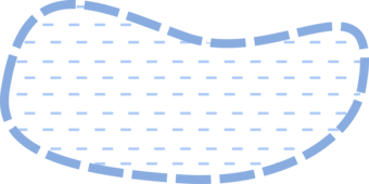
- Point Graphic Depiction: Not applicable
- Linear Graphic Depiction: Not applicable
- Polygon Graphic Depiction:
- Symbol, as applicable:
- Symbol Description: A blue, dashed outline with blue marker fill. The blue marker fill consists of two lines with different dash patterns offset from one another.
Polygon Symbology Specifications
- Layer 1 (Shape Marker - Fill):
- Size: 5.00 pt
- Color (R,G,B): 137,172,224
- Transparency: 0%
- Layer 2 (Shape Marker - Fill):
- Size: 5.00 pt
- Color (R,G,B): 137,172,224
- Transparency: 0%
- Layer 3 (Stroke: Dash/Gap Pattern – 5.68·1.42):
- Size: 0.576 pt
- Color (R,G,B): 81,129,184
- Transparency: 0%
Labeling
- Labeling: Not applicable
Levee (No attributes)
Subtype of NHDArea
- FType: Levee
- FCode: 56800
- Feature Description: An embankment built to prevent flooding or to control or confine the flow of liquids. Levee also exists as an NHDLine. Not a named feature. Levee exists as an NHDArea and NHDLine.
- Feature Geometry: Linear
Graphic Depiction

- Point Graphic Depiction: Not applicable
- Linear Graphic Depiction:
- Symbol: Levee (No attributes)
- Symbol Description: A brown, vertical hash line.
- Polygon Graphic Depiction: Not applicable
Line Symbology Specifications
- Layer 1 (Shape Marker - Hash):
- Shape Marker Size: 2.0016 pt
- Line Size: 1.00 pt
- Color (R,G,B): 159,85,31
- Transparency: 0%
Labeling
- Labeling: Not applicable
Rapids (No attributes)
Subtype of NHDArea
- FType: Rapids
- FCode: 43100
- Feature Description: An area of swift current in a stream or river, characterized by standing waves or by boulders and rocks. May be a named feature. Rapids exists as an NHDArea, NHDLine and NHDPoint.
- Feature Geometry: Point, Linear, Polygon
Graphic Depiction

- Point Graphic Depiction:
- Symbol: Rapids (No attributes)
- Symbol Description: A blue equal sign character (=) rotated 90 degrees shown on the left; shown in context on the right aligned perpendicular on a stream.

- Linear Graphic Depiction:
- Symbol: Rapids (No attributes)
- Symbol Description: A blue, solid line; shown in context on the top.
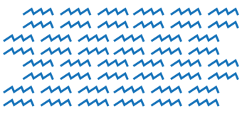
- Polygon Graphic Depiction:
- Symbol: Rapids (No attributes)
- Symbol Description: A blue, wave-patterned fill with no outline.
Point Symbology Specifications
- Layer 1 (Shape Marker):
- Size: 10.00 pt
- Color (R,G,B): 33,121,235
- Transparency: 0%
Line Symbology Specifications
- Layer 1 (Solid Stroke):
- Size: 1.00 pt
- Color (R,G,B): 137,172,224
- Transparency: 0%
Polygon Symbology Specifications
- Layer 1 (Shape Marker - Fill):
- Size: 9.00 pt
- Color (R,G,B): 137,172,224
- Transparency: 0%
Labeling

- Labeling Graphic Depiction:
- Label: Rapids (No attributes) - Label
- Label Description: Blue italic text.
- Font Style: Charis SIL, Italic
- Font Size: 7.00 pt
- Font Color (R,G,B): 101,137,191
- Font Halo Size: 0.70 pt
- Font Halo Color (R,G,B): 240,240,240
- Placement Properties: Best position around point.
SeaOcean (No attributes)
Subtype of NHDArea
- FType: SeaOcean
- FCode: 44500
- Feature Description: The great body of salt water that covers much of the earth. May be a named feature.
- Feature Geometry: Polygon
Graphic Depiction
- Point Graphic Depiction: Not applicable
- Linear Graphic Depiction: Not applicable
- Polygon Graphic Depiction:
- Symbol: SeaOcean (No attributes)
- Symbol Description: A blue outline with a blue, solid fill.
Polygon Symbology Specifications
- Layer 1 (Solid Stroke):
- Size: 0.45 pt
- Color (R,G,B): 137,172,224
- Transparency: 0%
- Layer 2 (Solid Fill):
- Size: Not applicable
- Color (R,G,B): 174,203,248
- Transparency: 70%
Labeling

- Labeling Graphic Depiction:
- Label: SeaOcean (No attributes) - Label
- Label Description: Blue italic text.
- Font Style: Charis SIL, Italic
- Font Size: 12.00 pt
- Font Color (R,G,B): 101,137,191
- Font Halo Size: 0.60 pt
- Font Halo Color (R,G,B): 240,240,240
- Placement Properties: Regular placement horizontal within the polygon.
Spillway (No attributes)
Subtype of NHDArea
- FType: Spillway
- FCode: 45500
- Feature Description: A constructed passage for surplus water to run over or around a dam.
- Feature Geometry: Polygon
Graphic Depiction

- Point Graphic Depiction: Not applicable
- Linear Graphic Depiction: Not applicable
- Polygon Graphic Depiction:
- Symbol: Spillway (No attributes)
- Symbol Description: Dark gray outline with no fill.
Polygon Symbology Specifications
- Layer 1 (Solid Stroke):
- Size: 0.50 pt
- Color (R,G,B): 52,52,52
- Transparency: 0%
Labeling
- Labeling: Not applicable
StreamRiver (Hydrographic Category = No attributes; Perennial)
Subtype of NHDArea
- StreamRiver (No attributes)
- FType: StreamRiver
- FCode: 46000
- Feature Description: A body of flowing water. Portion of the year the feature contains water unknown. StreamRiver exists as an NHDArea and NHDFlowline.
- Feature Geometry: Linear, Polygon
- StreamRiver (Hydrographic Category = Perennial)
- FType: StreamRiver
- FCode: 46006
- Feature Description: A body of flowing water that contains water throughout the year, except for infrequent periods of severe drought. StreamRiver exists as an NHDArea and NHDFlowline.
- Feature Geometry: Linear, Polygon
Graphic Depiction
- Point Graphic Depiction: Not applicable
- Linear Graphic Depiction:
- Symbol, as applicable:
- Symbol Description: A blue, solid line; shown in context on the top.
- Polygon Graphic Depiction:
- Symbol, as applicable:
- Symbol Description: A blue outline with a blue, solid fill.
Line Symbology Specifications
- Layer 1 (Solid Stroke):
- Size: 0.80 pt
- Color (R,G,B): 137,172,224
- Transparency: 0%
Polygon Symbology Specifications
- Layer 1 (Solid Stroke):
- Size: 0.45 pt
- Color (R,G,B): 137,172,224
- Transparency: 0%
- Layer 2 (Solid Fill):
- Size: Not applicable
- Color (R,G,B): 174,203,248
- Transparency: 70%
Labeling

- Labeling Graphic Depiction:
- Label, as applicable:
- Label Description: Blue italic text.
- Font Style: Charis SIL, Italic
- Font Size: 9.00 pt
- Font Color (R,G,B): 101,137,191
- Font Halo Size: 0.80 pt
- Font Halo Color (R,G,B): 240,240,240
- Placement Properties: Regular placement curved and offset from line.
StreamRiver (Hydrographic Category = Intermittent)
Subtype of NHDArea
- FType: StreamRiver
- FCode: 46003
- Feature Description: A body of flowing water that contains water for only part of the year, but more than just after rainstorms and at snowmelt. StreamRiver exists as an NHDArea and NHDFlowline.
- Feature Geometry: Linear, Polygon
Graphic Depiction
- Point Graphic Depiction: Not applicable
- Linear Graphic Depiction:
- Symbol: StreamRiver (Hydrographic Category = Intermittent)
- Symbol Description: A blue, dashed line.

- Polygon Graphic Depiction:
- Symbol: StreamRiver (Hydrographic Category = Intermittent)
- Symbol Description: A blue, solid outline with a blue, random square dot marker fill. The blue marker fill consists of three layers of markers at different angles.
Line Symbology Specifications
- Layer 1 (Stroke: Dash/Gap Pattern – 17·2·1·2·1·2·1·2):
- Size: 0.80 pt
- Color (R,G,B): 137,172,224
- Transparency: 0%
Polygon Symbology Specifications
- Layer 1 (Solid Stroke):
- Size: 0.58 pt
- Color (R,G,B): 137,172,224
- Transparency: 0%
- Layer 2 (Shape Marker - Fill):
- Size: 16.00 pt
- Color (R,G,B): 137,172,224
- Transparency: 0%
Labeling
- Labeling Graphic Depiction:
- Label: StreamRiver (Hydrographic Category = Intermittent) - Label
- Label Description: Blue italic text.
- Font Style: Charis SIL, Italic
- Font Size: 9.00 pt
- Font Color (R,G,B): 101,137,191
- Font Halo Size: 0.80 pt
- Font Halo Color (R,G,B): 240,240,240
- Placement Properties: Regular placement curved and offset from line.
Submerged Stream (No attributes)
Subtype of NHDArea
- FType: Submerged Stream
- FCode: 46100
- Feature Description: The original river course inundated by an impounded water body. These are mostly used in drowned river systems like the Tennessee Valley Authority (TVA) lakes. May be a named feature.
- Feature Geometry: Polygon
Graphic Depiction

- Point Graphic Depiction: Not applicable
- Linear Graphic Depiction: Not applicable
- Polygon Graphic Depiction:
- Symbol: Submerged Stream (No attributes)
- Symbol Description: A blue, dashed outline with no fill.
Polygon Symbology Specifications
- Layer 1 (Stroke: Dash/Gap Pattern – 5.68·1.42):
- Size: 0.576 pt
- Color (R,G,B): 137,172,224
- Transparency: 0%
Labeling
- Labeling: Not applicable
Wash (No attributes)
Subtype of NHDArea
- FType: Wash
- FCode: 48400
- Feature Description: The usually dry portion of a stream bed that contains water only during or after a local rainstorm or heavy snowmelt. May be a named feature.
- Feature Geometry: Polygon
Graphic Depiction
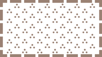
- Point Graphic Depiction: Not applicable
- Linear Graphic Depiction: Not applicable
- Polygon Graphic Depiction:
- Symbol: Wash (No attributes)
- Symbol Description: A brown, patterned marker fill with a brown, dashed outline. The marker fill consists of three dots arranged in a triangular pattern and repeated within in the polygon.
Polygon Symbology Specifications
- Layer 1 (Shape Marker - Fill):
- Size: 18.00 pt
- Color (R,G,B): 141,126,109
- Transparency: 0%
- Layer 2 (Stroke: Dash/Gap Pattern – 5.68·1.42):
- Size: 0.50 pt
- Color (R,G,B): 141,126,109
- Transparency: 0%
Labeling
- Labeling: Not applicable
NHDFlowline
Artificial Path (No attributes)
Subtype of NHDFlowline
- FType: ArtificialPath
- FCode: 55800
- Feature Description: A surrogate for general flow direction in NHDWaterbodies and NHDAreas. Artificial Paths carry the name of the flowline feature. NHDArea StreamRivers will have an Artificial Path that will carry the name of the river.
- Feature Geometry: Not applicable
Graphic Depiction
- Point Graphic Depiction: Not applicable
- Linear Graphic Depiction: Not applicable
- Polygon Graphic Depiction: Not applicable
Symbology Specifications
- Not applicable
Labeling

- Labeling Graphic Depiction:
- Label: Artificial Path (No attributes) - Label
- Label Description: Blue italic text.
- Font Style: Charis SIL, Italic
- Font Size: 9.00 pt
- Font Color (R,G,B): 101,137,191
- Font Halo Size: 0.70 pt
- Font Halo Color (R,G,B): 240,240,240
- Placement Properties: River placement curved and offset from line.
CanalDitch (Type = null; Aqueduct)
Subtype of NHDFlowline
- CanalDitch (CanalDitch Type = null)
- FType: CanalDitch
- FCode: 33600
- Feature Description: An artificial open waterway constructed to transport water, to irrigate or drain land, to connect two or more bodies of water, or to serve as a waterway for watercraft. May be a named feature. CanalDitch exists as an NHDArea and NHDFlowline.
- Feature Geometry: Linear, Polygon
- CanalDitch (CanalDitch Type = Aqueduct)
- FType: CanalDitch
- FCode: 33601
- Feature Description: An artificial, open waterway designed to transport domestic or industrial water from a supply source to a distribution point, often by gravity. CanalDitch exists as an NHDArea and NHDFlowline.
- Feature Geometry: Linear, Polygon
Graphic Depiction
- Point Graphic Depiction: Not applicable
- Linear Graphic Depiction:
- Symbol, as applicable:
- Symbol Description: A blue, dashed line.
- Polygon Graphic Depiction:
- Symbol, as applicable:
- Symbol Description: A solid blue outline with a blue, solid fill.
Line Symbology Specifications
- Layer 1 (Stroke: Dash/Gap Pattern – 17·2·1·2·1·2·1·2):
- Size: 0.80 pt
- Color (R,G,B): 137,172,224
- Transparency: 0%
Polygon Symbology Specifications
- Layer 1 (Solid Stroke):
- Size: 0.45 pt
- Color (R,G,B): 137,172,224
- Transparency: 0%
- Layer 2 (Solid Fill):
- Size: Not applicable
- Color (R,G,B): 174,203,248
- Transparency: 70%
Labeling
- Labeling Graphic Depiction:
- Label, as applicable:
- Label Description: Blue italic text.
- Font Style: Charis SIL, Italic
- Font Size: 9.00 pt
- Font Color (R,G,B): 101,137,191
- Font Halo Size: 0.80 pt
- Font Halo Color (R,G,B): 240,240,240
- Placement Properties: Regular placement curved and offset from line.
Coastline (No attributes)
Subtype of NHDFlowline
- FType: Coastline
- FCode: 56600
- Feature Description: A line of contact between the open sea and the land, including imaginary lines separating inland water bodies from the open sea. The NHD acquires coastline data from the National Ocean and Atmospheric Agency (NOAA) and it is not a product of the USGS. Coastline in the NHD is a representation of the Mean High Water (MHW) as calculated by NOAA and may not match orthoimagery. Coastline in the NHD could be altered but must have an accompanying metadata record that identifies the scientific method used to calibrate the coastline to a known vertical datum. Coastline may be a named feature.
- Feature Geometry: Linear
Graphic Depiction

- Point Graphic Depiction: Not applicable
- Linear Graphic Depiction:
- Coastline (No attributes)
- Symbol Description: A blue, solid line shown on the left; shown in context on the right adjacent to a waterbody.
- Polygon Graphic Depiction: Not applicable
Line Symbology Specifications
- Layer 1 (Solid Stroke):
- Size: 0.58 pt
- Color (R,G,B): 137,172,224
- Transparency: 0%
Labeling
- Labeling: Not applicable
Pipeline (Solid line, labeled)
Subtype of NHDFlowline
- Pipeline (Product = water, Pipeline Type = Aqueduct, Relationship to Surface = At or near)
- FType: Pipeline
- FCode: 42801
- Feature Description: A closed conduit, with pumps, valves and control devices, for conveying fluids, gases, or finely divided solids. Aqueduct pipeline, designed to transport domestic or industrial water from a supply source to a distribution point, often by gravity. Vertical location of pipeline is at or near the surface.
- Feature Geometry: Linear
- Pipeline (Product = water, Pipeline Type = Aqueduct, Relationship to Surface = Elevated)
- FType: Pipeline
- FCode: 42802
- Feature Description: A closed conduit, with pumps, valves and control devices, for conveying fluids, gases, or finely divided solids. Aqueduct pipeline, designed to transport domestic or industrial water from a supply source to a distribution point, often by gravity. Vertical location of pipeline is elevated (supported above the earth).
- Feature Geometry: Linear
- Pipeline (Product = water, Pipeline Type = Aqueduct, Relationship to Surface = Underwater)
- FType: Pipeline
- FCode: 42804
- Feature Description: A closed conduit, with pumps, valves and control devices, for conveying fluids, gases, or finely divided solids. Aqueduct pipeline, designed to transport domestic or industrial water from a supply source to a distribution point, often by gravity. Vertical location of pipeline is underwater (always submerged).
- Feature Geometry: Linear
Graphic Depiction
- Point Graphic Depiction: Not applicable
- Linear Graphic Depiction:
- Symbol, as applicable:
- Symbol Description: A blue, solid line; shown in context on the top.
- Polygon Graphic Depiction: Not applicable
Line Symbology Specifications
- Layer 1 (Solid Stroke):
- Size: 0.80 pt
- Color (R,G,B): 137,172,224
- Transparency: 0%
Labeling
- Labeling Graphic Depiction:
- Label, as applicable:
- Label Description: Blue italic text.
- Font Style: Charis SIL, Italic
- Font Size: 9.00 pt
- Font Color (R,G,B): 101,137,191
- Font Halo Size: 0.80 pt
- Font Halo Color (R,G,B): 240,240,240
- Placement Properties: Regular placement curved and offset from line.
Pipeline (Solid line, unlabeled)
Subtype of NHDFlowline
- Pipeline (Product = null, Pipeline Type = null, Relationship to Surface = null)
- FType: Pipeline
- FCode: 42800
- Feature Description: A closed conduit, with pumps, valves and control devices, for conveying fluids, gases, or finely divided solids. Type of product conveyed by pipeline unknown. Type of function or purpose of pipeline unknown. Vertical location of pipeline relative to the surface unknown.
- Feature Geometry: Linear
- Pipeline (Product = water, Pipeline Type = Aqueduct, Relationship to Surface = null)
- FType: Pipeline
- FCode: 42816
- Feature Description: A closed conduit, with pumps, valves and control devices, for conveying fluids, gases, or finely divided solids. Aqueduct pipeline, designed to transport domestic or industrial water from a supply source to a distribution point, often by gravity. Vertical location of pipeline is unknown.
- Feature Geometry: Linear
- Pipeline (Product = water, Pipeline Type = General Case, Relationship to Surface = null)
- FType: Pipeline
- FCode: 42814
- Feature Description: A closed conduit, with pumps, valves and control devices, for conveying fluids, gases, or finely divided solids. General case (common use) pipeline, used to channel flowing water to another site. Vertical location of pipeline is unknown.
- Feature Geometry: Linear
- Pipeline (Product = water, Pipeline Type = General Case, Relationship to Surface = At or near)
- FType: Pipeline
- FCode: 42805
- Feature Description: A closed conduit, with pumps, valves and control devices, for conveying fluids, gases, or finely divided solids. General case (common use) pipeline, used to channel flowing water to another site. Vertical location of pipeline is at or near the surface.
- Feature Geometry: Linear
- Pipeline (Product = water, Pipeline Type = General Case, Relationship to Surface = Elevated)
- FType: Pipeline
- FCode: 42806
- Feature Description: A closed conduit, with pumps, valves and control devices, for conveying fluids, gases, or finely divided solids. General case (common use) pipeline, used to channel flowing water to another site. Vertical location of pipeline is elevated (supported above the earth).
- Feature Geometry: Linear
- Pipeline (Product = water, Pipeline Type = General Case, Relationship to Surface = Underwater)
- FType: Pipeline
- FCode: 42808
- Feature Description: A closed conduit, with pumps, valves and control devices, for conveying fluids, gases, or finely divided solids. General case (common use) pipeline, used to channel flowing water to another site. Vertical location of pipeline is underwater (always submerged).
- Feature Geometry: Linear
- Pipeline (Product = water, Pipeline Type = Penstock, Relationship to Surface = null)
- FType: Pipeline
- FCode: 42815
- Feature Description: A closed conduit, with pumps, valves and control devices, for conveying fluids, gases, or finely divided solids. Penstock pipeline, designed to convey water into the turbine of a hydroelectric generating plant. Vertical location of pipeline is unknown.
- Feature Geometry: Linear
- Pipeline (Product = water, Pipeline Type = Penstock, Relationship to Surface = At or near)
- FType: Pipeline
- FCode: 42809
- Feature Description: A closed conduit, with pumps, valves and control devices, for conveying fluids, gases, or finely divided solids. Penstock pipeline, designed to convey water into the turbine of a hydroelectric generating plant. Vertical location of pipeline is at or near the surface.
- Feature Geometry: Linear
- Pipeline (Product = water, Pipeline Type = Penstock, Relationship to Surface = Elevated)
- FType: Pipeline
- FCode: 42810
- Feature Description: A closed conduit, with pumps, valves and control devices, for conveying fluids, gases, or finely divided solids. Penstock pipeline, designed to convey water into the turbine of a hydroelectric generating plant. Vertical location of pipeline is elevated (supported above the earth).
- Feature Geometry: Linear
- Pipeline (Product = water, Pipeline Type = Penstock, Relationship to Surface = Underwater)
- FType: Pipeline
- FCode: 42812
- Feature Description: A closed conduit, with pumps, valves and control devices, for conveying fluids, gases, or finely divided solids. Penstock pipeline, designed to convey water into the turbine of a hydroelectric generating plant. Vertical location of pipeline is underwater (always submerged).
- Feature Geometry: Linear
- Pipeline (Product = water, Pipeline Type = Siphon, Relationship to Surface = Unspecified)
- FType: Pipeline
- FCode: 42813
- Feature Description: A closed conduit, with pumps, valves and control devices, for conveying fluids, gases, or finely divided solids. Siphon pipeline, designed to convey water by gravitational force over, or under, an obstruction. Vertical location of pipeline is unknown.
- Feature Geometry: Linear
Graphic Depiction
- Point Graphic Depiction: Not applicable
- Linear Graphic Depiction:
- Symbol, as applicable:
- Pipeline (Product = null, Pipeline Type = null, Relationship to Surface = null)
- Pipeline (Product = water, Pipeline Type = Aqueduct, Relationship to Surface = null)
- Pipeline (Product = water, Pipeline Type = General Case, Relationship to Surface = null)
- Pipeline (Product = water, Pipeline Type = General Case, Relationship to Surface = At or near)
- Pipeline (Product = water, Pipeline Type = General Case, Relationship to Surface = Elevated)
- Pipeline (Product = water, Pipeline Type = General Case, Relationship to Surface = Underwater)
- Pipeline (Product = water, Pipeline Type = Penstock, Relationship to Surface = null)
- Pipeline (Product = water, Pipeline Type = Penstock, Relationship to Surface = At or near)
- Pipeline (Product = water, Pipeline Type = Penstock, Relationship to Surface = Elevated)
- Pipeline (Product = water, Pipeline Type = Penstock, Relationship to Surface = Underwater)
- Pipeline (Product = water, Pipeline Type = Siphon, Relationship to Surface = Unspecified)
- Symbol Description: A blue, solid line; shown in context on the top.
- Symbol, as applicable:
- Polygon Graphic Depiction: Not applicable
Line Symbology Specifications
- Layer 1 (Solid Stroke):
- Size: 0.80 pt
- Color (R,G,B): 137,172,224
- Transparency: 0%
Labeling
- Labeling: Not applicable
Pipeline (Dashed line, labeled)
Subtype of NHDFlowline
Pipeline (Product = water, Pipeline Type = Aqueduct, Relationship to Surface = Underground)
- FType: Pipeline
- FCode: 42803
- Feature Description: A closed conduit, with pumps, valves and control devices, for conveying fluids, gases, or finely divided solids. Aqueduct pipeline, designed to transport domestic or industrial water from a supply source to a distribution point, often by gravity. Vertical location of pipeline is underground (buried below the surface).
- Feature Geometry: Linear
Graphic Depiction
- Point Graphic Depiction: Not applicable
- Linear Graphic Depiction:
- Symbol: Pipeline (Product = water, Pipeline Type = Aqueduct, Relationship to Surface = Underground)
- Symbol Description: A blue, dashed line.
- Polygon Graphic Depiction: Not applicable
Line Symbology Specifications
- Layer 1 (Stroke: Dash/Gap Pattern – 4·2):
- Size: 0.80 pt
- Color (R,G,B): 137,172,224
- Transparency: 0%
Labeling
- Labeling Graphic Depiction:
- Label: Pipeline (Product = water, Pipeline Type = Aqueduct, Relationship to Surface = Underground) - Label
- Label Description: Blue italic text.
- Font Style: Charis SIL, Italic
- Font Size: 9.00 pt
- Font Color (R,G,B): 101,137,191
- Font Halo Size: 0.80 pt
- Font Halo Color (R,G,B): 240,240,240
- Placement Properties: Regular placement curved and offset from line.
Pipeline (Dashed line, unlabeled)
Subtype of NHDFlowline
- Pipeline (Product = water, Pipeline Type = General Case, Relationship to Surface = Underground)
- FType: Pipeline
- FCode: 42807
- Feature Description: A closed conduit, with pumps, valves and control devices, for conveying fluids, gases, or finely divided solids. General case (common use) pipeline, used to channel flowing water to another site. Vertical location of pipeline is underground (buried below the surface).
- Feature Geometry: Linear
- Pipeline (Product = water, Pipeline Type = Penstock, Relationship to Surface = Underground)
- FType: Pipeline
- FCode: 42811
- Feature Description: A closed conduit, with pumps, valves and control devices, for conveying fluids, gases, or finely divided solids. Penstock pipeline, designed to convey water into the turbine of a hydroelectric generating plant. Vertical location of pipeline is underground (buried below the surface).
- Feature Geometry: Linear
Graphic Depiction
- Point Graphic Depiction: Not applicable
- Linear Graphic Depiction:
- Symbol, as applicable:
- Symbol Description: A blue, dashed line.
- Polygon Graphic Depiction: Not applicable
Line Symbology Specifications
- Layer 1 (Stroke: Dash/Gap Pattern – 4·2):
- Size: 0.80 pt
- Color (R,G,B): 137,172,224
- Transparency: 0%
Labeling
- Labeling: Not applicable
StreamRiver (No attributes; Hydrographic Category = Perennial)
Subtype of NHDFlowline
- StreamRiver (No attributes)
- FType: StreamRiver
- FCode: 46000
- Feature Description: A body of flowing water. Portion of the year the feature contains water unknown. StreamRiver exists as an NHDArea and NHDFlowline.
- Feature Geometry: Linear, Polygon
- StreamRiver (Hydrographic Category = Perennial)
- FType: StreamRiver
- FCode: 46006
- Feature Description: A body of flowing water that contains water throughout the year, except for infrequent periods of severe drought. StreamRiver exists as an NHDArea and NHDFlowline.
- Feature Geometry: Linear, Polygon
Graphic Depiction
- Point Graphic Depiction: Not applicable
- Linear Graphic Depiction:
- Symbol, as applicable:
- Symbol Description: A blue, solid line; shown in context on the top.
- Polygon Graphic Depiction:
- Symbol, as applicable:
- Symbol Description: A blue, solid outline with a blue, solid fill.
Line Symbology Specifications
- Layer 1 (Solid Stroke):
- Size: 0.80 pt
- Color (R,G,B): 137,172,224
- Transparency: 0%
Polygon Symbology Specifications
- Layer 1 (Solid Stroke):
- Size: 0.45 pt
- Color (R,G,B): 137,172,224
- Transparency: 0%
- Layer 2 (Solid Fill):
- Size: Not applicable
- Color (R,G,B): 174,203,248
- Transparency: 70%
Labeling
- Labeling Graphic Depiction:
- Label, as applicable:
- Label Description: Blue italic text.
- Font Style: Charis SIL, Italic
- Font Size: 9.00 pt
- Font Color (R,G,B): 101,137,191
- Font Halo Size: 0.80 pt
- Font Halo Color (R,G,B): 240,240,240
- Placement Properties: Regular placement curved and offset from line.
StreamRiver (Hydrographic Category = Intermittent)
Subtype of NHDFlowline
- FType: StreamRiver
- FCode: 46003
- Feature Description: A body of flowing water that contains water for only part of the year, but more than just after rainstorms and at snowmelt. StreamRiver exists as an NHDArea and NHDFlowline.
- Feature Geometry: Linear, Polygon
Graphic Depiction
- Point Graphic Depiction: Not applicable
- Linear Graphic Depiction:
- Symbol: StreamRiver (Hydrographic Category = Intermittent)
- Symbol Description: A blue, dashed line.
- Polygon Graphic Depiction:
- Symbol: StreamRiver (Hydrographic Category = Intermittent)
- Symbol Description: A blue, solid outline with random blue square dot marker fill. Marker fill consists of three layers of markers at different angles.
Line Symbology Specifications
- Layer 1 (Stroke: Dash/Gap Pattern – 17·2·1·2·1·2·1·2):
- Size: 0.80 pt
- Color (R,G,B): 137,172,224
- Transparency: 0%
Polygon Symbology Specifications
- Layer 1 (Solid Stroke):
- Size: 0.58 pt
- Color (R,G,B): 137,172,224
- Transparency: 0%
- Layer 2 (Shape Marker - Fill):
- Size: 16.00 pt
- Color (R,G,B): 137,172,224
- Transparency: 0%
Labeling
- Labeling Graphic Depiction:
- Label: StreamRiver (Hydrographic Category = Intermittent) - Label
- Label Description: Blue italic text.
- Font Style: Charis SIL, Italic
- Font Size: 9.00 pt
- Font Color (R,G,B): 101,137,191
- Font Halo Size: 0.80 pt
- Font Halo Color (R,G,B): 240,240,240
- Placement Properties: Regular placement curved and offset from line.
Underground Conduit (Positional Accuracy = null)
Subtype of NHDFlowline
- FType: Underground Conduit
- FCode: 42000
- Feature Description: A set of naturally occurring subsurface drainage channels formed from the dissolution of soluble rocks in Karst terrain or in terrain similar to karst but formed in non-soluble rocks, as by melting of permafrost or ground ice, collapse after mining, and by outflow of liquid lava from beneath its solidified crust. The accuracy within which the feature may be confidently positioned is unknown.
- Feature Geometry: Linear
Graphic Depiction
- Point Graphic Depiction: Not applicable
- Linear Graphic Depiction:
- Symbol: Underground Conduit (Positional Accuracy = null)
- Symbol Description: A dark gray, solid line.
- Polygon Graphic Depiction: Not applicable
Line Symbology Specifications
- Layer 1 (Solid Stroke):
- Size: 0.72 pt
- Color (R,G,B): 52,52,52
- Transparency: 0%
Labeling
- Labeling: Not applicable
NHDLine
DamWeir (Construction Material = null; Earthen)
Subtype of NHDLine
- DamWeir (Construction Material = null)
- FType: DamWeir
- FCode: 34300
- Feature Description: A barrier constructed to control the flow or raise the level of water. No information on the predominant construction material. DamWeir exists as an NHDArea, NHDLine and NHDPoint.
- Feature Geometry: Point, Linear, Polygon
- DamWeir (Construction Material = Earthen)
- FType: DamWeir
- FCode: 34305
- Feature Description: A barrier constructed to control the flow or raise the level of water where the predominant material used in construction is earth, or a combination of earth and rock. DamWeir exists as an NHDArea, NHDLine and NHDPoint.
- Feature Geometry: Point, Linear, Polygon
Graphic Depiction
- Point Graphic Depiction:
- Symbol, as applicable:
- Symbol Description: A black "l" character shown on the left; shown in context on the right adjacent to a waterbody.
- Linear Graphic Depiction:
- Symbol, as applicable:
- Symbol Description: Brown, dashed line shown on the left; shown in context on the right adjacent to a waterbody.
- Polygon Graphic Depiction:
- Symbol, as applicable:
- Symbol Description: Dark gray outline with a light gray, solid fill.
Point Symbology Specifications
- Layer 1 (Shape Marker):
- Size: 10.00 pt
- Color (R,G,B): 0,0,0
- Transparency: 0%
Line Symbology Specifications
- Layer 1 (Stroke: Dash/Gap Pattern – 5·2):
- Size: 0.864 pt
- Color (R,G,B): 159,85,31
- Transparency: 0%
Polygon Symbology Specifications
- Layer 1 (Solid Fill):
- Size: Not applicable
- Color (R,G,B): 156,156,156
- Transparency: 0%
- Layer 2 (Solid Stroke):
- Size: 1.00 pt
- Color (R,G,B): 52,52,52
- Transparency: 0%
Labeling
- Labeling: Not applicable
DamWeir (Construction Material = Nonearthen)
Subtype of NHDLine
- FType: DamWeir
- FCode: 34306
- Feature Description: A barrier constructed to control the flow or raise the level of water where the predominant material used in construction is concrete, brick, or stone. Coincident with a Nonearthen Shore Feature. DamWeir exists as an NHDArea, NHDLine and NHDPoint.
- Feature Geometry: Point, Linear, Polygon
Graphic Depiction
- Point Graphic Depiction:
- Symbol: DamWeir (Construction Material = Nonearthen)
- Symbol Description: A black "l" character shown on the left; shown in context on the right adjacent to a waterbody.
- Linear Graphic Depiction:
- Symbol: DamWeir (Construction Material = Nonearthen)
- Symbol Description: A dark gray, solid line.
- Polygon Graphic Depiction:
- Symbol: DamWeir (Construction Material = Nonearthen)
- Symbol Description: A dark gray outline with a light gray solid fill.
Point Symbology Specifications
- Layer 1 (Shape Marker):
- Size: 10.00 pt
- Color (R,G,B): 0,0,0
- Transparency: 0%
Line Symbology Specifications
- Layer 1 (Solid Stroke):
- Size: 0.72 pt
- Color (R,G,B): 52,52,52
- Transparency: 0%
Polygon Symbology Specifications
- Layer 1 (Solid Fill):
- Size: Not applicable
- Color (R,G,B): 156,156,156
- Transparency: 0%
- Layer 2 (Solid Stroke):
- Size: 1.00 pt
- Color (R,G,B): 52,52,52
- Transparency: 0%
Labeling
- Labeling: Not applicable
Flume (No attributes)
Subtype of NHDLine
- FType: Flume
- FCode: 36200
- Feature Description: An open, inclined, artificial channel constructed of wood, metal, or concrete; generally elevated. May be a named feature. Flume exists as an NHDArea and NHDLine.
- Feature Geometry: Linear, Polygon
Graphic Depiction
- Point Graphic Depiction: Not applicable
- Linear Graphic Depiction:
- Symbol: Flume (No attributes)
- Symbol Description: A blue, dashed line.
- Polygon Graphic Depiction:
- Symbol: Flume (No attributes)
- Symbol Description: A blue, solid outline with a blue, solid fill.
Line Symbology Specifications
- Layer 1 (Stroke: Dash/Gap Pattern – 4·2):
- Size: 1.00 pt
- Color (R,G,B): 81,129,184
- Transparency: 0%
Polygon Symbology Specifications
- Layer 1 (Solid Stroke):
- Size: 0.45 pt
- Color (R,G,B): 137,172,224
- Transparency: 0%
- Layer 2 (Solid Fill):
- Size: Not applicable
- Color (R,G,B): 174,203,248
- Transparency: 70%
Labeling
- Labeling: Not applicable
Levee (No attributes)
Subtype of NHDLine
- FType: Levee
- FCode: 56800
- Feature Description: An embankment built to prevent flooding or to control or confine the flow of liquids. Not a named feature. Levee exists as an NHDArea and NHDLine.
- Feature Geometry: Linear
Graphic Depiction
- Point Graphic Depiction: Not applicable
- Linear Graphic Depiction:
- Symbol: Levee (No attributes)
- Symbol Description: A brown, vertical hash line.
- Polygon Graphic Depiction: Not applicable
Line Symbology Specifications
- Layer 1 (Shape Marker - Hash):
- Shape Marker Size: 2.0016 pt
- Line Size: 1.00 pt
- Color (R,G,B): 159,85,31
- Transparency: 0%
Labeling
- Labeling: Not applicable
Nonearthen Shore (No attributes)
Subtype of NHDLine
- FType: Nonearthen Shore
- FCode: 41100
- Feature Description: A structure built of stone, brick, concrete, or other building materials that borders a body of water. Not a named feature.
- Feature Geometry: Linear
Graphic Depiction

- Point Graphic Depiction: Not applicable
- Linear Graphic Depiction:
- Symbol: Nonearthen Shore (No attributes)
- Symbol Description: A dark gray, solid line.
- Polygon Graphic Depiction: Not applicable
Line Symbology Specifications
- Layer 1 (Solid Stroke):
- Size: 0.58 pt
- Color (R,G,B): 52,52,52
- Transparency: 0%
Labeling
- Labeling: Not applicable
Rapids (No attributes)
Subtype of NHDLine
- FType: Rapids
- FCode: 43100
- Feature Description: An area of swift current in a stream or river, characterized by standing waves or by boulders and rocks. May be a named feature. Rapids exists as an NHDArea, NHDLine and NHDPoint.
- Feature Geometry: Point, Linear, Polygon
Graphic Depiction
- Point Graphic Depiction:
- Symbol: Rapids (No attributes)
- Symbol Description: A blue, double hash marker; shown in context on the right aligned perpendicular on a stream.
- Linear Graphic Depiction:
- Symbol: Rapids (No attributes)
- Symbol Description: A blue, solid line; shown in context on the top.
- Polygon Graphic Depiction:
- Symbol: Rapids (No attributes)
- Symbol Description: A blue, wave-patterned fill with no outline.
Point Symbology Specifications
- Layer 1 (Shape Marker):
- Size: 10.00 pt
- Color (R,G,B): 33,121,235
- Transparency: 0%
Line Symbology Specifications
- Layer 1 (Solid Stroke):
- Size: 1.00 pt
- Color (R,G,B): 137,172,224
- Transparency: 0%
Polygon Symbology Specifications
- Layer 1 (Shape Marker - Fill):
- Size: 9.00 pt
- Color (R,G,B): 137,172,224
- Transparency: 0%
Labeling
- Labeling Graphic Depiction:
- Label: Rapids (No attributes) - Label
- Label Description: Blue italic text.
- Font Style: Charis SIL, Italic
- Font Size: 8.00 pt
- Font Color (R,G,B): 101,137,191
- Font Halo Size: 0.70 pt
- Font Halo Color (R,G,B): 240,240,240
- Placement Properties: Best position around point.
Reef (No attributes)
Subtype of NHDLine
- FType: Reef
- FCode: 43400
- Feature Description: A chain of rocks or coral at or near the surface of the water. May be a named feature.
- Feature Geometry: Linear
Graphic Depiction

- Point Graphic Depiction: Not applicable
- Linear Graphic Depiction:
- Symbol: Reef (No attributes)
- Symbol Description: A hashed line constructed with a double, straight quotation mark character (") shown on the left; shown in context on the right in a waterbody.
- Polygon Graphic Depiction: Not applicable
Line Symbology Specifications
- Layer 1 (Shape Marker - Hash):
- Shape Marker Size: 5.04 pt
- Color (R,G,B): 52,52,52
- Transparency: 0%
Labeling
- Labeling: Not applicable
Tunnel (No attributes)
Subtype of NHDLine
- FType: Tunnel
- FCode: 47800
- Feature Description: An underground or underwater passage that carries water bearing features such as CanalDitch or Pipeline. May be a named feature.
- Feature Geometry: Linear
Graphic Depiction

- Point Graphic Depiction: Not applicable
- Linear Graphic Depiction:
- Symbol: Tunnel (No attributes)
- Symbol Description: Blue parallel, dashed lines at different offsets.
- Polygon Graphic Depiction: Not applicable
Line Symbology Specifications
- Layer 1 (Stroke: Dash/Gap Pattern – 4·2):
- Size: 0.288 pt
- Color (R,G,B): 137,172,224
- Transparency: 0%
- Layer 2 (Stroke: Dash/Gap Pattern – 4·2):
- Size: 0.288 pt
- Color (R,G,B): 137,172,224
- Transparency: 0%
Labeling
- Labeling: Not applicable
Waterfall (No attributes)
Subtype of NHDLine
- FType: Waterfall
- FCode: 48700
- Feature Description: A vertical or near vertical descent of water over a step or ledge in the bed of a river. May be a named feature. Waterfall exists as an NHDLine and NHDPoint.
- Feature Geometry: Point, Linear
Graphic Depiction

- Point Graphic Depiction:
- Symbol: Waterfall (No attributes)
- Symbol Description: A triple, blue tilde character (~) rotated 90 degrees shown on the left; shown in context on the right perpendicular on a stream.
- Linear Graphic Depiction:
- Symbol: Waterfall (No attributes)
- Symbol Description: A blue, solid line; shown in context on the top.
- Polygon Graphic Depiction: Not applicable
Point Symbology Specifications
- Layer 1 (Shape Marker):
- Size: 14.00 pt
- Color (R,G,B): 137,172,224
- Transparency: 0%
Line Symbology Specifications
- Layer 1 (Solid Stroke):
- Size: 1.00 pt
- Color (R,G,B): 137,172,224
- Transparency: 0%
Labeling

- Labeling Graphic Depiction:
- Label: Waterfall (No attributes) - Label
- Label Description: Blue italic text.
- Font Style: Charis SIL, Italic
- Font Size: 8.00 pt
- Font Color (R,G,B): 101,137,191
- Font Halo Size: 0.70 pt
- Font Halo Color (R,G,B): 240,240,240
- Placement Properties: Best position around point.
NHDPoint
DamWeir (Construction Material = null; Earthen)
Subtype of NHDPoint
- DamWeir (Construction Material = null)
- FType: DamWeir
- FCode: 34300
- Feature Description: A barrier constructed to control the flow or raise the level of water. No information on the predominant construction material. DamWeir exists as an NHDArea, NHDLine and NHDPoint.
- Feature Geometry: Point, Linear, Polygon
- DamWeir (Construction Material = Earthen)
- FType: DamWeir
- FCode: 34305
- Feature Description: A barrier constructed to control the flow or raise the level of water where the predominant material used in construction is earth, or a combination of earth and rock. DamWeir exists as an NHDArea, NHDLine and NHDPoint.
- Feature Geometry: Point, Linear, Polygon
Graphic Depiction
- Point Graphic Depiction:
- Symbol, as applicable:
- Symbol Description: A black "l" character shown on the left; shown in context on the right adjacent to a waterbody.
- Linear Graphic Depiction:
- Symbol, as applicable:
- Symbol Description: Brown, dashed line shown on the left; shown in context on the right adjacent to a waterbody.
- Polygon Graphic Depiction:
- Symbol, as applicable:
- Symbol Description: Dark gray outline with a light gray, solid fill.
Point Symbology Specifications
- Layer 1 (Shape Marker):
- Size: 10.00 pt
- Color (R,G,B): 0,0,0
- Transparency: 0%
Line Symbology Specifications
- Layer 1 (Stroke: Dash/Gap Pattern – 5·2):
- Size: 0.864 pt
- Color (R,G,B): 159,85,31
- Transparency: 0%
Polygon Symbology Specifications
- Layer 1 (Solid Fill):
- Size: Not applicable
- Color (R,G,B): 156,156,156
- Transparency: 0%
- Layer 2 (Solid Stroke):
- Size: 1.00 pt
- Color (R,G,B): 52,52,52
- Transparency: 0%
Labeling
- Labeling: Not applicable
DamWeir (Construction Material = Nonearthen)
Subtype of NHDPoint
- FType: DamWeir
- FCode: 34306
- Feature Description: A barrier constructed to control the flow or raise the level of water where the predominant material used in construction is concrete, brick, or stone. Coincident with a Nonearthen Shore Feature. DamWeir exists as an NHDArea, NHDLine and NHDPoint.
- Feature Geometry: Point, Linear, Polygon
Graphic Depiction
- Point Graphic Depiction:
- Symbol: DamWeir (Construction Material = Nonearthen)
- Symbol Description: A black "l" character shown on the left; shown in context on the right adjacent to a waterbody.
- Linear Graphic Depiction:
- Symbol: DamWeir (Construction Material = Nonearthen)
- Symbol Description: A dark gray, solid line.
- Polygon Graphic Depiction:
- Symbol: DamWeir (Construction Material = Nonearthen)
- Symbol Description: A dark gray outline with a light gray, solid fill.
Point Symbology Specifications
- Layer 1 (Shape Marker):
- Size: 10.00 pt
- Color (R,G,B): 0,0,0
- Transparency: 0%
Line Symbology Specifications
- Layer 1 (Solid Stroke):
- Size: 0.72 pt
- Color (R,G,B): 52,52,52
- Transparency: 0%
Polygon Symbology Specifications
- Layer 1 (Solid Fill):
- Size: Not applicable
- Color (R,G,B): 156,156,156
- Transparency: 0%
- Layer 2 (Solid Stroke):
- Size: 1.00 pt
- Color (R,G,B): 52,52,52
- Transparency: 0%
Labeling
- Labeling: Not applicable
Gaging Station (No attributes)
Subtype of NHDPoint
- FType: Gaging Station
- FCode: 36700
- Feature Description: A structure used to measure the characteristics of a hydrographic feature. Stream Gages are usually captured on the flowline and not necessarily on the physical location of the monitoring station. Stream Gages are also available as a Point Event. Not a named feature.
- Feature Geometry: Point
Graphic Depiction

- Point Graphic Depiction:
- Symbol: Gaging Station (No attributes)
- Symbol Description: A circle with a black outline and alternating black-and-white-filled quadrants.
- Linear Graphic Depiction: Not applicable
- Polygon Graphic Depiction: Not applicable
Point Symbology Specifications
- Layer 1 (Shape Marker):
- Size: 7.00 pt
- Color (R,G,B): 0,0,0
- Transparency: 0%
Labeling
- Labeling: Not applicable
Rapids (No attributes)
Subtype of NHDPoint
- FType: Rapids
- FCode: 43100
- Feature Description: An area of swift current in a stream or river, characterized by standing waves or by boulders and rocks. May be a named feature. Rapids exists as an NHDArea, NHDLine and NHDPoint.
- Feature Geometry: Point, Linear, Polygon
Graphic Depiction
- Point Graphic Depiction:
- Symbol: Rapids (No attributes)
- Symbol Description: A blue, double hash marker; shown in context on the right aligned perpendicular on a stream.
- Linear Graphic Depiction:
- Symbol: Rapids (No attributes)
- Symbol Description: A blue, solid line; shown in context on the top.
- Polygon Graphic Depiction:
- Symbol: Rapids (No attributes)
- Symbol Description: A blue, wave-patterned fill with no outline.
Point Symbology Specifications
- Layer 1 (Shape Marker):
- Size: 10.00 pt
- Color (R,G,B): 33,121,235
- Transparency: 0%
Line Symbology Specifications
- Layer 1 (Solid Stroke):
- Size: 1.00 pt
- Color (R,G,B): 137,172,224
- Transparency: 0%
Polygon Symbology Specifications
- Layer 1 (Shape Marker - Fill):
- Size: 9.00 pt
- Color (R,G,B): 137,172,224
- Transparency: 0%
Labeling
- Labeling Graphic Depiction:
- Label: Rapids (No attributes) - Label
- Label Description: Blue italic text.
- Font Style: Charis SIL, Italic
- Font Size: 8.00 pt
- Font Color (R,G,B): 101,137,191
- Font Halo Size: 0.70 pt
- Font Halo Color (R,G,B): 240,240,240
- Placement Properties: Best position around point.
Rock (All)
Subtype of NHDPoint
- Rock (Relationship to Surface = null)
- FType: Rock
- FCode: 44100
- Feature Description: A concreted mass of stony material.
- Feature Geometry: Point
- Rock (Relationship to Surface = Abovewater)
- FType: Rock
- FCode: 44101
- Feature Description: A concreted mass of stony material. The vertical location of the rock relative to the surface is above water (exposed at mean lower low water).
- Feature Geometry: Point
- Rock (Relationship to Surface = Underwater)
- FType: Rock
- FCode: 44102
- Feature Description: A concreted mass of stony material. The vertical location of the rock relative to the surface is underwater (always submerged).
- Feature Geometry: Point

Graphic Depiction
- Point Graphic Depiction:
- Symbol, as applicable:
- Symbol Description: A dark gray, layered symbol with an "X" character and a dash (-), similar to an asterisk. Marker symbol is shown in context within a waterbody.
- Linear Graphic Depiction: Not applicable
- Polygon Graphic Depiction: Not applicable
Point Symbology Specifications
- Layer 1 (Shape Marker):
- Size: 5.00 pt
- Color (R,G,B): 78,78,78
- Transparency: 0%
- Layer 2 (Shape Marker):
- Size: 5.00 pt
- Color (R,G,B): 78,78,78
- Transparency: 0%
Labeling
- Labeling: Not applicable
SpringSeep (No attributes)
Subtype of NHDPoint
- FType: SpringSeep
- FCode: 45800
- Feature Description: A place where water issues from the ground naturally. May be a named feature.
- Feature Geometry: Point

Graphic Depiction
- Point Graphic Depiction:
- Symbol: SpringSeep (No attributes)
- Symbol Description: A white, round dot superimposed slightly off-center and above center onto a blue, larger dot with a downward pointing blue, wavy line.
- Linear Graphic Depiction: Not applicable
- Polygon Graphic Depiction: Not applicable
Point Symbology Specifications
- Layer 1 (Shape Marker):
- Size: 12.00 pt
- Color (R,G,B): 255,255,255
- Transparency: 0%
- Layer 2 (Shape Marker):
- Size: 20.00 pt
- Color (R,G,B): 137,172,224
- Transparency: 0%
Labeling

- Labeling Graphic Depiction:
- Label: SpringSeep (No attributes) - Label
- Label Description: Blue italic text.
- Font Style: Charis SIL, Italic
- Font Size: 8.00 pt
- Font Color (R,G,B): 101,137,191
- Font Halo Size: 0.70 pt
- Font Halo Color (R,G,B): 240,240,240
- Placement Properties: Best position around point.
Waterfall (No attributes)
Subtype of NHDPoint
- FType: Waterfall
- FCode: 48700
- Feature Description: A vertical or near vertical descent of water over a step or ledge in the bed of a river. May be a named feature. Waterfall exists as an NHDLine and NHDPoint.
- Feature Geometry: Point, Linear
Graphic Depiction
- Point Graphic Depiction:
- Symbol: Waterfall (No attributes)
- Symbol Description: A triple, blue tilde character (~) rotated 90 degrees shown on the left; shown in context on the right perpendicular on a stream.
- Linear Graphic Depiction:
- Symbol: Waterfall (No attributes)
- Symbol Description: A blue, solid line; shown in context on the top.
- Polygon Graphic Depiction: Not applicable
Point Symbology Specifications
- Layer 1 (Shape Marker):
- Size: 14.00 pt
- Color (R,G,B): 137,172,224
- Transparency: 0%
Line Symbology Specifications
- Layer 1 (Solid Stroke):
- Size: 1.00 pt
- Color (R,G,B): 137,172,224
- Transparency: 0%
Labeling
- Labeling Graphic Depiction:
- Label: Waterfall (No attributes) - Label
- Label Description: Blue italic text.
- Font Style: Charis SIL, Italic
- Font Size: 8.00 pt
- Font Color (R,G,B): 101,137,191
- Font Halo Size: 0.70 pt
- Font Halo Color (R,G,B): 240,240,240
- Placement Properties: Best position around point.
Well (No attributes)
Subtype of NHDPoint
- FType: Well
- FCode: 48800
- Feature Description: A pit or hole dug or bored into the earth for the extraction of oil, water, other fluids, including gases. May be a named feature.
- Feature Geometry: Point

Graphic Depiction
- Point Graphic Depiction:
- Symbol: Well (No attributes)
- Symbol Description: A blue, circular outline.
- Linear Graphic Depiction: Not applicable
- Polygon Graphic Depiction: Not applicable
Point Symbology Specifications
- Layer 1 (Shape Marker):
- Size: 11.00 pt
- Color (R,G,B): 137,172,224
- Transparency: 0%
Labeling
- Labeling: Not applicable
NHDWaterbody
Estuary (No attributes)
Subtype of NHDWaterbody
- FType: Estuary
- FCode: 49300
- Feature Description: An estuary is “a semi-enclosed coastal body of water which has a free connection with the open sea and within which sea water is measurably diluted with fresh water derived from land drainage" (Cameron and Pritchard, 1963). An estuary is defined by the NOAA's Coastal Aquatic Framework (CAF) or local information concerning the extent of the mixed zone of fresh and salt water.
- Feature Geometry: Polygon
Graphic Depiction

- Point Graphic Depiction: Not applicable
- Linear Graphic Depiction: Not applicable
- Polygon Graphic Depiction:
- Symbol: Estuary (No attributes)
- Symbol Description: A blue, solid outline with blue, solid fill.
Polygon Symbology Specifications
- Layer 1 (Solid Stroke):
- Size: 0.45 pt
- Color (R,G,B): 137,172,224
- Transparency: 0%
- Layer 2 (Solid Fill):
- Size: Not applicable
- Color (R,G,B): 174,203,248
- Transparency: 0%
Labeling
- Labeling: Not applicable
Ice Mass (No attributes)
Subtype of NHDWaterbody
- FType: Ice Mass
- FCode: 37800
- Feature Description: A field of ice usually formed in regions of perennial frost. Ice Mass primarily consists of glaciers. May be a named feature.
- Feature Geometry: Polygon
Graphic Depiction

- Point Graphic Depiction: Not applicable
- Linear Graphic Depiction: Not applicable
- Polygon Graphic Depiction:
- Symbol: Ice Mass (No attributes)
- Symbol Description: A blue, square-dot-shape marker fill with no outline.
Polygon Symbology Specifications
- Layer 1 (Shape Marker - Fill):
- Size: 6.00 pt
- Color (R,G,B): 137,172,224
- Transparency: 0%
Labeling

- Labeling Graphic Depiction:
- Label: Ice Mass (No attributes) - Label
- Label Description: Blue italic text.
- Font Style: Segoe UI, Italic
- Font Size: 9.00 pt
- Font Color (R,G,B): 101,137,191
- Font Halo Size: 0.70 pt
- Font Halo Color (R,G,B): 240,240,240
- Placement Properties: Best position around point.
LakePond (Hydrographic Category = null; Perennial)
Subtype of NHDWaterbody
- LakePond (Hydrographic Category = null, Stage = null)
- FType: LakePond
- FCode: 39000
- Feature Description: A standing body of water with a predominantly natural shoreline surrounded by land or a flooded river system where a dam has been built to withhold water. Portion of the year the LakePond contains water is unknown. Height of the water surface is unknown.
- Feature Geometry: Polygon
- LakePond (Hydrographic Category = Perennial, Stage = null)
- FType: LakePond
- FCode: 39004
- Feature Description: A standing body of water with a predominantly natural shoreline surrounded by land or a flooded river system where a dam has been built to withhold water. Contains water throughout the year, except for infrequent periods of severe drought. Height of the water surface is unknown.
- Feature Geometry: Polygon
- LakePond (Hydrographic Category = Perennial, Stage = Average Water Elevation)
- FType: LakePond
- FCode: 39009
- Feature Description: A standing body of water with a predominantly natural shoreline surrounded by land or a flooded river system where a dam has been built to withhold water. Contains water throughout the year, except for infrequent periods of severe drought. Height of the water surface is the stage of a natural water body that prevails for the greater part of the year.
- Feature Geometry: Polygon
- LakePond (Hydrographic Category = Perennial, Stage = Date of Photography)
- FType: LakePond
- FCode: 39011
- Feature Description: A standing body of water with a predominantly natural shoreline surrounded by land or a flooded river system where a dam has been built to withhold water. Contains water throughout the year, except for infrequent periods of severe drought. Height of the water surface is the stage that exists at the date of the photography.
- Feature Geometry: Polygon
- LakePond (Hydrographic Category = Perennial, Stage = Normal Pool)
- FType: LakePond
- FCode: 39010
- Feature Description: A standing body of water with a predominantly natural shoreline surrounded by land or a flooded river system where a dam has been built to withhold water. Contains water throughout the year, except for infrequent periods of severe drought. Height of the water surface is the stage of an artificially impounded water body that prevails for the greater part of the year.
- Feature Geometry: Polygon
Graphic Depiction
- Point Graphic Depiction: Not applicable
- Linear Graphic Depiction: Not applicable
- Polygon Graphic Depiction:
- Symbol, as applicable:
- LakePond (Hydrographic Category = null, Stage = null)
- LakePond (Hydrographic Category = Perennial, Stage = null)
- LakePond (Hydrographic Category = Perennial, Stage = Average Water Elevation)
- LakePond (Hydrographic Category = Perennial, Stage = Date of Photography)
- LakePond (Hydrographic Category = Perennial, Stage = Normal Pool)
- Symbol Description: A blue, solid outline with blue, solid fill.
- Symbol, as applicable:
Polygon Symbology Specifications
- Layer 1 (Solid Stroke):
- Size: 0.45 pt
- Color (R,G,B): 137,172,224
- Transparency: 0%
- Layer 2 (Solid Fill):
- Size: Not applicable
- Color (R,G,B): 174,203,248
- Transparency: 70%
Labeling

- Labeling Graphic Depiction:
- Label, as applicable:
- LakePond (Hydrographic Category = null, Stage = null) - Label
- LakePond (Hydrographic Category = Perennial, Stage = null) - Label
- LakePond (Hydrographic Category = Perennial, Stage = Average Water Elevation) - Label
- LakePond (Hydrographic Category = Perennial, Stage = Date of Photography) - Label
- LakePond (Hydrographic Category = Perennial, Stage = Normal Pool) - Label
- Label Description: Blue italic text.
- Label, as applicable:
- Font Style: Charis SIL, Italic
- Font Size: 9.00 pt
- Font Color (R,G,B): 101,137,191
- Font Halo Size: 0.80 pt
- Font Halo Color (R,G,B): 240,240,240
- Placement Properties: Regular placement horizontal within the polygon.
LakePond (Hydrographic Category = Perennial, Stage = Spillway Elevation)
- FType: LakePond
- FCode: 39012
- Feature Description: A standing body of water with a predominantly natural shoreline surrounded by land or a flooded river system where a dam has been built to withhold water. Contains water throughout the year, except for infrequent periods of severe drought. Height of the water surface is the stage of an artificially impounded water body as determined by the spillway.
- Feature Geometry: Polygon
Graphic Depiction
- Point Graphic Depiction: Not applicable
- Linear Graphic Depiction: Not applicable
- Polygon Graphic Depiction:
- Symbol: LakePond (Hydrographic Category = Perennial, Stage = Spillway Elevation)
- Symbol Description: A blue, solid outline with blue, solid fill.
Polygon Symbology Specifications
- Layer 1 (Solid Stroke):
- Size: 0.45 pt
- Color (R,G,B): 137,172,224
- Transparency: 0%
- Layer 2 (Solid Fill):
- Size: Not applicable
- Color (R,G,B): 174,203,248
- Transparency: 70%
Labeling
- Labeling: Not applicable
LakePond (Hydrographic Category = Intermittent)
Subtype of NHDWaterbody
- LakePond (Hydrographic Category = Intermittent, Stage = null)
- FType: LakePond
- FCode: 39001
- Feature Description: A standing body of water with a predominantly natural shoreline surrounded by land or a flooded river system where a dam has been built to withhold water. Contains water for only part of the year, but more than just after rainstorms and at snowmelt. Height of the water surface is unknown.
- Feature Geometry: Polygon
- LakePond (Hydrographic Category = Intermittent, Stage = Date of Photography)
- FType: LakePond
- FCode: 39006
- Feature Description: A standing body of water with a predominantly natural shoreline surrounded by land or a flooded river system where a dam has been built to withhold water. Contains water for only part of the year, but more than just after rainstorms and at snowmelt. Height of the water surface is the stage that exists at the date of the photography.
- Feature Geometry: Polygon
- LakePond (Hydrographic Category = Intermittent, Stage = High Water Elevation)
- FType: LakePond
- FCode: 39005
- Feature Description: A standing body of water with a predominantly natural shoreline surrounded by land or a flooded river system where a dam has been built to withhold water. Contains water for only part of the year, but more than just after rainstorms and at snowmelt. Height of the water surface is the stage that prevails when a natural water body is at or near capacity.
- Feature Geometry: Polygon
Graphic Depiction
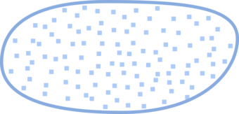
- Point Graphic Depiction: Not applicable
- Linear Graphic Depiction: Not applicable
- Polygon Graphic Depiction:
- Symbol, as applicable:
- Symbol Description: A blue, solid outline with a random blue square-dot fill.
Polygon Symbology Specifications
- Layer 1 (Shape Marker - Fill):
- Size: 6.00 pt
- Color (R,G,B): 137,172,224
- Transparency: 0%
- Layer 2 (Solid Stroke):
- Size: 0.58 pt
- Color (R,G,B): 137,172,224
- Transparency: 0%
Labeling
- Labeling Graphic Depiction:
- Font Style: Charis SIL, Italic
- Font Size: 9.00 pt
- Font Color (R,G,B): 101,137,191
- Font Halo Size: 0.80 pt
- Font Halo Color (R,G,B): 240,240,240
- Placement Properties: Regular placement horizontal within the polygon.
Playa (No attributes)
Subtype of NHDWaterbody
- FType: Playa
- FCode: 36100
- Feature Description: The flat area at the lowest part of an undrained desert basin, generally devoid of vegetation. May be a named feature.
- Feature Geometry: Polygon
Graphic Depiction
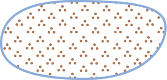
- Point Graphic Depiction: Not applicable
- Linear Graphic Depiction: Not applicable
- Polygon Graphic Depiction:
- Symbol: Playa (No attributes)
- Symbol Description: A brown, patterned marker fill with a blue, solid outline. The marker fill consists of three dots arranged in a triangular pattern and repeated within in the polygon.
Polygon Symbology Specifications
- Layer 1 (Solid Stroke):
- Size: 0.58 pt
- Color (R,G,B): 137,172,224
- Transparency: 0%
- Layer 2 (Shape Marker - Fill):
- Size: 18.00 pt
- Color (R,G,B): 157,99,55
- Transparency: 0%
Labeling
- Labeling: Not applicable
Reservoir (Blue outline (.45 pt), labeled)
Subtype of NHDWaterbody
- Reservoir (Reservoir Type = null, Construction Material = null, Hydrographic Category = null)
- FType: Reservoir
- FCode: 43600
- Feature Description: A constructed basin formed to contain water or other liquids. Function or purpose of reservoir is unknown. Predominant construction material used to construct the reservoir is unknown. The portion of the year the feature contains water is unknown.
- Feature Geometry: Polygon
- Reservoir (Reservoir Type = Water Storage, Construction Material = null, Hydrographic Category = null)
- FType: Reservoir
- FCode: 43617
- Feature Description: A constructed basin formed to contain water or other liquids. Water Storage reservoir, used for long or short-term storage of water. Predominant construction material used to construct the reservoir is unknown. The portion of the year the feature contains water is unknown.
- Feature Geometry: Polygon
- Reservoir (Reservoir Type = Water Storage, Construction Material = null, Hydrographic Category = Perennial)
- FType: Reservoir
- FCode: 43621
- Feature Description: A constructed basin formed to contain water or other liquids. Water Storage reservoir, used for long or short-term storage of water. Predominant construction material is unknown. The reservoir contains water throughout the year, except for infrequent periods of severe drought.
- Feature Geometry: Polygon
- Reservoir (Reservoir Type = Water Storage, Construction Material = Earthen, Hydrographic Category = Perennial)
- FType: Reservoir
- FCode: 43615
- Feature Description: A constructed basin formed to contain water or other liquids. Water Storage reservoir, used for long or short-term storage of water. Predominant construction material used to construct the reservoir is earth, or a combination of earth and rock. The reservoir contains water throughout the year, except for infrequent periods of severe drought.
- Feature Geometry: Polygon
Graphic Depiction
- Point Graphic Depiction: Not applicable
- Linear Graphic Depiction: Not applicable
- Polygon Graphic Depiction:
- Symbol, as applicable:
- Reservoir (Reservoir Type = null, Construction Material = null, Hydrographic Category = null)
- Reservoir (Reservoir Type = Water Storage, Construction Material = null, Hydrographic Category = null)
- Reservoir (Reservoir Type = Water Storage, Construction Material = null, Hydrographic Category = Perennial)
- Reservoir (Reservoir Type = Water Storage, Construction Material = Earthen, Hydrographic Category = Perennial)
- Symbol Description: A blue, solid outline with blue, solid fill.
- Symbol, as applicable:
Polygon Symbology Specifications
- Layer 1 (Solid Stroke):
- Size: 0.45 pt
- Color (R,G,B): 137,172,224
- Transparency: 0%
- Layer 2 (Solid Fill):
- Size: Not applicable
- Color (R,G,B): 174,203,248
- Transparency: 70%
Labeling

- Labeling Graphic Depiction:
- Label, as applicable:
- Reservoir (Reservoir Type = null, Construction Material = null, Hydrographic Category = null) - Label
- Reservoir (Reservoir Type = Water Storage, Construction Material = null, Hydrographic Category = null) - Label
- Reservoir (Reservoir Type = Water Storage, Construction Material = null, Hydrographic Category = Perennial) - Label
- Reservoir (Reservoir Type = Water Storage, Construction Material = Earthen, Hydrographic Category = Perennial) - Label
- Label Description: Blue italic text.
- Label, as applicable:
- Font Style: Charis SIL, Italic
- Font Size: 9.00 pt
- Font Color (R,G,B): 101,137,191
- Font Halo Size: 0.80 pt
- Font Halo Color (R,G,B): 240,240,240
- Placement Properties: Regular placement horizontal within the polygon.
Reservoir (Blue outline (.80 pt), labeled)
Subtype of NHDWaterbody
- Reservoir (Reservoir Type = Aquaculture, Construction Material = null, Hydrographic Category = null)
- FType: Reservoir
- FCode: 43601
- Feature Description: A constructed basin formed to contain water or other liquids. Aquaculture reservoir used for rearing finfish, shell fish, or aquatic plants. Predominant construction material used to construct the reservoir is unknown. The portion of the year the feature contains water is unknown.
- Feature Geometry: Polygon
Graphic Depiction
- Point Graphic Depiction: Not applicable
- Linear Graphic Depiction: Not applicable
- Polygon Graphic Depiction:
- Symbol: Reservoir (Reservoir Type = Aquaculture, Construction Material = null, Hydrographic Category = null)
- Symbol Description: A blue, solid outline with blue, solid fill.
Polygon Symbology Specifications
- Layer 1 (Solid Stroke):
- Size: 0.80 pt
- Color (R,G,B): 137,172,224
- Transparency: 0%
- Layer 2 (Solid Fill):
- Size: Not applicable
- Color (R,G,B): 174,203,248
- Transparency: 70%
Labeling
- Labeling Graphic Depiction:
- Label: Reservoir (Reservoir Type = Aquaculture, Construction Material = null, Hydrographic Category = null) - Label
- Label Description: Blue italic text.
- Font Style: Charis SIL, Italic
- Font Size: 9.00 pt
- Font Color (R,G,B): 101,137,191
- Font Halo Size: 0.80 pt
- Font Halo Color (R,G,B): 240,240,240
- Placement Properties: Regular placement horizontal within the polygon.
Reservoir (Blue outline (.45 pt), unlabeled)
Subtype of NHDWaterbody
- Reservoir (Reservoir Type = Disposal - unspecified, Construction Material = null, Hydrographic Category = null)
- FType: Reservoir
- FCode: 43606
- Feature Description: A constructed basin formed to contain water or other liquids. Disposal reservoir (function/purpose is not known and is not required). Predominant construction material used to construct the reservoir is unknown. The portion of the year the feature contains water is unknown.
- Feature Geometry: Polygon
- Reservoir (Reservoir Type = Disposal, Construction Material = Earthen, Hydrographic Category = null)
- FType: Reservoir
- FCode: 43625
- Feature Description: A constructed basin formed to contain water or other liquids. Disposal Reservoir. Predominant construction material used to construct the reservoir is unknown. The portion of the year the feature contains water is unknown.
- Feature Geometry: Polygon
- Reservoir (Reservoir Type = Unspecified, Construction Material = Earthen, Hydrographic Category = null)
- FType: Reservoir
- FCode: 43618
- Feature Description: A constructed basin formed to contain water or other liquids. Type of reservoir is not known and is not required. Predominant construction material used to construct the reservoir is earth, or a combination of earth and rock. The portion of the year the feature contains water is unknown.
- Feature Geometry: Polygon
Graphic Depiction
- Point Graphic Depiction: Not applicable
- Linear Graphic Depiction: Not applicable
- Polygon Graphic Depiction:
- Symbol, as applicable:
- Reservoir (Reservoir Type = Disposal - unspecified, Construction Material = null, Hydrographic Category = null)
- Reservoir (Reservoir Type = Disposal, Construction Material = Earthen, Hydrographic Category = null)
- Reservoir (Reservoir Type = Unspecified, Construction Material = Earthen, Hydrographic Category = null)
- Symbol Description: A blue, solid outline with blue, solid fill.
- Symbol, as applicable:
Polygon Symbology Specifications
- Layer 1 (Solid Stroke):
- Size: 0.45 pt
- Color (R,G,B): 137,172,224
- Transparency: 0%
- Layer 2 (Solid Fill):
- Size: Not applicable
- Color (R,G,B): 174,203,248
- Transparency: 70%
Labeling
- Labeling: Not applicable
Reservoir (Blue outline (.80 pt), unlabeled)
Subtype of NHDWaterbody
- Reservoir (Reservoir Type = Disposal - Tailing Pond, Construction Material = Earthen, Hydrographic Category = null)
- FType: Reservoir
- FCode: 43604
- Feature Description: A constructed basin formed to contain water or other liquids. Tailing pond reservoir used for the disposal of tailing. Predominant construction material used to construct the reservoir is earthen, or a combination of earth and rock. The portion of the year the feature contains water is unknown.
- Feature Geometry: Polygon
Graphic Depiction
- Point Graphic Depiction: Not applicable
- Linear Graphic Depiction: Not applicable
- Polygon Graphic Depiction:
- Symbol: Reservoir (Reservoir Type = Disposal - Tailing Pond, Construction Material = Earthen, Hydrographic Category = null)
- Symbol Description: A blue, solid outline with blue, solid fill.
Polygon Symbology Specifications
- Layer 1 (Solid Stroke):
- Size: 0.80 pt
- Color (R,G,B): 137,172,224
- Transparency: 0%
- Layer 2 (Solid Fill):
- Size: Not applicable
- Color (R,G,B): 174,203,248
- Transparency: 70%
Labeling
- Labeling: Not applicable
Reservoir (Black outline (.22 pt), labeled (.60 pt halo))
Subtype of NHDWaterbody
- Reservoir (Reservoir Type = Evaporator, Construction Material = null, Hydrographic Category = null)
- FType: Reservoir
- FCode: 43607
- Feature Description: A constructed basin formed to contain water or other liquids. Evaporator reservoir for natural evaporation of water to allow harvesting of mineral concentrates. Predominant construction material used to construct the reservoir is unknown. The portion of the year the feature contains water is unknown.
- Feature Geometry: Polygon
- Reservoir (Reservoir Type = Water Storage, Construction Material = Nonearthen, Hydrographic Category = null)
- FType: Reservoir
- FCode: 43613
- Feature Description: A constructed basin formed to contain water or other liquids. Water Storage reservoir, used for long or short-term storage of water. Predominant construction material used to construct the reservoir is concrete, brick, or stone. The portion of the year the feature contains water is unknown.
- Feature Geometry: Polygon
Graphic Depiction
- Point Graphic Depiction: Not applicable
- Linear Graphic Depiction: Not applicable
- Polygon Graphic Depiction:
- Symbol, as applicable:
- Symbol Description: A black, solid outline with blue, solid fill.
Polygon Symbology Specifications
- Layer 1 (Solid Stroke):
- Size: 0.22 pt
- Color (R,G,B): 0,0,0
- Transparency: 0%
- Layer 2 (Solid Fill):
- Size: Not applicable
- Color (R,G,B): 174,203,248
- Transparency: 70%
Labeling
- Labeling Graphic Depiction:
- Label, as applicable:
- Label Description: Blue italic text.
- Font Style: Charis SIL, Italic
- Font Size: 9.00 pt
- Font Color (R,G,B): 101,137,191
- Font Halo Size: 0.60 pt
- Font Halo Color (R,G,B): 240,240,240
- Placement Properties: Regular placement horizontal within the polygon.
Reservoir (Black outline (.22 pt), labeled (.80 pt halo))
Subtype of NHDWaterbody
- Reservoir (Reservoir Type = Decorative Pool, Construction Material = null, Hydrographic Category = null)
- FType: Reservoir
- FCode: 43603
- Feature Description: A constructed basin formed to contain water or other liquids. Decorative pool reservoir used for improving the aesthetic appearance of the landscape. Predominant construction material used to construct the reservoir is unknown. The portion of the year the feature contains water is unknown.
- Feature Geometry: Polygon
- Reservoir (Reservoir Type = Disposal, Construction Material = Nonearthen, Hydrographic Category = null)
- FType: Reservoir
- FCode: 43626
- Feature Description: A constructed basin formed to contain water or other liquids. Disposal Reservoir. Predominant construction material used to construct the reservoir is concrete, brick, or stone. The portion of the year the feature contains water is unknown.
- Feature Geometry: Polygon
- Reservoir (Reservoir Type = Evaporator, Construction Material = Earthen, Hydrographic Category = null)
- FType: Reservoir
- FCode: 43623
- Feature Description: A constructed basin formed to contain water or other liquids. Evaporator reservoir for natural evaporation of water to allow harvesting of mineral concentrates. Predominant construction material used to construct the reservoir is earth, or a combination of earth and rock. The portion of the year the feature contains water is unknown.
- Feature Geometry: Polygon
- Reservoir (Reservoir Type = Swimming Pool, Construction Material = null, Hydrographic Category = null)
- FType: Reservoir
- FCode: 43608
- Feature Description: A constructed basin formed to contain water or other liquids. Swimming pool reservoir, used for recreation. Predominant construction material used to construct the reservoir is unknown. The portion of the year the feature contains water is unknown.
- Feature Geometry: Polygon
- Reservoir (Reservoir Type = Treatment - Cooling Pond, Construction Material = null, Hydrographic Category = null)
- FType: Reservoir
- FCode: 43609
- Feature Description: A constructed basin formed to contain water or other liquids. Treatment reservoir, used as a cooling pond. Predominant construction material used to construct the reservoir is unknown. The portion of the year the feature contains water is unknown.
- Feature Geometry: Polygon
- Reservoir (Reservoir Type = Treatment - Filtration Pond, Construction Material = null, Hydrographic Category = null)
- FType: Reservoir
- FCode: 43610
- Feature Description: A constructed basin formed to contain water or other liquids. Treatment reservoir, used as a filtration pond. Predominant construction material used to construct the reservoir is unknown. The portion of the year the feature contains water is unknown.
- Feature Geometry: Polygon
- Reservoir (Reservoir Type = Treatment - Sewage Treatment Pond, Construction Material = null, Hydrographic Category = null)
- FType: Reservoir
- FCode: 43612
- Feature Description: A constructed basin formed to contain water or other liquids. Treatment reservoir, used as a sewage treatment pond. Predominant construction material used to construct the reservoir is unknown. The portion of the year the feature contains water is unknown.
- Feature Geometry: Polygon
- Reservoir (Reservoir Type = Treatment, Construction Material = null, Hydrographic Category = null)
- FType: Reservoir
- FCode: 43624
- Feature Description: A constructed basin formed to contain water or other liquids. Treatment reservoir. Predominant construction material used is unknown. The portion of the year the feature contains water is unknown.
- Feature Geometry: Polygon
Graphic Depiction
- Point Graphic Depiction: Not applicable
- Linear Graphic Depiction: Not applicable
- Polygon Graphic Depiction:
- Symbol, as applicable:
- Reservoir (Reservoir Type = Decorative Pool, Construction Material = null, Hydrographic Category = null)
- Reservoir (Reservoir Type = Disposal, Construction Material = Nonearthen, Hydrographic Category = null)
- Reservoir (Reservoir Type = Evaporator, Construction Material = Earthen, Hydrographic Category = null)
- Reservoir (Reservoir Type = Swimming Pool, Construction Material = null, Hydrographic Category = null)
- Reservoir (Reservoir Type = Treatment - Cooling Pond, Construction Material = null, Hydrographic Category = null)
- Reservoir (Reservoir Type = Treatment - Filtration Pond, Construction Material = null, Hydrographic Category = null)
- Reservoir (Reservoir Type = Treatment - Sewage Treatment Pond, Construction Material = null, Hydrographic Category = null)
- Reservoir (Reservoir Type = Treatment, Construction Material = null, Hydrographic Category = null)
- Symbol Description: A black, solid outline with blue, solid fill.
- Symbol, as applicable:
Polygon Symbology Specifications
- Layer 1 (Solid Stroke):
- Size: 0.22 pt
- Color (R,G,B): 0,0,0
- Transparency: 0%
- Layer 2 (Solid Fill):
- Size: Not applicable
- Color (R,G,B): 174,203,248
- Transparency: 70%
Labeling
- Labeling Graphic Depiction:
- Label, as applicable:
- Reservoir (Reservoir Type = Decorative Pool, Construction Material = null, Hydrographic Category = null) - Label
- Reservoir (Reservoir Type = Disposal, Construction Material = Nonearthen, Hydrographic Category = null) - Label
- Reservoir (Reservoir Type = Evaporator, Construction Material = Earthen, Hydrographic Category = null) - Label
- Reservoir (Reservoir Type = Swimming Pool, Construction Material = null, Hydrographic Category = null) - Label
- Reservoir (Reservoir Type = Treatment - Cooling Pond, Construction Material = null, Hydrographic Category = null) - Label
- Reservoir (Reservoir Type = Treatment - Filtration Pond, Construction Material = null, Hydrographic Category = null) - Label
- Reservoir (Reservoir Type = Treatment - Sewage Treatment Pond, Construction Material = null, Hydrographic Category = null) - Label
- Reservoir (Reservoir Type = Treatment, Construction Material = null, Hydrographic Category = null) - Label
- Label Description: Blue italic text.
- Label, as applicable:
- Font Style: Charis SIL, Italic
- Font Size: 9.00 pt
- Font Color (R,G,B): 101,137,191
- Font Halo Size: 0.80 pt
- Font Halo Color (R,G,B): 240,240,240
- Placement Properties: Regular placement horizontal within the polygon.
Reservoir (Black outline (.22 pt), unlabeled)
Subtype of NHDWaterbody
- Reservoir (Reservoir Type = Unspecified, Construction Material = Nonearthen, Hydrographic Category = null)
- FType: Reservoir
- FCode: 43619
- Feature Description: A constructed basin formed to contain water or other liquids. Type of reservoir is not known and is not required. Predominant construction material used to construct the reservoir is concrete, brick, or stone. The portion of the year the feature contains water is unknown.
- Feature Geometry: Polygon
Graphic Depiction
- Point Graphic Depiction: Not applicable
- Linear Graphic Depiction: Not applicable
- Polygon Graphic Depiction:
- Symbol: Reservoir (Reservoir Type = Unspecified, Construction Material = Nonearthen, Hydrographic Category = null)
- Symbol Description: A black, solid outline with blue, solid fill.
Polygon Symbology Specifications
- Layer 1 (Solid Stroke):
- Size: 0.22 pt
- Color (R,G,B): 0,0,0
- Transparency: 0%
- Layer 2 (Solid Fill):
- Size: Not applicable
- Color (R,G,B): 174,203,248
- Transparency: 70%
Labeling
- Labeling: Not applicable
Reservoir (Other - Settling Pond)
Subtype of NHDWaterbody
- Reservoir (Reservoir Type = Treatment - Settling Pond, Construction Material = Unspecified, Hydrographic Category = null)
- FType: Reservoir
- FCode: 43611
- Feature Description: A constructed basin formed to contain water or other liquids. Treatment reservoir, used as a settling pond. Predominant construction material used to construct the reservoir is not known and is not required. The portion of the year the feature contains water is unknown.
- Feature Geometry: Polygon
Graphic Depiction
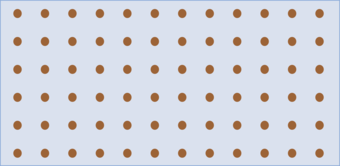
- Point Graphic Depiction: Not applicable
- Linear Graphic Depiction: Not applicable
- Polygon Graphic Depiction:
- Symbol: Reservoir (Reservoir Type = Treatment - Settling Pond, Construction Material = Unspecified, Hydrographic Category = null)
- Symbol Description: A blue, solid outline with two fills: a brown dot shape marker fill and light blue solid fill.
Polygon Symbology Specifications
- Layer 1 (Solid Stroke):
- Size: 0.58 pt
- Color (R,G,B): 137,172,224
- Transparency: 0%
- Layer 2 (Shape Marker - Fill):
- Size: 1.00 pt
- Color (R,G,B): 157,99,55
- Transparency: 0%
- Layer 3 (Solid Fill):
- Size: Not applicable
- Color (R,G,B): 174,203,248
- Transparency: 0%
Labeling
- Labeling Graphic Depiction:
- Label: Reservoir (Reservoir Type = Treatment - Settling Pond, Construction Material = Unspecified, Hydrographic Category = null) - Label
- Label Description: Blue italic text.
- Font Style: Charis SIL, Italic
- Font Size: 9.00 pt
- Font Color (R,G,B): 101,137,191
- Font Halo Size: 0.60 pt
- Font Halo Color (R,G,B): 240,240,240
- Placement Properties: Regular placement horizontal within the polygon.
Reservoir (Other - Tailings Pond)
Subtype of NHDWaterbody
- Reservoir (Reservoir Type = Disposal - Tailings Pond, Construction Material = null, Hydrographic Category = null)
- FType: Reservoir
- FCode: 43605
- Feature Description: A constructed basin formed to contain water or other liquids. Tailing pond reservoir used for the disposal of tailing. Predominant construction material used to construct the reservoir is unknown. The portion of the year the feature contains water is unknown.
- Feature Geometry: Polygon
Graphic Depiction

- Point Graphic Depiction: Not applicable
- Linear Graphic Depiction: Not applicable
- Polygon Graphic Depiction:
- Symbol: Reservoir (Reservoir Type = Disposal - Tailings Pond, Construction Material = null, Hydrographic Category = null)
- Symbol Description: A brown, dashed outline with a long dash, patterned fill.
Polygon Symbology Specifications
- Layer 1 (Shape Marker - Fill):
- Size: 0.288 pt
- Color (R,G,B): 157,99,55
- Transparency: 0%
- Layer 2 (Stroke: Dash/Gap Pattern – 2·1·3·0):
- Size: 0.288 pt
- Color (R,G,B): 157,99,55
- Transparency: 0%
Labeling
- Labeling Graphic Depiction:
- Label: Reservoir (Reservoir Type = Disposal - Tailings Pond, Construction Material = null, Hydrographic Category = null) - Label
- Label Description: Blue italic text.
- Font Style: Charis SIL, Italic
- Font Size: 9.00 pt
- Font Color (R,G,B): 101,37,191
- Font Halo Size: 0.80 pt
- Font Halo Color (R,G,B): 240,240,240
- Placement Properties: Regular placement horizontal within the polygon.
Reservoir (Other - Water Storage Pond)
Subtype of NHDWaterbody
- Reservoir (Reservoir Type = Water Storage, Construction Material = Earthen, Hydrographic Category = Intermittent)
- FType: Reservoir
- FCode: 43614
- Feature Description: A constructed basin formed to contain water or other liquids. Water Storage reservoir, used for long or short-term storage of water. Predominant construction material used to construct the reservoir is earth, or a combination of earth and rock. The reservoir contains water for only part of the year, but more than just after rainstorms and at snowmelt.
- Feature Geometry: Polygon
Graphic Depiction
- Point Graphic Depiction: Not applicable
- Linear Graphic Depiction: Not applicable
- Polygon Graphic Depiction:
- Symbol: Reservoir (Reservoir Type = Water Storage, Construction Material = Earthen, Hydrographic Category = Intermittent)
- Symbol Description: A blue, solid outline with a random blue square-dot fill.
Polygon Symbology Specifications
- Layer 1 (Shape Marker - Fill):
- Size: 6.00 pt
- Color (R,G,B): 137,172,224
- Transparency: 0%
- Layer 2 (Solid Outline):
- Size: 0.58 pt
- Color (R,G,B): 137,172,224
- Transparency: 0%
Labeling
- Labeling Graphic Depiction:
- Label: Reservoir (Reservoir Type = Water Storage, Construction Material = Earthen, Hydrographic Category = Intermittent) - Label
- Label Description: Blue italic text.
- Font Style: Charis SIL, Italic
- Font Size: 9.00 pt
- Font Color (R,G,B): 101,137,191
- Font Halo Size: 0.80 pt
- Font Halo Color (R,G,B): 240,240,240
- Placement Properties: Regular placement horizontal within the polygon.
NATIONAL WETLAND INVENTORY
Freshwater Emergent Wetland
Subtype of National Wetland Inventory
- FType: Not applicable
- FCode: Not applicable
- Feature Description: Fish and Wildlife Service wetland type generally consisting of herbaceous marsh, fen, swale and wet meadow.
- Feature Geometry: Polygon
Graphic Depiction

- Point Graphic Depiction: Not applicable
- Linear Graphic Depiction: Not applicable
- Polygon Graphic Depiction:
- Symbol: Freshwater Emergent Wetland
- Symbol Description: A blue marker fill, at varying offsets, with no outline.
Polygon Symbology Specifications
- Layer 1 (Shape Marker - Fill):
- Size: 8.00 pt
- Color (R,G,B): 115,178,255
- Transparency: 0%
- Layer 2 (Shape Marker - Fill):
- Size: 8.00 pt
- Color (R,G,B): 115,178,255
- Transparency: 0%
- Layer 3 (Shape Marker - Fill):
- Size: 8.00 pt
- Color (R,G,B): 115,178,255
- Transparency: 0%
- Layer 4 (Shape Marker - Fill):
- Size: 8.00 pt
- Color (R,G,B): 115,178,255
- Transparency: 0%
Labeling
- Labeling: Not applicable
Freshwater Forested/Shrub Wetland
Subtype of National Wetland Inventory
- FType: Not applicable
- FCode: Not applicable
- Feature Description: Fish and Wildlife Service wetland type generally consisting of forested swamp or wetland shrub bog or wetland.
- Feature Geometry: Polygon
Graphic Depiction

- Point Graphic Depiction: Not applicable
- Linear Graphic Depiction: Not applicable
- Polygon Graphic Depiction:
- Symbol: Freshwater Forested/Shrub Wetland
- Symbol Description: A green marker fill, at varying offsets, with no outline.
Polygon Symbology Specifications
- Layer 1 (Shape Marker - Fill):
- Size: 8.00 pt
- Color (R,G,B): 92,137,68
- Transparency: 0%
- Layer 2 (Shape Marker - Fill):
- Size: 8.00 pt
- Color (R,G,B): 92,137,68
- Transparency: 0%
- Layer 3 (Shape Marker - Fill):
- Size: 8.00 pt
- Color (R,G,B): 92,137,68
- Transparency: 0%
- Layer 4 (Shape Marker - Fill):
- Size: 8.00 pt
- Color (R,G,B): 92,137,68
- Transparency: 0%
Labeling
- Labeling: Not applicable
Related Information
-
7.5-Minute OnDemand Topo Cartographic Specifications - Map Symbol Guide 7.5-Minute OnDemand Topo Cartographic Specifications - Map Symbol Guide
7.5-Minute OnDemand Topo cartographic specifications map symbol guide.
7.5-Minute OnDemand Topo Cartographic Specifications 7.5-Minute OnDemand Topo Cartographic Specifications
This page and associated links define the U.S. Geological Survey (USGS) 7.5-Minute OnDemand Topo cartographic specifications including feature symbology and labels. The specifications are organized by data sets and themes listed within.
7.5-Minute OnDemand Topo Cartographic Specifications - Version History 7.5-Minute OnDemand Topo Cartographic Specifications - Version History
This page highlights version history and details the refinements made to the published 7.5-Minute Topo Cartographic Specifications.
7.5-Minute OnDemand Topo Cartographic Specifications - Elevation 7.5-Minute OnDemand Topo Cartographic Specifications - Elevation
7.5-Minute OnDemand Topo cartographic specifications including feature symbology and labels for elevation generated contours.
7.5-Minute OnDemand Topo Cartographic Specifications - Geographic Names 7.5-Minute OnDemand Topo Cartographic Specifications - Geographic Names
7.5-Minute OnDemand Topo cartographic specifications including feature symbology and labels for Geographic Names including Landforms and Populated Places.
7.5-Minute OnDemand Topo Cartographic Specifications - Government Units 7.5-Minute OnDemand Topo Cartographic Specifications - Government Units
7.5-Minute OnDemand Topo cartographic specifications including feature symbology and labels for Government Units (Boundaries) including County or Equivalent, Designated Areas, Federally Managed Lands, International, Military, Native American Area, Public Land Survey System (PLSS), and State.
7.5-Minute OnDemand Topo Cartographic Specifications - Hydrography 7.5-Minute OnDemand Topo Cartographic Specifications - Hydrography
7.5-Minute OnDemand Topo cartographic specifications including feature symbology and labels for Hydrography including NHDArea, NHDFlowline, NHDLine, NHDPoint, NHDWaterbody, and National Wetland Inventory (NWI).
7.5-Minute OnDemand Topo Cartographic Specifications - Land Cover 7.5-Minute OnDemand Topo Cartographic Specifications - Land Cover
7.5-Minute OnDemand Topo cartographic specifications including feature symbology and labels for Land Cover including Barren, Cropland, Grassland, Sedge, Shrubland, and Woodland.
7.5-Minute OnDemand Topo Cartographic Specifications - Structures 7.5-Minute OnDemand Topo Cartographic Specifications - Structures
7.5-Minute OnDemand Topo cartographic specifications including feature symbology and labels for Structures including Emergency Service, Pipeline, Public Service, and Recreation.
7.5-Minute OnDemand Topo Cartographic Specifications - Transportation 7.5-Minute OnDemand Topo Cartographic Specifications - Transportation
7.5-Minute OnDemand Topo cartographic specifications including feature symbology and labels for Transportation including Airport, Rail, Route, and Trail.