
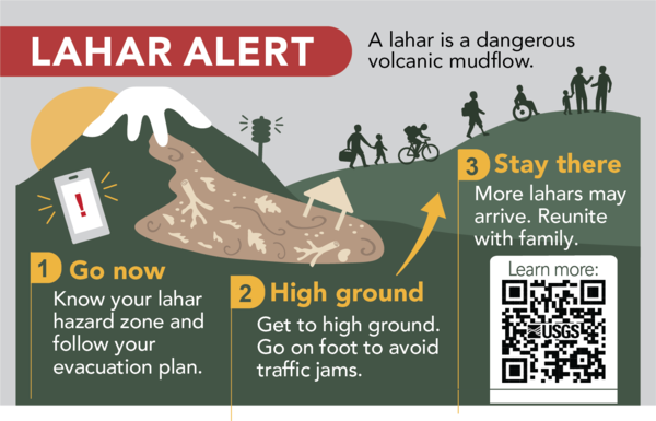
A lahar is a volcanic mudflow. Learn if you are if you are in a lahar hazard zone and how to evacuate to high ground. If you are in a lahar hazard zone and get a lahar alert - go now! Every second matters.
Multimedia
Images
Lahar Safety Infographic
A lahar is a volcanic mudflow. Learn if you are if you are in a lahar hazard zone and how to evacuate to high ground. If you are in a lahar hazard zone and get a lahar alert - go now! Every second matters.

A shaded relief map of Mount Rainier with GPS track from the gas observation flight.
A shaded relief map of Mount Rainier with GPS track from the gas observation flight.A shaded relief map of Mount Rainier with GPS track from the gas observation flight. The colors correspond to CO2 levels in parts per million by volume (ppmv) that were measured during the flight. Yellow points indicate elevated CO2 levels, which were located near visibly degassing volcanic gas vents.
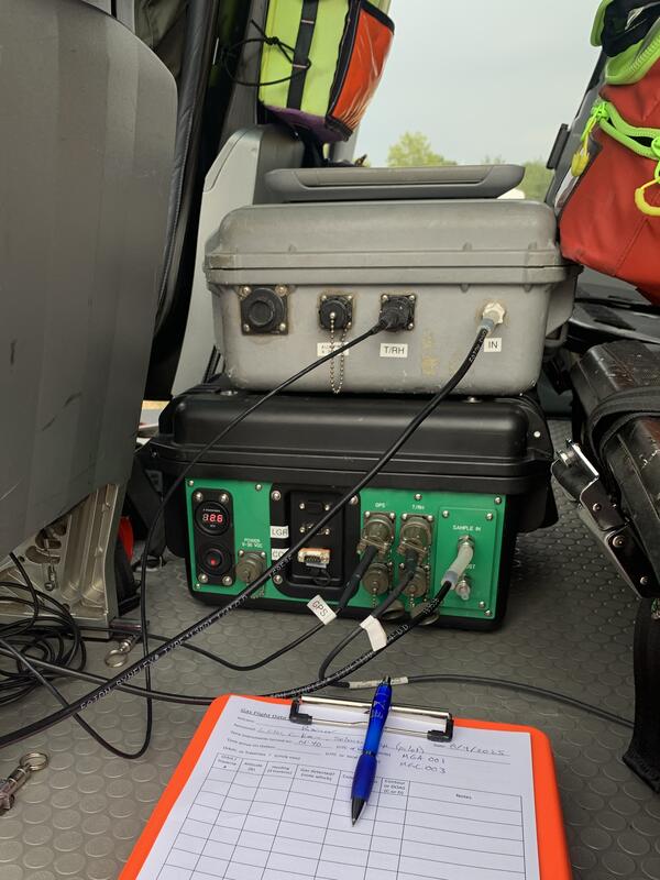
Gas sensor packages mounted to the floor of the aircraft near the rear passenger seats, connected to the outside through black tubing that attaches to the window plate.
Gas sensor packages mounted to the floor of the aircraft near the rear passenger seats, connected to the outside through black tubing that attaches to the window plate.Gas sensor packages mounted to the floor of the aircraft near the rear passenger seats, connected to the outside through black tubing that attaches to the window plate, pictured above.
Gas sensor packages mounted to the floor of the aircraft near the rear passenger seats, connected to the outside through black tubing that attaches to the window plate.
Gas sensor packages mounted to the floor of the aircraft near the rear passenger seats, connected to the outside through black tubing that attaches to the window plate.Gas sensor packages mounted to the floor of the aircraft near the rear passenger seats, connected to the outside through black tubing that attaches to the window plate.
Gas sensor packages mounted to the floor of the aircraft near the rear passenger seats, connected to the outside through black tubing that attaches to the window plate.Gas sensor packages mounted to the floor of the aircraft near the rear passenger seats, connected to the outside through black tubing that attaches to the window plate, pictured above.

USGS gas geochemists Christoph Kern (left) and Laura Clor (right) during the airborne gas survey of Mount Rainier.
USGS gas geochemists Christoph Kern (left) and Laura Clor (right) during the airborne gas survey of Mount Rainier.USGS gas geochemists Christoph Kern (left) and Laura Clor (right) during the airborne gas survey of Mount Rainier.
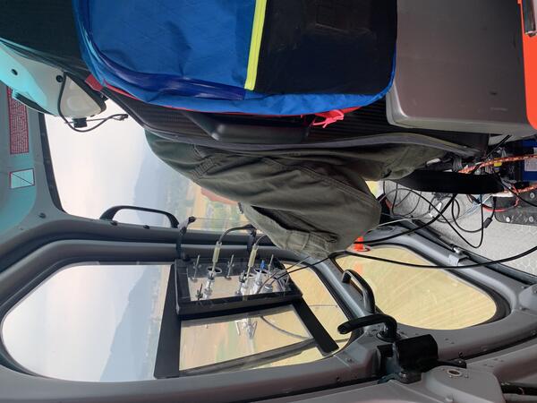
View from the helicopter cabin showing the connections from the inlet window to the measurement equipment inside.
View from the helicopter cabin showing the connections from the inlet window to the measurement equipment inside.View from the helicopter cabin showing the connections from the inlet window to the measurement equipment inside.
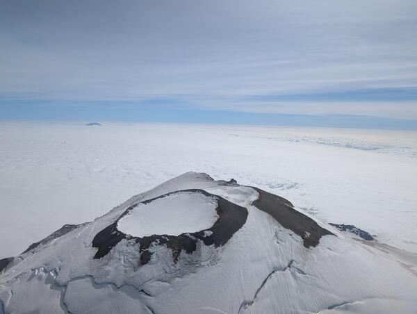
Aerial view of the summit of Mount Rainier taken during the gas flight.
Aerial view of the summit of Mount Rainier taken during the gas flight.Aerial view of the summit of Mount Rainier taken during the gas flight. The photo was taken looking south, and Rainier (14,411’) rises prominently above the cloud deck at about 8,000’. Mount St. Helens (8,357’) is faintly visible in the distance.
Videos

Rainier seismic swarm update - July 14, 2025
In this video, Cascades Volcano Observatory (CVO) scientists Tyler Paladino and Alex Iezzi and Mount Rainier National Park Geologist Scott Beason provide an update on the earthquake swarm at Mount Rainier.
In this video, Cascades Volcano Observatory (CVO) scientists Tyler Paladino and Alex Iezzi and Mount Rainier National Park Geologist Scott Beason provide an update on the earthquake swarm at Mount Rainier.
")
Update on recent seismic activity at Mount Adams (Sep - Nov 2024)
Update on recent seismic activity at Mount Adams (Sep - Nov 2024)Volcanoes tend to have seismicity that waxes and wanes over time. That’s considered normal and not necessarily a cause for concern. Let’s check on Mount Adams to see what USGS scientists are doing to learn more about its recent earthquake activity and what it could mean for this Cascade Range volcano.

Mount St. Helens: Land of Transformation
Mt St. Helens before 1980, Land of Transformation
A stylistic interpretation of pre eruption snowcapped Mount St Helens as seen from a blue Spirit Lake with green rolling hills.
Text changes to May 18, 1980, Eruption. There is a grey explosion of rocks and smoke coming out the top of Mt St Helens. The hills and water are grey and brown.
")
Ways the 1980 Mount St. Helens Eruption Changed Our World (AD)
Ways the 1980 Mount St. Helens Eruption Changed Our World (AD)The May 18, 1980, eruption of Mount St. Helens was historic and fundamentally changed how we see volcanoes. For those who lost family and friends, homes, and their livelihoods, it was an unimaginable tragedy. For others around the world, the eruption was an exciting curiosity, an experience they could share with their kids and grandkids.
Ways the 1980 Mount St. Helens Eruption Changed Our World
Ways the 1980 Mount St. Helens Eruption Changed Our WorldThe May 18, 1980, eruption of Mount St. Helens was historic and fundamentally changed how we see volcanoes. For those who lost family and friends, homes, and their livelihoods, it was an unimaginable tragedy. For others around the world, the eruption was an exciting curiosity, an experience they could share with their kids and grandkids.
Audio

How far did the ash from Mount St. Helens travel?
Welcome to CoreFacts, where we're always short on time and big on science. I'm Brian Campbell. Today's question is …
How far did the ash from Mount St. Helens travel?
Welcome to CoreFacts, where we're always short on time and big on science. I'm Brian Campbell. Today's question is …
How far did the ash from Mount St. Helens travel?

Where did the name "Mount St. Helens" come from?
Listen to hear the answer.
Webcams
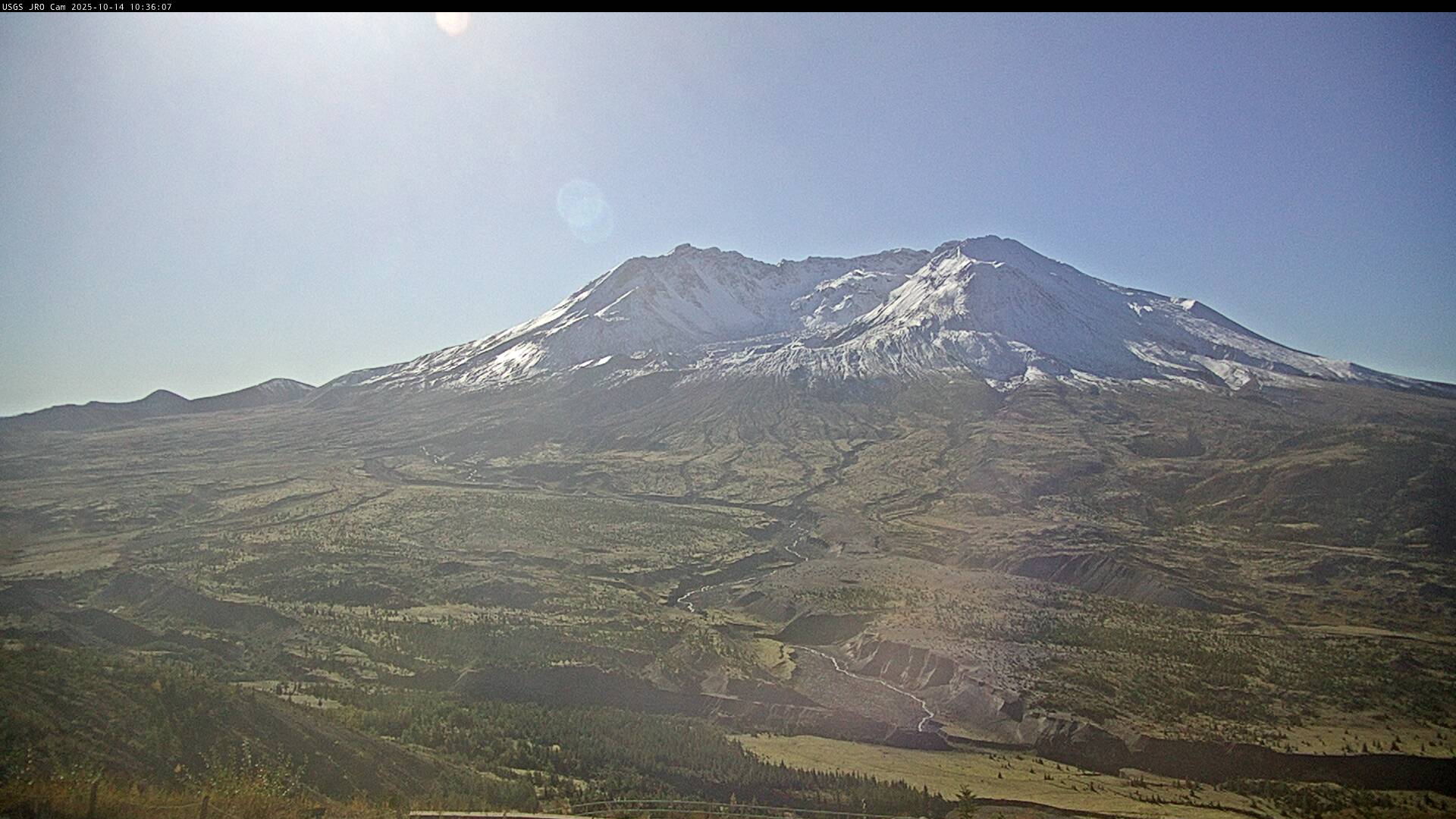
Johnston Ridge Observatory, Mount St. Helens
This static image is from a USGS Cascades Volcano Observatory research camera located at the Johnston Ridge Observatory, north of Mount St. Helens. The view is to the south. This camera is intended to assist the USGS with situational awareness. At times, clouds, rain, and snow obscure visibility.
This static image is from a USGS Cascades Volcano Observatory research camera located at the Johnston Ridge Observatory, north of Mount St. Helens. The view is to the south. This camera is intended to assist the USGS with situational awareness. At times, clouds, rain, and snow obscure visibility.