U.S. flag

An official website of the United States government

Multimedia

Webcams—Near-real-time images from webcams.

Videos—Collection of videos recorded during field excursions or caught on our webcams.

Image Galleries—Galleries of images and events with expanded descriptions.

The Kīlauea Photo and Video Chronology and Mauna Loa Photo and Video Chronology webpages also feature photos. 

Images

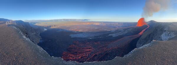
Color panoramic photo of volcanic crater with lava fountain and flows
August 12, 2026 — Panorama of Halemaʻumaʻu during episode 53

This panoramic photo from the northwest rim of Halemaʻumaʻu on August 12 shows Kīlauea summit eruption episode 53 lava fountaining and the spatter-fed flow running along the northern perimeter of the crater floor (bottom of photo). The V1cam and KWcam site is visible at the left edge of the photo. USGS photo by M. Patrick.
This panoramic photo from the northwest rim of Halemaʻumaʻu on August 12 shows Kīlauea summit eruption episode 53 lava fountaining and the spatter-fed flow running along the northern perimeter of the crater floor (bottom of photo). The V1cam and KWcam site is visible at the left edge of the photo. USGS photo by M. Patrick.
Visitors watch lava fountain at national park viewing area
Kīlauea summit eruption continues with episode 53

Episode 53 of the ongoing episodic Kīlauea summit eruption started on August 12 at 3:45 p.m. HST. The episode 53 lava fountain erupting from the north vent reached heights of approximately 500 ft (150 m) with the gas plume reaching 18,000 ft (5600 m) above sea level.

Episode 53 of the ongoing episodic Kīlauea summit eruption started on August 12 at 3:45 p.m. HST. The episode 53 lava fountain erupting from the north vent reached heights of approximately 500 ft (150 m) with the gas plume reaching 18,000 ft (5600 m) above sea level.

Color photograph of crowds watching lava fountain
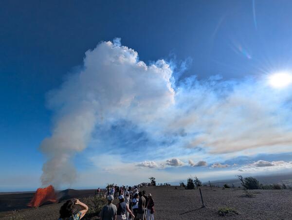
August 12, 2026 — Crowds watch Kīlauea summit eruption episode 53

Crowds of visitors gather at Uēkahuna bluff in Hawaiʻi Volcanoes National Park to watch Kīlauea summit eruption episode 53 lava fountaining on August 12, 2026. USGS photo by M. Patrick.
Crowds of visitors gather at Uēkahuna bluff in Hawaiʻi Volcanoes National Park to watch Kīlauea summit eruption episode 53 lava fountaining on August 12, 2026. USGS photo by M. Patrick.
Color photograph of lava fountain in the evening
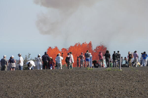
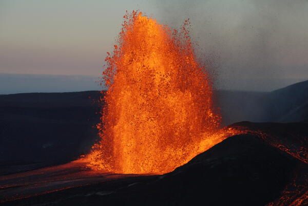
August 12, 2026 — Evening view of episode 53 lava fountain

As the sun set on August 12, USGS Hawaiian Volcano Observatory geologists had excellent views of Kīlauea summit eruption episode 53 lava fountaining in the clear weather. The fountain shape changed rapidly, often shutting off the spatter-fed flow on the north side of the vent (right side of photo). USGS photo by M. Patrick.
As the sun set on August 12, USGS Hawaiian Volcano Observatory geologists had excellent views of Kīlauea summit eruption episode 53 lava fountaining in the clear weather. The fountain shape changed rapidly, often shutting off the spatter-fed flow on the north side of the vent (right side of photo). USGS photo by M. Patrick.
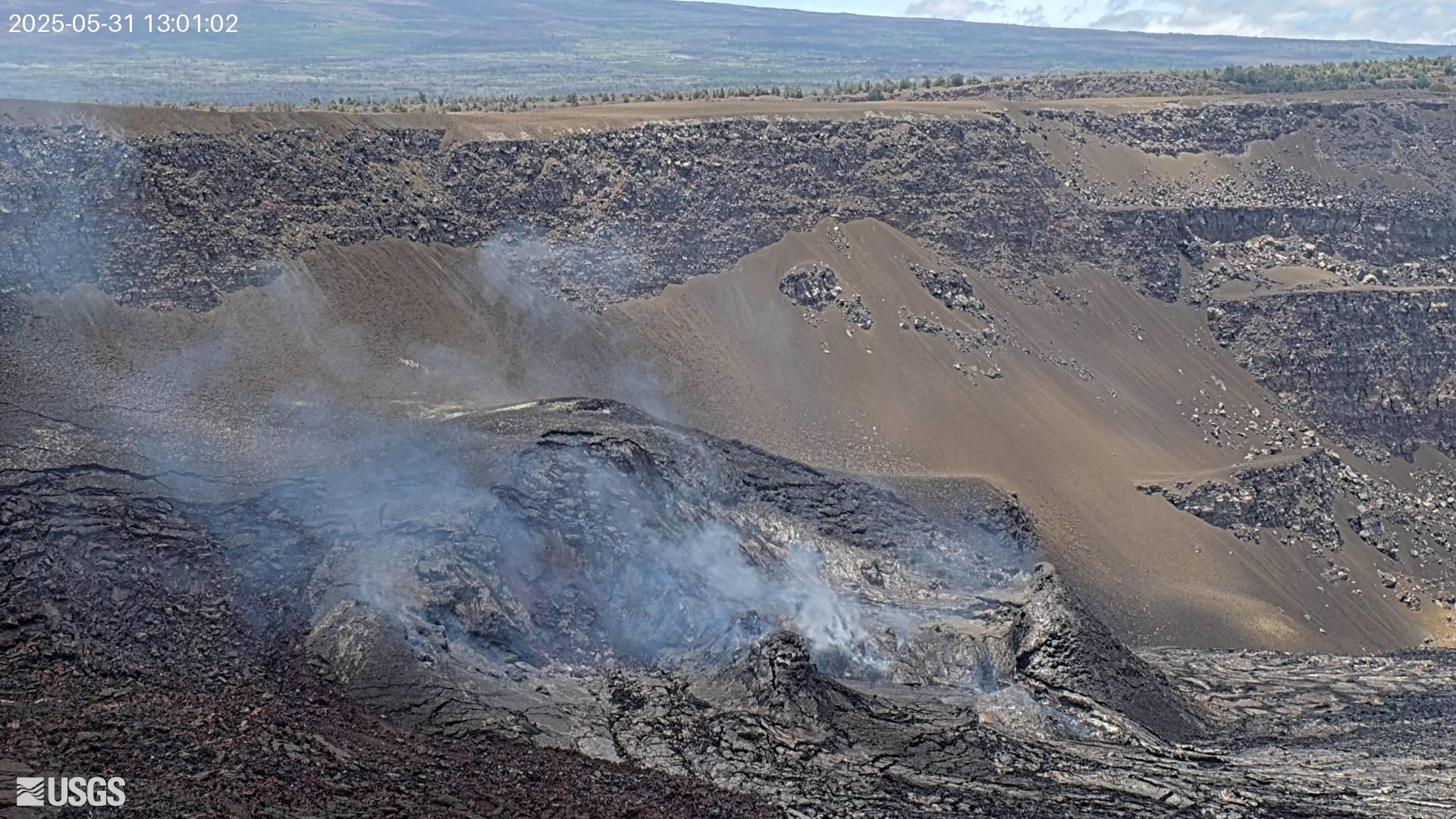
Color photograph of molten volcanic spatter landing in a lava flow
August 12, 2026 — Telephoto view of episode 53 spatter fallout

A closer look at the spatter fallout zone during Kīlauea summit eruption episode 53 lava fountaining on August 12, 2026. This was the source of the spatter-fed flow directed towards the northern portion of Halemaʻumaʻu crater. USGS photo by M. Patrick.
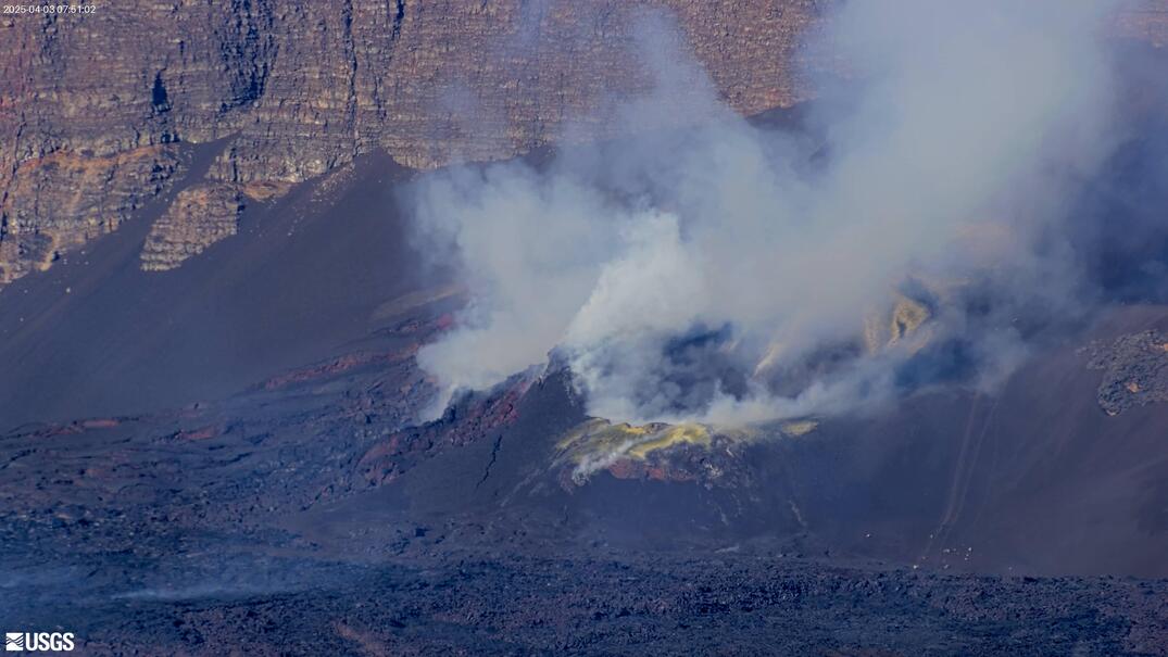
A closer look at the spatter fallout zone during Kīlauea summit eruption episode 53 lava fountaining on August 12, 2026. This was the source of the spatter-fed flow directed towards the northern portion of Halemaʻumaʻu crater. USGS photo by M. Patrick.
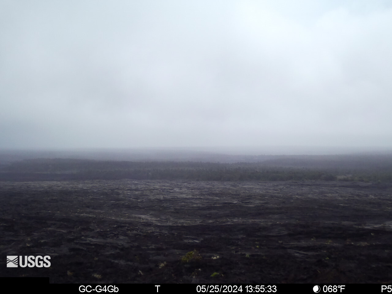
Color photograph of lava flow at night
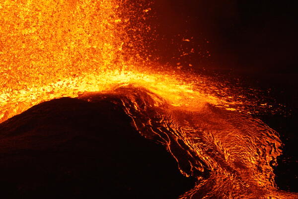
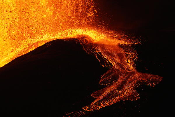
August 12, 2026 — Episode 53 spatter-fed flow

The spatter-fed flow on the north side of the vent was intermittent during Kīlauea summit eruption episode 53 lava fountaining on August 12, 2026. Changes in the shape of the fountain and spatter fallout zone often restarted the flow down the steep slopes of the vent cone. USGS photo by M. Patrick.
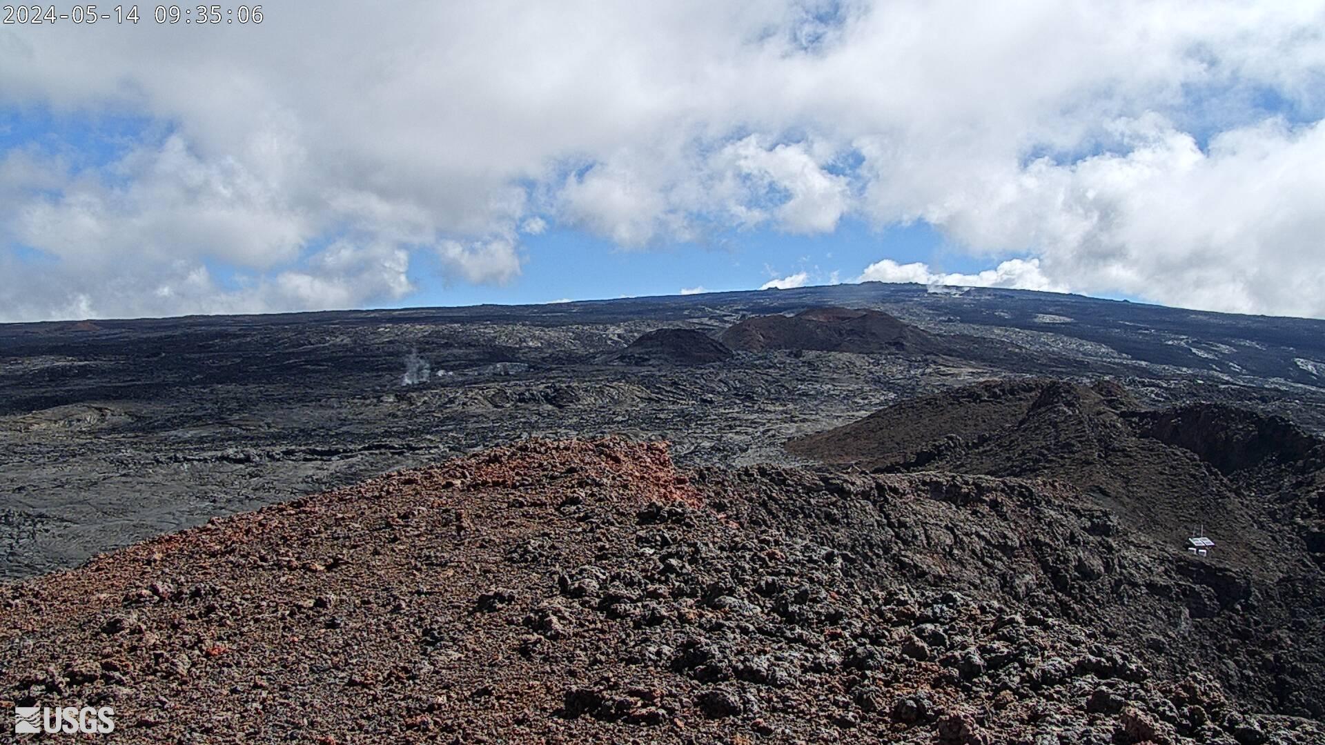
The spatter-fed flow on the north side of the vent was intermittent during Kīlauea summit eruption episode 53 lava fountaining on August 12, 2026. Changes in the shape of the fountain and spatter fallout zone often restarted the flow down the steep slopes of the vent cone. USGS photo by M. Patrick.
Videos

Color photograph of lava fountain Color photograph of lava fountain
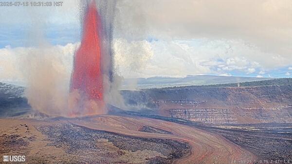
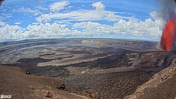
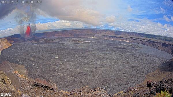
July 15, 2026 — Timelapse video of Kīlauea episode 51 of lava fountaining from the V3cam

Episode 51 of lava fountaining in Halemaʻumaʻu at the summit of Kīlauea took place for about 8 hours on July 15, 2026. This timelapse video of the episode was taken by the V3cam, located on the southern rim of the crater in Hawaiʻi Volcanoes National Park. The camera is a pan-tilt-zoom model so the perspective changes several times during the timelapse video.

Episode 51 of lava fountaining in Halemaʻumaʻu at the summit of Kīlauea took place for about 8 hours on July 15, 2026. This timelapse video of the episode was taken by the V3cam, located on the southern rim of the crater in Hawaiʻi Volcanoes National Park. The camera is a pan-tilt-zoom model so the perspective changes several times during the timelapse video.

Color photograph of lava fountain Color photograph of lava fountain
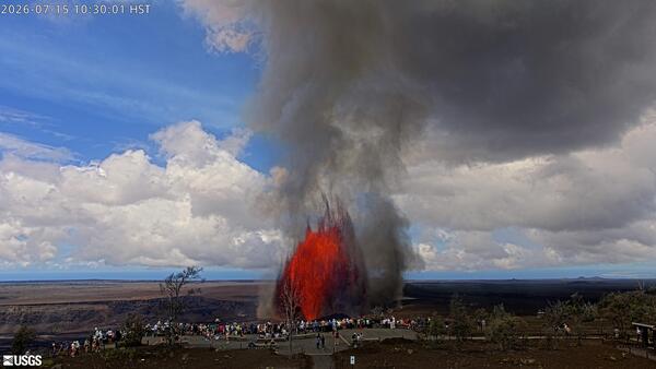
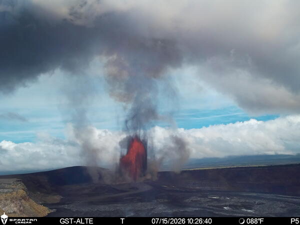
July 15, 2026 — Timelapse video of Kīlauea episode 51 of lava fountaining from the K2cam

Episode 51 of lava fountaining in Halemaʻumaʻu at the summit of Kīlauea took place for about 8 hours on July 15, 2026. This timelapse video of the episode was taken by the K2cam, located near Uēkahuna bluff in Hawaiʻi Volcanoes National Park, and shows visitors viewing the eruption. USGS webcam video. 

Episode 51 of lava fountaining in Halemaʻumaʻu at the summit of Kīlauea took place for about 8 hours on July 15, 2026. This timelapse video of the episode was taken by the K2cam, located near Uēkahuna bluff in Hawaiʻi Volcanoes National Park, and shows visitors viewing the eruption. USGS webcam video. 

Color photograph of lava fountain Color photograph of lava fountain
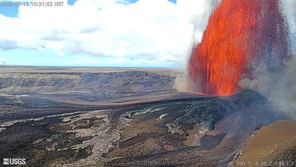
July 15, 2026 — Timelapse video Kīlauea episode 51 of lava fountaining from the KWcam

Episode 51 of lava fountaining in Halemaʻumaʻu at the summit of Kīlauea took place for about 8 hours on July 15, 2026. This timelapse video of the episode was taken by the KWcam, located on the northwest rim of the caldera in Hawaiʻi Volcanoes National Park. USGS webcam video. 

Episode 51 of lava fountaining in Halemaʻumaʻu at the summit of Kīlauea took place for about 8 hours on July 15, 2026. This timelapse video of the episode was taken by the KWcam, located on the northwest rim of the caldera in Hawaiʻi Volcanoes National Park. USGS webcam video. 

Color photograph of lava fountain Color photograph of lava fountain
July 15, 2026 — Timelapse video of Kīlauea episode 51 of lava fountaining from the B1cam

Timelapse video of episode 51 of lava fountaining in Halemaʻumaʻu at the summit of Kīlauea that took place for about 8 hours on July 15, 2026. This video of the episode was taken by the B1cam, located on the south rim of the summit caldera in Hawaiʻi Volcanoes National Park. USGS webcam video. 


Timelapse video of episode 51 of lava fountaining in Halemaʻumaʻu at the summit of Kīlauea that took place for about 8 hours on July 15, 2026. This video of the episode was taken by the B1cam, located on the south rim of the summit caldera in Hawaiʻi Volcanoes National Park. USGS webcam video. 


Color photograph of lava fountain Color photograph of lava fountain
July 15, 2026 — Timelapse of Kīlauea episode 51 of lava fountaining from the S4cam

Episode 51 of lava fountaining in Halemaʻumaʻu at the summit of Kīlauea took place for about 8 hours on July 15, 2026. This timelapse video of the episode was taken by the S4cam, located on the south rim of the summit caldera in Hawaiʻi Volcanoes National Park. USGS webcam video. 


Episode 51 of lava fountaining in Halemaʻumaʻu at the summit of Kīlauea took place for about 8 hours on July 15, 2026. This timelapse video of the episode was taken by the S4cam, located on the south rim of the summit caldera in Hawaiʻi Volcanoes National Park. USGS webcam video. 


Color photograph of lava fountain Color photograph of lava fountain
July 15, 2026 — Timelapse video of Kīlauea episode 51 of lava fountaining from the V1cam

Episode 51 of lava fountaining in Halemaʻumaʻu at the summit of Kīlauea took place for about 8 hours on July 15, 2026. This photograph of the episode was taken by the V1cam, located on the northwest rim of the crater in Hawaiʻi Volcanoes National Park. The camera is a pan-tilt-zoom model so the perspective changes several times during the timelapse video.

Episode 51 of lava fountaining in Halemaʻumaʻu at the summit of Kīlauea took place for about 8 hours on July 15, 2026. This photograph of the episode was taken by the V1cam, located on the northwest rim of the crater in Hawaiʻi Volcanoes National Park. The camera is a pan-tilt-zoom model so the perspective changes several times during the timelapse video.

Audio

Color logo for weekly audio update on volcanic activity in Hawaii
Volcano Minute Logo
Volcano Minute Logo
Volcano Minute — HVO field engineers, the backbone of the observatory
Color logo for weekly audio update on volcanic activity in Hawaii
Volcano Minute Logo
Volcano Minute Logo
Volcano Minute — HVO field engineers, the backbone of the observatory

The Volcano Minute is a brief audio update about eruptions, earthquakes, or ongoing volcano science in Hawaii, brought to you by scientists and affiliates of the U.S. Geological Survey Hawaiian Volcano Observatory.

The Volcano Minute is a brief audio update about eruptions, earthquakes, or ongoing volcano science in Hawaii, brought to you by scientists and affiliates of the U.S. Geological Survey Hawaiian Volcano Observatory.

Color logo for weekly audio update on volcanic activity in Hawaii
Volcano Minute Logo
Volcano Minute Logo
Volcano Minute — Using ocean noise to monitor for volcanic eruptions
Color logo for weekly audio update on volcanic activity in Hawaii
Volcano Minute Logo
Volcano Minute Logo
Volcano Minute — Using ocean noise to monitor for volcanic eruptions

The Volcano Minute is a brief audio update about eruptions, earthquakes, or ongoing volcano science in Hawaii, brought to you by scientists and affiliates of the U.S. Geological Survey Hawaiian Volcano Observatory.

The Volcano Minute is a brief audio update about eruptions, earthquakes, or ongoing volcano science in Hawaii, brought to you by scientists and affiliates of the U.S. Geological Survey Hawaiian Volcano Observatory.

Color logo for weekly audio update on volcanic activity in Hawaii
Volcano Minute Logo
Volcano Minute Logo
Volcano Minute — What can chemistry tell us about lava fountain heights?
Color logo for weekly audio update on volcanic activity in Hawaii
Volcano Minute Logo
Volcano Minute Logo
Volcano Minute — What can chemistry tell us about lava fountain heights?

The Volcano Minute is a brief audio update about eruptions, earthquakes, or ongoing volcano science in Hawaii, brought to you by scientists and affiliates of the U.S. Geological Survey Hawaiian Volcano Observatory.


The Volcano Minute is a brief audio update about eruptions, earthquakes, or ongoing volcano science in Hawaii, brought to you by scientists and affiliates of the U.S. Geological Survey Hawaiian Volcano Observatory.


Color photograph of person presenting to an audience in a gymnasium
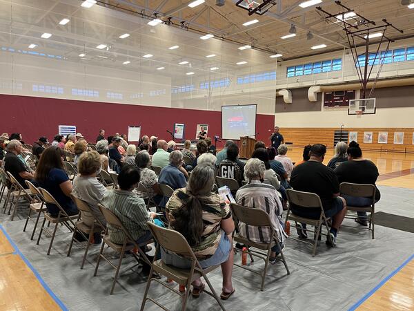
Hawaii County Civil Defense Administrator Talmadge Magno at a community meeting
Volcano Minute — Aloha to Hawaii County Civil Defense Administrator
Color photograph of person presenting to an audience in a gymnasium
Hawaii County Civil Defense Administrator Talmadge Magno at a community meeting
Volcano Minute — Aloha to Hawaii County Civil Defense Administrator

The Volcano Minute is a brief audio update about eruptions, earthquakes, or ongoing volcano science in Hawaii, brought to you by scientists and affiliates of the U.S. Geological Survey Hawaiian Volcano Observatory.

The Volcano Minute is a brief audio update about eruptions, earthquakes, or ongoing volcano science in Hawaii, brought to you by scientists and affiliates of the U.S. Geological Survey Hawaiian Volcano Observatory.

Color logo for weekly audio update on volcanic activity in Hawaii
Volcano Minute Logo
Volcano Minute Logo
Volcano Minute — Mauna Loa on the move
Color logo for weekly audio update on volcanic activity in Hawaii
Volcano Minute Logo
Volcano Minute Logo
Volcano Minute — Mauna Loa on the move

The Volcano Minute is a brief audio update about eruptions, earthquakes, or ongoing volcano science in Hawaii, brought to you by scientists and affiliates of the U.S. Geological Survey Hawaiian Volcano Observatory.

The Volcano Minute is a brief audio update about eruptions, earthquakes, or ongoing volcano science in Hawaii, brought to you by scientists and affiliates of the U.S. Geological Survey Hawaiian Volcano Observatory.

Color photograph of volcanic vents degassing
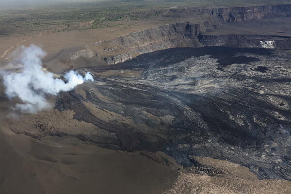
July 16, 2026 — Overview of western Halema‘uma‘u, Kīlauea summit
Volcano Minute — Will lava flow out of the caldera?
Color photograph of volcanic vents degassing
July 16, 2026 — Overview of western Halema‘uma‘u, Kīlauea summit
Volcano Minute — Will lava flow out of the caldera?

The Volcano Minute is a brief audio update about eruptions, earthquakes, or ongoing volcano science in Hawaii, brought to you by scientists and affiliates of the U.S. Geological Survey Hawaiian Volcano Observatory.

The Volcano Minute is a brief audio update about eruptions, earthquakes, or ongoing volcano science in Hawaii, brought to you by scientists and affiliates of the U.S. Geological Survey Hawaiian Volcano Observatory.

Webcams

webcam image of flank of volcano
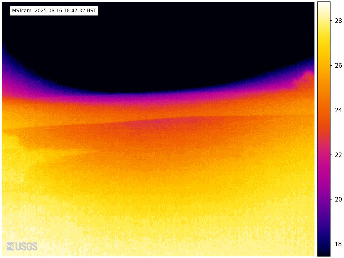
[MSTcam] South Pit and Upper Southwest Rift Zone - thermal image from Moku‘āweoweo south rim
[MSTcam] South Pit and Upper Southwest Rift Zone - thermal image from Moku‘āweoweo south rim
[MSTcam] South Pit and Upper Southwest Rift Zone - thermal image from Moku‘āweoweo south rim

This image is from a research camera positioned on the south rim of Mokuʻāweoweo, Mauna Loa's summit caldera, in Hawaiʻi Volcanoes National Park. The camera looks west-southwest, across South Pit, focusing on the south part of Mauna Loa's summit region and upper Southwest Rift Zone.

This image is from a research camera positioned on the south rim of Mokuʻāweoweo, Mauna Loa's summit caldera, in Hawaiʻi Volcanoes National Park. The camera looks west-southwest, across South Pit, focusing on the south part of Mauna Loa's summit region and upper Southwest Rift Zone.

Color webcam image
[V3cam] Kīlauea volcano, Hawaii (south Halemaʻumaʻu crater)
[V3cam] Kīlauea volcano, Hawaii (south Halemaʻumaʻu crater)
[V3cam] Kīlauea volcano, Hawaii (south Halemaʻumaʻu crater)

Last 24 Hours - Live view of Halemaʻumaʻu crater within Kaluapele (Kīlauea caldera), from the south rim of the crater [V3cam]. This camera is a pan-tilt-zoom model and the view may change depending on activity.

Disclaimer

Last 24 Hours - Live view of Halemaʻumaʻu crater within Kaluapele (Kīlauea caldera), from the south rim of the crater [V3cam]. This camera is a pan-tilt-zoom model and the view may change depending on activity.

Disclaimer

Color image of caldera
[V2cam] Kīlauea volcano, Hawaii (east Halemaʻumaʻu crater)
[V2cam] Kīlauea volcano, Hawaii (east Halemaʻumaʻu crater)
[V2cam] Kīlauea volcano, Hawaii (east Halemaʻumaʻu crater)

Live view of Kaluapele (Kīlauea caldera) and Halemaʻumaʻu crater, from the northeast rim of the caldera [V2cam]. This camera is a pan-tilt-zoom model and the view may change depending on activity.

Disclaimer

Live view of Kaluapele (Kīlauea caldera) and Halemaʻumaʻu crater, from the northeast rim of the caldera [V2cam]. This camera is a pan-tilt-zoom model and the view may change depending on activity.

Disclaimer

Color image of volcano
[KOcam] Live Image of upper East Rift Zone from Maunaulu
[KOcam] Live Image of upper East Rift Zone from Maunaulu
[KOcam] Live Image of upper East Rift Zone from Maunaulu

This image is from a temporary research camera positioned near Maunaulu, looking northwest toward the upper East Rift Zone of Kīlauea.

Disclaimer

Color webcam image showing rift zone of volcano
[MDLcam] The Upper and Middle Parts of Mauna Loa's Southwest Rift Zone
[MDLcam] The Upper and Middle Parts of Mauna Loa's Southwest Rift Zone
[MDLcam] The Upper and Middle Parts of Mauna Loa's Southwest Rift Zone

Live image of Mauna Loa's upper and middle Southwest Rift Zone from Dandelion Cone along the middle part of the rift zone [MDLcam]. This camera is a pan-tilt-zoom model and the view may change depending on activity.


Disclaimer

Live image of Mauna Loa's upper and middle Southwest Rift Zone from Dandelion Cone along the middle part of the rift zone [MDLcam]. This camera is a pan-tilt-zoom model and the view may change depending on activity.


Disclaimer

Color webcam image showing flank of volcano
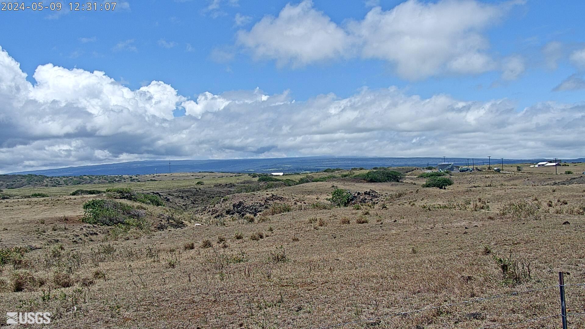
[MSPcam] Mauna Loa's Southwest Rift Zone from the South Point area
[MSPcam] Mauna Loa's Southwest Rift Zone from the South Point area
[MSPcam] Mauna Loa's Southwest Rift Zone from the South Point area

Live image of Mauna Loa's Southwest Rift Zone from the South Point area [MSPcam]. This camera is a pan-tilt-zoom model and the view may change depending on activity.


Disclaimer

Live image of Mauna Loa's Southwest Rift Zone from the South Point area [MSPcam]. This camera is a pan-tilt-zoom model and the view may change depending on activity.


Disclaimer

Was this page helpful?