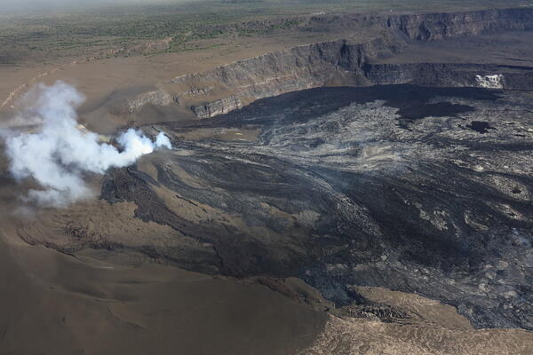
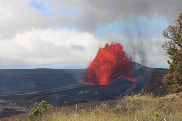
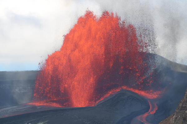
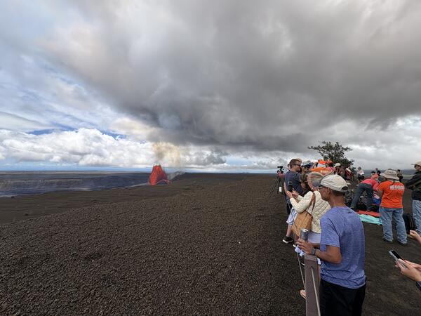
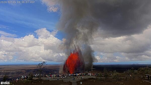
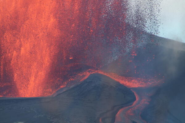
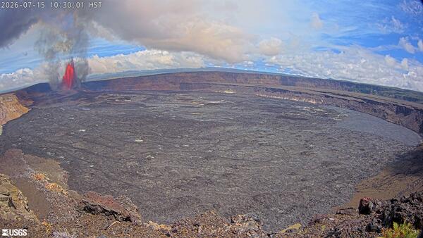
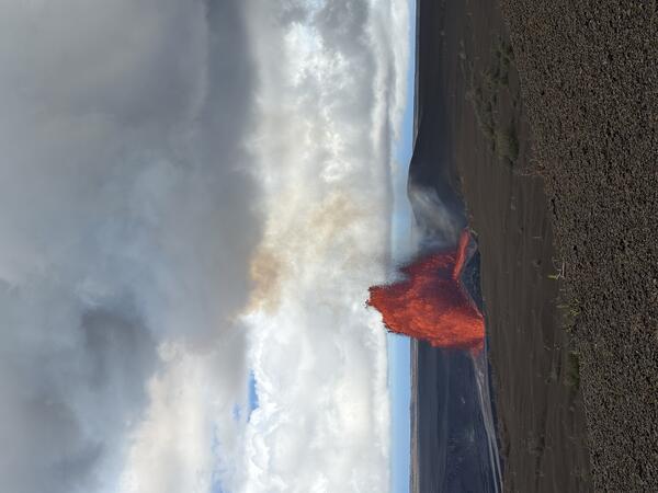
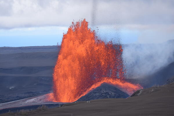
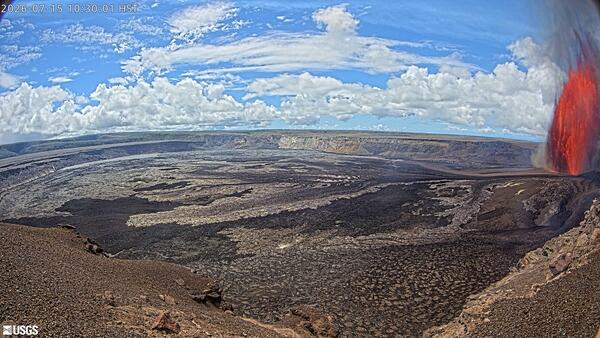
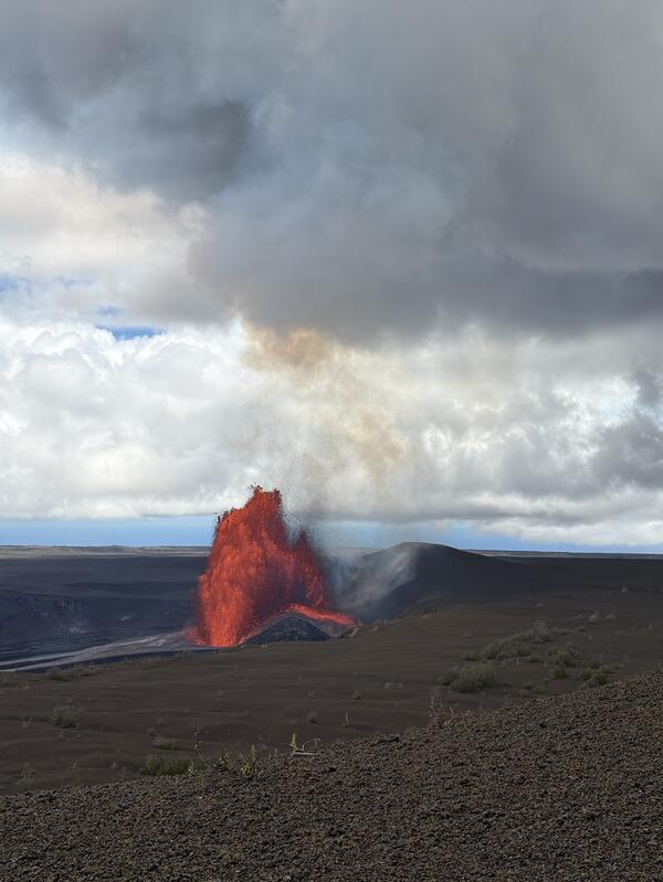
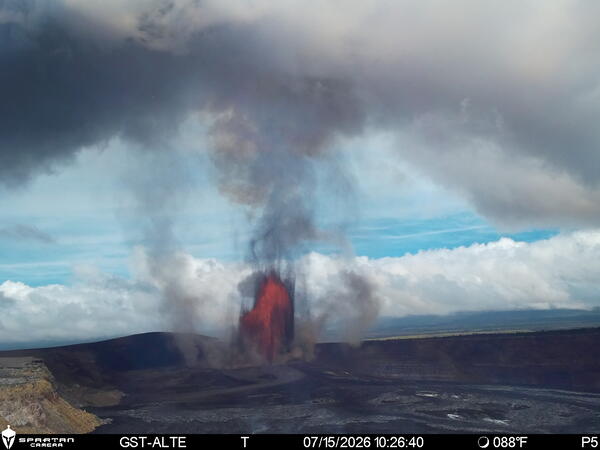
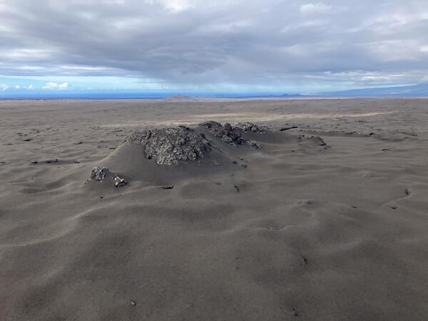
View from the southwest rim of Kaluapele, the summit caldera of Kīlauea, where the temporary S2 webcam is located. This view looks down on the active north and south vents on the morning of January 17, 2025, as lava fountains reached 100-115 ft (30-35 m) high and feeding lava flows in the western part of Halemaʻumaʻu.
Images
Hawaiian Volcano Observatory images of eruptive activity, field work, and more.
View from the southwest rim of Kaluapele, the summit caldera of Kīlauea, where the temporary S2 webcam is located. This view looks down on the active north and south vents on the morning of January 17, 2025, as lava fountains reached 100-115 ft (30-35 m) high and feeding lava flows in the western part of Halemaʻumaʻu.
Close up view of the south vent from the southwest rim of Kaluapele, the summit caldera of Kīlauea, on the morning of January 17, 2025. The cone is almost 100 ft (30 m) high and the lava fountain is just as high to slightly high at times. The outlet at the front of the cone is feeding some of the lava flows in the western part of Halemaʻumaʻu. USGS photo by D.
Staff from the USGS Hawaiian Volcano Observatory at the rim of Kaluapele (Kīlauea caldera) monitoring and taking measurements of ongoing activity within the summit caldera. USGS photo by K. Mulliken.
A view of the nearly vertical eruption plume at Kīlauea summit during the afternoon on January 17, 2025. Photo taken from within the closed area of Hawaiʻi Volcanoes National Park and showing Crater Rim Drive. USGS photo by P. Nadeau.
With permission from Hawaiʻi Volcanoes National Park, USGS Hawaiian Volcano Observatory scientists conducted Uncrewed Aerial Systems (UAS) operations at the Kīlauea summit eruption site on January 17, 2025. Scientists conducted flights to assess volcanic gas emissions and take aerial imagery, which will aid in hazard assessment of the ongoing eruption.
Over the past day, persistent lava fountaining at Kīlauea summit, coupled with Kona wind conditions, has resulted in Pele's hair falling on nearby communities and within parts of Hawaiʻi Volcanoes National Park.
USGS Hawaiian Volcano Observatory scientists conducted a monitoring overflight of the ongoing summit within Halemaʻumaʻu at the summit of Kīlauea. This aerial view shows the two erupting vents that are located in the southwest part of the caldera. A portion of Crater Rim Drive that collapsed into the caldera in 2018 is visible in the foreground of the photo.
Aerial view of tephra erupted from December 23, 2024, to present (with several pauses) and deposited within the closed area of Hawai‘i Volcanoes National Park. Early in the eruption the lava fountains were ejecting bombs and lapilli across the closed portion of Crater Rim Drive. In places this tephra gets to almost a foot (30 cm) thick. USGS photo by D. Downs.
USGS Hawaiian Volcano Observatory scientists conducted a monitoring overflight of the ongoing summit within Halemaʻumaʻu at the summit of Kīlauea. This low-angle aerial view looking westward shows the two erupting vents that are located in the southwest part of the caldera, and along with the Pāhoehoe lava flowing out of the vents. USGS photo by N. Deligne.
This zoom view of the two active lava fountains within Halema‘uma‘u at the summit of Kīlauea was captured by USGS Hawaiian Volcano Observatory geologists during an observational visit to the southern crater rim on the morning of January 16, 2025.
(A) Spatter cone samples from the Kīlauea middle East Rift Zone eruption in and near Nāpau Crater from September 15–20, 2024. Crystals were collected from samples like this. (B) Back-scattered electron image of a plagioclase crystal from the September 2024 Kīlauea middle East Rift Zone eruption. This crystal shows two distinct chemical zones from its core to rim.
Panorama view of the Kīlauea summit eruption from Keanakākoʻi Overlook in Hawaiʻi Volcanoes National Park. The Keanakākoʻi Overlook is on the south side of Kaluapele (Kīlauea summit caldera) and the view is the northwest. On the left, the two erupting vents are visible within Halemaʻumaʻu in the southwest part of Kaluapele.
View of the Kīlauea summit eruption in Hawaiʻi Volcanoes National Park, from the south rim of the caldera. The caldera wall behind the erupting vents is approximately 210 meters (690 feet) tall.
USGS Hawaiian Volcano Observatory scientists observe the continuation of the ongoing Kīlauea eruption during its fourth eruptive episode. The eruption had been paused since January 3, 2025, and resumed on January 15, 2025.
During the reactivation of the Kīlauea summit eruption, USGS Hawaiian Volcano Observatory scientists setup high resolution cameras to record eruption dynamics. While on field shifts, scientists measure fountain and cone heights, take thermal and observational images, and collect samples for monitoring purposes.
Telephoto view of the two vents erupting in the southwest part of Halema'uma'u in Kaluapele (Kīlauea summit caldera) at approximately 6 a.m. HST on January 16, 2025. USGS Hawaiian Volcano Observatory geologists in the field this morning measured the lava fountains as reaching approximately 60 meters (197 feet) high.
Early morning view of visitors gathered at Keanakākoʻi Overlook in Hawaiʻi Volcanoes National Park to view the ongoing Kīlauea eruption within Halema'uma'u in Kaluapele (the summit caldera). As of the morning on January 16, 2025, both the north and south vents are erupting lava fountains which are feeding lava flows in the southwest part of the caldera.
Early morning view of the ongoing Kīlauea eruption within Halema'uma'u in Kaluapele (the summit caldera) on January 16, 2025. This telephoto view is from the Volcano House overlook within Hawaiʻi Voclanoes National Park. USGS photo by K. Mulliken.
Telephoto view of the two vents erupting in the southwest part of Kīlauea summit caldera at approximately 6 a.m. HST. This view is to the southwest, from Volcano House within Hawaiʻi Volcanoes National Park. USGS photo by K. Mulliken.
Episode 4 of the ongoing Kīlauea summit eruption began this morning, January 15, 2025. Lava fountains resumed erupting from the two vents that have been active in the eruption that began within Halemaʻumaʻu at the summit of Kīlauea volcano on December 23, 2024.
USGS Hawaiian Volcano Observatory scientists collected samples of episode 4 of the ongoing Kīlauea summit eruption, which began the morning of January 15, 2025. The samples were collected from the west rim of Kaluapele, Kīlauea summit caldera.