U.S. flag

An official website of the United States government

August 26, 2026

The USGS Hawaiian Volcano Observatory supported the response to Hurricane Lala, which affected the Hawaiian Islands the weekend of August 15.  On Friday, August 21, HVO organized a helicopter LiDAR mission over flood-damaged areas in the Kaʻū district on the Island of Hawaiʻi.

Landslides are large masses of wet or dry rock and soil that fall, slide, or flow under the force of gravity. Large rainfall events, like Hurricane Lala, put extra strain on the steep slopes near volcanoes and in surrounding stream channels, potentially increase landslide risk. 

Helicopter-based LiDAR, short for Light Detection and Ranging, provides high-resolution topographic data beneath the helicopter's flight path, and an integrated camera additionally captures imagery of the same terrain.  The data was collected for emergency-response partners at the Hawaii County Civil Defense Agency to assess flood damage and coordinate cleanup efforts. The topographic data will also be used by the USGS Landslide Hazards Program to improve models of slope failures during future rainfall events in the area.

The helicopter surveyed the towns of Nāʻālehu and Waiʻōhinu, stream channels upslope and downslope of the communities, and the routes of Kaʻalaiki ("Cane Haul") Road and Highway 11 leading to the town of Pāhala.  
Media
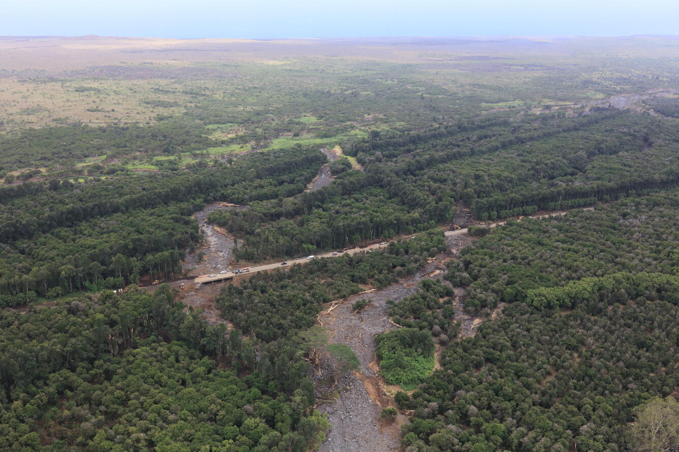
Color photograph of highway and flood-damaged areas
On Friday, August 21, the USGS Hawaiian Volcano Observatory (HVO) organized a helicopter lidar mission over flood-damaged areas in the Ka‘ū district on the Island of Hawai‘i following Hurricane Lala the previous weekend. This mission supported HVO's emergency-response partners at the Hawaii County Civil Defense Agency, providing data they can use to assess flood damage and coordinate cleanup efforts. This photo shows K‘a‘āla‘āla Gulch just east of the town of Pāhala, with its stream basin stripped completely bare of vegetation and now strewn with boulders and downed trees. Cleanup efforts along Highway 11 were underway at the time of the flight. USGS photo by M. Zoeller.
Media
Color photograph of helicopter being prepared for flight
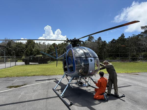
On Friday, August 21, the USGS Hawaiian Volcano Observatory (HVO) organized a helicopter LiDAR mission over flood-damaged areas in the Kaʻū district on the Island of Hawaiʻi following Hurricane Lala that affected the Hawaiian Islands the weekend of August 15. HVO normally uses LiDAR for assessing eruption-related landscape changes in Hawaii.  Helicopter-based LiDAR, short for Light Detection and Ranging, provides high-resolution topographic data beneath the helicopter's flight path, and an integrated camera additionally captures imagery of the same terrain.  USGS photo by D. Downs. 
Media
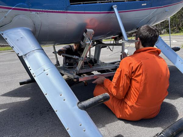
Color photograph of scientist mounting equipment at base of helicopter
A USGS Hawaiian Volcano Observatory (HVO) scientist mounts the LiDAR (Light Detection and Ranging) instrument on the base of the helicopter. The helicopter surveyed areas damaged during Hurricane Lala over the weekend of August 15, including the towns of Nāʻālehu and Waiʻōhinu, stream channels upslope and downslope of the communities, and the routes of Kaʻalaiki ("Cane Haul") Road and Highway 11 leading to the town of Pāhala.  USGS photo by D. Downs. 
Media
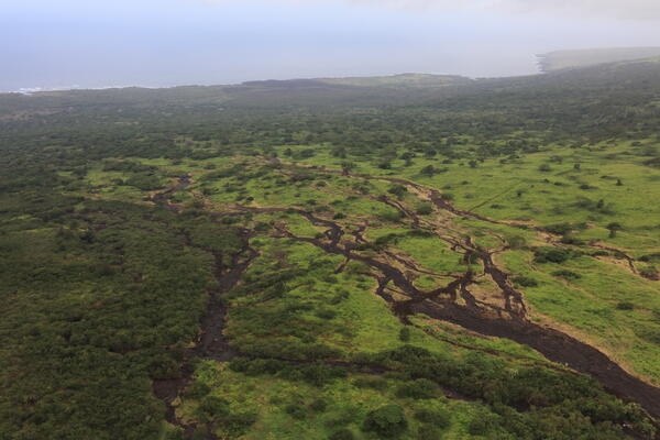
Color photograph of green pasture area with braided scours from flooding
Flooding in the Ka‘ū district during Hurricane Lala over the weekend of August 15–16 appears to have activated hydrologic drainages that only carry water during the heaviest of rains. Here, pastures along K‘a‘ālaiki Road between the towns of Pāhala and Nā‘ālehu are seen to have been scoured by ephemeral streams, stripped of vegetation down to the underlying lava rock in places. Honu‘apo Bay can be seen in the distance on the right. USGS photo by M. Zoeller.
Media
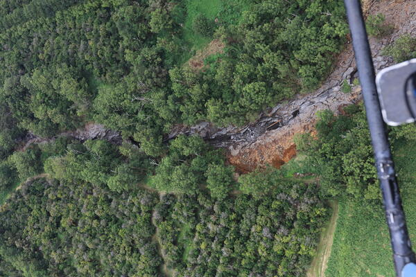
Color photograph of flood-scoured gulch surrounded by greenery
The USGS Hawaiian Volcano Observatory helicopter lidar mission on Friday, August 21 provided near-vertical views down into narrow channels carved by streams on the southeast flank of Mauna Loa volcano. This photo shows Hionamoa Gulch just west of the town of Pāhala, clearly widened by flooding during Hurricane Lala the previous weekend. A high-resolution topographic model from the lidar instrument will additionally tell scientists whether or not the channel has deepened. USGS photo by M. Zoeller.
Was this page helpful?