
Data
Browse real-time data, data releases, software/code releases and more.
Filter Total Items: 194
Locations of Smith's Longspurs tagged with light-level geolocators in northern Alaska, 2013 and 2014 Locations of Smith's Longspurs tagged with light-level geolocators in northern Alaska, 2013 and 2014
These data are locations derived from light-level geolocators placed on 4 male Smith Longspurs captured on the breeding grounds of northern Alaska in 2013. In addition, we downloaded data from eBird to record where this species was observed through citizen science. Finally, we collected head feathers from birds on the breeding ground of Alaska to determine their isotopic values of...
White-tailed deer from culling efforts in Minnesota White-tailed deer from culling efforts in Minnesota
Dataset containing information for white-tailed deer samples from Minnesota. Samples were genotyped for 11 microsatellites markers and sequenced for a fragment of approx. 546 bp belonging to the mitochondrial control region. Marker OvirQ should not be used as it presents alleles inconsistent with reported pattern, with some alleles separated by only 1 base pair and inconsistent between...
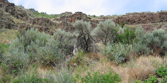
Winter tick counts and covariates in Massachusetts and New Hampshire from fall 2022 Winter tick counts and covariates in Massachusetts and New Hampshire from fall 2022
The dataset accompanies manuscript: "Monitoring off-host winter tick abundance on traditional moose hunting lands" . It is a single table that includes counts of winter tick (Dermacentor albipictus) obtained by a modified flagging technique developed by the Penobscot Nation. The table includes both detection and site covariates used for the data analyses presented in the paper. Data were...
Roundtail Chub and Flannelmouth Sucker movement data within the Blacks Fork subbasin, Wyoming 2019-2021 Roundtail Chub and Flannelmouth Sucker movement data within the Blacks Fork subbasin, Wyoming 2019-2021
The dataset includes Roundtail Chub and Flannelmouth Sucker detections at passive integrated transponder (PIT) tag antenna systems. We installed nine instream Biomark PIT-tag antenna systems (five 24-meter and four 9-meter antennas) in a pass-over orientation throughout the Blacks Fork subbasin. In addition to the fixed antennas, we used a Biomark inflatable antenna and two Biomark...
Evaluating the effectiveness of joint species distribution modeling for riverine fish communities Evaluating the effectiveness of joint species distribution modeling for riverine fish communities
Species Distribution Models (JSDMs) allow for accounting for both environmental predictors and species dependencies within a single statistical modeling frameworks. However, it is unclear under what conditions incorporating residual species dependencies (conditional predictions) might outperform predictions made using only environmental information (marginal predictions). Here, we...
Feeding Habits and Ecological Implications of the Invasive Flathead Catfish, Pylodictis olivaris, in the Susquehanna River Basin, Pennsylvania Feeding Habits and Ecological Implications of the Invasive Flathead Catfish, Pylodictis olivaris, in the Susquehanna River Basin, Pennsylvania
Flathead Catfish _Pylodictis olivaris_ are a prominent aquatic invasive species within the United States and a recent invader in the Susquehanna River Basin, Pennsylvania. Flathead Catfish are piscivores known to consume native and recreationally important fish species. In the northeastern United States, it is unknown how this invader is impacting food webs and which species may be at...
Stream hydrology and a pulse subsidy shape patterns of fish foraging Stream hydrology and a pulse subsidy shape patterns of fish foraging
Pulsed subsidy events create ephemeral fluxes of hyper-abundant resources that can shape annual patterns of consumption and growth for recipient consumers. However, environmental conditions strongly affect local resource availability for much of the year, and can heavily impact consumer foraging and growth patterns prior to pulsed subsidy events. Thus, a consumer’s capacity to exploit...
Comparing datasets by surveillance method using spatial models Comparing datasets by surveillance method using spatial models
This software compares statistical methods to model habitat risk of CWD in white-tailed deer in Pennsylvania using Bayesian hierarchical models in R-INLA and compares these results with model output from WinBugs. The software also uses R-INLA with the Stochastic Partial Differential Approach (SPDE) to compare different surveillance methods to model CWD in relation to habitat features and...
Code to Support Hypoxia vulnerability in the salmon watersheds of Southeast Alaska Code to Support Hypoxia vulnerability in the salmon watersheds of Southeast Alaska
Oxygen depletion events (hypoxia) in coastal aquatic ecosystems occur more frequently, yet their causes and consequences remain poorly understood. We identified key drivers of hypoxia in Southeast Alaska watersheds for long-term hypoxia monitoring. This software release contains one R script that can be used to calculate hypoxia risk from environmental variables. This R code will re...
Population Viability Model for Western Pond Turtle Population Viability Model for Western Pond Turtle
The code herein uses a triple loop structure to simulate a spatially implicit stage structured matrix model for two species of western pond turtle with parametric uncertainty and temporal stochasticity.
R code for calculating imperilment of freshwater fish with a Bayesian belief network R code for calculating imperilment of freshwater fish with a Bayesian belief network
This R script is reproduces a Bayesian belief network built within the propriety software program, Netica. The R- and Netica-based belief networks were used in Dunn and Schumann et al. (in press), which presents an approach for calculating imperilment of freshwater fishes.
Microsatellite genotypes and metadata for white-tailed deer samples from the Mid-Atlantic region of USA Microsatellite genotypes and metadata for white-tailed deer samples from the Mid-Atlantic region of USA
Dataset containing information for white-tailed deer samples from Ohio, Pennsylvania, Maryland, Virginia and New York, genotyped for 11 microsatellites markers. Marker OvirQ should not be used as it presents alleles inconsistent with reported pattern, with some alleles separated by only 1 base pair and inconsistent between runs. Projected coordinates representing sampling location are in...