
Data
Browse real-time data, data releases, software/code releases and more.
Filter Total Items: 209
AMMonitor AMMonitor
AMMonitor is an open source R package dedicated to collecting, storing, and analyzing AMU information in a way that 1) is cost-effective, 2) can efficiently process and store information, and 3) can take advantage of the vast and growing community of R analytics.
Stream Temperature and Dissolved Oxygen Responses to Small Dams and Dam Removal in Massachusetts Stream Temperature and Dissolved Oxygen Responses to Small Dams and Dam Removal in Massachusetts
Small, surface-release dams are ubiquitous across the U.S. and have the potential to alter stream flow, impede sediment and nutrient transport, and fragment biotic assemblages. To mitigate these and other ecological impacts and reduce public safety hazards, dam removal has become an increasingly prevalent method of stream restoration. However, few streams have been consistently monitored...
Movement Data of Partially Migratory Brown Pelicans from the South Atlantic Bight Movement Data of Partially Migratory Brown Pelicans from the South Atlantic Bight
This dataset contains locations acquired from GPS-tagged Brown Pelicans in the South Atlantic Bight. Locations correspond to the movements of pelicans tracked during the autumn migratory period (post-breed to the following spring, with length of deployment varying individually) from 2017-2020. Additional metrics include intrinsic and extrinsic variables both measured and acquired which...
American alligator demographic and harvest data from Georgetown County, South Carolina, 1979-2017 American alligator demographic and harvest data from Georgetown County, South Carolina, 1979-2017
The American alligator (Alligator mississippiensis) is a species of ecological and economic importance in the southeastern United States. Within South Carolina, alligators are subject to private and public harvest programs, as well as nuisance removal. These management activities can have different impacts across alligator size classes that may not be apparent through widely-used...
shinymgr: A framework for building, managing, and stitching Shiny modules into reproducible analyses and reports. shinymgr: A framework for building, managing, and stitching Shiny modules into reproducible analyses and reports.
Shinymgr is an R package that provides a unifying framework for managing and deploying Shiny applications that consist of modules. Developers use the shinymgr framework to write modules and seamlessly combine them into Shiny apps, and users of these apps can execute reproducible analyses that can be incorporated into reports for rapid dissemination. The package includes 11 instructional...
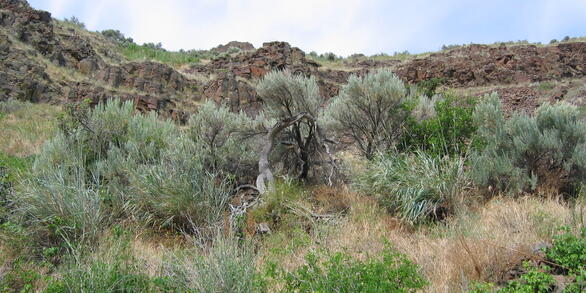
Vegetation_LTDS Vegetation_LTDS
Line-transect distance sampling (LTDS) surveys are commonly used to estimate abundance of animals or objects. In terrestrial LTDS surveys of gopher tortoise (Gopherus polyphemus) burrows, the presence of ground-level vegetation significantly decreases detection of burrows of all sizes, but no field or analytical methods exist to control for spatially heterogeneous vegetation obstruction...
Predicting climate change impacts on poikilotherms using physiologically guided species abundance models Predicting climate change impacts on poikilotherms using physiologically guided species abundance models
R code and .stan files for fitting physiologically guided abundance models for predicting climate change impacts on poikilotherms.
Co-occurance Simulation Modeling Co-occurance Simulation Modeling
R-based script used to simulate patterns of co-occurrence among two hypothetical species under patterns of avoidance, aggregation, and independence when the closure assumption is met or not, analyze simulated patterns with two-species occupancy models, and summarize the results.
Ungulate Migrations of the Western United States, Volume 2 Ungulate Migrations of the Western United States, Volume 2
This is the data archive for the publication Ungulate Migrations of the Western United States, Volume 2 (Kauffman et al. 2022) and includes the collection of GIS map files that are mapped and described in the report. These map files are meant to provide a common spatial representation of the mapped migrations. This data release provides the means for ungulate migrations to be mapped and...
Modeling population viability of gopher tortoises across the species range Modeling population viability of gopher tortoises across the species range
The code runs a population viability assessment simulation and analyzes the simulated output for Gopher Tortoise Metapopulations in the South Eastern US.
In-vitro Propagation and Fish Assessments to Inform Restoration of Dwarf Wedgemussel (Alasmidonta Heterodon) In-vitro Propagation and Fish Assessments to Inform Restoration of Dwarf Wedgemussel (Alasmidonta Heterodon)
The dwarf wedgemussel (Alasmidonta heterodon) is a federally endangered freshwater mussel that once ranged from New Brunswick to North Carolina, but now only exists in isolated populations throughout its diminished range. Laboratory propagation in conjunction with augmentation or reintroduction is considered a critical component of dwarf wedgemussel restoration. The presented data aimed...
Population genetic analysis of three aquatic macroinvertebrate species from samples in Grand Canyon (Arizona, USA) tributaries and nearby reference streams, 2016-2021 Population genetic analysis of three aquatic macroinvertebrate species from samples in Grand Canyon (Arizona, USA) tributaries and nearby reference streams, 2016-2021
This dataset contains single nucleotide polymorphism (SNP) information for aquatic insect species collected in tributaries of the Colorado River in Grand Canyon (Arizona, USA), as well as SNP information for individuals collected from reference reaches of the Upper Colorado River Basin in Utah. This dataset focuses specifically on three species that were common and widely distributed...