
Data
Browse real-time data, data releases, software/code releases and more.
Filter Total Items: 209
Maine Department of Inland Fisheries and Wildlife Moose Project - Volume 2 (2021 - 2024) Maine Department of Inland Fisheries and Wildlife Moose Project - Volume 2 (2021 - 2024)
This volume's release consists of 320104 media files captured by autonomous wildlife monitoring devices under the project, Maine Department of Inland Fisheries and Wildlife. The attached files listed below include several CSV files that provide information about the data release. The file, "media.csv" provides the metadata about the media, such as filename and date/time of capture. The...
Massachusetts Wildlife Monitoring Project (2022 - 2024) Massachusetts Wildlife Monitoring Project (2022 - 2024)
This volume's release consists of 143321 media files captured by autonomous wildlife monitoring devices under the project, Massachusetts Wildlife Monitoring Project. The attached files listed below include several CSV files that provide information about the data release. The file, "media.csv" provides the metadata about the media, such as filename and date/time of capture. The actual...
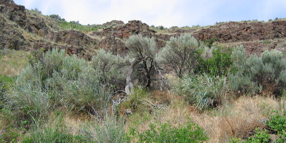
Greater Sage Grouse Encounter Histories in Modoc County, California 2019 - 2021 Greater Sage Grouse Encounter Histories in Modoc County, California 2019 - 2021
The greater sage-grouse (Centrocercus urophasianus: hereafter; sage-grouse) population in Modoc County California is geographically isolated and has been subsidized by translocation to prevent inbreeding depression since 2005. Despite significant efforts to increase the population through translocations and habitat improvement by cutting encroaching western juniper (Juniperus...
USDA Green Mountain National Forest Volume 1 (2016 - 2022) USDA Green Mountain National Forest Volume 1 (2016 - 2022)
This volume's release consists of 84049 media files captured by autonomous wildlife monitoring devices under the project, USDA Green Mountain National Forest. The attached files listed below include several CSV files that provide information about the data release. The file, "media.csv" provides the metadata about the media, such as filename and date/time of capture. The actual media...
Vermont Fish and Wildlife Department Volume 1 (2014 - 2022) Vermont Fish and Wildlife Department Volume 1 (2014 - 2022)
This volume's release consists of 41933 media files captured by autonomous wildlife monitoring devices under the project, Vermont Fish and Wildlife Department. The attached files listed below include several CSV files that provide information about the data release. The file, "media.csv" provides the metadata about the media, such as filename and date/time of capture. The actual media...
Indiana Dunes National Park Volume 1 (2019) Indiana Dunes National Park Volume 1 (2019)
This volume's release consists of 26141 media files captured by autonomous wildlife monitoring devices under the project, Indiana Dunes National Park. The attached files listed below include several CSV files that provide information about the data release. The file, "media.csv" provides the metadata about the media, such as filename and date/time of capture. The actual media files are...
Dartmouth College Woodlands Wildlife Monitoring Project Volume 1 (2014 - 2024) Dartmouth College Woodlands Wildlife Monitoring Project Volume 1 (2014 - 2024)
This volume's release consists of 46576 media files captured by autonomous wildlife monitoring devices under the project, Dartmouth College Woodlands Wildlife Monitoring Project. The attached files listed below include several CSV files that provide information about the data release. The file, "media.csv" provides the metadata about the media, such as filename and date/time of capture...
Silvio O Conte National Fish and Wildlife Refuge Wildlife Monitoring Project (2014 - 2024) Silvio O Conte National Fish and Wildlife Refuge Wildlife Monitoring Project (2014 - 2024)
This volume's release consists of 90364 media files captured by autonomous wildlife monitoring devices under the project, Silvio O Conte National Fish and Wildlife Refuge Wildlife Monitoring Project. The attached files listed below include several CSV files that provide information about the data release. The file, "media.csv" provides the metadata about the media, such as filename and...
SiMPL Wildlife Magnet Project Data Release Volume 1 (2019 - 2023) SiMPL Wildlife Magnet Project Data Release Volume 1 (2019 - 2023)
This volume's release consists of 281258 media files captured by autonomous wildlife monitoring devices under the project, SiMPL Wildlife Magnet Project. The attached files listed below include several CSV files that provide information about the data release. The file, "media.csv" provides the metadata about the media, such as filename and date/time of capture. The actual media files...
Adirondack Inventory & Monitoring (AIM) Network Volume 1 (2021 - 2023) Adirondack Inventory & Monitoring (AIM) Network Volume 1 (2021 - 2023)
This volume's release consists of 42105 media files captured by autonomous wildlife monitoring devices under the project, Adirondack Inventory & Monitoring (AIM) Network. The attached files listed below include several CSV files that provide information about the data release. The file, "media.csv" provides the metadata about the media, such as filename and date/time of capture. The...
Maine Department of Inland Fisheries and Wildlife Volume 1 (2022 - 2023) Maine Department of Inland Fisheries and Wildlife Volume 1 (2022 - 2023)
This volume's release consists of 64642 media files captured by autonomous wildlife monitoring devices under the project, Maine Department of Inland Fisheries and Wildlife. The attached files listed below include several CSV files that provide information about the data release. The file, "media.csv" provides the metadata about the media, such as filename and date/time of capture. The...
Ungulate Migrations of the Western United States, Volume 4 Ungulate Migrations of the Western United States, Volume 4
This is the data archive for the publication Ungulate Migrations of the Western United States, Volume 4 and includes the collection of GIS map files that are mapped and described in the report. These map files are meant to provide a common spatial representation of the mapped migrations and seasonal ranges. This data release provides the means for ungulate migrations to be mapped and...