
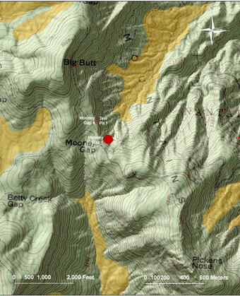
Mooney Gap, Coweeta Experimental Forest, North Carolina
The USGS and its cooperators have installed instruments in a steep hillside about 16 km southeast of Otto, NC in the Coweeta Experimental Forest.
Recent Conditions
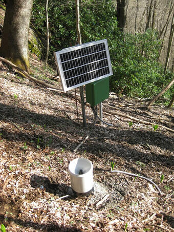
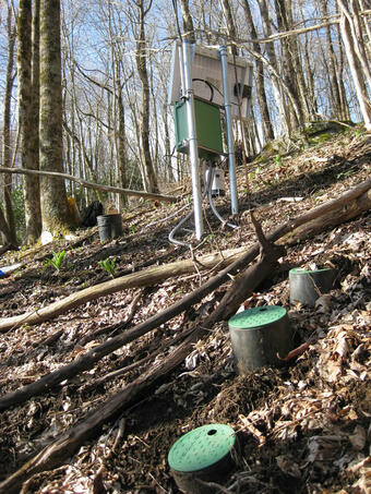
Instruments were installed in the fall of 2013 and are used to monitor and detect changes in local conditions, including
Project Background
Landslides in southern Appalachia impact people and the environment, and they are commonly induced by intense or prolonged rainfall associated with strong back-to-back storms. For example, in September 2004 heavy rainfall from two hurricanes, Frances and Ivan, induced thousands of landslides over a large part of western North Carolina. More recently, Hurricane Helene and a predecessor rainfall event exceeded historical rainfall records and again triggered several thousands of landslides across the region.
In many landslide-prone hillsides, infiltration of water from rainfall or snowmelt increases ground-water pressures. These elevated pressures can, in turn, induce landslide movement. The USGS and its cooperators have installed instruments in a steep hillside at Mooney Gap. Data collection at this site supports research on hydrologic factors that control landslide initiation and is provided here for situational awareness before and during major storm events.
The USGS and its cooperators have installed instruments in a steep hillside about 16 km southeast of Otto, NC in the Coweeta Experimental Forest.
Recent Conditions
Instruments were installed in the fall of 2013 and are used to monitor and detect changes in local conditions, including
Project Background
Landslides in southern Appalachia impact people and the environment, and they are commonly induced by intense or prolonged rainfall associated with strong back-to-back storms. For example, in September 2004 heavy rainfall from two hurricanes, Frances and Ivan, induced thousands of landslides over a large part of western North Carolina. More recently, Hurricane Helene and a predecessor rainfall event exceeded historical rainfall records and again triggered several thousands of landslides across the region.
In many landslide-prone hillsides, infiltration of water from rainfall or snowmelt increases ground-water pressures. These elevated pressures can, in turn, induce landslide movement. The USGS and its cooperators have installed instruments in a steep hillside at Mooney Gap. Data collection at this site supports research on hydrologic factors that control landslide initiation and is provided here for situational awareness before and during major storm events.