



Water Quantity
Water Quantity
Filter Total Items: 3
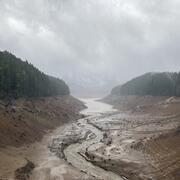
Water temperature modeling in the Willamette Valley
The U.S. Geological Survey (USGS) monitors, studies, and models water temperature to better understand how dam releases affect stream temperature and flow.

Prey Availability
Migratory wildlife need to balance the benefits of migration and reproduction with the physiological costs. This is particularly challenging in dynamic environments like wetlands, where food levels can vary greatly from year to year. For shorebirds in the Great Basin region, saline or terminal lakes provide essential habitats during their annual life cycle. To understand how changes in hydrology...
By
Ecosystems Mission Area, Water Resources Mission Area, Species Management Research Program, Forest and Rangeland Ecosystem Science Center, Fort Collins Science Center, Nevada Water Science Center, Oregon Water Science Center, Utah Water Science Center, Western Ecological Research Center (WERC), Saline Lake Ecosystems Integrated Water Availability Assessment

New gages for understanding surface water availability and spring Chinook salmon habitat in the Willamette Basin
Learn about our new streamgages in the Williamette River Basin.