
This is a dredge material deposition site named the Woodland Islands. Western Fisheries Research Center scientists study this area as habitat for fish like salmon.
Multimedia
Explore our multimedia resources.
Images
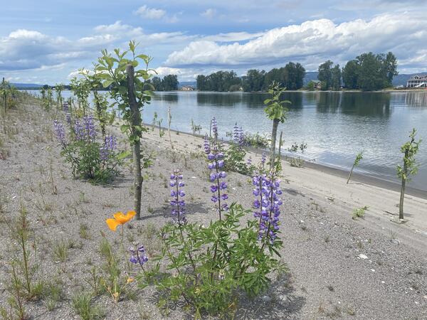
Woodland Islands
This is a dredge material deposition site named the Woodland Islands. Western Fisheries Research Center scientists study this area as habitat for fish like salmon.
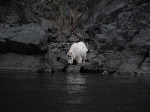
Mountain Goat in the Upper Reach of Snake River below Hells Canyon Dam and Seven Devils Mountains
Mountain Goat in the Upper Reach of Snake River below Hells Canyon Dam and Seven Devils MountainsThis is a mountain goat in the upper reach Snake River below Hells Canyon dam and Seven Devils mountains, captured during coop work with Idaho Power by Tobyn Rhodes, a scientist at the Western Fisheries Research Center.
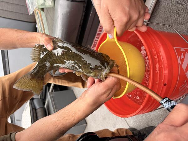
Scientists Collect Diet Samples from Fish
Scientists at the Western Fisheries Research Center collect fish diet samples to analyze their contents and better understand the food web.
Scientists at the Western Fisheries Research Center collect fish diet samples to analyze their contents and better understand the food web.
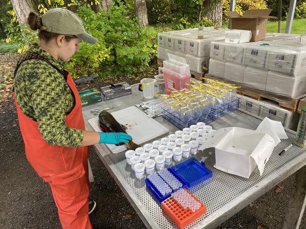
Scientist Examining a Fish
Sophie Hall of the Pacific States Marine Fisheries Commission sampling tissues of a Sockeye Salmon Oncorhynchus nerka at the Washington Department of Fish and Wildlife (WDFW) Cedar River Hatchery in the Lake Washington watershed. Led by U.S.
Sophie Hall of the Pacific States Marine Fisheries Commission sampling tissues of a Sockeye Salmon Oncorhynchus nerka at the Washington Department of Fish and Wildlife (WDFW) Cedar River Hatchery in the Lake Washington watershed. Led by U.S.
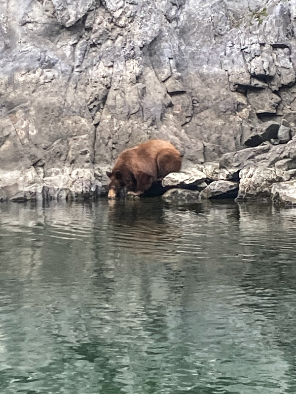
Bear Drinking Water in the upper reach of the Snake River
Bear Drinking Water in the upper reach of the Snake RiverThis is a photo of a black bear drinking in the upper reach Snake River below Hells Canyon dam and Seven Devils mountains. This photo was shot by Brandon Falish while doing cooperative work with Idaho Power.
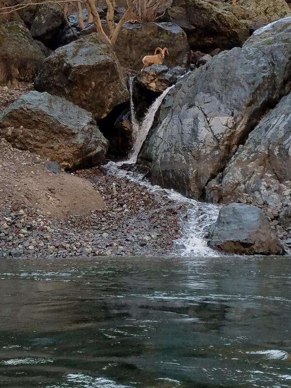
Bighorn Above Cherry Creek
This is a photograph of a Bighorn above Cherry Creek. Alexis Litty took the picture in the fall working on deepwater salmon redd surveys.
This is a photograph of a Bighorn above Cherry Creek. Alexis Litty took the picture in the fall working on deepwater salmon redd surveys.
Videos

Artificial Light At Night
This is a video about the artificial light at night project, happening in Seattle, WA out of the USGS Western Fisheries Research Center.
This is a video about the artificial light at night project, happening in Seattle, WA out of the USGS Western Fisheries Research Center.
Artificial Light At Night (AD Version)
This is a video about the artificial light at night project, happening in Seattle, WA out of the USGS Western Fisheries Research Center.
This is a video about the artificial light at night project, happening in Seattle, WA out of the USGS Western Fisheries Research Center.

Saline Lake Ecosystems IWAA Spring Seminar: Project Updates and 2026 Field Season Plans
Saline Lake Ecosystems IWAA Spring Seminar: Project Updates and 2026 Field Season PlansThis video presents the Spring 2026 Saline Lake Ecosystems Integrated Water Availability Assessment Spring Seminar by the U.S. Geological Survey (USGS). Narrated by Lisa Hoaks, the seminar provides project updates, summer 2026 field season plans, and recently published products.

Juvenile Sucker in Upper Klamath Lake, OR
This is a video of a juvenile sucker in Upper Klamath Lake, OR. Through decades of research, scientists at the USGS Western Fisheries Research Center have determined that over the last 30 years something has prevented young suckers from reaching adulthood. Scientists work tirelessly to find the cause of this break in recruitment into adulthood.
This is a video of a juvenile sucker in Upper Klamath Lake, OR. Through decades of research, scientists at the USGS Western Fisheries Research Center have determined that over the last 30 years something has prevented young suckers from reaching adulthood. Scientists work tirelessly to find the cause of this break in recruitment into adulthood.

Juvenile Sucker Sampling on Upper Klamath Lake, OR
Juvenile Sucker Sampling on Upper Klamath Lake, ORThis is a video of fieldwork in Upper Klamath Lake, OR. Here, biologists sample for juvenile suckers, an endangered fish species in the lake.
Juvenile Sucker Sampling on Upper Klamath Lake, OR
Juvenile Sucker Sampling on Upper Klamath Lake, ORThis is a video of fieldwork in Upper Klamath Lake, OR. Here, biologists sample for juvenile suckers, an endangered fish species in the lake.

Saline Lake Ecosystems IWAA Spring Seminar: Project Updates and 2025 Field Season Plans
Saline Lake Ecosystems IWAA Spring Seminar: Project Updates and 2025 Field Season PlansThis video presents the Spring 2025 Saline Lake Ecosystems Integrated Water Availability Assessment Spring Seminar by the U.S. Geological Survey (USGS). Hosted by Allison Shipp, the seminar provides updates on how hydroclimatic changes and water management affect terminal lake ecosystems and waterbird populations.
Audio

Eyes on Earth Episode 84 - Hurricane Disturbance Mapping
Eyes on Earth Episode 84 - Hurricane Disturbance MappingWhen disaster strikes, near-real-time images of its effects can be invaluable. In this episode of Eyes on Earth, we learn about how a newly developed system using the Harmonized Landsat Sentinel-2 dataset and artificial intelligence was put to the test when Hurricane Ian tore through Florida in late September 2022.