
Energy and Minerals for the Future
Climate Science Spotlight
As the world economy transitions from the carbon-heavy energy sources of the past to renewable energy sources in the future, USGS scientists are at the forefront of the science behind that transition.
From the critical mineral resources required to construct renewable energy infrastructure to the potential for geothermal and hydrogen energy, USGS science is foundational to the future of our Nation’s energy and mineral promise.
Quickly jump to how USGS is delivering climate science:
Geothermal Energy
Geologic Energy Storage
Wind Turbine Database
Some Like It Hot
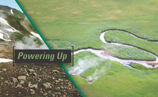
Geothermal energy is a significant source of renewable electric power in the western United States. With advances in exploration and development of technologies, it could even be a potential source of electric power for the entire country.
In addition to generating electricity, low-temperature geothermal resources and thermal energy storage in geological reservoirs may offer potentially large sources of energy for heating and cooling infrastructure across the entire U.S. The results of national-scale assessments and supporting research studies provide State and Federal government policymakers with the information they need to evaluate the potential contribution of geothermal energy to the nation’s energy mix.
The USGS provides critical assessment maps for the full range of geothermal resource types, can improve technologies for characterizing resources, and can develop products to aid the U.S. Bureau of Land Management and other regulatory agencies in streamlining their permitting processes. Shortened permitting timelines are identified as a critical factor for effective geothermal development, and appropriate products generated by this project will aid partners in the decision-making process.
Storing Excess Energy and Heat Underground for Later Use

Renewable energy sources like wind and solar energy have the benefits of producing electricity without carbon emissions but have the downside of being reliant on forces that we do not control, like the sun or the wind. This can lead to situations where there is more energy available than is needed at some times of the day, then not enough energy to meet our needs at other times of the day. Figuring out how to store the excess energy to meet later demands is a priority for supporting renewable energy development.
Another facet to energy storage centers around heating and cooling our communities. During the summer, increasing temperatures cause more air conditioning to be used, and having a way to store that excess heat for later use during the winter could be an effective way of reducing reliance on fuels like natural gas and heating oil.
The USGS is looking at how underground rock and water formations might be able to help store excess heat and energy to be used later.
Information on the Nation’s Wind Turbines in One Place
To support assessing wind power capacity the USGS created the WindFarm Mapper to show all wind turbines in the United States in a single viewer. The WindFarm Mapper is also useful for evaluating the effects of wind turbines on local airports and defense applications, as well as studying ecosystem and community impacts from wind energy utility developments. For each wind turbine, the mapper shows the height of the turbine, the length of the blades, the power it generates, the manufacturer, what project it is associated with, etc. The viewer contains both onshore and offshore wind turbines.
USGS Delivering Climate Science
To policymakers, resource managers, and the public to help guide better decisions for building sustainable resource stewardship across America’s public lands and beyond.
From the critical mineral resources required to construct renewable energy infrastructure to the potential for geothermal and hydrogen energy, USGS science is foundational to the future of our Nation’s energy and mineral promise.
Quickly jump to how USGS is delivering climate science:
Geothermal Energy
Geologic Energy Storage
Wind Turbine Database
Some Like It Hot
Geothermal energy is a significant source of renewable electric power in the western United States. With advances in exploration and development of technologies, it could even be a potential source of electric power for the entire country.
In addition to generating electricity, low-temperature geothermal resources and thermal energy storage in geological reservoirs may offer potentially large sources of energy for heating and cooling infrastructure across the entire U.S. The results of national-scale assessments and supporting research studies provide State and Federal government policymakers with the information they need to evaluate the potential contribution of geothermal energy to the nation’s energy mix.
The USGS provides critical assessment maps for the full range of geothermal resource types, can improve technologies for characterizing resources, and can develop products to aid the U.S. Bureau of Land Management and other regulatory agencies in streamlining their permitting processes. Shortened permitting timelines are identified as a critical factor for effective geothermal development, and appropriate products generated by this project will aid partners in the decision-making process.
Storing Excess Energy and Heat Underground for Later Use
Renewable energy sources like wind and solar energy have the benefits of producing electricity without carbon emissions but have the downside of being reliant on forces that we do not control, like the sun or the wind. This can lead to situations where there is more energy available than is needed at some times of the day, then not enough energy to meet our needs at other times of the day. Figuring out how to store the excess energy to meet later demands is a priority for supporting renewable energy development.
Another facet to energy storage centers around heating and cooling our communities. During the summer, increasing temperatures cause more air conditioning to be used, and having a way to store that excess heat for later use during the winter could be an effective way of reducing reliance on fuels like natural gas and heating oil.
The USGS is looking at how underground rock and water formations might be able to help store excess heat and energy to be used later.
Information on the Nation’s Wind Turbines in One Place
To support assessing wind power capacity the USGS created the WindFarm Mapper to show all wind turbines in the United States in a single viewer. The WindFarm Mapper is also useful for evaluating the effects of wind turbines on local airports and defense applications, as well as studying ecosystem and community impacts from wind energy utility developments. For each wind turbine, the mapper shows the height of the turbine, the length of the blades, the power it generates, the manufacturer, what project it is associated with, etc. The viewer contains both onshore and offshore wind turbines.
USGS Delivering Climate Science
To policymakers, resource managers, and the public to help guide better decisions for building sustainable resource stewardship across America’s public lands and beyond.