
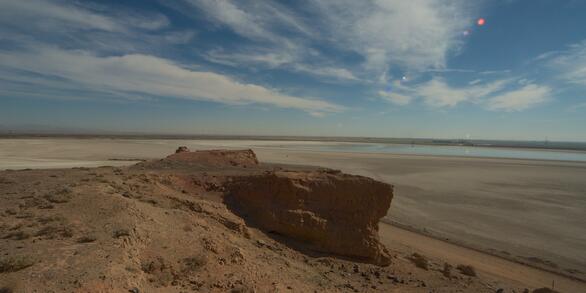
Salton Sea
Changes in regional water management practices have reduced freshwater inflow to the Salton Sea, changing what was once a popular vacation destination to a shrinking hypersaline lake. As the lake bed dries to a dusty playa, air, water, and wildlife managers will depend on careful monitoring and research to inform critical decisions affecting the future of the lake and surrounding communities.
Science Projects
Science Projects
Learn more about USGS science in and around the Salton Sea.
State of the Salton Sea Report
State of the Salton Sea Report
Geonarrative Investigates Geohazards of the Salton Sea
Geonarrative Investigates Geohazards of the Salton Sea
The geonarrative, “A Desert on the Move”, addresses the geohazards present in the Salton Sea area. Beneath the Salton Sea is a network of active tectonic faults some of which have produced some of the largest earthquakes in California’s history.
News
Geonarrative Investigates Geohazards of the Salton Sea
Geonarrative Investigates Geohazards of the Salton Sea
Scientists Study Selenium Hazard in the Salton Sea Environment
Scientists Study Selenium Hazard in the Salton Sea Environment
Publications
Irregular focal mechanisms observed at Salton Sea Geothermal Field: Possible influences of anthropogenic stress perturbations Irregular focal mechanisms observed at Salton Sea Geothermal Field: Possible influences of anthropogenic stress perturbations
At the Salton Sea Geothermal Field (SSGF), strain accumulation is released through seismic slip and aseismic deformation. Earthquake activity at the SSGF often occurs in swarm-like clusters, some with clear migration patterns. We have identified an earthquake sequence composed entirely of focal mechanisms representing an ambiguous style of faulting, where strikes are similar but...
Punctuated sediment discharge during early Pliocene birth of the Colorado River: Evidence from regional stratigraphy, sedimentology, and paleontology Punctuated sediment discharge during early Pliocene birth of the Colorado River: Evidence from regional stratigraphy, sedimentology, and paleontology
The Colorado River in the southwestern U.S. provides an excellent natural laboratory for studying the origins of a continent-scale river system, because deposits that formed prior to and during river initiation are well exposed in the lower river valley and nearby basinal sink. This paper presents a synthesis of regional stratigraphy, sedimentology, and micropaleontology from the...
Subsurface geometry of the San Andreas fault in southern California: Results from the Salton Seismic Imaging Project (SSIP) and strong ground motion expectations Subsurface geometry of the San Andreas fault in southern California: Results from the Salton Seismic Imaging Project (SSIP) and strong ground motion expectations
The San Andreas fault (SAF) is one of the most studied strike‐slip faults in the world; yet its subsurface geometry is still uncertain in most locations. The Salton Seismic Imaging Project (SSIP) was undertaken to image the structure surrounding the SAF and also its subsurface geometry. We present SSIP studies at two locations in the Coachella Valley of the northern Salton trough. On our...
Science

Water Availability of the Salton Sea Watershed
Throughout history, the Salton Sea has formed and dried up due to flooding from the Colorado River. It was most recently formed in 1905 when the Colorado River broke through an irrigation canal and flowed uncontrolled into the Salton Sea watershed. The Salton Sea is a terminal lake (it has no outlets). It is also a transboundary watershed, with area in both the state of California and Mexico’s...

Selenium Cycling in Salton Sea Wetlands
The effect of selenium toxicity on wildlife has been known for more than 50 years. This issue drew particular attention in the 1980s when embryo deformity and mortality was observed in birds at a wildlife refuge in California. Harmful effects from selenium were determined to be connected to irrigation drainage water. As a result, an effort began to monitor levels of selenium in irrigation drainage...