
FAQs

Why/When does the USGS update the magnitude of an earthquake? Why/When does the USGS update the magnitude of an earthquake?
The USGS often updates an earthquake's magnitude in the hours and sometimes days following the event. Updates occur as more data become available for analysis and more time-intensive analysis is performed. Additional updates are possible as part of the standard procedure of assembling a final earthquake catalog. There are physical and operational constraints on how quickly seismic data are...
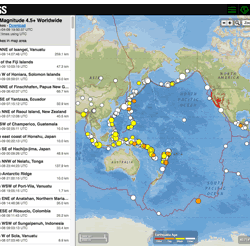
Where can I find current earthquake lists and maps for the world or for a specific area? Where can I find current earthquake lists and maps for the world or for a specific area?
The Earthquake Hazards Program Latest Earthquakes Map displays earthquakes in near-realtime and up to the past 30 days of earthquakes. The interface includes three panels: a list of earthquakes, a map, and a settings/options panel. You can pan and zoom the map to view specific areas. Click on an event on the list or map for additional information and a link to the event page with all the details...

How quickly is earthquake information posted to the USGS website and sent out via the Earthquake Notification Service (ENS) and other feeds? How quickly is earthquake information posted to the USGS website and sent out via the Earthquake Notification Service (ENS) and other feeds?
USGS earthquake information mechanisms are all triggered by the same system, so they all receive the information at the same time. The time it takes for the system to receive the information primarily depends on the size and location of the earthquake: An earthquake in California is processed and posted to the system in 2.5 minutes (on average). This is because our seismic network is very...

What is UTC, and why do you report earthquakes in UTC? What is UTC, and why do you report earthquakes in UTC?
UTC stands for Coordinated Universal Time, and for this purpose is the same as GMT (Greenwich Mean Time). Since the USGS and other seismic network agencies record earthquakes around the globe in all the various time zones, using a single standard time reference is best for record-keeping and exchange of data. The individual event pages with details about each earthquake use UTC for the reference...

Where can I find earthquake educational materials? Where can I find earthquake educational materials?
Start with our Earthquake Hazards Education site. That includes: Earthquakes for Kids Cool Earthquake Facts Earthquake Science for Everyone Other good starting points include: State Geological Surveys for states in earthquake-prone regions The Great ShakeOut Earthquake Drills website SAGE (Seismological Facility for the Advancement of Geoscience), which is a non-profit consortium

At what depth do earthquakes occur? What is the significance of the depth? At what depth do earthquakes occur? What is the significance of the depth?
Earthquakes occur in the crust or upper mantle, which ranges from the earth's surface to about 800 kilometers deep (about 500 miles). The strength of shaking from an earthquake diminishes with increasing distance from the earthquake's source, so the strength of shaking at the surface from an earthquake that occurs at 500 km deep is considerably less than if the same earthquake had occurred at 20...