U.S. flag

An official website of the United States government

Images

Land Use Land Cover Modeling Images

A graphic shown with varying colors of green, beige, white and black
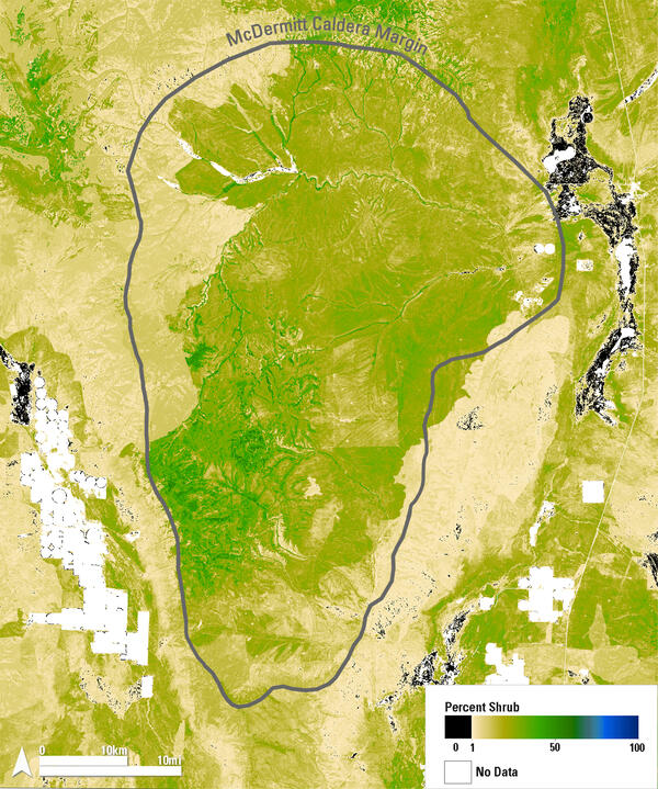
Shrub Distribution Over the McDermitt Caldera Region

This map shows 2024 shrub cover from the Rangeland Condition Monitoring Assessment and Projection (RCMAP) project across the McDermitt Caldera, outlined in gray, along the Nevada–Oregon border. Dark green areas indicate high shrub cover, typically found in riparian zones and at higher elevations.

This map shows 2024 shrub cover from the Rangeland Condition Monitoring Assessment and Projection (RCMAP) project across the McDermitt Caldera, outlined in gray, along the Nevada–Oregon border. Dark green areas indicate high shrub cover, typically found in riparian zones and at higher elevations.

Was this page helpful?