
How Do Hydrologists Locate Groundwater?
Groundwater Data for the Nation
The USGS National Water Information System (NWIS) contains extensive groundwater data for thousands of sites nationwide.
Groundwater Information by Topic
Water Science School Home
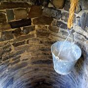
As a non-existent proverb states: "Humans don't live by surface water alone." For thousands of years, people have also relied on groundwater to serve their every need. Groundwater is invaluable for many uses, from irrigation to drinking-water supply. But, you can't see groundwater, so how do water scientists know where it is in order to be able to drill wells and pump it out for use?
• Water Science School HOME • Groundwater topics •
How Do Hydrologists Locate Groundwater?
Using scientific methods to locate water
To locate groundwater accurately and to determine the depth, quantity, and quality of the water, several techniques must be used, and a target area must be thoroughly tested and studied to identify hydrologic and geologic features important to the planning and management of the resource. The landscape may offer clues to the hydrologist about the occurrence of shallow groundwater. Conditions for large quantities of shallow groundwater are more favorable under valleys than under hills. In some regions--in parts of the arid Southwest, for example--the presence of "water-loving" plants, such as cottonwoods or willows, indicates groundwater at shallow to moderate depth. Areas where water is at the surface as springs, seeps, swamps, or lakes reflect the presence of groundwater, although not necessarily in large quantities or of usable quality.
It is difficult to visualize water underground. Some people believe that ground water collects in underground lakes or flows in underground rivers. In fact, ground water is simply the subsurface water that fully saturates pores or cracks in soils and rocks. Groundwater is replenished by precipitation and, depending on the local climate and geology, is unevenly distributed in both quantity and quality. When rain falls or snow melts, some of the water evaporates, some is transpired by plants, some flows overland and collects in streams, and some infiltrates into the pores or cracks of the soil and rocks. The first water that enters the soil replaces water that has been evaporated or used by plants during a preceding dry period. Between the land surface and the aquifer water is a zone that hydrologists call the unsaturated zone. In this unsaturated zone, there usually is at least a little water, mostly in smaller openings of the soil and rock; the larger openings usually contain air instead of water. After a significant rain, the zone may be almost saturated; after a long dry spell, it may be almost dry. Some water is held in the unsaturated zone by adhesion and cohesion, and it will not flow toward or enter a well. Similar forces hold enough water in a wet towel to make it feel damp after it has stopped dripping.

Locating groundwater
Groundwater is simply the subsurface water that fully saturates pores or cracks in soils and rocks. Aquifers are replenished by the seepage of precipitation that falls on the land, although they can be artificially replenished by people, also. There are many geologic, meteorologic, topographic, and human factors that determine the extent and rate to which aquifers are refilled with water.
The landscape offers helpful clues. Shallow ground water is more likely to occur in larger quantities under valleys than under hills, because ground water obeys the law of gravity and flows downward just as surface water does. In arid regions the presence of "water-loving" plants is an indication of ground water at shallow depth. Any area where water shows up at the surface, in springs, seeps, swamps, or lakes, must have some ground water, though not necessarily in large quantity or of usable quality.
Rocks are the most valuable clues of all consolidated formations such as sandstone, limestone, or granite as well as for loose, unconsolidated sediments such as gravel or sand. An "'aquifer" is any body of rock that contains a usable supply of water. A good aquifer must be both porous enough to hold water and permeable enough to allow the continuous recharge of water to a well.
Gravel, sand, sandstone, and limestone are among the best aquifers, but they form only a fraction of the rocks in the Earth's crust. Most rocks are fine grained or otherwise '"tight" and store or carry little water.
As a first step in locating ground water, the hydrologist prepares a geologic map showing where the different kinds of rock come to the land surface. Some of the rocks may be so cracked and broken that they provide good openings to carry water underground. The rocks may be so folded and displaced, however, that it is difficult to trace their location underground.
Next, the hydrologist gathers information on the wells in the area—their locations, the depth to water, the amount of water pumped, and the kinds of rock they penetrate. Because the water-seeker cannot always afford to drill a test hole to obtain information, records of wells already drilled are of great value.
If there are no wells in the area, or not enough information is available on existing ones, the hydrologist may contract with a well driller to put down some test holes. At these holes a pumping or aquifer test will be conducted. These tests indicate the water-bearing properties of the aquifer tapped by the well. From the tests the hydrologist can determine the amount of water moving through the aquifer, the volume of water that can enter the well, and the effect of pumping on the water level of other wells in the area.
For man's use of water, quality is just as important as quantity. The hydrologist will take samples of water from different wells and have them chemically analyzed.
The hydrologist's report and geologic map will show where water can be found, its chemical composition, and in a general way, how much is available. This is the scientific approach used by the U.S. Geological Survey, State resource agencies, and consulting engineers in making their ground-water studies. Information about local ground-water conditions may be found in the offices that the U.S. Geological Survey's Water Resources Division maintains in all 50 States.
Do you think you know about groundwater?
Take our Groundwater true/false quiz, part of our Activity Center.
Sources and more information:
- Appraising the Nation's Ground-Water Resources, USGS General Information publication
Quiz icon made by mynamepong from www.flaticon.com

Want to know more about how hydrologists locate groundwater? Follow me to the Geophysics for USGS Groundwater/Surface Water Interaction Studies website!
Below are other science topics associated with groundwater.

Groundwater Information by Topic

Infiltration and the Water Cycle

Groundwater Quality

Groundwater Flow and the Water Cycle
Groundwater Storage and the Water Cycle
As a non-existent proverb states: "Humans don't live by surface water alone." For thousands of years, people have also relied on groundwater to serve their every need. Groundwater is invaluable for many uses, from irrigation to drinking-water supply. But, you can't see groundwater, so how do water scientists know where it is in order to be able to drill wells and pump it out for use?
• Water Science School HOME • Groundwater topics •
How Do Hydrologists Locate Groundwater?
Using scientific methods to locate water
To locate groundwater accurately and to determine the depth, quantity, and quality of the water, several techniques must be used, and a target area must be thoroughly tested and studied to identify hydrologic and geologic features important to the planning and management of the resource. The landscape may offer clues to the hydrologist about the occurrence of shallow groundwater. Conditions for large quantities of shallow groundwater are more favorable under valleys than under hills. In some regions--in parts of the arid Southwest, for example--the presence of "water-loving" plants, such as cottonwoods or willows, indicates groundwater at shallow to moderate depth. Areas where water is at the surface as springs, seeps, swamps, or lakes reflect the presence of groundwater, although not necessarily in large quantities or of usable quality.
It is difficult to visualize water underground. Some people believe that ground water collects in underground lakes or flows in underground rivers. In fact, ground water is simply the subsurface water that fully saturates pores or cracks in soils and rocks. Groundwater is replenished by precipitation and, depending on the local climate and geology, is unevenly distributed in both quantity and quality. When rain falls or snow melts, some of the water evaporates, some is transpired by plants, some flows overland and collects in streams, and some infiltrates into the pores or cracks of the soil and rocks. The first water that enters the soil replaces water that has been evaporated or used by plants during a preceding dry period. Between the land surface and the aquifer water is a zone that hydrologists call the unsaturated zone. In this unsaturated zone, there usually is at least a little water, mostly in smaller openings of the soil and rock; the larger openings usually contain air instead of water. After a significant rain, the zone may be almost saturated; after a long dry spell, it may be almost dry. Some water is held in the unsaturated zone by adhesion and cohesion, and it will not flow toward or enter a well. Similar forces hold enough water in a wet towel to make it feel damp after it has stopped dripping.
Locating groundwater
Groundwater is simply the subsurface water that fully saturates pores or cracks in soils and rocks. Aquifers are replenished by the seepage of precipitation that falls on the land, although they can be artificially replenished by people, also. There are many geologic, meteorologic, topographic, and human factors that determine the extent and rate to which aquifers are refilled with water.
The landscape offers helpful clues. Shallow ground water is more likely to occur in larger quantities under valleys than under hills, because ground water obeys the law of gravity and flows downward just as surface water does. In arid regions the presence of "water-loving" plants is an indication of ground water at shallow depth. Any area where water shows up at the surface, in springs, seeps, swamps, or lakes, must have some ground water, though not necessarily in large quantity or of usable quality.
Rocks are the most valuable clues of all consolidated formations such as sandstone, limestone, or granite as well as for loose, unconsolidated sediments such as gravel or sand. An "'aquifer" is any body of rock that contains a usable supply of water. A good aquifer must be both porous enough to hold water and permeable enough to allow the continuous recharge of water to a well.
Gravel, sand, sandstone, and limestone are among the best aquifers, but they form only a fraction of the rocks in the Earth's crust. Most rocks are fine grained or otherwise '"tight" and store or carry little water.
As a first step in locating ground water, the hydrologist prepares a geologic map showing where the different kinds of rock come to the land surface. Some of the rocks may be so cracked and broken that they provide good openings to carry water underground. The rocks may be so folded and displaced, however, that it is difficult to trace their location underground.
Next, the hydrologist gathers information on the wells in the area—their locations, the depth to water, the amount of water pumped, and the kinds of rock they penetrate. Because the water-seeker cannot always afford to drill a test hole to obtain information, records of wells already drilled are of great value.
If there are no wells in the area, or not enough information is available on existing ones, the hydrologist may contract with a well driller to put down some test holes. At these holes a pumping or aquifer test will be conducted. These tests indicate the water-bearing properties of the aquifer tapped by the well. From the tests the hydrologist can determine the amount of water moving through the aquifer, the volume of water that can enter the well, and the effect of pumping on the water level of other wells in the area.
For man's use of water, quality is just as important as quantity. The hydrologist will take samples of water from different wells and have them chemically analyzed.
The hydrologist's report and geologic map will show where water can be found, its chemical composition, and in a general way, how much is available. This is the scientific approach used by the U.S. Geological Survey, State resource agencies, and consulting engineers in making their ground-water studies. Information about local ground-water conditions may be found in the offices that the U.S. Geological Survey's Water Resources Division maintains in all 50 States.
Do you think you know about groundwater?
Take our Groundwater true/false quiz, part of our Activity Center.
Sources and more information:
- Appraising the Nation's Ground-Water Resources, USGS General Information publication
Quiz icon made by mynamepong from www.flaticon.com
Want to know more about how hydrologists locate groundwater? Follow me to the Geophysics for USGS Groundwater/Surface Water Interaction Studies website!
Below are other science topics associated with groundwater.
Groundwater Information by Topic
Infiltration and the Water Cycle
Groundwater Quality
Groundwater Flow and the Water Cycle