
Annett Sullivan
Annett Sullivan is a hydrologist at the USGS Oregon Water Science Center.
Focus of work:
- Klamath River, from Link River to Keno Dam
- Detroit Lake
- Henry Hagg Lake
- North Santiam River
Part of the water quality modeling group at the USGS Oregon Water Science Center.
Professional Experience
2002-present: U.S. Geological Survey, Oregon Water Science Center (2012 USGS Superior Service Award)
1999-2002: Oak Ridge National Laboratory, Environmental Sciences Division (Wigner Fellow)
Education and Certifications
B.A. Geology, Bryn Mawr College, PA
Technische Universitaet Clausthal, Germany
Ph.D. Geology, University of Wyoming, WY
Science and Products
Water Quality in Keno Reach of the Klamath River
The U.S. Geological Survey, U.S. Bureau of Reclamation, and Watercourse Engineering, Inc. are collaborating to develop knowledge and tools to better manage water quality in the Link-Keno reach of the Klamath River and the Lost River.
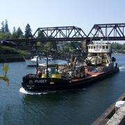
Lake Washington Ship Canal Sustainable Rivers Project
The U.S. Geological Survey (USGS) and the U.S. Army Corps of Engineers (USACE) are refining a water quality model to better understand temperature and salinity dynamics in the Lake Washington Ship Canal. This effort is supported by the Sustainable Rivers Program, a partnership between the USACE and The Nature Conservancy (TNC).
Modeling the water-quality effects to the Klamath River from drain recirculation
What could happen to nutrient loads in the Klamath River if water from the Klamath Straits Drain is recirculated into the Ady Canal? USGS scientists investigate.
CE–QUAL–W2 water-quality models for Klamath Straits Drain recirculation scenarios, Klamath River, Oregon, 2006–15 CE–QUAL–W2 water-quality models for Klamath Straits Drain recirculation scenarios, Klamath River, Oregon, 2006–15
A hydrodynamic, water-temperature, and water-quality model (CE-QUAL-W2; Wells, 2020) of the Link-Keno reach of the Klamath River (Oregon) was used for calendar years 2006–15 to run a series of base and recirculation scenarios. These model runs were implemented to test alternative scenarios for routing some of the Klamath Straits Drain discharge into Ady Canal. The model scenarios were...
CE-QUAL-W2 water-quality model and data for Berlin Lake, Lake Milton, Michael J Kirwan Reservoir, Mosquito Creek Lake, and the Mahoning River, Ohio CE-QUAL-W2 water-quality model and data for Berlin Lake, Lake Milton, Michael J Kirwan Reservoir, Mosquito Creek Lake, and the Mahoning River, Ohio
The U.S. Army Corps of Engineers is considering changing the operations of Berlin Lake, Lake Milton, Michael J Kirwan Reservoir, and Mosquito Creek Lake. The lakes in this study are all reservoirs, formed by dams. These models were constructed to simulate those operations and document possible water-quality effects in the lakes, the lake outflows, and the Mahoning River downstream of the...
CE-QUAL-W2 water-quality model for Green Peter and Foster Lakes and the South Santiam River, Oregon: 2002-2011 CE-QUAL-W2 water-quality model for Green Peter and Foster Lakes and the South Santiam River, Oregon: 2002-2011
Green Peter Dam on the Middle Santiam River and the downstream Foster Dam on the South Santiam River in Oregon have altered natural seasonal temperature patterns in those rivers. In response, the U.S. Army Corps of Engineers is leading efforts to improve conditions for Chinook salmon upstream and downstream of these dams by considering structural alterations and by exploring changes to...
Below are publications that Annett Sullivan has authored.
Filter Total Items: 24
Modeling the water-quality effects to the Klamath River from recirculation in drains and canals, Oregon and California, 2006–15 Modeling the water-quality effects to the Klamath River from recirculation in drains and canals, Oregon and California, 2006–15
The potential recirculation of Klamath Strait Drain (hereafter called by its local name, “Klamath Straits Drain”) water into Ady Canal to reduce the drain discharge of high nutrient loads into the Klamath River was assessed by the U.S. Geological Survey for the Bureau of Reclamation. To study the feasibility of recirculation, this investigation evaluated three recirculation scenarios...
Authors
Erik A. Smith, Annett B. Sullivan
Modeling flow and water quality in reservoir and river reaches of the Mahoning River Basin, Ohio Modeling flow and water quality in reservoir and river reaches of the Mahoning River Basin, Ohio
Authors
Annett B. Sullivan, Gabrielle M. Georgetson, Christina E. Urbanczyk, Gabriel W. Gordon, Susan A. Wherry, William B. Long
Modeling water temperature response to dam operations and water management in Green Peter and Foster Lakes and the South Santiam River, Oregon Modeling water temperature response to dam operations and water management in Green Peter and Foster Lakes and the South Santiam River, Oregon
Authors
Annett B. Sullivan, Stewart A. Rounds
Evaluation of restoration alternatives using hydraulic models of lake outflow at Wapato Lake National Wildlife Refuge, northwestern Oregon Evaluation of restoration alternatives using hydraulic models of lake outflow at Wapato Lake National Wildlife Refuge, northwestern Oregon
Wapato Lake National Wildlife Refuge near the city of Gaston in northwestern Oregon was established in 2013, and planning is underway to restore a more natural lake and wetland system after more than 100 years of agricultural activity on the lakebed. Several water-management and restoration alternatives are under consideration, one of which involves opening and reconnecting Wapato Lake’s...
Authors
Stewart A. Rounds, Stephen L. Pilson, Annett B. Sullivan, Adam J. Stonewall
Characteristics of dissolved organic matter in the Upper Klamath River, Lost River, and Klamath Straits Drain, Oregon and California Characteristics of dissolved organic matter in the Upper Klamath River, Lost River, and Klamath Straits Drain, Oregon and California
Concentrations of particulate organic carbon (POC) and dissolved organic carbon (DOC), which together comprise total organic carbon, were measured in this reconnaissance study at sampling sites in the Upper Klamath River, Lost River, and Klamath Straits Drain in 2013–16. Optical absorbance and fluorescence properties of dissolved organic matter (DOM), which contains DOC, also were...
Authors
Jami H. Goldman, Annett B. Sullivan
Modeling water quality, temperature, and flow in Link River, south-central Oregon Modeling water quality, temperature, and flow in Link River, south-central Oregon
The 2.1-km (1.3-mi) Link River connects Upper Klamath Lake to the Klamath River in south-central Oregon. A CE-QUAL-W2 flow and water-quality model of Link River was developed to provide a connection between an existing model of the upper Klamath River and any existing or future models of Upper Klamath Lake. Water-quality sampling at six locations in Link River was done during 2013–15 to...
Authors
Annett B. Sullivan, Stewart A. Rounds
Water-quality modeling of Klamath Straits Drain recirculation, a Klamath River wetland, and 2011 conditions for the Link River to Keno Dam reach of the Klamath River, Oregon Water-quality modeling of Klamath Straits Drain recirculation, a Klamath River wetland, and 2011 conditions for the Link River to Keno Dam reach of the Klamath River, Oregon
The upper Klamath River and adjacent Lost River are interconnected basins in south-central Oregon and northern California. Both basins have impaired water quality with Total Maximum Daily Loads (TMDLs) in progress or approved. In cooperation with the Bureau of Reclamation, the U.S. Geological Survey (USGS) and Watercourse Engineering, Inc., have conducted modeling and research to inform...
Authors
Annett B. Sullivan, I. Ertugrul Sogutlugil, Michael L. Deas, Stewart A. Rounds
Review of revised Klamath River Total Maximum Daily Load models from Link River Dam to Keno Dam, Oregon Review of revised Klamath River Total Maximum Daily Load models from Link River Dam to Keno Dam, Oregon
Flow and water-quality models are being used to support the development of Total Maximum Daily Load (TMDL) plans for the Klamath River downstream of Upper Klamath Lake (UKL) in south-central Oregon. For riverine reaches, the RMA-2 and RMA-11 models were used, whereas the CE-QUAL-W2 model was used to simulate pooled reaches. The U.S. Geological Survey (USGS) was asked to review the most...
Authors
Stewart A. Rounds, Annett B. Sullivan
Modeling the Water - Quality Effects of Changes to the Klamath River Upstream of Keno Dam, Oregon Modeling the Water - Quality Effects of Changes to the Klamath River Upstream of Keno Dam, Oregon
The Link River to Keno Dam (Link-Keno) reach of the Klamath River, Oregon, generally has periods of water-quality impairment during summer, including low dissolved oxygen, elevated concentrations of ammonia and algae, and high pH. Efforts are underway to improve water quality in this reach through a Total Maximum Daily Load (TMDL) program and other management and operational actions. To...
Authors
Annett B. Sullivan, I. Ertugrul Sogutlugil, Stewart A. Rounds, Michael L. Deas
Science and Products
Water Quality in Keno Reach of the Klamath River
The U.S. Geological Survey, U.S. Bureau of Reclamation, and Watercourse Engineering, Inc. are collaborating to develop knowledge and tools to better manage water quality in the Link-Keno reach of the Klamath River and the Lost River.
Lake Washington Ship Canal Sustainable Rivers Project
The U.S. Geological Survey (USGS) and the U.S. Army Corps of Engineers (USACE) are refining a water quality model to better understand temperature and salinity dynamics in the Lake Washington Ship Canal. This effort is supported by the Sustainable Rivers Program, a partnership between the USACE and The Nature Conservancy (TNC).
Modeling the water-quality effects to the Klamath River from drain recirculation
What could happen to nutrient loads in the Klamath River if water from the Klamath Straits Drain is recirculated into the Ady Canal? USGS scientists investigate.
CE–QUAL–W2 water-quality models for Klamath Straits Drain recirculation scenarios, Klamath River, Oregon, 2006–15 CE–QUAL–W2 water-quality models for Klamath Straits Drain recirculation scenarios, Klamath River, Oregon, 2006–15
A hydrodynamic, water-temperature, and water-quality model (CE-QUAL-W2; Wells, 2020) of the Link-Keno reach of the Klamath River (Oregon) was used for calendar years 2006–15 to run a series of base and recirculation scenarios. These model runs were implemented to test alternative scenarios for routing some of the Klamath Straits Drain discharge into Ady Canal. The model scenarios were...
CE-QUAL-W2 water-quality model and data for Berlin Lake, Lake Milton, Michael J Kirwan Reservoir, Mosquito Creek Lake, and the Mahoning River, Ohio CE-QUAL-W2 water-quality model and data for Berlin Lake, Lake Milton, Michael J Kirwan Reservoir, Mosquito Creek Lake, and the Mahoning River, Ohio
The U.S. Army Corps of Engineers is considering changing the operations of Berlin Lake, Lake Milton, Michael J Kirwan Reservoir, and Mosquito Creek Lake. The lakes in this study are all reservoirs, formed by dams. These models were constructed to simulate those operations and document possible water-quality effects in the lakes, the lake outflows, and the Mahoning River downstream of the...
CE-QUAL-W2 water-quality model for Green Peter and Foster Lakes and the South Santiam River, Oregon: 2002-2011 CE-QUAL-W2 water-quality model for Green Peter and Foster Lakes and the South Santiam River, Oregon: 2002-2011
Green Peter Dam on the Middle Santiam River and the downstream Foster Dam on the South Santiam River in Oregon have altered natural seasonal temperature patterns in those rivers. In response, the U.S. Army Corps of Engineers is leading efforts to improve conditions for Chinook salmon upstream and downstream of these dams by considering structural alterations and by exploring changes to...
Below are publications that Annett Sullivan has authored.
Filter Total Items: 24
Modeling the water-quality effects to the Klamath River from recirculation in drains and canals, Oregon and California, 2006–15 Modeling the water-quality effects to the Klamath River from recirculation in drains and canals, Oregon and California, 2006–15
The potential recirculation of Klamath Strait Drain (hereafter called by its local name, “Klamath Straits Drain”) water into Ady Canal to reduce the drain discharge of high nutrient loads into the Klamath River was assessed by the U.S. Geological Survey for the Bureau of Reclamation. To study the feasibility of recirculation, this investigation evaluated three recirculation scenarios...
Authors
Erik A. Smith, Annett B. Sullivan
Modeling flow and water quality in reservoir and river reaches of the Mahoning River Basin, Ohio Modeling flow and water quality in reservoir and river reaches of the Mahoning River Basin, Ohio
Authors
Annett B. Sullivan, Gabrielle M. Georgetson, Christina E. Urbanczyk, Gabriel W. Gordon, Susan A. Wherry, William B. Long
Modeling water temperature response to dam operations and water management in Green Peter and Foster Lakes and the South Santiam River, Oregon Modeling water temperature response to dam operations and water management in Green Peter and Foster Lakes and the South Santiam River, Oregon
Authors
Annett B. Sullivan, Stewart A. Rounds
Evaluation of restoration alternatives using hydraulic models of lake outflow at Wapato Lake National Wildlife Refuge, northwestern Oregon Evaluation of restoration alternatives using hydraulic models of lake outflow at Wapato Lake National Wildlife Refuge, northwestern Oregon
Wapato Lake National Wildlife Refuge near the city of Gaston in northwestern Oregon was established in 2013, and planning is underway to restore a more natural lake and wetland system after more than 100 years of agricultural activity on the lakebed. Several water-management and restoration alternatives are under consideration, one of which involves opening and reconnecting Wapato Lake’s...
Authors
Stewart A. Rounds, Stephen L. Pilson, Annett B. Sullivan, Adam J. Stonewall
Characteristics of dissolved organic matter in the Upper Klamath River, Lost River, and Klamath Straits Drain, Oregon and California Characteristics of dissolved organic matter in the Upper Klamath River, Lost River, and Klamath Straits Drain, Oregon and California
Concentrations of particulate organic carbon (POC) and dissolved organic carbon (DOC), which together comprise total organic carbon, were measured in this reconnaissance study at sampling sites in the Upper Klamath River, Lost River, and Klamath Straits Drain in 2013–16. Optical absorbance and fluorescence properties of dissolved organic matter (DOM), which contains DOC, also were...
Authors
Jami H. Goldman, Annett B. Sullivan
Modeling water quality, temperature, and flow in Link River, south-central Oregon Modeling water quality, temperature, and flow in Link River, south-central Oregon
The 2.1-km (1.3-mi) Link River connects Upper Klamath Lake to the Klamath River in south-central Oregon. A CE-QUAL-W2 flow and water-quality model of Link River was developed to provide a connection between an existing model of the upper Klamath River and any existing or future models of Upper Klamath Lake. Water-quality sampling at six locations in Link River was done during 2013–15 to...
Authors
Annett B. Sullivan, Stewart A. Rounds
Water-quality modeling of Klamath Straits Drain recirculation, a Klamath River wetland, and 2011 conditions for the Link River to Keno Dam reach of the Klamath River, Oregon Water-quality modeling of Klamath Straits Drain recirculation, a Klamath River wetland, and 2011 conditions for the Link River to Keno Dam reach of the Klamath River, Oregon
The upper Klamath River and adjacent Lost River are interconnected basins in south-central Oregon and northern California. Both basins have impaired water quality with Total Maximum Daily Loads (TMDLs) in progress or approved. In cooperation with the Bureau of Reclamation, the U.S. Geological Survey (USGS) and Watercourse Engineering, Inc., have conducted modeling and research to inform...
Authors
Annett B. Sullivan, I. Ertugrul Sogutlugil, Michael L. Deas, Stewart A. Rounds
Review of revised Klamath River Total Maximum Daily Load models from Link River Dam to Keno Dam, Oregon Review of revised Klamath River Total Maximum Daily Load models from Link River Dam to Keno Dam, Oregon
Flow and water-quality models are being used to support the development of Total Maximum Daily Load (TMDL) plans for the Klamath River downstream of Upper Klamath Lake (UKL) in south-central Oregon. For riverine reaches, the RMA-2 and RMA-11 models were used, whereas the CE-QUAL-W2 model was used to simulate pooled reaches. The U.S. Geological Survey (USGS) was asked to review the most...
Authors
Stewart A. Rounds, Annett B. Sullivan
Modeling the Water - Quality Effects of Changes to the Klamath River Upstream of Keno Dam, Oregon Modeling the Water - Quality Effects of Changes to the Klamath River Upstream of Keno Dam, Oregon
The Link River to Keno Dam (Link-Keno) reach of the Klamath River, Oregon, generally has periods of water-quality impairment during summer, including low dissolved oxygen, elevated concentrations of ammonia and algae, and high pH. Efforts are underway to improve water quality in this reach through a Total Maximum Daily Load (TMDL) program and other management and operational actions. To...
Authors
Annett B. Sullivan, I. Ertugrul Sogutlugil, Stewart A. Rounds, Michael L. Deas