
Briana Stewart
Briana Stewart is a Physical Scientist in the New England Water Science Center.
Briana currently works on data analysis and visualization for projects focused in flood response, hydrography, and water infrastructure.
Science and Products
Enhancing Water and Sewer Utility Mapping in Massachusetts
The U.S. Geological Survey (USGS), in cooperation with the Massachusetts Department of Environmental Protection (MassDEP) Water Utility Resilience Program (WURP), is assisting public water and wastewater utilities in transitioning their service infrastructure data to geographic information systems (GIS) and updating related statewide datasets and data visualization tools. Improving access to...

December 2023 Flood in Maine
The U.S. Geological Survey (USGS) New England Water Science Center, in cooperation with the Federal Emergency Management Agency (FEMA), is conducting a study to characterize the magnitude and extent of the December 18-21, 2023 Flood in various portions of the State of Maine.

July 2023 Flood in Vermont
From July 9 through July 12, 2023, 3 to 9 inches of rain fell within 48 hours across the state of Vermont, causing catastrophic flooding and millions of dollars in damage. The high amount of rain caused several rivers to peak at record levels, in some cases exceeding records set during Tropical Storm Irene in 2011.

Water Resources Inventory and Assessment at Katahdin Woods and Waters National Monument
The U.S. Geological Survey (USGS) New England Water Science Center, in cooperation with the National Park Service, is compiling and evaluating all known water resources, and documented infrastructure associated with these resources, within the Katahdin Woods and Waters National Monument and contributing associated watersheds.

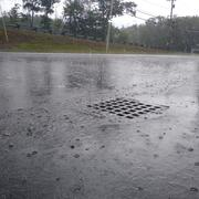
A Statewide Hydraulic Modeling Tool for Stream Crossing Projects in Massachusetts
The U.S. Geological Survey (USGS) and the University of Massachusetts at Amherst (UMass Amherst), in cooperation with the Massachusetts Department of Environmental Protection (MassDEP), began a series of studies in 2019 to develop a GIS-based hydraulic modeling tool and to provide preliminary culvert designs for stream-crossing replacement projects in Massachusetts on USGS StreamStats.
Science and Products
Enhancing Water and Sewer Utility Mapping in Massachusetts
The U.S. Geological Survey (USGS), in cooperation with the Massachusetts Department of Environmental Protection (MassDEP) Water Utility Resilience Program (WURP), is assisting public water and wastewater utilities in transitioning their service infrastructure data to geographic information systems (GIS) and updating related statewide datasets and data visualization tools. Improving access to...
December 2023 Flood in Maine
The U.S. Geological Survey (USGS) New England Water Science Center, in cooperation with the Federal Emergency Management Agency (FEMA), is conducting a study to characterize the magnitude and extent of the December 18-21, 2023 Flood in various portions of the State of Maine.
July 2023 Flood in Vermont
From July 9 through July 12, 2023, 3 to 9 inches of rain fell within 48 hours across the state of Vermont, causing catastrophic flooding and millions of dollars in damage. The high amount of rain caused several rivers to peak at record levels, in some cases exceeding records set during Tropical Storm Irene in 2011.
Water Resources Inventory and Assessment at Katahdin Woods and Waters National Monument
The U.S. Geological Survey (USGS) New England Water Science Center, in cooperation with the National Park Service, is compiling and evaluating all known water resources, and documented infrastructure associated with these resources, within the Katahdin Woods and Waters National Monument and contributing associated watersheds.
A Statewide Hydraulic Modeling Tool for Stream Crossing Projects in Massachusetts
The U.S. Geological Survey (USGS) and the University of Massachusetts at Amherst (UMass Amherst), in cooperation with the Massachusetts Department of Environmental Protection (MassDEP), began a series of studies in 2019 to develop a GIS-based hydraulic modeling tool and to provide preliminary culvert designs for stream-crossing replacement projects in Massachusetts on USGS StreamStats.