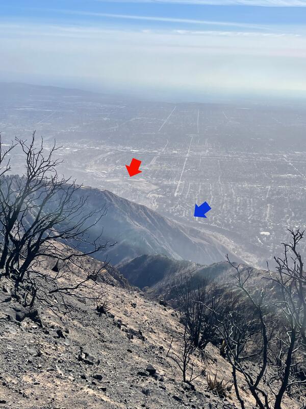
I investigate landslide and debris flow processes, primarily after wildfire.
General Research Statement:
My work leverages high-resolution topography from airborne and ground-based lidar, as well as drone-based structure-from-motion, to characterize the controls on mass movement after wildfire. I also use modeling and field-instrumentation to characterize how wildfire creates the hydrologic and soil conditions that lead to sedimentation hazards. My work is primarily focused in the semi-arid portions of the Western United States, and I have worked on projects in Australia, New Zealand, and Sri Lanka. In addition, I serve as an adjunct professor at the Colorado School of Mines, I advise USGS post-docs, and I am currently serving on Ph.D. thesis committees at several universities.
Education:
- Ph.D., Geology, University of Colorado, Boulder, CO. 2014. The Influence of Transient Perturbations on Landscape Evolution: Exploring Gully Erosion and Post-Wildfire Erosion.
- M. S., Geology, Colorado State University, Fort Collins, CO. 2005. Grain Size Trends of Gravel Bars on the Rio Chagres, Panama
- B. S., Geology, Summa Cum Laude, West Virginia University, Morgantown, WV. 2003. Spatial Analysis of Landforms on Reclaimed Surface Mines of Monongalia County
- B. A., French, Summa Cum Laude, West Virginia University, Morgantown, WV. 2003
Professional Appointments:
2016-present Research Geologist
2014-2016 Mendenhall Postdoctoral Research Fellow
Staley, D.M., Kean, J.W., Rengers, F.K. 2020. The recurrence interval of post-fire debris-flow generating rainfall in the southwestern United States. Geomorphology. https://doi.org/10.1016/j.geomorph.2020.107392
Rengers, F.K., McGuire, L.A., Oakley, N.S., Tang, H., Kean, J.W., and Staley, D.M. 2020. Landslides after Wildfire: initiation, magnitude, and mobility after fire. Landslides. https://doi.org/10.1007/s10346-020-01506-3
Rengers, F.K., Kean, J.W., Reitman, N.G., Smith, J.B., Coe, J.A., McGuire, L.A., 2020. The Influence of Frost Weathering on Debris Flow Sediment Supply in an Alpine Basin. Journal of Geophysical Research: Earth Surface 125, e2019JF005369. https://doi.org/10.1029/2019JF005369
Wall, S., Roering, J., Rengers, F.K., 2020. Runoff-initiated post-fire debris flow Western Cascades, Oregon. Landslides. https://doi.org/10.1007/s10346-020-01376-9
Rapstine, T.D., Rengers, F.K., Allstadt, K.E., Iverson, R.M., Smith, J.B., Obryk, M.K., Logan, M. Olsen, M.J. 2020. Reconstructing the velocity and deformation of a rapid landslide using multiview video. Journal of Geophysical Research: Earth Surface. https://doi.org/10.1029/2019JF005348
Kean, Jason W., Staley, D.M., Lancaster, J.T., Rengers, F.K., Swanson, B.J., Coe, J.A., Hernandez, J.L., Sigman, A.J., Allst
Science and Products
Columbia River Gorge Landslides
Northern and Central California Debris Flows - January 2021
Cameron Peak, Colorado, Fire: Flooding and Debris Flows - July 20, 2021
Glenwood Canyon, Colorado, Flooding and Debris Flows: 2021
Bond Fire Debris Flows, California: January 25 and 28, 2021
Tadpole Fire Debris Flows, New Mexico: July and September 2020
Woodbury Fire, Arizona Debris Flows - September 2019
Calwood Fire "Heil Ranch" Landslide Monitoring Site near Boulder, CO
Advancing Post-Fire Debris Flow Hazard Science with a Field Deployable Mapping Tool
How Often Do Rainstorms Cause Debris Flows in Burned Areas of the Southwestern U.S.?
Exploiting high-resolution topography for advancing the understanding of mass and energy transfer across landscapes: Opportunities, challenges, and needs
Reclassified lidar point cloud data from 2016 LARIAC and 2019 NCALM collections covering part of the Woolsey wildfire near Malibu, California
Post-wildfire debris-flow monitoring data, 2019 Woodbury Fire, Superstition Mountains, Arizona, USA November 2019 to February 2020
Data supporting an analysis of the recurrence interval of post-fire debris-flow generating rainfall in the southwestern United States
Inventory of landslides triggered by rainfall on 16-17 January 2019, Los Angeles County, CA
Lidar data for gate release experiment at the USGS Debris-Flow Flume 24 and 25 May 2017
Lidar data for natural release experiment at the USGS Debris Flow Flume 17 May 2017
Chalk Cliffs Channel Surveys derived from Structure-from-Motion
Post-wildfire debris-flow monitoring data, Las Lomas, 2016 Fish Fire, Los Angeles County, California, November 2016 to February 2017
Debris-flow inundation and damage data from the 9 January 2018 Montecito Debris-Flow Event
Las Lomas Hillside Lidar
A review of common natural disasters as analogs for asteroid impact effects and cascading hazards
Simulating debris flow and levee formation in the 2D shallow flow model D-Claw: Channelized and unconfined flow
A progressive flow-routing model for rapid assessment of debris-flow inundation
Multi-model comparison of computed debris flow runout for the 9 January 2018 Montecito, California post-wildfire event
Hydrogeomorphic recovery and temporal changes in rainfall thresholds for debris flows following wildfire
Movement of sediment through a burned landscape: Sediment volume observations and model comparisons in the San Gabriel Mountains, California, USA
The timing and magnitude of changes to Hortonian overland flow at the watershed scale during the post-fire recovery process
Postwildfire soil‐hydraulic recovery and the persistence of debris flow hazards
Extreme precipitation across adjacent burned and unburned watersheds reveals impacts of low severity wildfire on debris-flow processes
Time since burning and rainfall characteristics impact post-fire debris flow initiation and magnitude
Using high sample rate lidar to measure debris-flow velocity and surface geometry
Modeling hydrologic processes associated with soil saturation and debris flow initiation during the September 2013 storm, Colorado Front Range
Non-USGS Publications**
**Disclaimer: The views expressed in Non-USGS publications are those of the author and do not represent the views of the USGS, Department of the Interior, or the U.S. Government.
Science and Products
- Science
Columbia River Gorge Landslides
Extreme rainfall during two atmospheric river events in January 2021 and January 2022 triggered a series of debris flows in the Columbia River Gorge, Oregon. The flows had significant impacts, including multiple highway closures and one fatality. This story map highlights rainfall data and observations of debris flow deposits by the Oregon Department of Geology and Mineral Industries (DOGAMI)...Northern and Central California Debris Flows - January 2021
An atmospheric river (AR) moved into California late on the evening of January 26, 2021, bringing intermittent heavy rainfall that resulted in flooding, debris flows, and heavy snowfall at high elevations.Cameron Peak, Colorado, Fire: Flooding and Debris Flows - July 20, 2021
On Thursday, August 13, 2020, at approximately 1:45 PM MDT, the Cameron Peak fire was reported in steep, rugged terrain 15 miles southwest of Red Feather Lakes, Colorado, near Cameron Pass. The fire spread rapidly due to extreme temperatures, strong winds, and high fuel loads. The largest wildfire in Colorado history, the Cameron Peak fire burned 845 square kilometers (sq km) on the Arapaho and...Glenwood Canyon, Colorado, Flooding and Debris Flows: 2021
Summer storms on the Grizzly Creek burn area have resulted in repeated flooding and debris flows that are having enormous impacts in Glenwood Canyon. This Story Map collection summarizes the June and July events.Bond Fire Debris Flows, California: January 25 and 28, 2021
On Wednesday, December 2, 2020 at approximately 10:15 PM PST, the Bond wildfire ignited in Orange County, California, burning partially within the Cleveland Forest, near Silverado Canyon just north of the area burned by the October 2020 Silverado fire. The fire burned 27 square kilometers (sq km) prior to containment on December 10, 2020 (CalFire). Fuels were primarily chaparral, brush, and tall...Tadpole Fire Debris Flows, New Mexico: July and September 2020
On Saturday, June 6, 2020 at approximately 1:45 PM MDT, the Tadpole wildfire ignited in the Gila National Forest, approximately 19 kilometers (km) north of Silver City, Grant County, New Mexico. The fire burned 45 square kilometers prior to containment in early July, 2020 (Inciweb). Fuels were primarily timber with grass understory, brush, and chaparral. The Brush, Bringham, and Bighorn fires in...Woodbury Fire, Arizona Debris Flows - September 2019
On Saturday, June 8, 2019 at approximately 1:30 PM MST, the Woodbury wildfire ignited approximately 8 kilometers (km) northwest of Superior, Arizona. The 7th largest wildfire in Arizona’s recorded history, the fire burned 501 km2 prior to containment on July 15, 2019. The fire occurred within the Superstition Wilderness of the Tonto National Forest. The wilderness area extends from the...Calwood Fire "Heil Ranch" Landslide Monitoring Site near Boulder, CO
Wildfire can radically change a mountainous landscape such that even a modest rainstorm is capable of producing deadly and destructive flash flooding and debris flows.Advancing Post-Fire Debris Flow Hazard Science with a Field Deployable Mapping Tool
Mapping the occurrence of post-fire flooding and debris flow is crucial for 1) integrating observations into models used to define rainfall thresholds for early warning, 2) understanding patterns of inundation, and 3) improving models for predictive hazard assessment. Despite the critical role mapping plays in post-fire hazard assessment and early warning, there has not been a standardized approaHow Often Do Rainstorms Cause Debris Flows in Burned Areas of the Southwestern U.S.?
Debris flows, sometimes referred to as mudslides, mudflows, lahars, or debris avalanches, are common types of fast-moving landslides. They usually start on steep hillsides as a result of shallow landslides, or from runoff and erosion that liquefy and accelerate to speeds in excess of 35 mi/h. The consistency of debris flows ranges from thin, watery to thick, rocky mud that can carry large items...Exploiting high-resolution topography for advancing the understanding of mass and energy transfer across landscapes: Opportunities, challenges, and needs
One of the grand challenges of Earth Surface Science and Natural Resource Management lies in the prediction of mass and energy transfer for large watersheds and landscapes. High resolution topography (lidar) datasets show potential to significantly advance our understanding of hydrologic and geomorphic processes controlling mass and energy transfer because they represent features at the appropriat - Data
Reclassified lidar point cloud data from 2016 LARIAC and 2019 NCALM collections covering part of the Woolsey wildfire near Malibu, California
These lidar data are derived from two airborne lidar surveys: a 2016 Los Angeles Region Imagery Acquisition Consortium (LARIAC) survey, and a 2019 National Center for Airborne Laser Mapping (NCALM) survey. These data were reclassified in order to improve the classification of ground points, and to make the classification of both datasets as consistent as possible. The NCALM data had their positionPost-wildfire debris-flow monitoring data, 2019 Woodbury Fire, Superstition Mountains, Arizona, USA November 2019 to February 2020
This data release contains data summarizing observations within and adjacent to the Woodbury Fire, which burned from 8 June to 15 July 2019. In particular, this monitoring data was focused on debris flows in burned and unburned areas. Rainfall data (1_Woodbury_Rainfall.zip) are contained in comma-separated value (CSV) files named ?Wdby_Rainfall? appended with the names of 3 rain gages: B2, B6,Data supporting an analysis of the recurrence interval of post-fire debris-flow generating rainfall in the southwestern United States
This data release supports the analysis of the recurrence interval of post-fire debris-flow generating rainfall in the southwestern United States. We define the recurrence interval of the peak 15-, 30-, and 60-minute rainfall intensities for 316 observations of post-fire debris-flow occurrence in 18 burn areas, 5 U.S. states, and 7 climate types. These data support the analysis described in StaleyInventory of landslides triggered by rainfall on 16-17 January 2019, Los Angeles County, CA
This dataset contains 286 landslide polygons mapped after a rainstorm on 16-17 January 2019. The majority of the landslides are located in the burn areas of the 2016 San Gabriel Complex fire, the 2014 Colby fire, and the 2009 Morris fire. A smaller number of additional landslides were located in nearby unburned areas. More information about the burn perimeters associated with this inventory and tLidar data for gate release experiment at the USGS Debris-Flow Flume 24 and 25 May 2017
Lidar data was collected on 24 and 25 May 2017 at the USGS debris-flow flume to monitor two gate-release debris flow experiments. A static prism of sediment was emplaced behind a gate at the top of the flume. Water was added via sprinklers to the surface and also via pipes to the subsurface, in order to saturate the sediment mass. The sediment mass moved down the flume as a debris flow when the gaLidar data for natural release experiment at the USGS Debris Flow Flume 17 May 2017
Lidar data were collected on 17 May 2017 at the USGS debris-flow flume (44.215, -122.254) to monitor the movement of a constructed landslide experiment. A static prism of sediment was emplaced behind a retaining wall at the top of the flume. Water was added via sprinklers to the surface and also via pipes to the subsurface, in order to saturate the sediment mass. The sediment mass eventually faChalk Cliffs Channel Surveys derived from Structure-from-Motion
This data release contains two point clouds derived from structure-from-motion photogrammetry. The first survey was conducted on 10 September 2015 and the second survey was conducted on 1 June 2016. Each survey was designed to capture a 35-meter channel reach using digital photos (1187 photos were taken in the first survey and 1085 photos were taken in the second survey). Twenty-five bolts were drPost-wildfire debris-flow monitoring data, Las Lomas, 2016 Fish Fire, Los Angeles County, California, November 2016 to February 2017
This data release includes time-series data from a monitoring site located in a small (0.12 km2) drainage basin in the Las Lomas watershed in Los Angeles County, CA, USA. The site was established after the 2016 Fish Fire and recorded a series debris flows in the first winter after the fire. The station is located along the channel at the outlet of the study area (34 9'18.50"N, 117 56'Debris-flow inundation and damage data from the 9 January 2018 Montecito Debris-Flow Event
On 9 January 2018, intense rain above Montecito, California triggered a series of debris flows from steep catchments in the Santa Ynez Mountains. These catchments were burned three weeks earlier by the 1140 km2 Thomas Fire. After exiting the mountain front, the debris flows traveled over 3 km down a series of alluvial fans, killing 23 people and damaging over 400 homes. To understand the flow dynaLas Lomas Hillside Lidar
This data release contains point clouds obtained from three terrestrial laser scanner (TLS) surveys of a hillslope burned by the 2016 Fish Fire in the San Gabriel Mountains, CA, USA. The TLS surveys were completed with a Leica ScanStation C10. All point data are in local coordinates and the units are in meters. The first survey was made on 19 November 2016 prior to the first post-wildfire rainstor - Multimedia
- Publications
Filter Total Items: 46
A review of common natural disasters as analogs for asteroid impact effects and cascading hazards
Modern civilization has no collective experience with possible wide-ranging effects from a medium-sized asteroid impactor. Currently, modeling efforts that predict initial effects from a meteor impact or airburst provide needed information for initial preparation and evacuation plans, but longer-term cascading hazards are not typically considered. However, more common natural disasters, such as voSimulating debris flow and levee formation in the 2D shallow flow model D-Claw: Channelized and unconfined flow
Debris flow runout poses a hazard to life and infrastructure. The expansion of human population into mountainous areas and onto alluvial fans increases the need to predict and mitigate debris flow runout hazards. Debris flows on unconfined alluvial fans can exhibit spontaneous self-channelization through levee formation that reduces lateral spreading and extends runout distances compared to unchanA progressive flow-routing model for rapid assessment of debris-flow inundation
Debris flows pose a significant hazard to communities in mountainous areas, and there is a continued need for methods to delineate hazard zones associated with debris-flow inundation. In certain situations, such as scenarios following wildfire, where there could be an abrupt increase in the likelihood and size of debris flows that necessitates a rapid hazard assessment, the computational demands oMulti-model comparison of computed debris flow runout for the 9 January 2018 Montecito, California post-wildfire event
Hazard assessment for post-wildfire debris flows, which are common in the steep terrain of the western United States, has focused on the susceptibility of upstream basins to generate debris flows. However, reducing public exposure to this hazard also requires an assessment of hazards in downstream areas that might be inundated during debris flow runout. Debris flow runout models are widely availabHydrogeomorphic recovery and temporal changes in rainfall thresholds for debris flows following wildfire
Wildfire-induced changes to soil and vegetation promote runoff-generated debris flows in steep watersheds. Postfire debris flows are most commonly observed in steep watersheds during the first wet season following a wildfire, but it is unclear how long the elevated threat of debris flow persists and why debris-flow potential changes in recovering burned areas. This work quantifies how rainfall intMovement of sediment through a burned landscape: Sediment volume observations and model comparisons in the San Gabriel Mountains, California, USA
Post-wildfire changes to hydrologic and geomorphic systems can lead to widespread sediment redistribution. Understanding how sediment moves through a watershed is crucial for assessing hazards, developing debris flow inundation models, engineering sediment retention solutions, and quantifying the role that disturbances play in landscape evolution. In this study, we used terrestrial and airborne liThe timing and magnitude of changes to Hortonian overland flow at the watershed scale during the post-fire recovery process
Extreme hydrologic responses following wildfires can lead to floods and debris flows with costly economic and societal impacts. Process-based hydrologic and geomorphic models used to predict the downstream impacts of wildfire must account for temporal changes in hydrologic parameters related to the generation and subsequent routing of infiltration-excess overland flow across the landscape. HoweverPostwildfire soil‐hydraulic recovery and the persistence of debris flow hazards
Deadly and destructive debris flows often follow wildfire, but understanding of changes in the hazard potential with time since fire is poor. We develop a simulation‐based framework to quantify changes in the hydrologic triggering conditions for debris flows as postwildfire infiltration properties evolve through time. Our approach produces time‐varying rainfall intensity‐duration thresholds for ruExtreme precipitation across adjacent burned and unburned watersheds reveals impacts of low severity wildfire on debris-flow processes
In steep landscapes, wildfire-induced changes to soil and vegetation can lead to extreme and hazardous geomorphic responses, including debris flows. The wildfire-induced mechanisms that lead to heightened geomorphic responses, however, depend on many site-specific factors including regional climate, vegetation, soil texture, and soil burn severity. As climate and land use change drive changes in fTime since burning and rainfall characteristics impact post-fire debris flow initiation and magnitude
The extreme heat from wildfire alters soil properties and incinerates vegetation, leading to changes in infiltration capacity, ground cover, soil erodibility, and rainfall interception. These changes promote elevated rates of runoff and sediment transport that increase the likelihood of runoff-generated debris flows. Debris flows are most common in the year immediately following wildfire, but tempUsing high sample rate lidar to measure debris-flow velocity and surface geometry
Debris flows evolve in both time and space in complex ways, commonly starting as coherent failures but then quickly developing structures such as roll waves and surges. These processes are readily observed but difficult to study or quantify because of the speed at which they evolve. Many methods for studying debris flows consist of point measurements (e.g., flow height or basal stresses), which arModeling hydrologic processes associated with soil saturation and debris flow initiation during the September 2013 storm, Colorado Front Range
Seven days of extreme rainfall during September 2013 produced more than 1100 debris flows in the Colorado Front Range, about 78% of which occurred on south-facing slopes (SFS). Previously published soil moisture (volumetric water content) observations suggest that SFS were wetter than north-facing slopes (NFS) during the event, which contrasts with soil moisture patterns observed during normal conNon-USGS Publications**
Rengers, F., Lunacek, M., and Tucker, G. 2016. Application of an Evolutionary Algorithm for Parameter Optimization in a Gully Erosion Model, Environmental Modelling & Software. 80, 297-305. doi:10.1016/j.envsoft.2016.02.033Rengers, F. and Tucker G. 2015. The evolution of gully headcut morphology: a case study using terrestrial laser scanning and hydrological monitoring. Earth Surface Processes and Landforms. doi: 10.1002/esp.3721Ebel, B., Rengers, F., Tucker, G. 2015. Aspect-dependent soil saturation and insight into debris-flow initiation during extreme rainfall in the Colorado Front Range. Geology. 43, 8, p. 659-652. doi: 10.1130/G36741.1Rengers, F. and Tucker, G. 2014. Analysis and modeling of gully headcut dynamics, North American high plains. Journal of Geophysical Research: Earth Surface. 119, doi:10.1002/2013JF002962.Rengers, F. and Tucker, G. 2013. Processes and rates of headcut migration in eastern Colorado gullies: West Bijou Creek field trip guide. Geological Society of America Field Guide 33.Rengers, F. and Wohl, E. 2006. Trends of grain sizes on gravel bars in the Rio Chagres, Panama. Geomorphology. 83, 3-4, p. 282-293.**Disclaimer: The views expressed in Non-USGS publications are those of the author and do not represent the views of the USGS, Department of the Interior, or the U.S. Government.
- News