
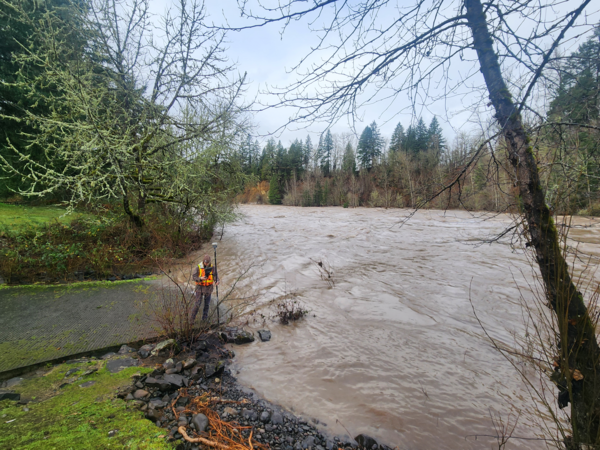
USGS scientist, wearing a personal protection device, or PFD, surveys water levels and debris line on the Clackamas River, Milo McIver park boat ramp. These measurements are used to validate a 2D hydraulic model of the Clackamas River.
Karen Bartelt
Karen Bartelt is a hydrologist at the USGS Oregon Water Science Center.
Karen Bartelt is a Hydrologist with the Geomorphology Team at the Oregon Water Science Center in Portland, OR. Karen joined the USGS in February, 2022. Her work with USGS has mostly focused on hydraulic and habitat modeling in the Willamette River Basin. Karen's skills and experience include geospatial analysis, conducting field studies, and data analysis/visualization.
Science and Products
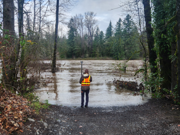
Clackamas River high-flow survey
USGS scientist, wearing a personal protection device, or PFD, surveys water levels and debris line on the Clackamas River, Milo McIver park boat ramp. These measurements are used to validate a 2D hydraulic model of the Clackamas River.
Clackamas River high-flow survey
USGS scientist, wearing a personal protection device, or PFD, surveys water levels and debris line on the Clackamas River, Milo McIver park boat ramp. These measurements are used to validate a 2D hydraulic model of the Clackamas River.
USGS scientist, wearing a personal protection device, or PFD, surveys water levels and debris line on the Clackamas River, Milo McIver park boat ramp. These measurements are used to validate a 2D hydraulic model of the Clackamas River.

Collecting velocity data on the North-Santiam
Researcher using an advanced acoustic instrument to collect river velocity data. The river velocity data is used to calibrate and validate hydraulic models.
Researcher using an advanced acoustic instrument to collect river velocity data. The river velocity data is used to calibrate and validate hydraulic models.
Science and Products
Clackamas River high-flow survey
USGS scientist, wearing a personal protection device, or PFD, surveys water levels and debris line on the Clackamas River, Milo McIver park boat ramp. These measurements are used to validate a 2D hydraulic model of the Clackamas River.
USGS scientist, wearing a personal protection device, or PFD, surveys water levels and debris line on the Clackamas River, Milo McIver park boat ramp. These measurements are used to validate a 2D hydraulic model of the Clackamas River.
Collecting velocity data on the North-Santiam
Researcher using an advanced acoustic instrument to collect river velocity data. The river velocity data is used to calibrate and validate hydraulic models.
Researcher using an advanced acoustic instrument to collect river velocity data. The river velocity data is used to calibrate and validate hydraulic models.