Benefits of Using the SPN
SPN services help you publish high-quality products, such as scientific investigations reports, scientific investigations maps, fact sheets, and other USGS series numbered reports. Besides numbered reports, the SPN can help with innovative products like posters, journal articles, interactive maps and graphics, geonarratives, and more.
Types of Services
→ Content presentation planning
→ Technical editing
→ Illustration and graphic design
→ Geographic information system (GIS) maps
→ Cartography
→ Assessing resolution of, creating collages, and retouching and color balancing photographs
→ Section-508 accessibility
→ Video editing and consulting
→ Printing
Types of Products
→ Infographics
→ Animations
→ 3-dimensional figures
→ Product and exhibit banners
→ Postcards
→ Web pages
→ USGS series reports and products
→ 2-dimensional cross sections to block diagrams
→ 3-dimensional maps
→ Banners and exhibit displays
→ Graphical abstracts
How can the SPN help you?
The SPN provides services to improve visuals, text, and communications that resonate with your audience helping you transform your study into the most effective information products for the intended audience and the public. From start to finish, the SPN, offers a unique, reader-focused approach that helps to clearly communicate your study’s findings in the best possible publication formats. And of course, we align your product with USGS publishing standards and policies.
Publications Warehouse
USGS formal numbered series reports are made available to the public through the Publications Warehouse, which delivers access to more than 160,000 publications written by USGS scientists.
The Publications Warehouse provides a public-facing web page for reports. This citation page provides a brief abstract about the report, a link to the report, and links to any additional parts of the report such as data releases, interactive maps, and HTML format.
Editing
- Edit information products planned for publication or release to ensure clarity of expression, effectiveness of presentation, and appropriateness for the intended audience
- Assist authors with preparation of draft documents (USGS series and external information products, outreach material, and more)
- Assist authors with writing, rewriting, and formatting of documents
- Help authors develop derivative information products from other publications, such as a Fact Sheet from journal-article content
- Identify and help resolve possible conflicts or other issues related to USGS policy
Graphics and Design
- Create web- or print-ready illustrations, maps, and charts by using visual design presentation skills in accord with USGS publication standards
- Clearly and accurately portray technical information while ensuring the information and message are understandable for intended audience
- Advise and consult on appropriateness, effectiveness, and technical feasibility of illustrations, maps, charts, and photographs
- Enhance and restore photographs, improving quality of color, tone, and detail
- Create layout and design for a variety of publication products and provide guidance on overall layout presentation and style appropriate to the product and the intended audience
- Apply art and design principles to enhance a wide range of information products
Web and Video
- Design, develop, and program web sites, pages, and HTML documents that conform with Section 508 of the Rehabilitation Act following USGS standards, style, and Visual Identity System guidelines
- Provide content management, updates, and archiving for web sites and pages
- Provide artistic enhancements to existing web sites and pages
- Create dynamic web sites with interactive features
- Enhance information products by embedding or adding links to video, sound, and animation
- Provide transcripts and synchronized closed-captioning for video
- Ensure compliance with Section 508 of the Rehabilitation Act, which assures that people with disabilities have equal access to Government information
The SPN can also ...
- Produce base materials, thematic maps, plates, and posters
- Develop and design templates for a suite of information products
- Provide interactive features to files and discs
- Collaborate on multimedia options
- Coordinate GPO printing/reproduction of information products
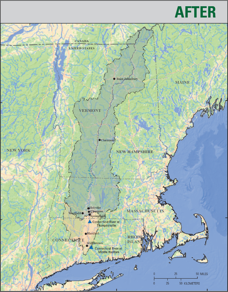
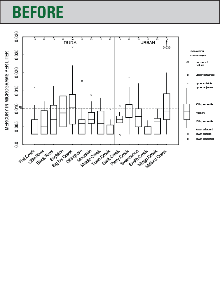
Before/After Examples
The left image shows the original product before improvements applied by the SPN.