
Medicine Lake, California simplified hazards map showing potential impact area for ground-based hazards during a volcanic event.
Images
Images related to Medicine Lake.

Medicine Lake, CA simplified hazards map
Medicine Lake, California simplified hazards map showing potential impact area for ground-based hazards during a volcanic event.
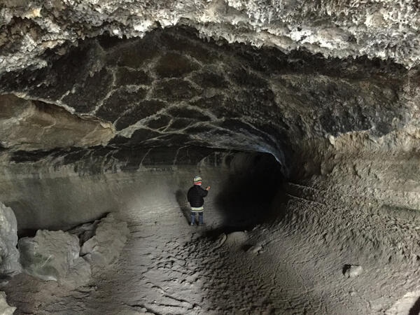
Valentine Cave lava tube at Medicine Lake volcano
View from entrance of Valentine Cave toward interior shows the raised lines of high-lava marks on wall on wall of central pillar. USGS photo by J. Donnelly-Nolan.
View from entrance of Valentine Cave toward interior shows the raised lines of high-lava marks on wall on wall of central pillar. USGS photo by J. Donnelly-Nolan.

Map showing one-year probability of accumulation of 1 centimeter
Map showing one-year probability of accumulation of 1 centimeterMap showing one-year probability of accumulation of 1 centimeter (0.4 inch) or more of tephra from eruptions of volcanoes in the Cascade Range.
By
Natural Hazards Mission Area, Volcano Hazards Program, California Volcano Observatory, Cascades Volcano Observatory, Crater Lake, Glacier Peak, Lassen Volcanic Center, Medicine Lake, Mount Adams, Mount Baker, Mount Hood, Mount Jefferson, Mount Rainier, Mount Shasta, Mount St. Helens, Newberry, Three Sisters

Tephra provides clues to eruptive history of Medicine Lake Volcano, CA
Tephra provides clues to eruptive history of Medicine Lake Volcano, CAGeologists examine tephra deposits to better understand the early eruptive behavior of the Medicine Lake Volcano, evidence of which can be found as far away as central Oregon.

A tumulus at Captain Jack's stronghold within Lava Beds National Mo...
A tumulus at Captain Jack's stronghold within Lava Beds National Mo...A tumulus at Captain Jack's stronghold within Lava Beds National Monument .
A tumulus at Captain Jack's stronghold within Lava Beds National Mo...
A tumulus at Captain Jack's stronghold within Lava Beds National Mo...A tumulus at Captain Jack's stronghold within Lava Beds National Monument .

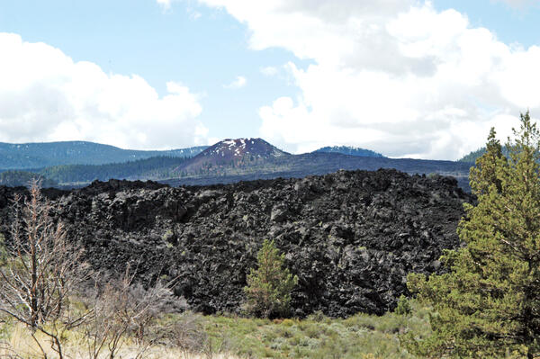
A lava tube trace (dark sinuous shape) along the ground surface.
A lava tube trace (dark sinuous shape) along the ground surface.Aerial view of a lava tube trace (dark sinuous shape) along the ground surface at Medicine Lake Volcano, California.
A lava tube trace (dark sinuous shape) along the ground surface.
A lava tube trace (dark sinuous shape) along the ground surface.Aerial view of a lava tube trace (dark sinuous shape) along the ground surface at Medicine Lake Volcano, California.

Aerial view west across the upper part of Medicine Lake Volcano tow...
Aerial view west across the upper part of Medicine Lake Volcano tow...Medicine Lake lies within the shallow basin of Medicine Lake caldera. Glass Mountain flow, draped over the east side of the volcano, is the youngest lava flow at the volcano. The northeasternmost dacite tongue extends nearly to the bottom of the photo (distal lobes are outlined to enhance visibility).

Eruptions in the Cascade Range during the past 4000 years. USGS GIP 64
Eruptions in the Cascade Range during the past 4000 years. USGS GIP 64Eruptions in the Cascade Range during the past 4000 years. USGS GIP 64
Eruptions in the Cascade Range during the past 4000 years. USGS GIP 64
Eruptions in the Cascade Range during the past 4000 years. USGS GIP 64Eruptions in the Cascade Range during the past 4000 years. USGS GIP 64

Glass Mountain obsidian flow at Medicine Lake volcano, CA.
Glass Mountain obsidian flow at Medicine Lake volcano, CA.Glass Mountain obsidian flow at Medicine Lake volcano, California. Glass Mountain is a spectacular, nearly treeless, steep-sided rhyolite and dacite obsidian flow that erupted just outside the eastern caldera rim and flowed down the steep eastern flank of Medicine Lake volcano.
Callahan Lava Flow, Medicine Lake Volcano
Photograph looking south across the rugged andesitic northern end of the compositionally zoned Callahan Flow toward the main vent at Cinder Butte (partly covered by snow.) USGS photograph by Tanya Blacic
Photograph looking south across the rugged andesitic northern end of the compositionally zoned Callahan Flow toward the main vent at Cinder Butte (partly covered by snow.) USGS photograph by Tanya Blacic
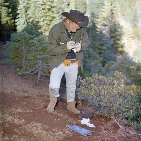
NASA engineer Donald A. Beattie takes notes during a field visit to Medicine Lake Volcano in September 1965
NASA engineer Donald A. Beattie takes notes during a field visit to Medicine Lake Volcano in September 1965View of Donald A. Beattie (manager of NASA's lunar surface experiments) during a geological field trip to the Medicine Lake Volcano, California in September 1965. Beattie was joined by astronauts William Anders (Apollo 8), Alan Bean (Apollo 12), and Rusty Schweikert (Apollo 9). Photo by NASA.