U.S. flag

An official website of the United States government

Multimedia

Images

Map of earthquakes located at Newberry volcano during geothermal work in 2012 and 2014 compared to all seismicity
Map of earthquakes located at Newberry volcano from 2012 to 2024

Map of Newberry volcano shows location where earthquakes occurred during geothermal work in 2012 and 2014 (orange circles) and volcanic earthquakes that have occurred since 2011 (blue circles).

Map of Newberry volcano shows location where earthquakes occurred during geothermal work in 2012 and 2014 (orange circles) and volcanic earthquakes that have occurred since 2011 (blue circles).

Color photograph of visitors on overlook
View from Paulina Peak on south rim of Newberry caldera

Unvegetated Big Obsidian Flow about 500 m (1640 ft) below people. Central Pumice Cone separates East Lake (distant) and Paulina Lake.

Unvegetated Big Obsidian Flow about 500 m (1640 ft) below people. Central Pumice Cone separates East Lake (distant) and Paulina Lake.

Brown hut in forest houses volcano monitoring equipment
Volcano monitoring station KWBU at Newberry volcano

The USGS Cascades Volcano Observatory installed an 8-station seismic monitoring network at Newberry volcano in 2011, which includes station KWBU.

The USGS Cascades Volcano Observatory installed an 8-station seismic monitoring network at Newberry volcano in 2011, which includes station KWBU.

Monitoring for volcanic gases at Newberry Volcano
A MultiGAS instrument measures gases at Newberry Volcano

Scientists use a MultiGAS instrument (gray, hard-shell case) to measure gas compositions from the East Lake hot spring in the Newberry caldera. The photo was taken on August 3, 2020 just after sunrise. The vapor above the hot spring and lake is typical for cool mornings and is not visible later in the day.

Scientists use a MultiGAS instrument (gray, hard-shell case) to measure gas compositions from the East Lake hot spring in the Newberry caldera. The photo was taken on August 3, 2020 just after sunrise. The vapor above the hot spring and lake is typical for cool mornings and is not visible later in the day.

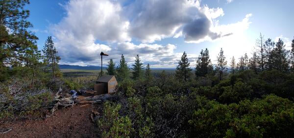
View of a sturdy brown hut and radio mast for volcano monitoring station ASBU at Newberry volcano.
View of volcano monitoring station ASBU at Newberry volcano

The USGS Cascades Volcano Observatory installed monitoring station ASBU near Newberry volcano in central Oregon in 2011.

The USGS Cascades Volcano Observatory installed monitoring station ASBU near Newberry volcano in central Oregon in 2011.

Digital Elevation Model for Newberry Volcano and vicinity....
Digital Elevation Model for Newberry Volcano and vicinity.

High-resolution digital elevation dataset for Newberry Volcano and vicinity, Oregon, based on lidar survey of August-September, 2010 and bathymetric survey of June, 2001.

High-resolution digital elevation dataset for Newberry Volcano and vicinity, Oregon, based on lidar survey of August-September, 2010 and bathymetric survey of June, 2001.

Was this page helpful?