Woods Hole Coastal and Marine Science Center Newsletter: December 2025-January 2026
Our Science Stories
-
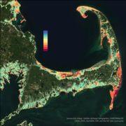
Coastal Change Likelihood Assessment—Predicting Coastal Landscape Change with Accuracy Coastal Change Likelihood Assessment—Predicting Coastal Landscape Change with Accuracy
In a recently published study, USGS scientists assess the accuracy of the Coastal Change Likelihood assessment. Results demonstrate the assessment provides accurate estimates of coastal landscape change in the next decade, consistent with recent observed change.
-
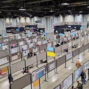
AGU25: Where Science Connects Us AGU25: Where Science Connects Us
AGU25 is the world’s largest annual Earth science meeting, bringing together more than 25,000 attendees from over 100 countries to share innovative research and foster global collaboration. If you’re at the meeting this year, attend presentations representing USGS research to learn more about our work and how we benefit the Nation.
-
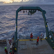
Sound Waves Newsletter: December 2025-January 2026 Sound Waves Newsletter: December 2025-January 2026
This Sound Waves issue includes stories about the accuracy of the Coastal Change Likelihood Assessment, new insights into Cascadia’s earthquake recurrence, comparing nearly 40 years of satellite-derived shoreline positions with traditional shoreline measurements, plankton migration, and so much more!
Publications and Data Releases
Data Releases
De Meo, O.A., Suttles, S.E., Marsjanik, E.D., Bales, R.D., and Sherwood, C.R., 2026, Time-series measurements of oceanographic data collected in the nearshore zone offshore of Marconi Beach, Wellfleet, MA, December 9, 2024 to March 10, 2025: U.S. Geological Survey data release, https://doi.org/10.5066/P13KF7UW.
Ackerman, K.V., Andrews, B.D., Ganju, N.K., and Defne, Z., 2025, Geospatial data in support of structured decision making for northeast coastal parks: U.S. Geological Survey data release, https://doi.org/10.5066/P13E2NM2.
Upcoming Opportunities
Webinar About Marshes for Maine's Future
The National Estuarine Research Reserve (NERR) Science Collaborative is hosting a webinar on March 3 from 3-4pm ET about the Marshes for Maine's Future project. The Wells NERR collaborated with about a dozen marsh managers and restoration practitioners across Maine and with Neil Ganju and Kate Ackerman of USGS to adapt and apply USGS geospatial tools to salt marsh projects in Maine.
Registration on Zoom is required and is available at the following link: https://nerrssciencecollaborative.org/event/marshes-maines-future. A recording of the webinar will be archived on the Science Collaborative website after the live webinar.
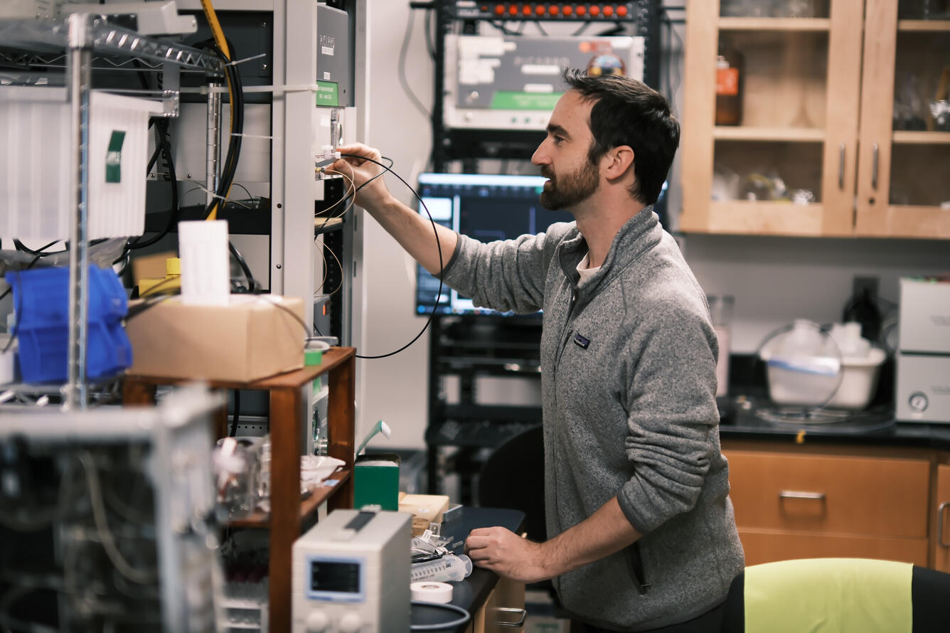
Laboratory Highlight
Tracking Invisible Gases From Around the World
Which gas is it? How did it form? How did it end up where we find it? For the past decade, the USGS Gas Hydrate Biogeochemistry team in Woods Hole, MA has been answering these questions by developing advanced instruments that measure gas composition and carbon isotope ratios from field sites around the world.
The group has revealed information on the origins of natural gas at a well pad in Prudhoe Bay, Alaska; tracked methane and carbon dioxide in Cape Cod salt marshes; and uncovered how gases form and change beneath natural gas seeps on the seafloor.
Understanding these gas properties helps scientists and practitioners protect the environment, safeguard infrastructure, and better manage important resources.
Lee-Gray Boze measuring the performance of their newly upgraded gas analyzer, designed and installed by the team.