
Sound Waves Newsletter: December 2025-January 2026
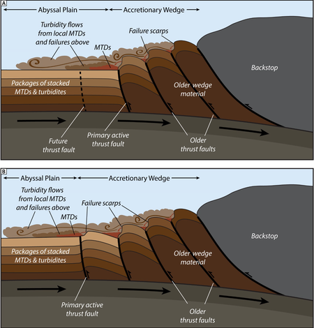
Widespread Abyssal Landslides Offer New Insights into Cascadia’s Earthquake Recurrence
Far below the ocean surface off the Pacific Northwest coast, earthquake-triggered landslides record the powerful stirrings of the Cascadia Subduction Zone.
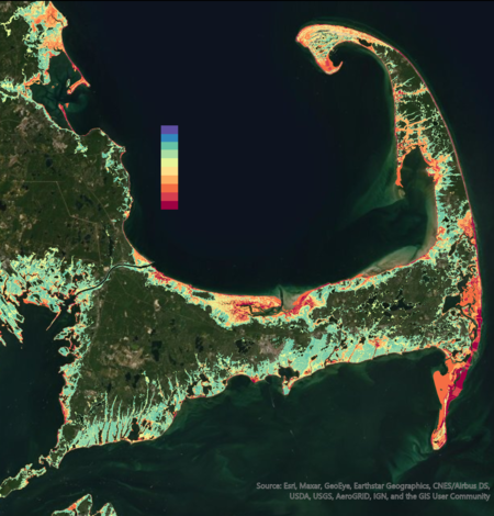
Coastal Change Likelihood Assessment—Predicting Coastal Landscape Change with Accuracy
In a recently published study, USGS scientists assess the accuracy of the Coastal Change Likelihood assessment. Results demonstrate the assessment provides accurate estimates of coastal landscape change in the next decade, consistent with recent observed change.
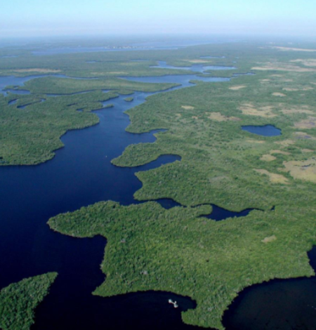
High-resolution estimates of water levels in the Everglades, Florida: Software release
SPCMSC physical scientist Bryan McCloskey and CFWSC hydrologist Saira Haider developed an update to the Everglades Depth Estimation Network (EDEN) interpolation algorithm by introducing a high-resolution option.
Expedition Recap - Hawai'i Abyssal Nodules and Associated Ecosystems
Supporting coastal adaptation planning across California – flood hazard maps now available state-wide
Coastal communities across California face increasing threats from flooding with changes in storm patterns and sea-level. Now all coastal areas across the state have future flood hazard projections from the USGS Coastal Storm Modeling System (CoSMoS) to inform coastal planning and risk reduction.
Comparing Nearly 40 years of Satellite-derived Shorelines with Traditional Shoreline Measurements
A new USGS study compares nearly 40 years of satellite-derived shorelines with traditional shoreline measurements, finding that despite greater uncertainty in any single satellite snapshot, long-term shoreline trends detected from space closely match those captured by more labor-intensive field surveys.
Coastal Observing Cameras at America’s Northernmost Point Decommissioned Due to Coastal Erosion
Point Barrow, Alaska, or Nuvuk, is the northernmost point in the United States. Since 2021, USGS has maintained two video cameras here to study sediment movement and wave dynamics along this dynamic coastline. Rapid erosion destabilized the cameras in Fall 2025, and they were taken down.
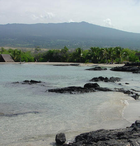
Submarine groundwater discharge cools heat-stressed reefs in Hawai'i
A new publication describes the wide-ranging potential for groundwater flow into the coast to reduce heat stress and bleaching of corals that are experiencing increasing mortality around the world as ocean temperatures warm.
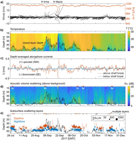
Oceanographic Instrumentation Detects Layers of Plankton Migration off Puerto Rico
Beneath the surface of the ocean, vast layers of planktonic life are constantly on the move—rising, sinking, spreading, and regrouping in response to light, predators, currents, and storms. This epic choreography is sometimes called the largest mass migration on earth, and it happens every day, out of our view.
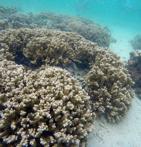
Impact of warming and suspended land-based sediment on Hawaiian reef corals
A new study from Texas A&M University, Hawaiʻi Institute of Marine Biology, and USGS offers fresh insight into how Hawai‘i’s corals are coping with the double threat of turbid water and rising ocean temperatures—stressors that are threatening reef health, especially along densely populated coasts.
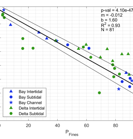
A Model to Predict Sediment Bulk Density for the San Francisco Estuary
Sediment bulk density is a physical property of the sediment bed that tells scientists how compacted the particles are. It’s a key parameter for calculating sediment budgets, modeling sediment transport, and predicting bed erosion, and can be used to calculate carbon density when measured with carbon content to quantify sequestration rates.

USGS PCMSC-PICASC Tour Engages Local Hawaiian Communities About Deep-Sea Research
The USGS Pacific Coastal and Marine Science Center (PCMSC) partnered with the USGS Pacific Islands Climate Adaptation Science Center (PICASC) to organize a six-day tour across Hawaii Island and Oahu to engage with local communities about planned deep-sea research during the USGS Hawaii Abyssal Nodules and Associated Ecosystems Expedition.

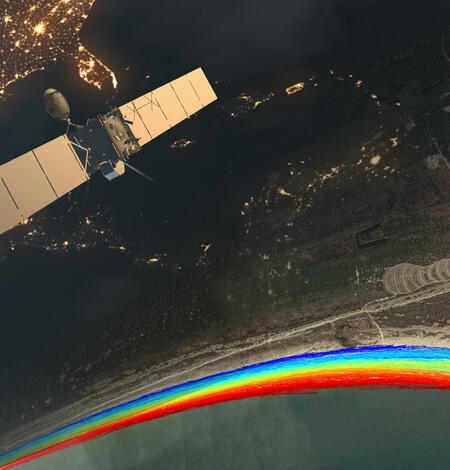
AGU25: Where Science Connects Us
AGU25 is the world’s largest annual Earth science meeting, bringing together more than 25,000 attendees from over 100 countries to share innovative research and foster global collaboration. If you’re at the meeting this year, attend presentations representing USGS research to learn more about our work and how we benefit the Nation.
-
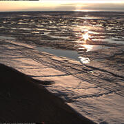
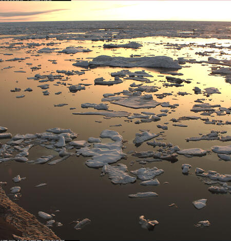
Photo Roundup: December 2025-January 2026 Photo Roundup: December 2025-January 2026
A selection of coastal and ocean videos and photographs from across the USGS.
-
Woods Hole Coastal and Marine Science Center Newsletter: December 2025-January 2026 Woods Hole Coastal and Marine Science Center Newsletter: December 2025-January 2026
Welcome to our newsletter, where we share science stories, recent publications, fieldwork activities, and more center happenings.