
New Product from the 3D Elevation Program
Seamless 1 Meter Digital Elevation Model (S1M)
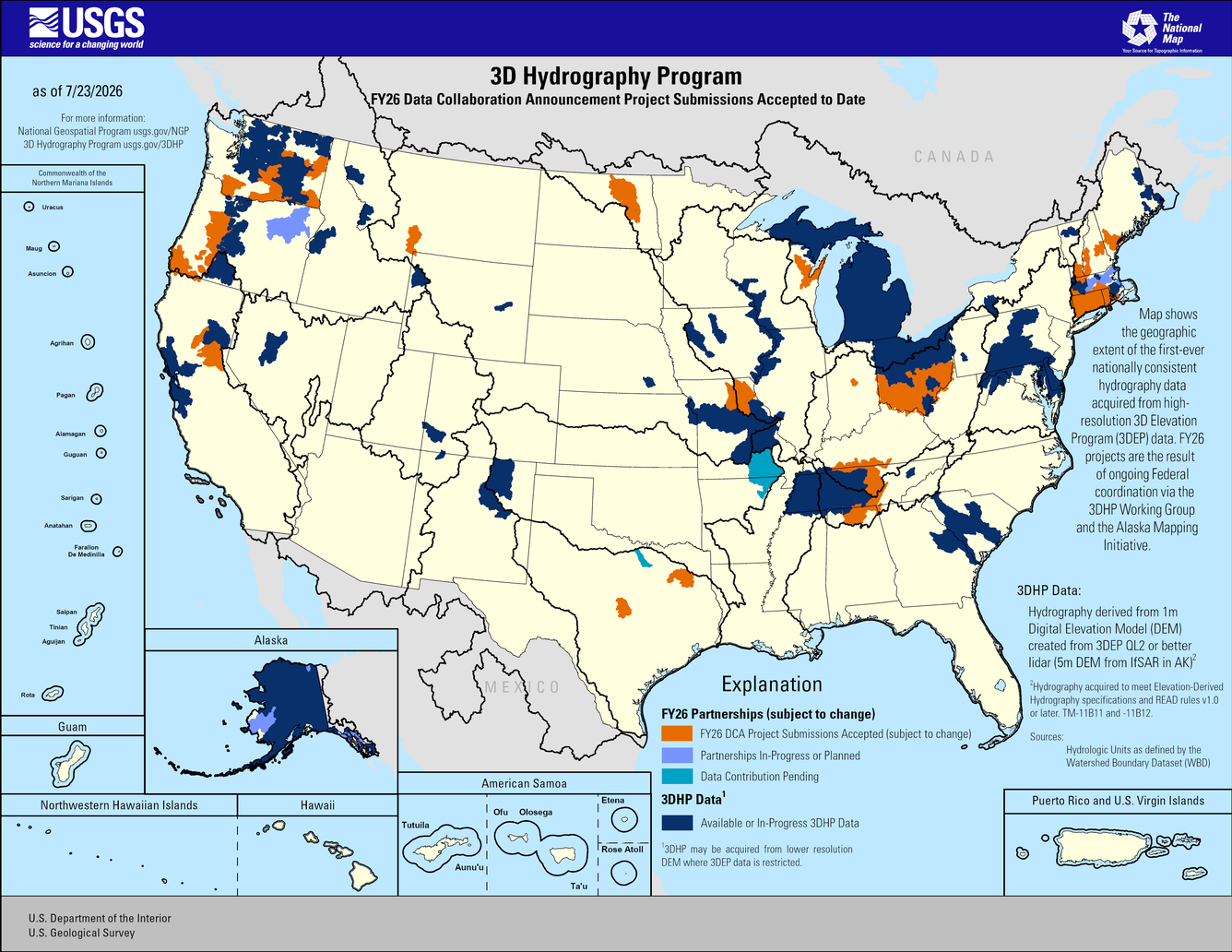
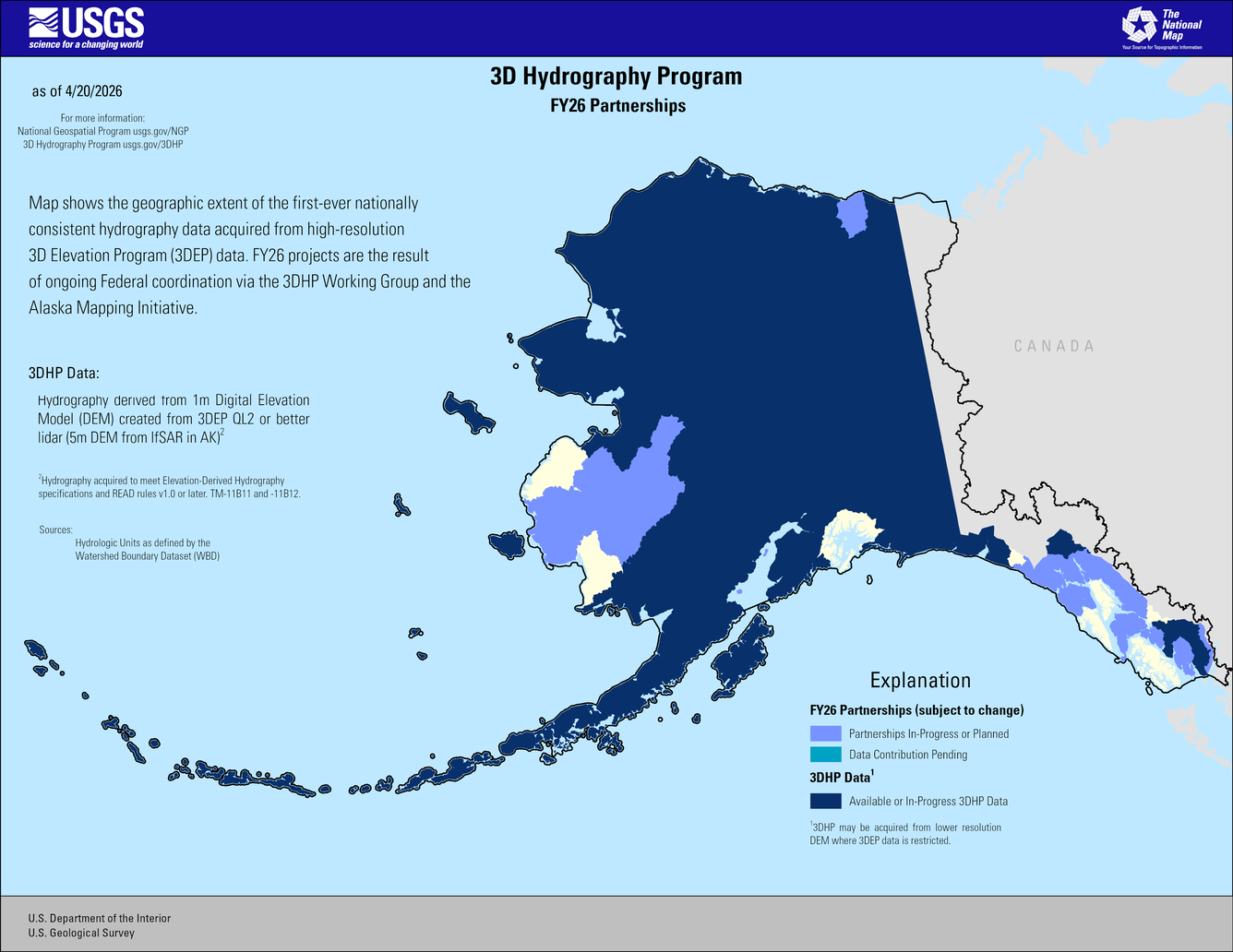
FY26 3D Hydrography Program DCA
USGS announces release of updated 3D Hydrography Program data service
3DNTM DCA Web Mapping Application
Learn About the 3D Hydrography Program
The 3D National Topography Model Call for Action—Part 1. The 3D Hydrography Program
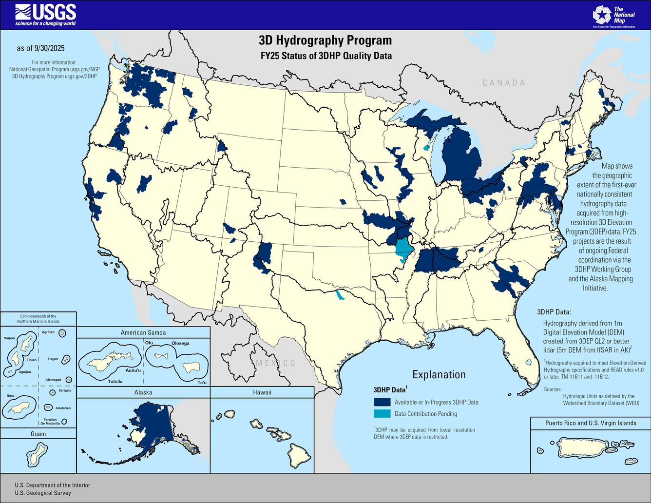
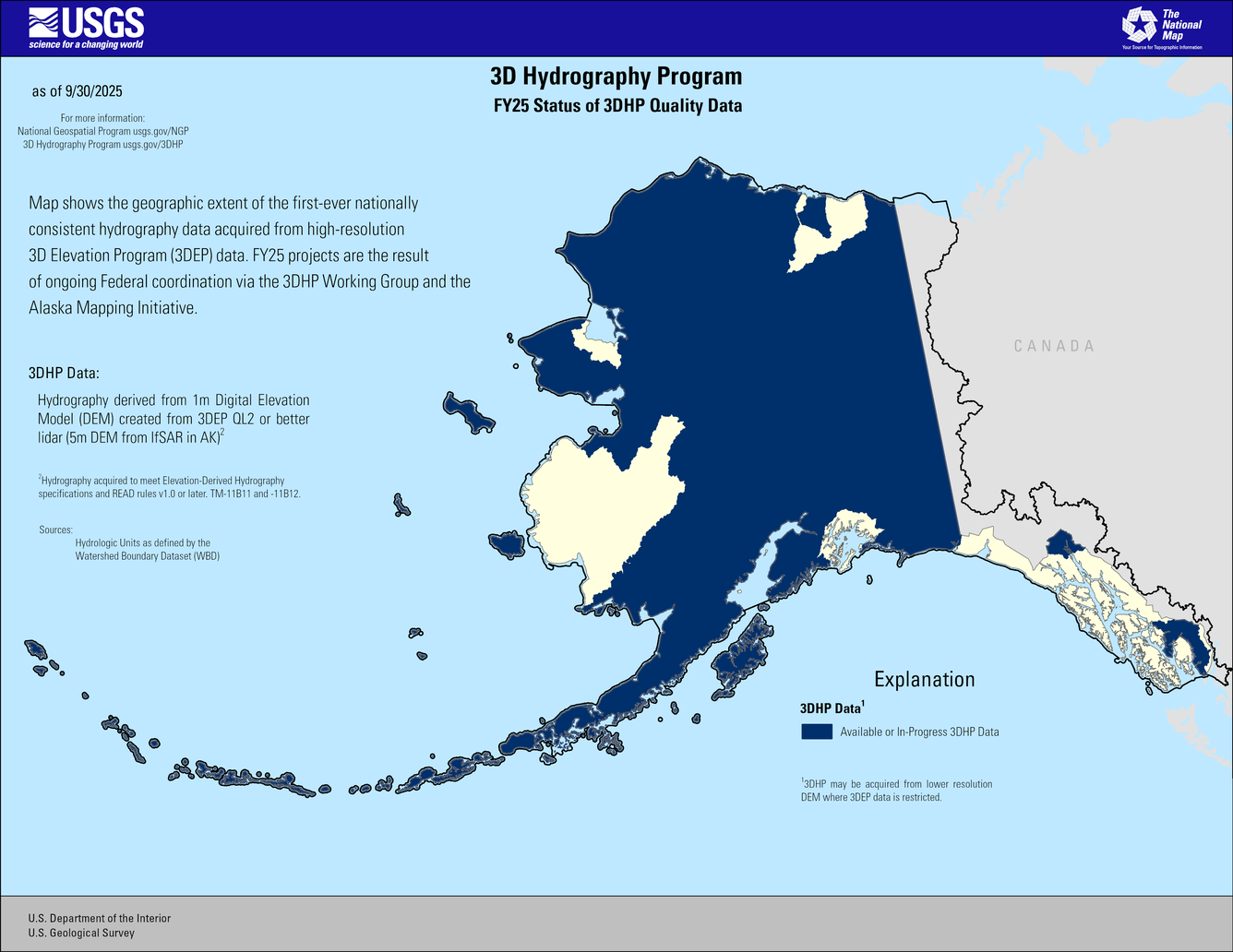
3D Hydrography Program
The implementation of 3D National Hydrography Program (3DHP) marks the start of a new era of water data - the first systematic remapping of the Nation’s hydrography since the original USGS 1:24,000-scale topographic mapping program was active. Community-wide coordinated investments will contribute toward a consistent set of national water data to answer the most demanding water resource questions.
Data Collaboration Announcement

The DCA provides a mechanism for partnering with the USGS and other Federal Agencies to acquire high-quality 3D Elevation or 3D Hydrography data to provide the Nation with high-resolution topographic products to support a broad array of applications.
The 3DNTM Call for Action—Part 1. The 3D Hydrography Program

The first systematic remapping of the Nation’s surface waters since the original 1:24,000-scale topographic mapping program was active from 1947 to 1992. Building on decades of experience maintaining the NHD, the WBD, and the NHDPlus HR, the 3DHP will completely refresh the Nation’s hydrography data and improve discovery and sharing of water-related data.
Benefits and Applications

The National Hydrography Requirements and Benefits Study was performed to establish a baseline understanding of national business uses, needs, and associated benefits for national hydrography data, and to inform the design of an enhanced future program that balances requirements, benefits, and costs.
The 3DHP will significantly improve the level of detail, currency, and content of hydrography data by deriving (1) three-dimensional (3D) stream network datasets and watersheds from high-quality 3D Elevation Program (3DEP) data and (2) other elevation derivatives to support applications like hydrologic and hydraulic modeling (Figure 1). The 3DHP will improve the ability to track information related to water as it moves through the hydrologic cycle by connecting surface-water features traditionally represented in the National Hydrography Dataset (NHD) to data about wetlands, engineered hydrologic systems, and groundwater; it will also improve the attribution of important hydrologic characteristics like streamflow permanence.

News
USGS announces release of updated 3D Hydrography Program data service and supporting tables
Partnership Selections for the 2025 3D National Topography Model Data Collaboration Announcement
USGS announces elevation and hydrography data acquisition partnership opportunities for fiscal year 2026
Publications
The 3D National Topography Model Call for Action—Part 1. The 3D Hydrography Program The 3D National Topography Model Call for Action—Part 1. The 3D Hydrography Program
Elevation-derived hydrography acquisition specifications Elevation-derived hydrography acquisition specifications
Elevation-derived hydrography—Representation, extraction, attribution, and delineation rules Elevation-derived hydrography—Representation, extraction, attribution, and delineation rules
Science

2026 18th CEGIS Annual Research Meeting