



California Waters – Fall 2026 - Vol. IV | Issue II
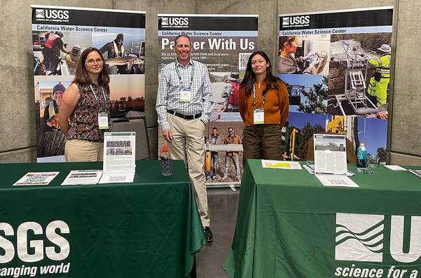
In this issue, we highlight several events from earlier this year:
- 2026 Bay-Delta Science Conference – This leading forum showcases scientific research that informs management of the Bay-Delta. CAWSC scientists, along with USGS researchers from other centers, delivered talks and presented posters.
- Signing of the Clear Lake Watershed and Chi (Ṣátti) Memorandum of Understanding Co‑Management Agreement – This agreement supports the restoration of the Clear Lake watershed and the Clear Lake hitch, a threatened fish species. USGS scientists joined partners for the signing at Big Valley Rancheria in Lakeport, CA.
- 2026 Esri User Conference – CAWSC scientists shared their work, highlighting innovative applications of Geographic Information Systems (GIS) and water science.
- 2026 Tahoe Summit – Scientists from the California and Nevada Water Science Centers attended the 30th annual Lake Tahoe Summit to discuss ongoing USGS work in the Tahoe Basin.
- 2026 Interagency Ecological Program (IEP) Annual Workshop – Held each spring, the IEP Workshop provides a forum for sharing new research that advances science important to the IEP and the broader Sacramento–San Joaquin Delta community.
We also feature recent publications, science pages, online tools, and other new material produced by CAWSC. Please share this newsletter with your friends and colleagues, and feel free to send questions to: gs_cawsc@usgs.gov.
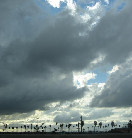
Stormwater Recharge in Los Angeles
The Greater Los Angeles region faces growing pressure to secure reliable, sustainable water supplies. Local leaders have set a goal of meeting 80 percent of its water needs from local sources by 2045, up from roughly 10 percent in recent years. Capturing water and storing it underground for later use is one of the ways the region plans to reach that goal.This practice of storing more water in...
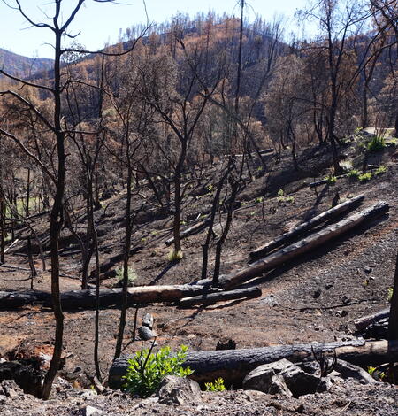
As Wildfires Burn, Rainfall Can Strip Oxygen From Rivers, Killing Fish
Runoff from a high-intensity storm during the 2022 McKinney Fire depleted oxygen in the Klamath River to levels lethal to fish, killing aquatic life along nearly 60 miles of one of California's most culturally significant waterways, according to a U.S. Geological Survey study.

Santa Ana River Native Fish Study
Native Fish Population and Habitat Study, Santa Ana River, CaliforniaThe Santa Ana River stretches approximately 96 miles (154 kilometers) from its headwaters in the San Bernardino Mountains to its mouth at the Pacific Ocean near Huntington Beach, flowing through high desert and dense urban development in San Bernardino, Riverside, and Orange Counties. Native fish, also known as indigenous fish...
USGS Scientists Share Their Research at the 2026 Bay-Delta Science Conference

Monitoring and Modeling of Nutrient and Sediment Sources to Clear Lake, California
A tool that allows the public and water resource managers to understand the water quality of Clear Lake and its surrounding watersheds, particularly because of potential impacts on human health. Harmful algal blooms (featuring cyanobacteria, aka blue-green algae), elevated nutrient levels, elevated nutrient levels, mercury, and suspended sediment are key factors contributing to these concerns.

Cyanobacteria Assessment Network: Pilot study with Sentinel-2 derived chlorophyll data
Harmful algal blooms (HABs) affect global water quality, limiting uses like recreation and consumption because of excessive algal biomass and toxin production. These blooms cause surface scums, taste and odor issues, hypoxia, and negative health and socioeconomic impacts. The US Army Corps of Engineers (USACE) manages over 400 lakes and reservoirs and seeks to improve monitoring of HABs...

Evaluation of Groundwater Resources in the Adelaida Area of San Luis Obispo County, California
Stakeholders in San Luis Obispo County are concerned that the increased demand for water use has, and will continue to, affect groundwater levels and availability in the Adelaida area. To address stakeholder concerns, the County of San Luis Obispo Board of Supervisors has asked the USGS to conduct a comprehensive evaluation of groundwater resources of the Adelaida area.
Partnering for Clear Lake
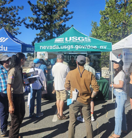
Nevada and California Water Science Centers Join Forces at 2026 Tahoe Summit
Scientists from the California and Nevada Water Science Centers attended the 30th annual Lake Tahoe Summit to discuss the work the USGS is doing in the Tahoe Basin. This year’s event was hosted by Nevada senator Jacky Rosen and featured, American rock climber and author, Tommy Caldwell, as keynote speaker.
Evaluation and synthesis of the Yolo Bypass fish monitoring program
The Yolo Bypass is the largest functional remnant floodplain of the Sacramento River, providing benefits to aquatic taxa of the San Francisco Bay and Sacramento–San Joaquin Delta (hereafter, Bay-Delta). Because of the Yolo Bypass’s vital role in flood control and its ecological effects, the California Department of Water Resources started the Yolo Bypass Fish Monitoring Program (YBFMP)...
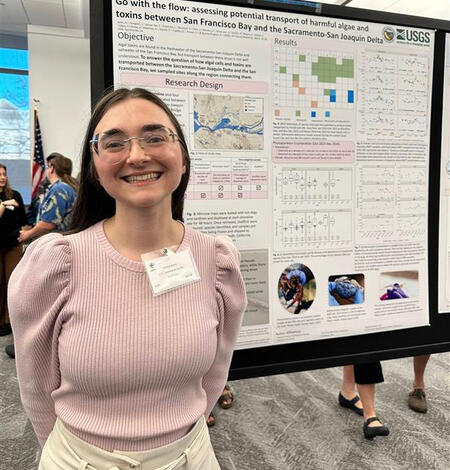
California Water Science Center Scientists Share their Research at 2026 IEP Annual Workshop
From March 16th through the 18th, Scientists from the USGS California Water Science Center (CAWSC) presented their research at the 2026 Interagency Ecological Program (IEP) Workshop in Sacramento.
From Streamgage to Smartphone
Assessing the status and drivers of phytoplankton blooms along the riverine to freshwater-tidal continuum in a modified delta
Shifts in phytoplankton communities, from beneficial taxa that fuel food webs to harmful taxa that degrade water quality, are often linked to anthropogenic modifications to estuaries. We analyzed monitoring data from 2000 to 2023 in the heavily modified southern, landward portion of the Sacramento-San Joaquin Delta (California, USA) to determine the status and drivers of phytoplankton...

A More Intelligent World
Two scientists from the California Water Science Center will share their work at the 2026 Esri User Conference, highlighting innovative applications of Geographic Information System (GIS) and water science. Their presentations showcase how geospatial tools help advance scientific understanding and support informed resource management.
Evaluating groundwater quality influences from oil field operations and other anthropogenic activities in an urban setting, Santa Fe Springs, California
Groundwater quality is often affected by anthropogenic activities in urban settings. This study examines groundwater quality in and around the Santa Fe Springs Oil Field in Los Angeles County, California, where oil and gas production commonly intersects with high density industrial, commercial and residential land uses. Utilizing a combination of new and historical data, we evaluated...
Status and understanding of groundwater quality in the San Joaquin Valley Kern County subbasin domestic-supply aquifer study unit, 2022—California GAMA Priority Basin Project
The quality of water accessed by domestic wells (here referred to as domestic groundwater resources) in the San Joaquin Valley Kern County subbasin (basin number 5-022.14) was assessed as part of the California Groundwater Ambient Monitoring and Assessment (GAMA) Program Priority Basin Project (GAMA-PBP), in cooperation with the California State Water Resources Control Board. Kern County...
High-resolution landscape-scale maps of nutrients, phytoplankton, and related water-quality constituents in Suisun Bay and the Sacramento–San Joaquin Delta, California, during 2018—Results from high-resolution underway surveys
We examined the abundance and distribution of nutrients and phytoplankton in the tidal aquatic environments of the Sacramento–San Joaquin Delta (Delta) and Suisun, Grizzly, and Honker Bays in California by completing three spatial surveys that used continuous underway high frequency (1 hertz) measurements and sampling onboard a high-speed boat. Surveys were conducted in May, July, and...
Co-occurrence of pesticides and pharmaceuticals and personal care products (PPCPs) across Zostera marina (common eelgrass) communities
Anthropogenic pressures are driving changes in eelgrass communities, which are altering baseline conditions in estuarine environments. Field detections have validated the transport of land-sourced pollutants to aquatic systems; however, studies rarely sample concurrently for pesticides, and pharmaceuticals and personal care products (PPCPs) across environmental compartments. Moreover...