
Completed projects
Center of Excellence for Geospatial Information Science (CEGIS)
A list of completed projects is below.
Current projects and their related data can be found on the CEGIS Science theme page and topics list.


-

Topographic design
Electronic Topographic Map Design was a five-year research project led by Prof. Cynthia Brewer of Pennsylvania State University to develop new designs and symbology for U.S. Topo.
Volunteered Geographic Information (VGI)
Volunteered geographic information, that is, geospatial content generated by non-professionals using mapping systems available on the Internet, offers possibilities for government agencies at all levels to enhance their geospatial databases.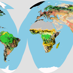
Map projections
CEGIS research in map projections began with problems of commercial projection software in handling raster data projection for global modeling applications. With pixel sizes of 1 km or larger, raster cells cannot be treated as points in the transformations. This work led to the USGS implementing the mapimg projections package for raster data.
Soil moisture measurement from remotely sensed images
Field collected values of soil moisture from Theta probes are being used to calibrate transformations of Landsat Thematic mapper (TM), Advanced Spaceborne Thermal Emission and Reflection Radiometer (ASTER), Advanced Land Imager (ALI), Hyperion and airborne-collected hyperspectral images to create soil moisture values directly from the image radiances.
Multi-dimensional theory
The project is focused on multidimensional representation, including three-dimensional and temporal object attributes.
Watershed modeling
This cooperative effort with the USGS Water Resources Discipline is investigating the effects of data resolution on the outputs of watershed and water quality models.
Soil moisture
The availability of soil moisture affects plant production potential, rainfall runoff volume, and many other parameters that are of interest to agricultural production, forest management, soil conservation, and watershed management and modeling.
Web modeling
This project will demonstrate the application of The National Map to web-enabled modeling by deriving model parameter values from data extracted from The National Map, and by recommending modeling tools to be developed for The National Map.
Delaware River Basin historical land use
The objectives for these projects are to address and quantify predominant affects and outcomes of land-surface change in urbanizing areas.