U.S. flag

An official website of the United States government

A selection of coastal and ocean images and videos from across the USGS.

DUring Nearshore Event eXperiment (DUNEX)

DUring Nearshore Event eXperiment (DUNEX) is a multi-agency, academic, and non-governmental organization (NGO) collaborative community experiment designed to study nearshore coastal processes during storm events. The experiment involved a large field component that took place in fall of 2021. USGS participation in DUNEX will contribute new measurements and models that will increase our understanding of storm impacts to coastal environments, including hazards to humans and infrastructure and changes in landscape and natural habitats. The data will help evaluate and improve the models used to forecast coastal water levels and storm impacts. 

Learn more about the DUring Nearshore Event eXperiment (DUNEX) project

Two high-resolution, digital cameras are mounted on towers overlooking the beach and dunes
Two high-resolution, digital cameras were mounted on towers overlooking the beach, dunes, and instrument arrays in the Outer Banks of North Carolina on September 18, 2021, as part of the DUring Nearshore Event eXperiment (DUNEX) project. The cameras will collect pairs of overlapping images throughout calm and storm conditions to better understand coastal change processes. Images will be used to measure wave runup at the shoreline and estimate the storm-induced total water level. Camera data, beach-change measurements, and topographic surveys will reveal how the beach and dune profiles change, as well as the magnitude of sand eroded or accreted along an experimental transect extending from the dune and into the nearshore zone. 
A woman sitting cross legged on top of a ladder writing in a notebook next to long skinny equipment
USGS researcher Jenna Brown takes a measurement with a real time kinematic GPS receiver, this will give her an accurate position and height of the aluminum pole beneath it, which will have mutliple instruments attached to it to measure water flow and elevation changes.
Two people inspect a metal sign on a vegetated sandy backdrop and blue sky.
USGS personnel install signs on the beach warning and informing beach goers of the DUNEX experiment
Aerial view of a sandy beach and dune. A scientists holds a post near a black and white marker on the ground.
Overhead image collected by a helikite of field work being conducted in the Outer Banks of North Carolina. An alternative to uncrewed aerial systems (UAS; commonly known as 'drones'), USGS scientists use helikites equipped with cameras to collect imagery of the coastline. The pictures collected by these helium-powered kite-balloons are used to create a digital elevation model with structure- from-motion techniques. Here, Jin-Si Over of the Woods Hole Coastal and Marine Science Center uses a mobile Global Positioning System (GPS) unit to record beach elevations. The black and white ground control target nearby is used for photo rectification with aerial imagery collected by the helikite. 
Two boats and multiple people on a calm ocean with a clear blue sky
To install instruments offshore professional divers were hired to work alongside USGS personnel. Here, long segments of pipe are jetted into the seafloor to which instruments will be attached to measure offshore oceanographic conditions.


A person walks down a sandy shoreline near the waves under a cloudy sky, pulling along a white balloon-shaped kite
An alternative to uncrewed aerial systems (UAS; commonly known as 'drones'), U.S. Geological Survey (USGS) scientists use helikites equipped with cameras to collect imagery of the coastline. The pictures collected by these helium-powered kite-balloons are used to create a 3D digital elevation map of the beach. Here, Woods Hole Oceanographic Institution scientist Peter Traykovski, a USGS research partner, tows a helikite on a beach in Pea Island National Wildlife Refuge on the Outer Banks of North Carolina.  


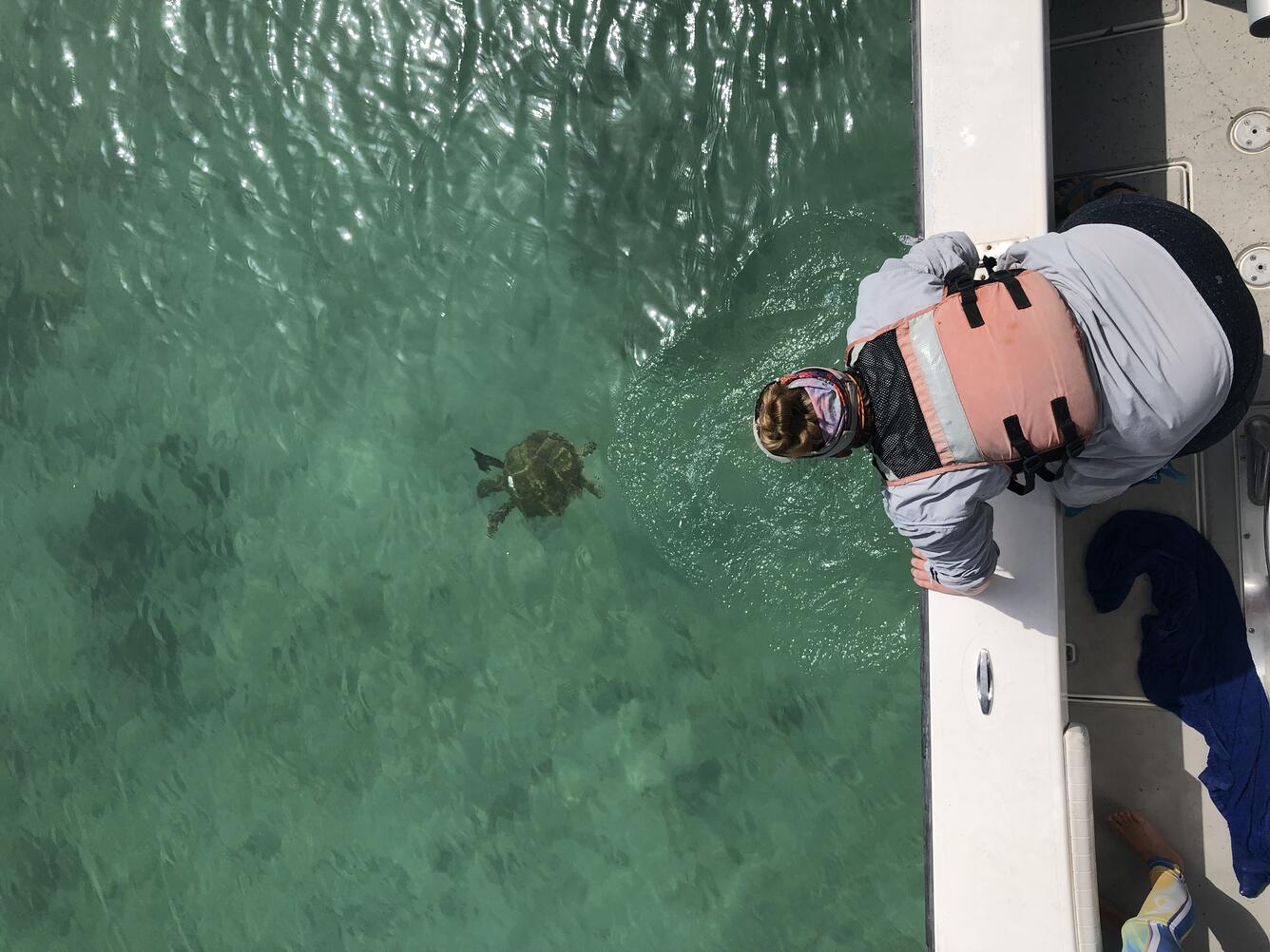
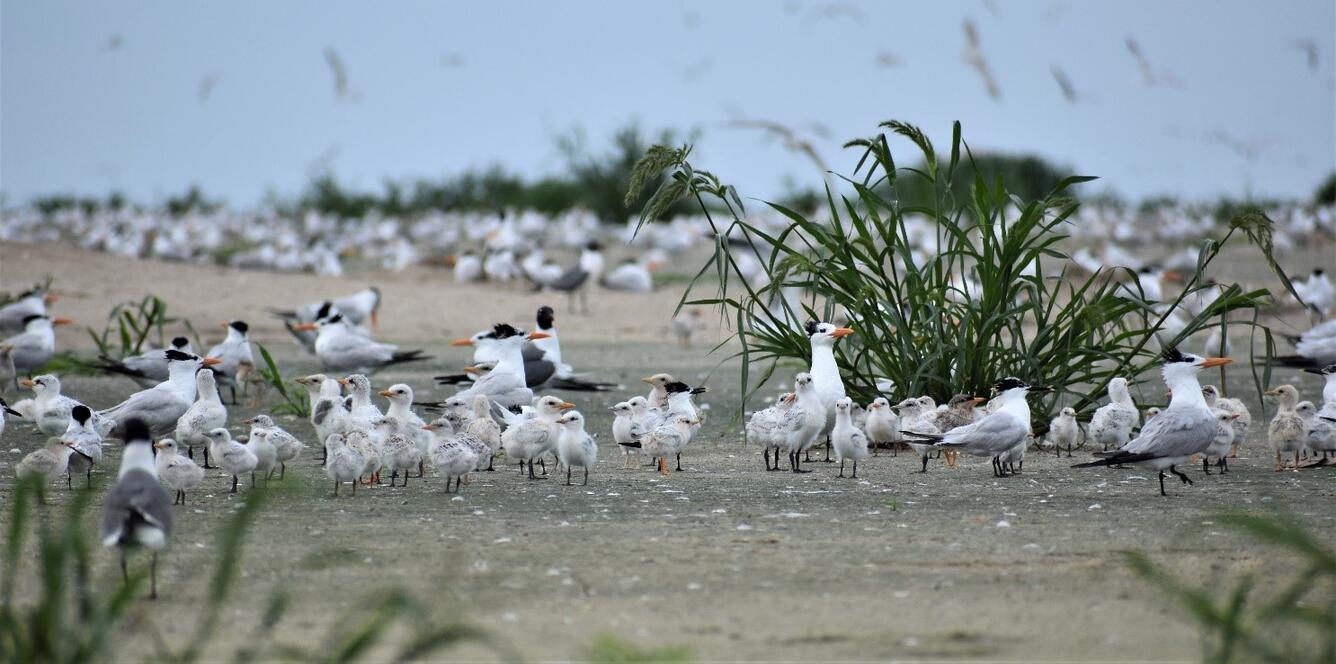
Other Fieldwork Photos

Impounded wetland eddy flux tower install
Impounded wetland eddy flux tower install: The instruments on this tower measure methane and CO2 fluxes related to plant and soil processes day in and day out for the entire year. This information is critical for understanding how wetlands that have been cut-off from tidal exchange, such as at the Herring River, impact greenhouse gas fluxes to the atmosphere.
Green sea turtle
Jackie Guzy releases a juvenile green sea turtle in Garden Key Harbor. Image taken during a sampling event in Dry Tortugas National Park, FL.
Shorebirds on Gunn Island
Royal Tern and Sandwich Tern adults and young, Gunn Island. Gunn Island is dredge material island constructed in the Baptiste Collette Bayou near Venice, Louisiana.
A SCUBA diver underwater next to a buoy extending from a concrete block on the seafloor
A scientific diver next to an anchor station in 20m water depth with a wave buoy and smart mooring attached. This instrument will deliver high-fidelity, real-time wave, water level, and wind data to scientists at the USGS St. Petersburg Coastal and Marine Science Center. This buoy, along with other instruments further inshore and a camera on the beach, will be used to collect data to track how waves and water level transform as they travel towards the beach. This information is used to assess the skill and improve models used in the Total Water Level and Coastal Change Forecast viewer. These forecasts help inform coastal communities about potential coastal hazards.

Get Our News

These items are in the RSS feed format (Really Simple Syndication) based on categories such as topics, locations, and more. You can install and RSS reader browser extension, software, or use a third-party service to receive immediate news updates depending on the feed that you have added. If you click the feed links below, they may look strange because they are simply XML code. An RSS reader can easily read this code and push out a notification to you when something new is posted to our site.