
Feature Representation
Feature Representation
Center of Excellence for Geospatial Information Science (CEGIS)
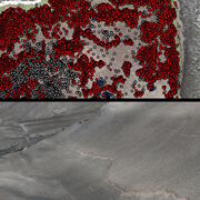
Feature representation is the way features or phenomenon on the earth’s surface are captured and stored in a database.
Features, such as roads, streams, or soil types can be stored in raster or vector data formats.
Raster data are stored like images that have rows, columns, and pixel values. Vector data are stored through point, line, and polygon representations.


Multiscale representation
Multiscale representation
Filter Total Items: 3

2026 18th CEGIS Annual Research Meeting
The Center of Excellence for Geospatial Information Science (CEGIS) is proud to host the 2026 18th CEGIS Annual Research Meeting June 23-25, 2026, in Denver, Colorado. The annual research meeting is a special occasion to celebrate our accomplishments, explore ongoing projects, and foster collaboration for future endeavors. This year's gathering featured a broad range of presentations from our...
2025 CEGIS Annual Research Meeting
The Center of Excellence for Geospatial Information Science (CEGIS) was proud to host the 2025 CEGIS Annual Research Meeting July 22-24, 2025. The annual research meeting is a special occasion to celebrate our accomplishments, explore ongoing projects, and foster collaboration for future endeavors. This year's gathering featured a broad range of presentations from our researchers and their...
Feature representation
Feature representation is the way features or phenomenon on the earth’s surface are captured and stored in a database. Features, such as roads, streams, or soil types can be stored in raster or vector data formats. Raster data are stored like images that have rows, columns, and pixel values. Vector data are stored through point, line, and polygon representations.