Multiscale representation
Center of Excellence for Geospatial Information Science (CEGIS)
Multiple representation concerns the various ways that features or phenomena are acquired and stored in databases and displayed on maps or other visual displays.
Depending on the display type, features or phenomenon may be represented in different ways. This is called multiscale representation.
Simplifying features for map view is referred to as generalization.
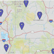
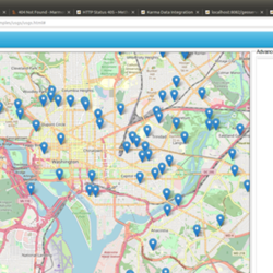
Cartographic representation
Cartographic representation is how we display information on a map.
Topographic features that exist on earth’s surface—such as terrain contours, surface water features, roads, and buildings—are displayed on topographic maps. Features are drawn with the amount of detail that can be clearly displayed within the map extent, which is the area on the ground that the map covers.
Feature representation
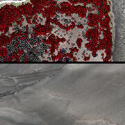
Feature representation is the way features or phenomenon on the earth’s surface are captured and stored in a database.
Features, such as roads, streams, or soil types can be stored in raster or vector data formats. Raster data are stored like images that have rows, columns, and pixel values. Vector data are stored through point, line, and polygon representations.
Generalization
In order to display complex features on the small space of a map, the information must be generalized, which means the amount of information and the detail must be reduced.
Generalization involves various operations or techniques for selecting the proper amount of content to show on a map and how that content is displayed.

2026 18th CEGIS Annual Research Meeting
2025 CEGIS Annual Research Meeting
Generalization
Feature representation