
Comprehensive Sturgeon Research Project Blog - 2020
The USGS Comprehensive Sturgeon Research Project is a multi-year, interdisciplinary research study to determine factors leading to spawning and survival of the endangered pallid sturgeon and the closely related shovelnose sturgeon.
Click here to see the previous year's blog or Click here to return to the 2021 blog
Ecoflume Design Takes Shape
By Brandon Sansom, Maura Roberts, Kim Chojnacki and Robert Jacobson
December 8, 2020
The design of a new continuous-loop, racetrack Ecoflume developed for the Comprehensive Sturgeon Research Project (CSRP) has been finalized and construction has begun at the Columbia Environmental Research Center (CERC). Scientists from the U.S. Geological Survey, in collaboration with scientists at Saint Anthony Falls Laboratory (SAFL) at the University of Minnesota completed the engineering and design phase of a large, indoor Ecoflume to study the early life-stages of pallid sturgeon from egg deposition through the first year of life (see previous blog post, Bringing the Missouri River into the Laboratory). The 9,500-gallon flume will be constructed in a new 1,350 square-foot laboratory within the main wet laboratory facility at CERC. The new laboratory will be photoperiod and climate controlled. Large, commercial heat exchangers and treatment systems will be capable of providing the flume with water temperatures and water quality representative of locations along the length of the entire Missouri River. Construction of the laboratory and supporting infrastructure at CERC will begin in Winter of 2020–2021. Components of the Ecoflume are being fabricated at the Saint Anthony Falls Laboratory and will be shipped to CERC for final assembly. Novel, removable paddlewheel systems specifically developed by SAFL to be safe for sturgeon embryos and free embryos will move the water 0–0.5 meters per second in the Ecoflume for studies with the earliest life stages. Pump systems with diffuse jets designed for larval and juvenile sturgeon will be used to move water 0–1.0 meters per second in studies with later life stages with greater swimming capacity. The Ecoflume will be constructed with internal heat exchangers to precisely maintain temperature and scientists will have the ability to modify substrate and bedforms to simulate conditions experienced by young sturgeon in the Missouri River. Digital imaging systems and automated acoustic Doppler velocimeters to study the responses of pallid sturgeon, shovelnose sturgeon and other native species under controlled fluvial conditions are also in development. The Ecoflume is anticipated to be completed in late winter of 2022.

Intensive “Hotspot” Studies Link Field Sampling and Mapping to Models and Lab Studies
By Caroline Elliott and Heather Shaughnessy
November 24, 2020
How do you study a developing fish less than 25 mm long—about the diameter of a U.S. quarter-dollar coin—in one of the largest rivers in North America? Teams of researchers from the U.S. Army Corps of Engineers from Kansas City and Omaha, the Missouri Department of Conservation, the Nebraska Game and Parks Commission, and the U.S. Geological Survey are working together on a multi-scale project to understand how pallid sturgeon larvae develop and drift, and where they end up in the Lower Missouri River.
Through extensive sampling over the years, fisheries biologists have identified a few “hotspots,” or areas off the main channel where biologists have been reliably able to collect sturgeon larvae. These areas are often in wing-dike fields where variation in spring and summer discharge can quickly change habitat conditions causing the number of sturgeon captured by biologists to fluctuate rapidly from week to week. In 2020, biological sampling was closely coordinated with physical habitat measurements (see previous blog Using ‘hotspots’ to guide habitat assessments) to map the depths, velocities, and riverbed conditions where and when young sturgeon were sampled.

These rich datasets provide information about the locations where sturgeon are caught at a scale consistent with that of the trawl nets (10’s of meters) used by biologists. This same physical information can be scaled up to examine river processes at the bend scale (1000’s of meters) that are responsible for creating and maintaining habitats and facilitating retention of sturgeon larvae. These data are used to build models and propose metrics to explain how dispersing larvae get out of the main current and end up in “hotspots” and to understand how hotspots change over a range of river flows. These models are then integrated with behavioral understanding from laboratory studies to understand when, at what temperatures, and how these fish can arrest their downstream dispersal and move on their own into habitats out of the main channel. Eventually we hope to use new understanding gained through these models to predict where to find hotspots in the river and to guide modification of existing habitats to support the survival and growth of young pallid sturgeon in the Lower Missouri River.
USGS Sturgeon Research Project Adds Expertise
By: Aaron DeLonay
November 11, 2020

The USGS Comprehensive Sturgeon Research Project (CSRP) recently added a new research scientist to the team. Dr. Brandon Sansom joined the River Studies Branch at the Columbia Environmental Research Center in September. Brandon is a research engineer with extensive experience in biophysical hydrodynamic transport phenomena. His academic background combines Bachelor’s and Master’s degrees in biology with a Doctorate in water resources engineering. Most recently he has held positions as a postdoctoral associate at the University at Buffalo and as a hydraulic engineer with the U.S. Army Corps of Engineers in Buffalo, NY. Previous research has focused on how organism-flow interactions contribute to the structure and function of stream ecosystems using state of the art technology, such as acoustic Doppler velocimetry and particle image velocimetry to collect high-frequency and high-resolution data. Brandon’s research reinforces the multi-disciplinary CSRP approach of using of field studies, laboratory experiments, and computational fluid dynamic modeling to improve conservation and management efforts for aquatic resources. Initially he will be investigating transport phenomena related to aspects of pallid sturgeon age-0 larval dispersal and native, freshwater mussel eDNA.
Selected Recent Publications:
Sansom, B.J., Bennett, S.J., Atkinson, J.F., Vaughn, C.C. 2020. Emergent hydrodynamics and skimming flow over mussel covered beds in rivers. Water Resources Research 56: e2019WR02652. DOI 10.1029/2019WR026252
Sansom, B.J., Bennett, S.J., Atkinson, J.F., Vaughn, C.C. 2018. Long-term persistence of freshwater mussel communities in labile channels. Freshwater Biology 63: 1469-1481. DOI 10.1111/fwb.13175.
Sansom, B.J., Sassoubre, L.M. 2017. Environmental DNA (eDNA) shedding and decay rates to model freshwater mussel eDNA transport in a river. Environmental Science and Technology 51: 14244-14253. DOI: 10.1021/acs.est.7b05199.
Sansom, B.J., Atkinson, J.F., Bennett, S.J. 2017. Modulation of near-bed hydrodynamics by freshwater mussels in an experimental channel. Hydrobiologia 810: 449-463. DOI: 10.1007/s10750-017-3172-9.
Scientists Help Clean Up the Big Muddy
By Kimberly Chojnacki and Caroline Elliott
October 27, 2020

U.S. Geological Survey (USGS), Comprehensive Sturgeon Research Project (CSRP) researchers don’t just work on the Missouri River, they are committed to improving the Big Muddy, too. One weekend in late October CSRP scientists and their families turned out to prove it. Researchers, including Sabrina Davenport, Carrie Elliott, and Kimberly Chojnacki volunteered to help Missouri River Relief (MRR) collect trash along a 14-mile segment of river near Easley, Missouri (near river mile 170). The Missouri River Relief is a not-for-profit organization that strives to connect people to the Missouri River through hands-on river clean-ups and education events. The MRR clean-up events actively involve volunteers in the stewardship of the Missouri River, increase awareness of the solid waste in streams, and places volunteers on the river, many for the first time. During the clean-up event, CSRP researchers and their families joined small groups of volunteers armed with lots of blue, heavy-duty trash bags. Each group was transported by boat to various ‘trashy’ locations along the river identified beforehand by MRR scouts. The volunteers disembarked from the boats to search the riverbank and surrounding forest to fill their blue bags with all manner of trash. Volunteers noted that the flood event of 2019 left its mark on the floodplain trees and distributed trash into the forest far from the riverbank.

Since the onset of COVID-19, river clean-up efforts have been somewhat different than those in the past with smaller groups, social distancing, and facemasks but neither the circumstances nor cool, damp weather could keep the volunteers away or prevent them from accomplishing their mission. During the three-day clean-up in October, 99 volunteers and MRR staff members removed 5.5 tons of trash, including 56 tires, 1 refrigerator, 2 freezers, 5 coolers, 5 lawn chairs, all sorts of plastics, glass bottles, Styrofoam, and much, much more. For more information and photos of this and other MRR clean-up efforts, see the Missouri River Relief webpage.

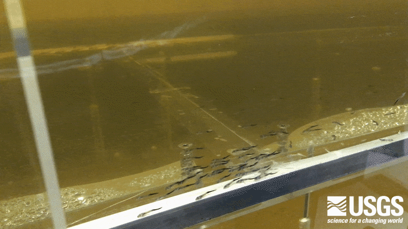
Experimentally Released Larval Pallid Sturgeon Survive and Grow
By: Pat Braaten, Aaron DeLonay, Kim Chojnacki, and Casey Hickcox
October 8, 2020
In early July, 2019, the USGS Comprehensive Sturgeon Research Project (CSRP), in collaboration with the U.S Army Corps of Engineers, U.S. Fish and Wildlife Service (USFWS), Montana Fish, Wildlife and Parks (MFWP), and Southern Illinois University, completed a large-scale, pallid sturgeon larval dispersal study (see previous blog post, Unprecedented Pallid Sturgeon Larval Drift Experiment) on the Upper Missouri River. Approximately 770,000 1-day post-hatch (dph) and 200,000 5-dph yolk-sac larvae (prior to the initiation of feeding) were released and monitored as they drifted downstream of Fort Peck Dam to the headwaters of Lake Sakakawea. Scientists monitored how far and how fast the yolk-sac larvae drifted, and where they began to settle to the riverbed as they transition into feeding larvae and young-of-year (YOY) juveniles. The USGS, USFWS, and MFWP sampled for feeding larvae and YOY sturgeon using bottom trawls beginning in mid-July through mid-September (see previous blog post, A Nine Week Search for Baby Pallid Sturgeon). Trawling resulted in the collection of 84 YOY pallid sturgeon that had been stocked at 5-dph as part of the dispersal study, and several hundred YOY shovelnose sturgeon from naturally spawning, wild populations.

Experimentally released pallid sturgeon grew from approximately 12 to 14 mm at the beginning of the drift-phase of the dispersal study to approximately 25 to 100 mm by the time they were recaptured. From the survival and growth of the young sturgeon it was evident they were successfully feeding. One objective of CSRP scientists is to examine the stomach contents of the preserved pallid sturgeon specimens to identify the items in their diets and quantify the importance of different insect species. Dr. Barry Poulton, an aquatic entomologist at the Columbia Environmental Research Center, is leading the effort to microscopically analyze and taxonomically classify dietary items found in the stomachs of young sturgeon collected from the Upper Missouri. Diets of the young pallid sturgeon will be compared with diets of young shovelnose sturgeon of the same size and age, collected in the same habitats. There have been few comparative diet studies of YOY pallid sturgeon and those studies were limited by very low sample sizes—not surprising since getting a large sample of YOY pallid sturgeon (specifically those foraging in a natural river environment) is not an easy task. With the collection of these specimens, the largest diet analyses for YOY pallid sturgeon to date is now underway at the Columbia Environmental Research Center (CERC).

Genetics Explained—Verifying Pallid Sturgeon Identity and Parentage
By Killian Kelly, Marlene Dodson, Kimberly Chojnacki, Aaron DeLonay and Dr. Edward Heist
August 15, 2020

The endangered pallid sturgeon and the common shovelnose sturgeon are closely related and indistinguishable from one another during their early development. Biologists must rely on genetic analyses to identify pallid sturgeon embryos, larvae, and early juveniles in samples collected during monitoring and research studies. Unfortunately, a single, cost-effective, diagnostic genetic marker that differentiates pallid sturgeon from shovelnose sturgeon has not yet been identified. Instead Comprehensive Sturgeon Research Project (CSRP) geneticists at the Southern Illinois University Carbondale Conservation Genomic Laboratory rely on a tiered-screening approach to identify pallid sturgeon captured in Missouri River monitoring studies (see previous blog post, Using “Hotspots” to Guide Habitat Assessments), in large scale experimental larval drift studies (see previous blog post, Unprecedented Pallid Sturgeon Larval Drift Experiment) and in seeding experiments to assess survival in supportive habitats.
All specimens of Acipenseriformes (sturgeon and paddlefish) identified in the field or the laboratory are first screened using inexpensive genetic assays for single nucleotide polymorphism markers (SNPs). Fixed differences between species (meaning that all individuals of a species have the same sequence of nucleotides, the building blocks of DNA) at a location on a DNA strand can be used as diagnostic markers. Currently, scientists use fixed genetic markers for a diagnostic test to distinguish early life stages of sturgeon from those of paddlefish, which are similar in appearance (see previous blog post, Sturgeon and Paddlefish Under the Microscope), especially if the specimen was damaged at the time of collection.
Separating pallid sturgeon from shovelnose sturgeon is more difficult because there are no known fixed genetic markers between these closely related species. Instead geneticists use a pair of SNPs that are nearly fixed in pallid sturgeon for alleles (variations) that are less common in shovelnose sturgeon. Detecting the rare alleles in a sturgeon specimen from the Missouri River results in a 97% likelihood that it is a pallid sturgeon. The identity of the few likely pallid sturgeon specimens is then confirmed with more definitive analyses (microsatellite genotyping) using a panel of 19 markers. This tiered screening approach will falsely identify about 3% of pallid sturgeon as shovelnose sturgeon, but because pallid sturgeon are rare and because SNPs are far more efficient and cost-effective than microsatellite analyses, it allows scientists to screen thousands of embryos and larvae, and detect more pallid sturgeon than would be possible using microsatellite markers alone. Once pallid sturgeon specimens are genotyped they can be compared with known spawning adults and their parents can potentially be determined.

USGS Biologist Conquers the Missouri River 340
Casey Hickcox, Kimberly Chojnacki, and Aaron DeLonay
August 8, 2020
For a few days each year the community of Missouri River recreational boaters swells dramatically with seasoned paddlers and new challengers arriving to take on the Big Muddy. Participants come from around the country to compete in the Missouri American Water Missouri River 340 (MR340). The MR340 is an endurance boat race spanning 340 miles of the Missouri River from Kaw Point (the confluence of the Kansas and Missouri Rivers) in Kansas City, Missouri to Frontier Park in St. Charles, Missouri. Participants have 85 hours to complete the race, this year from August 4–7. Approximately 350 individual racers or race teams in canoes, kayaks, stand-up paddleboards, and even dragon boats (with 10+ team members) were registered to compete 2020. Racers are supported by ground crews, often consisting of family and friends, that meet them at mandatory checkpoints along the river to resupply them food, water and other necessities. During the MR340, our Comprehensive Sturgeon Research Project (CSRP) scientists schedule activities to accommodate the paddlers by avoiding boat ramps that serve as checkpoints.

The Missouri River has no locks or dams on this segment of the river, but that doesn’t mean there are no obstacles. Obstacles include fixed features in the river like wing dikes, bridge pilings, and marker buoys, as well as mobile obstacles like motorboats and barges shuttled by tugboats. The current moves along at approximately 3 miles per hour as the paddlers race downstream day and night with little rest.

This year, Ross Burlbaw, Biological Science Technician for the CSRP, and Dave Combs, a former member of the CSRP and veteran MR 340 participant, competed in the men’s tandem kayak division. Ross and Dave finished the race in approximately 56 hours and 31 minutes. Paddling 340 miles in less than 85 hours is a grueling undertaking and is a remarkable feat. Fewer than 2/3 of last year’s participants could claim that accomplishment.

Panoramic Camera Testing on the Missouri River
By Tyrell Helmuth and Caroline Elliott
July 30, 2020

Scientists from the Columbia Environmental Research Center are testing a new panoramic camera on the Missouri River and Perche Creek near Columbia, Missouri. This camera will be utilized as part of a project in conjunction with the National Park Service on the Missouri National Recreational River in South Dakota.
The Missouri National Recreational River is a scenic section of the Missouri River containing large, shifting sandbars, eroding stream banks, and a complex channel morphology. The Missouri National Recreational River is comprised of two free-flowing segments of the Missouri River, encompassing nearly 100 river miles, and forming part of the border between South Dakota and Nebraska. These two segments of the Missouri River offer park visitors a rare view of the river in nearly its original form, not channelized or inundated by fluctuating reservoir levels.

The camera, an iSTAR Pulsar+ made by NCTech1, is a high-resolution, spherical, panoramic camera with a 360-degree field of view and an internal GPS receiver. Images are captured at up to seven frames per second and have a resolution of 60.5 megapixels. The camera is designed to be used on a moving platform and has been modified to mount on an open deck boat to capture high definition, georeferenced images of the riverbanks in the Missouri National Recreational River. The images captured by the camera are processed and edited together to form a continuous view of the river and its banks in the collection area. The high definition images collected by this camera will allow scientists to evaluate the type of bank vegetation as well as the degree of bank erosion present within the Missouri National Recreational River boundaries.
The U. S. Geological Survey and National Park Service will use the images collected with this camera to develop a predictive model of future riverbank erosion. This predictive model, in conjunction with water-quality data, river-discharge measurements, and other data will form a decision-support tool that will allow the National Park Service to make data-based decisions about park management in the Missouri National Recreational River. The images collected with this new camera will help the National Park Service protect the existing recreational infrastructure as well as plan placement of new infrastructure development in the park while preserving its natural, cultural, and historic value for future generations.
1Trade names are used for information only and do not constitute an endorsement by USGS.
Using “Hotspots” to Guide Habitat Assessments
Carrie Elliott and Aaron DeLonay
July 6, 2020
Assessing reproduction and habitat use by a rare sturgeon in a large river is a challenging task. Larval endangered pallid sturgeon and common shovelnose sturgeon settle to the bottom and begin to search for food when they are only about 16 to 20 mm long (See previous blog post, A Change is Gonna Come). Young sturgeon must find supportive rearing habitat quickly if they are to survive and grow. Biologists have learned after several years of trawling that larval and young-of-the-year sturgeon are not randomly distributed on the bottom of the river. Young sturgeon are most often found in small patches of habitat that biologists have learned to identify through experience. These “hotspots” are targeted to collect larger numbers of young sturgeon than can be captured through random sampling alone. Larger numbers of captured sturgeon allow biologists to better evaluate reproduction, growth, and food habits.

In late May and June, Comprehensive Sturgeon Research Project (CSRP) hydrologists from the Columbia Environmental Research Center mapped habitats at six different hotspots on the Lower Missouri River where biologists from the U.S. Army Corps of Engineers and the Missouri Department of Conservation successfully captured larval sturgeon. The sites were mapped over a range or river discharges to access changes in the bed of the river at different flows. In total, 13 multibeam-sonar maps were made at the 6 sites (See previous blog post, Equipment Testing 1, 2, Spring!). The hotspot sampling strategy gives physical scientists a starting point to begin to characterize the attributes of habitats where young sturgeon are found. Understanding the characteristics of physical habitats and how they change over time is critical to defining habitats that support the requirements of young sturgeon, assessing where those habitats are, how much is available, and when. Insights can also be gained by comparing areas where sturgeon are often found to where they are notably absent.

Passive Acoustic Receivers to Monitor Sturgeon in the Lower Missouri River
Ross Burlbaw and Aaron DeLonay
June 25, 2020
Throughout the month of June, the U.S. Geological Survey has been deploying passive acoustic receivers in the Lower Missouri River to monitor the movement of telemetry tagged pallid sturgeon. The passive acoustic receivers are small, self-contained versions of the receivers used by research and monitoring vessels to actively track pallid sturgeon in the Lower Missouri and Mississippi Rivers. The passive receivers contain batteries, acoustic receiver electronics, and a small hydrophone in a unit not much bigger than a large thermos. Dozens of these units will be placed at locations such as the mouth of the Missouri River, at boundaries of the pallid sturgeon population assessment program (PSPAP) segments, and at the confluences of significant tributaries. Passive telemetry detection networks have been identified by the Missouri River Science and Adaptive Management Program as a fundamental information need for monitoring pallid sturgeon populations and their response to potential management actions in the Missouri River basin. These passive receivers augment active manual tracking by population assessment biologists during spring and fall migrations and provide estimates of immigration and emigration rates across river segment boundaries throughout the year.
Telemetry technology used to monitor pallid sturgeon in the Lower Missouri River is different from that in the Upper Missouri River. The Upper River uses radio-frequency transmitters with signals that that can be detected through the air using specialized aerial antennas attached to receivers mounted on tracking vessels or to passive receiver stations on the bank (see previous blog post, Remotely Monitoring Pallid Sturgeon Movement in Real Time). The high conductivity and great depth of the Lower Missouri River prevent the use of radio telemetry and require biologists to use acoustic or ultrasonic-frequency transmitters. The signals from acoustic transmitters can only be detected using specialized microphones, or hydrophones, underwater. Passive acoustic receivers must therefore either be completely submerged in the river with an integrated hydrophone or have a submersed hydrophone on a long cable attached to a receiver on the riverbank. From years of previous experience, we know that the Missouri River transports large amounts of woody debris and sand in the form of dynamic, shifting dunes (see previous blog post, Delivering Science to Stakeholders and the Public During the Pandemic). It is a challenge to site, deploy, and retrieve submerged acoustic receivers under these conditions. The Comprehensive Sturgeon Research Project (CSRP) has adopted and modified several different types of receiver mounts and deployment strategies from other river systems for use in 2020. Experimentation and evaluation of deployment systems will continue throughout the summer as more than two dozen receivers are deployed along 811 miles of river and at the confluences of as many as seven tributaries.

Cellular Technology Monitors Sturgeon Across 300 Miles of Remote River
Colt Holley, Chad Vishy, Patrick Braaten
June 22, 2020
USGS scientists from the Fort Peck Project Office and Columbia Environmental Research Center have developed and deployed radio telemetry stations with cellular communications capabilities (See previous blog post: USGS Redefines, “Working Remotely”) on the Upper Missouri and Lower Yellowstone Rivers. The telemetry stations continuously monitor pallid sturgeon migration in the Upper Missouri River Basin. These new telemetry stations allow scientists and managers remote access to near real-time telemetry data. At 6:00 AM and 6:00 PM, the logging stations upload telemetry transmitter detection data to a server. This allows biologists to closely track and target specific individuals during the migration and spawning season, as well as monitor critical junction points.

Each of these stations has been placed in key locations to assist biologists in monitoring pallid sturgeon migrations, and to direct manual tracking efforts of target fishes to specific areas. Two stations were placed on the Upper Missouri River – one upstream of the confluence of the Yellowstone River and another 180 miles upstream in the outfall of the Fort Peck spillway. Two stations were also deployed on the Yellowstone River. Four miles up the Yellowstone River, a cellular station now monitors individuals entering and exiting an area between two previously defined spawning patches. The second station on the Yellowstone River was placed at river mile 147, near the Powder River confluence (shown above). Pallid sturgeon in previous years have been documented to migrate up the Yellowstone and into the Powder River. The new station monitors this important junction and documents fish moving to this point, past this point, or potentially into the Powder River.
Development, refinement, and deployment of the cellular-linked telemetry logging stations will continue. One additional cellular-enabled station will be deployed in mid-summer 2020. Cellular communication capability will be added to many of the more than 20 other radio telemetry stations located throughout the basin in 2021. After this initial year of broad-scale deployment, biologists from collaborating agencies (USGS, Montana Fish, Wildlife and Parks, Bureau of Reclamation, USFWS, USACE) will discuss performance of the stations and options for improvement, including evaluation of detection capabilities and automated data reporting.
Delivering Science to Stakeholders and the Public During the Pandemic
Casey Hickcox and Aaron DeLonay
May 18, 2020
While large laboratory studies and overnight field work are limited due to the COVID-19 pandemic, scientists at the Columbia Environmental Research Center (CERC) and our partners at Missouri River Relief are still working and communicating science to the public. On May 12th, the most recent installment of the Big Muddy Speaker Series, CERC geologist Carrie Elliott shared her science with the Missouri River community in a presentation titled “River of Sand – The bottom of the Big Muddy”. Her presentation was streamed live over the internet and attended by more than 150 viewers through Zoom and YouTube. It has since been viewed more than 250 additional times on Missouri River Relief’s YouTube page.

In her talk, available here, Carrie showed never-before seen views of the bottom of the Missouri River mapped using high-resolution multibeam sonar during the flood of 2019. While it is impossible to see the bottom of the muddy Missouri River with our own eyes, Carrie and her team of hydrologists and geologists used sonar technology to repeatedly map in fine detail the bottom of the river from before the water began to rise, during the crest of the historic flood, and through the receding flows as flood water drained from levee breeches. The data show that the river bottom is dynamic and ever changing with sand dunes several meters high marching downstream; in some areas the dunes move dozens of meters per day. The team’s persistent efforts to brave the flood waters and collect these critical data have yielded a treasure trove of data to better understand how the river responds to changes in water flow, velocity, and sediment availability. Future publications and data releases will share new understanding with the scientific communities, stakeholders, and citizens of the Missouri River basin.
For more information on Missouri River Relief and CERC collaborations, see previous blog posts Tomorrow’s Scientists Today and It Takes a Village.
USGS Redefines, “Working Remotely”
Chad Vishy, Aaron DeLonay, and Casey Hickcox
May 15, 2020
Research and monitoring an endangered sturgeon in a large, dynamic river like the Missouri River has always presented challenges. Seasonal, and often unpredictable, extremes in weather and flow make tracking the movement and spawning behavior of pallid sturgeon in the Missouri and Yellowstone rivers difficult. The present era of social distancing and restricted travel within various parts of the basin due to the COVID-19 pandemic have further strained our ability to keep tabs on the rare pallid sturgeon. Researchers at the Columbia Environmental Research Center (CERC) have developed technological solutions to overcome some of these challenges. Monitoring and communication technologies developed at CERC now allow researchers to continuously monitor the movement of pallid sturgeon in even the most remote parts of the river without boats and without ever leaving the office (or home).

The Missouri River Science and Adaptive Management Plan identified passive telemetry detection networks as fundamental tools for monitoring pallid sturgeon populations and their response to potential management actions in the Missouri River basin. Data-logging radio receivers have been used for many years on the banks of the Upper Missouri and Lower Yellowstone river to monitor radio-tagged sturgeon. Preliminary, proof-of-concept efforts by CERC scientists successfully added real-time data communication and connectivity to these receivers in 2019 (see previous blog post "Remotely Monitoring Pallid Sturgeon Movement in Real Time"). Since then, technical glitches in communications and power systems have been identified and addressed with new system updates. With the new systems, scientists have the means to troubleshoot these remote devices effectively despite limited network availability. Fail-safes for system malfunctions were also engineered, including a text-message-based remote power switch to reset the communication module without interrupting data collection by the telemetry receiver. Five communication-enabled systems have been constructed and shipped to the USGS Fort Peck Project Office. They will be deployed and functional by mid-May in time for spring migration and spawning.
CSRP Research Continues Despite COVID-19

Kimberly Chojnacki and Aaron DeLonay
April 13, 2020
Like many across the United States, we at the USGS Columbia Environmental Research Center (CERC), are focused on ensuring the safety of our employees during the COVID-19 outbreak and have temporarily maximized telework in order to prevent spread of the virus. Across USGS, new safety protocols and procedures have been established to maintain physical distance of employees engaged in mission-critical functions.
While some of our Comprehensive Sturgeon Research Project (CSRP) activities that require field work and travel have been temporarily curtailed, we are continuing to move forward with many CSRP research objectives. Staff at CERC continue to feed and care for our captive population of hatchery-origin pallid sturgeon that are essential to produce eggs, embryos, free embryos, and larvae for priority CSRP studies. Limited numbers of biological technicians are working in isolation in empty laboratories to complete the staging and cataloging of free embryos collected as part of the Pallid Sturgeon Larval Drift Experiment conducted during 2019 (See previous blog posts “Unprecedented Pallid Sturgeon Larval Drift Experiment” and “Down to the Bottom, and Back Again….and Again”). Using internet remote meetings, USGS researchers continue to move forward with collaborative design of the new Ecoflume scheduled for CSRP studies of sturgeon early life stages in spring of 2021 (see previous blog post “Bringing the Missouri River into the Laboratory”). Progress also continues on quantitative hydrodynamic modelling, analyses of data, and publication of earlier studies.
Working within USGS guidelines to limit the spread of COVID-19, some field work continues. Ecologist, Aaron DeLonay, has been travelling to remote locations in a self-contained sturgeon surgery-support truck to assist Pallid Sturgeon Population Assessment Program field crews by providing reproductive stage assessments and telemetry transmitter implantations of adult pallid sturgeon. The vehicle is designed to allow the surgeon to perform procedures alone without contact with cooperating agency personnel or the public.

CSRP staff are closely monitoring conditions in order to preserve the health and wellness of our employees. Though many of us may be away from our offices and laboratories, we remain connected, engaged, and hard at work moving science forward.
The Cold Never Bothered Us Anyway
March 31, 2020
Early this March, USGS Comprehensive Sturgeon Research Program (CSPR) biologists coordinated and led a pallid sturgeon surgery training effort in Dakota City, Nebraska for the U.S. Fish and Wildlife Service (USFWS) and the Missouri Department of Conservation (MDC). Scientists from the three agencies endured bitter conditions with 20–30 mph wind gusts and wind chills below freezing to complete the training under field conditions on the bank of the Missouri River. The USFWS brought five pallid sturgeon from the USFWS Gavins Point National Fish Hatchery. The sturgeon had originally been captured for the use of broodstock but were later determined to be of hatchery origin and unsuitable for propagation. The five sturgeon, two males and three females, were designated to be released back into the river with telemetry transmitters. This made them perfect candidates for training new sturgeon surgeons. Training included minimally invasive reproductive assessment with ultrasound, blood sampling for measurement of reproductive hormones, and surgical implantation with transmitters and archival data storage tags (DST).

Training began by performing an ultrasound on each fish to determine the sex and reproductive readiness. The ultrasound allows a preliminary assessment of each sturgeon’s testes or ovaries to determine if they may be ready to spawn. Following the ultrasound, 3.5 milliliters of blood were drawn from each fish and centrifuged in order to separate the blood platelets and plasma. The blood plasma will be frozen and stored for later measurement of sex steroids that provide additional information on sex and reproductive status. The final procedure of the training was the surgical implantation of each sturgeon. A 24–30 mm incision is made on the ventral surface of the abdomen with a surgical scalpel. The surgeon visibly determines the sex of the sturgeon and notes the condition of the ovaries and testes, and the presence of visceral and gonad fat deposits. An acoustic transmitter and DST tag are inserted through the ventral incision and the opening is closed with 3–4 sutures. Acoustic transmitters allow CSRP biologists and scientists of other agencies to monitor the sturgeon’s movement while archival tags record the depth and temperature of the water wherever the sturgeon goes. Each surgery is completed in 10–15 minutes. Upon completion of the surgical training, all sturgeon were transported in an aerated tank by truck to the river access closest to the point of their original capture on the Missouri River. All sturgeon were released within hours of the procedures. Two males and two females were released at the Dakota City access in Nebraska, and one female was released at the Blencoe access in Iowa.
All five pallid sturgeon brought from Gavins Point for surgery were in excellent health, condition, and had notable fat concentrations. All three females were determined to be reproductively immature without visible maturing ova (eggs) and are not expected to spawn this year. One of the males was also immature and not likely to be in spawning condition. The second male had testes that were thickening with prominent lobes developing indicating that it is entering its pre-spawning stage. Biologists will watch it closely to see if it finds other reproductive tagged sturgeon during the spawning season.
Equipment Testing 1, 2, Spring!
March 30, 2020

In early spring the Comprehensive Sturgeon Research Project (CSRP) gets the boats out on the river to test and calibrate our equipment for the field season ahead. Project hydrologists took one of our research vessels, the R.V. Brush, equipped with a multibeam echosounder to survey a section of the Missouri River a short drive from the office near river mile 170 on March 11. This section of river is familiar to people in mid-Missouri who bicycle or walk on the Katy Trail, or visit Cooper’s Landing a few miles south of Columbia. Cooper’s Landing is also the home base for Missouri River Days, an education and outreach event held by Missouri River Relief each fall and spring for fourth graders in Columbia’s Public Schools. Back in the office, we used the survey data from our spring equipment test to make a map to help teach students about the habitats that pallid sturgeon use in the Missouri River.
The river was high on the day of this survey; the discharge at the U.S. Geological Survey streamgage in Boonville, Missouri about 30 miles upstream was 175,000 cubic feet per second. It was an excellent day for a survey. The rock, wing dikes were submerged under 3–4 meters (10–13 feet) of water. This allowed us to pilot our survey vessel from bank to bank; mapping every feature of the bottom in detail. There is a large scour hole on the upstream end of the reach near the south bank which was 21 meters (69 feet) deep that day. Downstream from the scour hole is a submerged wing dike and further downstream is a sandbar. On the north bank of the river, Perche Creek enters the river. Downstream from the creek mouth, smaller dikes, bank revetments, and bedrock can be seen under the water. The deeper parts of the river along the north bank are around 12 meters (40 feet) deep. Sand dunes of a wide range of sizes can be seen in this reach of river. The largest sand dunes are about 2.5 meters high (8 feet) and 120 meters (400 feet) long.

No Second Chance to Put Safety First
By Christopher Green and Casey Hickcox
March 25, 2020

While work at the Columbia Environmental Research Center continues throughout the year, much of the data collected by scientists happens during our annual field season beginning in spring. The Missouri River and its tributaries pose unique and difficult challenges to not only boat operators but boats as well (for one example, see previous blog post Boating the Missouri is Not for the Faint of Heart). Thousands of miles spent traveling on roads and navigating rivers can put intense strain on watercraft and their trailers. In order to ensure researchers can operate safely in these environments, USGS boats must be regularly inspected and maintained.
With field season fast approaching, our technicians perform annual maintenance and extensive inspections of both boats and the boat trailers that haul them. Annual boat maintenance includes replacing water pumps, fuel filters, spark plugs, and fluids. Boat and trailer inspections are extremely thorough. Inspections identify the full range of maintenance issues, from expired safety equipment to faulty electrical components and structural damage.
Due to the nature of our work, scientists with the Comprehensive Sturgeon Research Project (CSRP) have many different types of boats at their disposal and each serves a specific purpose. There are 16 primary research vessels in CSRP with specialized functions ranging from hydrographic surveys, acoustic fish surveys, telemetry tracking, larval fish collection, trot lining and drifting trammel nets, and navigating flood plains and small tributaries. Each boat and its trailer have their own detailed checklist tailored to the watercraft’s function and complement of equipment. Inspections are meticulous and must be performed by the Center’s certified Motorboat Operator Certification Instructor.
Any issues that arise during boat maintenance or inspections must be resolved and repairs made before the vessels are placed into service. Most concerns that arise are simple and can be addressed on site by technicians. On occasion, more complex issues can occur that require specialists like mechanics or welders to solve. In addition to annual inspections, technicians reinspect all boats and boat trailers monthly. Recurring inspections ensure that potential problems are found and fixed early on before they can negatively affect our program or the safety of our staff.
Big Muddy Speaker Series Features CSRP Scientist
By Kimberly Chojnacki and Aaron DeLonay
March 24, 2020
On March 10, Kimberly Chojnacki, Biologist with the Comprehensive Sturgeon Research Project (CSRP), was the featured presenter at the Big Muddy Speaker Series in Rocheport, Missouri. The Big Muddy Speaker Series is a free monthly seminar series, hosted by Missouri River Relief, that brings together interested community members with Missouri River experts to share knowledge on Missouri River ecology, history, biology and more. Kim’s presentation was titled “Through the Looking-glass: Early Development of Pallid Sturgeon and Shovelnose Sturgeon”. Kim highlighted recent advances made in understanding early-life stages of both Pallid Sturgeon and Shovelnose Sturgeon from the time eggs are deposited on the river bottom to the time young fish begin exogenous feeding. Her presentation featured findings from laboratory, mesocosm, and modeling studies by Kim and her colleagues from the CSRP performed in collaboration with scientists from the U.S. Geological Survey, University of Minnesota Saint Anthony Falls Laboratory, U.S. Army Corps of Engineers, and the U.S. Fish and Wildlife Service.

Sturgeon Egg Characteristics Used to Model Dispersal at Known Spawning Sites
By Kimberly Chojnacki, Marlene Dodson, and Casey Hickcox
March 17, 2020
Researchers at the U.S. Geological Survey’s Columbia Environmental Research Center have published results from laboratory studies describing egg characteristics of the endangered pallid sturgeon and common shovelnose sturgeon. Sturgeon egg characteristics measured in the laboratory are used in the article to parameterize models of egg dispersal at known sturgeon spawning sites. The work provides analyses needed to construct a framework of hypotheses to guide research and monitoring of functional sturgeon spawning habitats for a critically endangered species in the Lower Yellowstone and Missouri rivers. The article, titled “Physical Characteristics and Simulated Transport of Pallid Sturgeon and Shovelnose Sturgeon Eggs” authored by Kimberly A. Chojnacki, Susannah O. Erwin, Amy E. George, James S. Candrl, Robert B. Jacobson, and Aaron J. DeLonay was recently published in the Journal of Freshwater Ecology.

Understanding the physical properties of eggs of the endangered pallid sturgeon and more common shovelnose sturgeon and the hydraulic conditions that prevail in spawning reaches is critical to inform ongoing management actions and planned habitat construction. It has been hypothesized that the eggs settle immediately following fertilization, but conditions in large, swift, and turbulent rivers where these species spawn precludes direct observation. Laboratory studies were performed to characterize the diameter, shape, settling velocity, and specific gravity of pallid sturgeon and shovelnose sturgeon eggs. Based on laboratory measurements, we then modeled the potential fate of the eggs by considering the physical properties in the context of two documented spawning sites (the relatively unaltered Lower Yellowstone River, and the highly modified Lower Missouri River). Determining whether eggs incubate where spawning occurs, or at a location downstream where substrate conditions may differ, will help better define factors limiting recruitment of pallid sturgeon.

Citation: Kimberly A. Chojnacki, Susannah O. Erwin, Amy E. George, James S. Candrl, Robert B. Jacobson & Aaron J. DeLonay (2020): Physical characteristics and simulated transport of pallid sturgeon and shovelnose sturgeon eggs, Journal of Freshwater Ecology, DOI: 10.1080/02705060.2020.1736191
Sturgeon and Paddlefish Under the Microscope
By Killian Kelly, Marlene Dodson, Kimberly Chojnacki, and Aaron DeLonay
February 21, 2020
The identification of sturgeon, unhatched embryos, and drifting free embryos is essential to many research and monitoring efforts for the endangered pallid sturgeon in the Missouri and Lower Yellowstone rivers. Identification of young pallid sturgeon collected from the river aids in determining the timing of spawning, discovering functional spawning habitat, and validating the successful survival of embryos and dispersal of free embryos. Accurate identification is also critical to large-scale studies using releases of free embryos and larvae to assess downstream dispersal and interception processes in supportive habitats (see previous blog post “Unprecedented Pallid Sturgeon Larval Drift Experiment”). The pallid sturgeon and the shovelnose sturgeon of the Missouri River (both, Scaphirhynchus sturgeons) and Paddlefish (Polyodon spathula) are very similar in appearance at hatching. Free-embryo Scaphirhynchus sturgeons and paddlefishes can be differentiated by subtle external features such as, the number of barbels, eye characteristics, tail pigmentation, length of snout to the urogenital vent, and length of snout to the beginning of the dorsal finfold. In contrast to free embryos, identification of fertilized eggs or unhatched embryos as either sturgeon or paddlefish is not possible using visual characteristics. Eggs and developing embryos are morphologically indistinguishable between pallid sturgeon, shovelnose sturgeon, and paddlefish (all belonging to the order, Acipenseriformes). Because the three species do all share similar developmental traits biologists can assign a developmental stage to each embryo and free-embryo specimen to provide information about how long ago spawning or hatch may have happened (see previous post, “A Change is Gonna Come”).
Comprehensive Sturgeon Research Project (CSRP) biologists at the Columbia Environmental Research Center (CERC) examine early life-stage sturgeon from many laboratory studies and field collections. Each sample is individually examined using a research stereomicroscope then developmentally staged and cataloged to be sturgeon, paddlefish, or unknown. Unhatched embryos are determined to be viable, non-viable, or of unknown viability, and are developmentally staged if possible. Many of the specimens that are collected from the river are damaged in the process. It takes many hours of training for biologists to identify the traits of each species and recognize milestones associated with developmental stages from damaged or partial specimens. After microscopic assessment the specimens are sent to the Southern Illinois University Carbondale Conservation Genomics Laboratory for genetic testing to conclusively determine the species of each specimen.


Bringing the Missouri River into the Laboratory
By Aaron DeLonay, Kimberly Chojnacki, Maura Roberts, Susannah Erwin
February 10, 2020
The Comprehensive Sturgeon Research Project (CSRP) scientists from the U.S. Geological Survey, in collaboration with scientists at Saint Anthony Falls Laboratory (SAFL) at the University of Minnesota, are working to complete the design of a large, indoor Ecoflume to study the early life-stages of pallid sturgeon from egg deposition through the first year of life. The design of the flume is guided by results of successful preliminary studies conducted at SAFL in 2018 (see previous blog post, Going with the flow) with free-embryo pallid sturgeon and by computational fluid dynamics modeling. The proposed Ecoflume designed for CERC will be an oval, continuous-loop, racetrack flume with an overall length of approximately 11.5 meters and volume of nearly 9,500 gallons. Water will continuously recirculate through the 1.5-meter wide by 1-meter deep channel of the Ecoflume at velocities up to 1 meter per second. A novel, removable paddlewheel system shown to be safe for sturgeon embryos and free embryos will be used to move the water (0–0.5 meters per second) in the Ecoflume for studies with the earliest life stages. A pump system with diffuse jets will be used to move water (0–1.0 meters per second) for studies with larvae and juveniles with greater swimming capacity. The Ecoflume will be temperature controlled and scientists will have the ability to modify substrate and bedforms to simulate conditions like that experienced by young sturgeon in the Missouri River. The Ecoflume will be instrumented with digital imaging systems and acoustic Doppler velocimeters to study pallid sturgeon behavior, micro-habitat selection, energetics, growth, survival, and comparative responses of shovelnose sturgeon and other native species under controlled fluvial conditions. Studies will provide insight into monitoring activities and management actions at a scale that is not -possible in the large, turbid, Missouri River. The Ecoflume is anticipated to be completed in spring of 2021.

Drift Study Collects 3,356 Free Embryos—What Comes Next.
By Kimberly Chojnacki, Marlene Dodson, and Killian Kelly
January 30, 2020
During the summer of 2019, scientists with the USGS Comprehensive Sturgeon Research Project (CSRP), along with collaborators from the U.S. Army Corps of Engineers; U.S. Fish and Wildlife Service; Montana Fish, Wildlife and Parks; and Southern Illinois University, Carbondale carried out a large-scale larval drift experiment. The experiment began with the release of over one million day-old and five-day-old pallid sturgeon free embryos into the Upper Missouri River in Montana (see previous blog post “Unprecedented Pallid Sturgeon Larval Drift Experiment”). For eight days, field crews sampled the river with fine-mesh ichthyoplankton nets (see previous blog post “Down to the Bottom, and Back Again…and Again”) to track the downstream movement of the free-embryo sturgeon. The effort resulted in the collection and preservation of 3,356 potential sturgeon free embryos.
With the field collection of specimens completed, the experiment moved on to the next phase in the Larval Fish Laboratory at the USGS Columbia Environmental Research Center (CERC). All collected specimens were shipped to CERC where CSRP biologists sorted and cataloged each individual specimen. Once cataloged, biologists meticulously examine each specimen using research stereomicroscopes equipped with digital cameras and image analysis software. Free embryos are preliminarily identified as either a paddlefish or sturgeon, photographed, measured, and assigned a developmental stage using a suite of externally identified morphological characteristics. Developmental stage data allow biologists to incorporate changes in behavior and swimming ability into hydraulic models to explain changes in rates of downstream dispersal as pallid sturgeon free embryos transition into feeding larvae. To see more on developmental stages of sturgeon see previous post, “A Change is Gonna Come”.
Once each specimen has been photographed, identified, measured, and staged, they will be sent to collaborators at the Southern Illinois University Carbondale Conservation Genomics Laboratory for genetic analyses. Genetic analyses will identify the specimens to species (shovelnose sturgeon, pallid sturgeon, or paddlefish) and determine which were pallid sturgeon free embryos stocked as part of the drift experiment.

USGS Scientists Assess Pallid Sturgeon Spawning Habitat
By Caroline Elliott and Aaron DeLonay
January 8, 2020
Researchers from the U.S. Geological Survey, Comprehensive Sturgeon Research Project have published the results of a unique, multi-year study of spawning habitat of the endangered pallid sturgeon in the Lower Missouri River. The scientific journal article, “Characterization of Pallid Sturgeon (Scaphirhynchus albus) Spawning Habitat in the Lower Missouri River, “ was authored by Caroline Elliott and others and published in the Journal of Applied Ichthyology.
This is the first study to present detailed quantitative measurements and maps of pallid sturgeon spawning habitat in a large, regulated, and channelized river. For the six years between 2008–2013, biologists used acoustic telemetry to follow tagged female pallid sturgeon during their spring migrations to their spawning locations. Hydrologists used a multibeam echosounder, and an acoustic Doppler current profiler (ADCP) georeferenced with a high-resolution real-time kinematic global positioning system (RTK GPS) to map depths and velocities at ten confirmed spawning locations. A sidescan sonar georeferenced with sub-meter DGPS was used to map substrates.
Results of the study show pallid sturgeon in the Lower Missouri River select deep and fast areas in or near the navigation channel along outside revetted banks for spawning. These habitats are deeper and faster than nearby river habitats. Spawning patches used by pallid sturgeon had a mean depth of 6.6 meters and a mean depth-averaged water-column velocity of 1.4 meters per second. Substrates in spawning patches consisted of coarse bank revetment, gravel, sand, and bedrock. Results indicate habitat used by pallid sturgeon for spawning may be more common and widespread in the present-day channelized Lower Missouri River relative to coarse substrates available prior to channelization.
Citation: Elliott CM, DeLonay AJ, Chojnacki KA, Jacobson RB. Characterization of Pallid Sturgeon (Scaphirhynchus albus) Spawning Habitat in the Lower Missouri River. J Appl Ichthyol. 2020; 36:25–38. https://doi.org/10.1111/jai.13994
Putting the Pieces Together: 3-Dimensional Particle Tracking
By Susannah Erwin, Bruce Call, and Aaron DeLonay
January 3, 2020
The Comprehensive Sturgeon Research Project (CSRP) is a multi-disciplinary research framework that is designed to combine understanding of sturgeon ecology, biology and behavior with the complex physical context of a highly altered, regulated large river. Advances in understanding of biological and physical processes reduces uncertainty of management actions designed to promote sturgeon reproduction and survival. Numerical models - such as drift and dispersal models in use on the Upper Missouri River - are one tool scientists and managers use to evaluate the effects of varying management actions on outcomes for sturgeon.
In advance of the large-scale larval experiment in 2019, USGS geologists and hydrologists conducted statistical analyses of channel width, sinuosity and geomorphic complexity to select a representative reach of the Upper Missouri River (see previous post, “Unprecedented Pallid Sturgeon Larval Drift Experiment”). High-resolution topographic maps of the river banks and sand bars in the reach were constructed using LiDAR (see previous post, “Mapping the River with Lasers”) and extensive hydrographic surveys using single beam hydroacoustics and an acoustic Doppler profiler (ADCP) were used to map bathymetry and water velocities (see previous post, “Fine-scale Mapping of the Complex Upper Missouri River”). The result was a high-resolution, multidimensional hydrodynamic model that can be used to examine how water flows through the reach at a wide range of discharges. CSRP scientists working with USGS colleagues from the USGS Modeling Support and Coordination Branch are using these complex hydraulic models to construct 3-dimensional particle tracking models.
Particle tracking models “seed” multidimensional flow fields with populations of virtual particles to track how the particles move through the reach in 3-dimensions. The particles may be completely passive, or they can be given behavioral traits to simulate the movement of a pallid sturgeon free embryo as it disperses from the spawning patch downstream to supportive rearing habitats. Particle tracking models provide crucial capabilities to managers considering managing flows, reconfiguring channels, or adjusting reservoir levels to provide for the survival of early life-stage pallid sturgeon. As laboratory, flume and mesocosm studies increase our understanding of early life stages (see previous post, “Going with the Flow”) particle tracking models can be further refined, adding more ecological and behavioral complexity to explore complex management scenarios.
To revisit what happened in 2019 at the Comprehensive Sturgeon Research project, click here!
To return to the Comprehensive Sturgeon Research Project Overview, click here!
To return to River Studies, click here!