
USGS EROS Archive - Landsat Archives - U.S. Landsat Analysis Ready Data (ARD) Level-2 Data Product
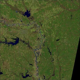
The Landsat Analysis Ready Data (ARD) consists of Top of Atmosphere (TA) reflectance, top of atmosphere Brightness Temperature (BT), Surface Reflectance (SR), Provisional Surface Temperature (ST), and Quality Assessment (QA) data.
NOTE: Landsat Collection 1 data and products are no longer available to download from the USGS as of December 30, 2022. Landsat Collection 2 remains available. Please access the Landsat Collection 2 webpage below for information about Collection 2 data and science products.
Dataset Citation
Please cite this dataset in the following manner:
Earth Resources Observation and Science (EROS) Center. (2017). Landsat Level-2 United States Analysis Ready Data, Collection 1 [dataset]. U.S. Geological Survey. https://doi.org/10.5066/F7319TSJ
NOTE: Landsat Collection 1 data and products are no longer available to download from the USGS as of December 30, 2022. The information on this webpage is for reference only.
U.S. Landsat Analysis Ready Data (ARD) are consistently processed to the highest scientific standards and level of processing required for direct use in monitoring and assessing landscape change. A fundamental goal for Landsat ARD is to significantly reduce the magnitude of data processing for application scientists, who currently have to download and prepare large amounts of Landsat scene-based data for time-series investigative analysis.
U.S. Landsat ARD consists of Top of Atmosphere (TA) reflectance, top of atmosphere Brightness Temperature (BT), Surface Reflectance (SR), Provisional Surface Temperature (ST)and Quality Assessment (QA) data that are consistently processed using per pixel solar zenith angle corrections, gridded to a common cartographic projection, and accompanied by appropriate metadata to enable further processing while retaining data provenance.
The current definition of Landsat ARD includes the products output of the Landsat Ecosystem Disturbance Adaptive Processing System (LEDAPS) Surface Reflectance Algorithm and of the Landsat Surface Reflectance Code (LaSRC).
Landsat ARD products are available for the conterminous United States (CONUS), Alaska, and Hawaii. The data are generated in the Albers Equal Area Conic (AEA) map projection for the conterminous U.S. and Hawaii. Alaska is generated to the Alaska Albers map projection. Tiles are processed directly from Level-1 AEA scenes through Level-2 products using the World Geodetic System 1984 (WGS84) datum.
Tile Grid System
Landsat ARD products are processed to a common tiling scheme of uniform dimensions bounded by static corner points in a defined grid system.
Each tile contains 5,000 x 5,000 30-meter pixels, and includes all the pixels acquired in a given day within its extents. The ARD tile pixel dimension (number of columns and rows) is smaller than the dimensions of individual Landsat acquisitions (Landsat 8: ~6300 x ~6000 pixels; Landsat 7: ~6,166 x ~5,666 pixels).
- 422 tiles cover the land mass extent of the conterminous United States (Figure 1).
- 110 tiles cover the land mass extent of Alaska (Figure 2).
- 8 tiles cover the islands of Hawaii (Figure 3).


Digital Products
Each product is available for download through EarthExplorer for the data held in the USGS archive. Download products (.tar) are
- Top of Atmosphere (TA) reflectance
- Top of atmosphere Brightness Temperature (BT)
- Surface reflectance (SR)
- Provisional Surface Temperature (ST)
- Quality assessment (QA)
- FGDC Metadata
- Top of atmosphere full-resolution browse
ARD package download products include GeoTIFF formatted images, the associated pixel quality attributes, Metadata in XML format, and full-resolution browse.
Additional Information
- U.S. Landsat Analysis Ready Data (ARD) Tiles product page
- Analysis Ready Data (ARD) Data Format Control Book (DFCB)
Access Data
Landsat Collection 1 ARD no longer available.
Data Citation History
The preferred citation for this dataset was revised in 2024 to improve accuracy and alignment with USGS Fundamental Science Practices. The dataset digital object identifier (DOI) and version did not change.
Please cite this dataset in the following manner:
Earth Resources Observation and Science (EROS) Center. (2017). Landsat Level-2 United States Analysis Ready Data, Collection 1 [dataset]. U.S. Geological Survey. https://doi.org/10.5066/F7319TSJ
The previously used citation shown below is provided here for historical reference only:
Earth Resources Observation And Science (EROS) Center. (2017). Collection-1 U.S. Landsat Analysis Ready Data (ARD) Level-2 Data Product [dataset]. U.S. Geological Survey. https://doi.org/10.5066/F7319TSJ
Below are other science projects associated with this product.

USGS EROS Archive - Landsat Archives - Landsat Level-2 Provisional Surface Temperature (ST)

USGS EROS Archive - Landsat Archives - Landsat 4-8 Collection 1 Level-2 U.S. Albers Scene Bundles

USGS EROS Archive - Landsat Archives - Landsat 4-5 TM Level-2 Data Products - Surface Reflectance

USGS EROS Archive - Landsat Archives - Landsat 7 ETM+ Level-2 Data Products - Surface Reflectance

USGS EROS Archive - Landsat Archives - Landsat 8 OLI/TIRS Level-2 Data Products - Surface Reflectance
The Landsat Analysis Ready Data (ARD) consists of Top of Atmosphere (TA) reflectance, top of atmosphere Brightness Temperature (BT), Surface Reflectance (SR), Provisional Surface Temperature (ST), and Quality Assessment (QA) data.
NOTE: Landsat Collection 1 data and products are no longer available to download from the USGS as of December 30, 2022. Landsat Collection 2 remains available. Please access the Landsat Collection 2 webpage below for information about Collection 2 data and science products.
Dataset Citation
Please cite this dataset in the following manner:
Earth Resources Observation and Science (EROS) Center. (2017). Landsat Level-2 United States Analysis Ready Data, Collection 1 [dataset]. U.S. Geological Survey. https://doi.org/10.5066/F7319TSJ
NOTE: Landsat Collection 1 data and products are no longer available to download from the USGS as of December 30, 2022. The information on this webpage is for reference only.
U.S. Landsat Analysis Ready Data (ARD) are consistently processed to the highest scientific standards and level of processing required for direct use in monitoring and assessing landscape change. A fundamental goal for Landsat ARD is to significantly reduce the magnitude of data processing for application scientists, who currently have to download and prepare large amounts of Landsat scene-based data for time-series investigative analysis.
U.S. Landsat ARD consists of Top of Atmosphere (TA) reflectance, top of atmosphere Brightness Temperature (BT), Surface Reflectance (SR), Provisional Surface Temperature (ST)and Quality Assessment (QA) data that are consistently processed using per pixel solar zenith angle corrections, gridded to a common cartographic projection, and accompanied by appropriate metadata to enable further processing while retaining data provenance.
The current definition of Landsat ARD includes the products output of the Landsat Ecosystem Disturbance Adaptive Processing System (LEDAPS) Surface Reflectance Algorithm and of the Landsat Surface Reflectance Code (LaSRC).
Landsat ARD products are available for the conterminous United States (CONUS), Alaska, and Hawaii. The data are generated in the Albers Equal Area Conic (AEA) map projection for the conterminous U.S. and Hawaii. Alaska is generated to the Alaska Albers map projection. Tiles are processed directly from Level-1 AEA scenes through Level-2 products using the World Geodetic System 1984 (WGS84) datum.
Tile Grid System
Landsat ARD products are processed to a common tiling scheme of uniform dimensions bounded by static corner points in a defined grid system.
Each tile contains 5,000 x 5,000 30-meter pixels, and includes all the pixels acquired in a given day within its extents. The ARD tile pixel dimension (number of columns and rows) is smaller than the dimensions of individual Landsat acquisitions (Landsat 8: ~6300 x ~6000 pixels; Landsat 7: ~6,166 x ~5,666 pixels).
- 422 tiles cover the land mass extent of the conterminous United States (Figure 1).
- 110 tiles cover the land mass extent of Alaska (Figure 2).
- 8 tiles cover the islands of Hawaii (Figure 3).
Digital Products
Each product is available for download through EarthExplorer for the data held in the USGS archive. Download products (.tar) are
- Top of Atmosphere (TA) reflectance
- Top of atmosphere Brightness Temperature (BT)
- Surface reflectance (SR)
- Provisional Surface Temperature (ST)
- Quality assessment (QA)
- FGDC Metadata
- Top of atmosphere full-resolution browse
ARD package download products include GeoTIFF formatted images, the associated pixel quality attributes, Metadata in XML format, and full-resolution browse.
Additional Information
- U.S. Landsat Analysis Ready Data (ARD) Tiles product page
- Analysis Ready Data (ARD) Data Format Control Book (DFCB)
Access Data
Landsat Collection 1 ARD no longer available.
Data Citation History
The preferred citation for this dataset was revised in 2024 to improve accuracy and alignment with USGS Fundamental Science Practices. The dataset digital object identifier (DOI) and version did not change.
Please cite this dataset in the following manner:
Earth Resources Observation and Science (EROS) Center. (2017). Landsat Level-2 United States Analysis Ready Data, Collection 1 [dataset]. U.S. Geological Survey. https://doi.org/10.5066/F7319TSJ
The previously used citation shown below is provided here for historical reference only:
Earth Resources Observation And Science (EROS) Center. (2017). Collection-1 U.S. Landsat Analysis Ready Data (ARD) Level-2 Data Product [dataset]. U.S. Geological Survey. https://doi.org/10.5066/F7319TSJ
Below are other science projects associated with this product.
USGS EROS Archive - Landsat Archives - Landsat Level-2 Provisional Surface Temperature (ST)
USGS EROS Archive - Landsat Archives - Landsat 4-8 Collection 1 Level-2 U.S. Albers Scene Bundles
USGS EROS Archive - Landsat Archives - Landsat 4-5 TM Level-2 Data Products - Surface Reflectance
USGS EROS Archive - Landsat Archives - Landsat 7 ETM+ Level-2 Data Products - Surface Reflectance