USGS EROS Archive - Landsat Archives - Landsat 4-8 Collection 1 Level-2 U.S. Albers Scene Bundles
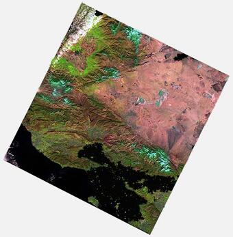
Albers Scene Bundles contain 30-meter Collection 1 Level-2 products including Top of Atmosphere (TOA) Reflectance, Surface Reflectance (SR), Top of Atmosphere Brightness Temperature (BT), Surface Temperature (ST), Dynamic Surface Water Extent (DSWE), and Quality Assessment (QA) projected to the Albers Equal Area (AEA) map projection.
NOTE: Landsat Collection 1 data and products are no longer available to download from the USGS as of December 30, 2022. Landsat Collection 2 remains available. Please access the Landsat Collection 2 webpage below for information about Collection 2 data and science products.
NOTE: Landsat Collection 1 data and products are no longer available to download from the USGS as of December 30, 2022. The information on this webpage is for reference only.

Landsat Collection 1 Level-2 Albers Scene Bundles consist of the following Collection 1 Level-2 data products processed in the Albers Equal Area (AEA) map projection and World Geodetic System 1984 (WGS84) datum: Top of Atmosphere (TOA) Reflectance, Surface Reflectance (SR), Top of Atmosphere Brightness Temperature (BT), Surface Temperature (ST), Dynamic Surface Water Extent (DSWE), and Quality Assessment (QA).
The creation of Level-2 Albers Scene Bundles begins with Landsat Collection 1 Level-1 Tier 1 data (For Landsat 8, Tier 2 data are also used). Collection 1 Level-1 data are processed into the AEA map projection, after which science algorithms (see documentation links below) are applied to create the Level-2 data product.
Collection 1 Level-2 Albers Scene Bundles are available for the conterminous United States (CONUS), Alaska, and Hawaii.
Additional Information
- Landsat 4-8 Surface Reflectance (SR) Level-2 Data Information
- Landsat 4-8 Surface Temperature (ST) Level-2 Data Information
- Landsat 4-8 Dynamic Surface Water Extent (DSWE) Level-3 Data Information
- Landsat 4-7 Surface Reflectance (SR) Product Guide
- Landsat 8 Surface Reflectance (SR) Product Guide
- Landsat Collections
Access Data
Landsat Collection 1 no longer available.
Digital Object Identifier (DOI)
Below are other science projects associated with this product.
USGS EROS Archive - Landsat Archives - U.S. Landsat Analysis Ready Data (ARD) Level-2 Data Product
Below are data or web applications associated with this product.
EarthExplorer EarthExplorer
Albers Scene Bundles contain 30-meter Collection 1 Level-2 products including Top of Atmosphere (TOA) Reflectance, Surface Reflectance (SR), Top of Atmosphere Brightness Temperature (BT), Surface Temperature (ST), Dynamic Surface Water Extent (DSWE), and Quality Assessment (QA) projected to the Albers Equal Area (AEA) map projection.
NOTE: Landsat Collection 1 data and products are no longer available to download from the USGS as of December 30, 2022. Landsat Collection 2 remains available. Please access the Landsat Collection 2 webpage below for information about Collection 2 data and science products.
NOTE: Landsat Collection 1 data and products are no longer available to download from the USGS as of December 30, 2022. The information on this webpage is for reference only.

Landsat Collection 1 Level-2 Albers Scene Bundles consist of the following Collection 1 Level-2 data products processed in the Albers Equal Area (AEA) map projection and World Geodetic System 1984 (WGS84) datum: Top of Atmosphere (TOA) Reflectance, Surface Reflectance (SR), Top of Atmosphere Brightness Temperature (BT), Surface Temperature (ST), Dynamic Surface Water Extent (DSWE), and Quality Assessment (QA).
The creation of Level-2 Albers Scene Bundles begins with Landsat Collection 1 Level-1 Tier 1 data (For Landsat 8, Tier 2 data are also used). Collection 1 Level-1 data are processed into the AEA map projection, after which science algorithms (see documentation links below) are applied to create the Level-2 data product.
Collection 1 Level-2 Albers Scene Bundles are available for the conterminous United States (CONUS), Alaska, and Hawaii.
Additional Information
- Landsat 4-8 Surface Reflectance (SR) Level-2 Data Information
- Landsat 4-8 Surface Temperature (ST) Level-2 Data Information
- Landsat 4-8 Dynamic Surface Water Extent (DSWE) Level-3 Data Information
- Landsat 4-7 Surface Reflectance (SR) Product Guide
- Landsat 8 Surface Reflectance (SR) Product Guide
- Landsat Collections
Access Data
Landsat Collection 1 no longer available.
Digital Object Identifier (DOI)
Below are other science projects associated with this product.
USGS EROS Archive - Landsat Archives - U.S. Landsat Analysis Ready Data (ARD) Level-2 Data Product
Below are data or web applications associated with this product.


