



A scientist from the Florence Bascom Geoscience Center performs field work in support of Task 2 of the Quaternary Geologic Mapping of the Glaciated Regions Project.
Images
Florence Bascom Geoscience Center images.
Filter Total Items: 155

Task 2 field work
A scientist from the Florence Bascom Geoscience Center performs field work in support of Task 2 of the Quaternary Geologic Mapping of the Glaciated Regions Project.

Byron 12D
Photograph of a boulder (glacial drop stone) in Massachusetts taken during field work for Task 1.
Photograph of a boulder (glacial drop stone) in Massachusetts taken during field work for Task 1.

US glaciated regions
Figure adapted from Soller and Reheis (2004) showing the extent of the glaciated regions in the continental United States; blue star indicates the location of active (ongoing) USGS Quaternary geologic mapping at US Army Base Fort Drum, New York.
Figure adapted from Soller and Reheis (2004) showing the extent of the glaciated regions in the continental United States; blue star indicates the location of active (ongoing) USGS Quaternary geologic mapping at US Army Base Fort Drum, New York.

FD23_UAVSP
USGS scientists Brandon Graham, Grant Colip, and Shannon Mahan collect sediment samples at US Army Base Fort Drum, New York.
USGS scientists Brandon Graham, Grant Colip, and Shannon Mahan collect sediment samples at US Army Base Fort Drum, New York.

Shannon Mahan sampling
USGS scientist Shannon Mahan records notes at a field sampling site.
USGS scientist Shannon Mahan records notes at a field sampling site.

Kusick field work
USGS Pathways intern Allison Kusick labels rotosonic sediment cores collected from a glacial lake in Jefferson County, Wisconsin.
USGS Pathways intern Allison Kusick labels rotosonic sediment cores collected from a glacial lake in Jefferson County, Wisconsin.

William E. Odom
Will Odom is a Research Geologist at the Florence Bascom Geoscience Center. Hiswork uses cosmogenic nuclide geochronology and AI-based mapping techniques to address geologic, tectonic, and geomorphologic questions.
Will Odom is a Research Geologist at the Florence Bascom Geoscience Center. Hiswork uses cosmogenic nuclide geochronology and AI-based mapping techniques to address geologic, tectonic, and geomorphologic questions.

CH-38 bedding-cleavage relations
An outcrop of greenschist-facies metamorphosed siltstone from the Roanoke Rapids terrane in southeastern Virginia.
An outcrop of greenschist-facies metamorphosed siltstone from the Roanoke Rapids terrane in southeastern Virginia.

Piedmont rocks along the Fall Zone, Virginia to Georgia
Piedmont rocks along the Fall Zone, Virginia to GeorgiaThis is a map showing the various different rock bodies of the Piedmont geologic province spanning Virginia, North and South Carolina, and Georgia.
Piedmont rocks along the Fall Zone, Virginia to Georgia
Piedmont rocks along the Fall Zone, Virginia to GeorgiaThis is a map showing the various different rock bodies of the Piedmont geologic province spanning Virginia, North and South Carolina, and Georgia.

Large pavement outcrop of granite in the Piedmont National Wildlife Refuge, Georgia
Large pavement outcrop of granite in the Piedmont National Wildlife Refuge, GeorgiaLarge pavement outcrop of granite in the Piedmont National Wildlife Refuge, Georgia. These rocks may hold valuable mineral commodities, but such pavements also host unique and rare plant ecosystems. Our work in Georgia provides critical geologic information for natural resource management.
Large pavement outcrop of granite in the Piedmont National Wildlife Refuge, Georgia
Large pavement outcrop of granite in the Piedmont National Wildlife Refuge, GeorgiaLarge pavement outcrop of granite in the Piedmont National Wildlife Refuge, Georgia. These rocks may hold valuable mineral commodities, but such pavements also host unique and rare plant ecosystems. Our work in Georgia provides critical geologic information for natural resource management.

CH-425 mineralized silicified cataclasite
Mineralized silicified cataclasite (fault rock) from the Roanoke Rapids terrane in southeastern Virginia. This rock contains abundant pyrite, as well as traces of gold, silver, and telluride minerals.
Mineralized silicified cataclasite (fault rock) from the Roanoke Rapids terrane in southeastern Virginia. This rock contains abundant pyrite, as well as traces of gold, silver, and telluride minerals.

WR-14 OSL sample site in relation to three potential paleoliquefaction dikes
WR-14 OSL sample site in relation to three potential paleoliquefaction dikesA paleoliquefaction sand dike in riverbank sediment along the Nottoway River in southeastern Virginia (the dike is the light-colored vertical feature between the shovel and the end of the sample tube). Such sand dikes may be the result of strong earthquakes. We collected sediment in the tube for optically stimulated luminescence dating (conducted by the U
WR-14 OSL sample site in relation to three potential paleoliquefaction dikes
WR-14 OSL sample site in relation to three potential paleoliquefaction dikesA paleoliquefaction sand dike in riverbank sediment along the Nottoway River in southeastern Virginia (the dike is the light-colored vertical feature between the shovel and the end of the sample tube). Such sand dikes may be the result of strong earthquakes. We collected sediment in the tube for optically stimulated luminescence dating (conducted by the U

Lab
Photo of the Laser Diffraction Lab at the Florence Bascom Geoscience Center
Photo of the Laser Diffraction Lab at the Florence Bascom Geoscience Center
Paleoclimate Research: Integrating Systems and Models (PRISM5)
Paleoclimate Research: Integrating Systems and Models (PRISM5)Logo for Paleoclimate Research: Integrating Systems and Models (PRISM5) project at Florence Bascom Geoscience Center
Paleoclimate Research: Integrating Systems and Models (PRISM5)
Paleoclimate Research: Integrating Systems and Models (PRISM5)Logo for Paleoclimate Research: Integrating Systems and Models (PRISM5) project at Florence Bascom Geoscience Center
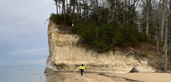
Harry at Stratford Hall cliff
Project co-lead Harry Dowsett by Miocene sediments at Stratford Hall, VA in support of the Florence Bascom Geoscience Center
Project co-lead Harry Dowsett by Miocene sediments at Stratford Hall, VA in support of the Florence Bascom Geoscience Center

Marci digging
Project co-lead Marci Robinson by Pliocene sediments near Rushmere, VA in support of the Florence Bascom Geoscience Center
Project co-lead Marci Robinson by Pliocene sediments near Rushmere, VA in support of the Florence Bascom Geoscience Center

Pickaxe and shells
Scallop shells from the Miocene and Pliocene were as big as dinner plates
Scallop shells from the Miocene and Pliocene were as big as dinner plates

Sandtown core
A sediment core being measured and described at the drill site
A sediment core being measured and described at the drill site
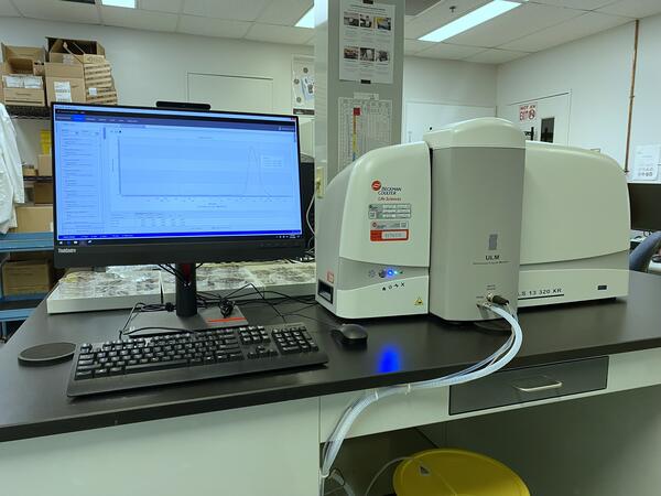
Beckman Coulter LS 13 320 XR at FBGC
Beckman Coulter LS 13 320 XR laser diffraction analyzer equipment housed in the Laser Diffraction Lab.
Beckman Coulter LS 13 320 XR laser diffraction analyzer equipment housed in the Laser Diffraction Lab.
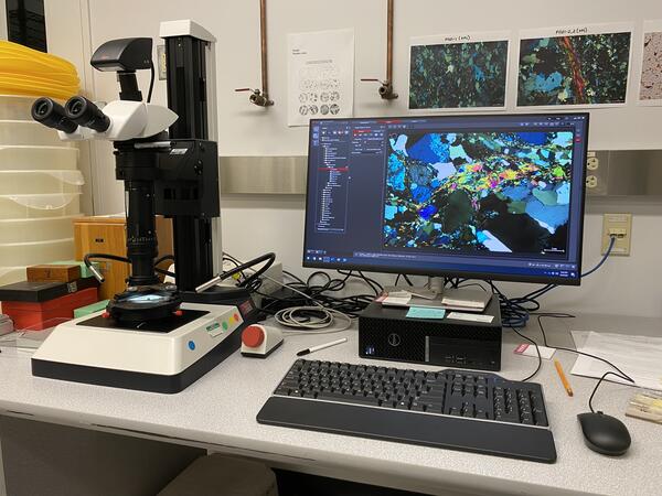
Leica Z16 APO petrographic microscope equipment housed in the Laser Diffraction Lab at FBGC
Leica Z16 APO petrographic microscope equipment housed in the Laser Diffraction Lab at FBGCA photo of the Leica Z16 APO petrographic microscope equipment housed in the Laser Diffraction Lab
Leica Z16 APO petrographic microscope equipment housed in the Laser Diffraction Lab at FBGC
Leica Z16 APO petrographic microscope equipment housed in the Laser Diffraction Lab at FBGCA photo of the Leica Z16 APO petrographic microscope equipment housed in the Laser Diffraction Lab
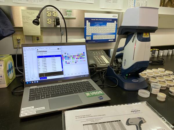
Bruker S1 Titan portable X-ray fluorescence (XRF) instrumentation housed in the Laser Diffraction Lab.
Bruker S1 Titan portable X-ray fluorescence (XRF) instrumentation housed in the Laser Diffraction Lab.A photo of the Bruker S1 Titan portable X-ray fluorescence (XRF) instrumentation housed in the Laser Diffraction Lab.
Bruker S1 Titan portable X-ray fluorescence (XRF) instrumentation housed in the Laser Diffraction Lab.
Bruker S1 Titan portable X-ray fluorescence (XRF) instrumentation housed in the Laser Diffraction Lab.A photo of the Bruker S1 Titan portable X-ray fluorescence (XRF) instrumentation housed in the Laser Diffraction Lab.