Nicholas E Powell gives a thumbs up while proudly showing off lab equipment
Nicholas E Powell gives a thumbs up while proudly showing off lab equipmentNicholas E Powell gives a thumbs up while proudly showing off lab equipment

Official websites use .gov
A .gov website belongs to an official government organization in the United States.
Secure .gov websites use HTTPS
A lock () or https:// means you’ve safely connected to the .gov website. Share sensitive information only on official, secure websites.
Florence Bascom Geoscience Center images.
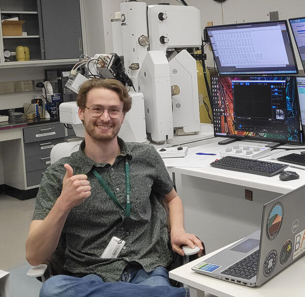
Nicholas E Powell gives a thumbs up while proudly showing off lab equipment
Nicholas E Powell gives a thumbs up while proudly showing off lab equipment
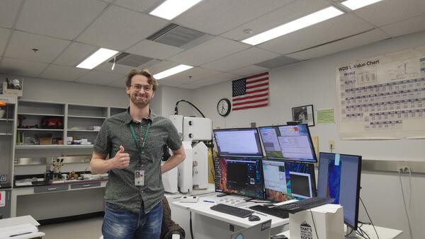
Nicholas E Powell stands in a lab in Florence Bascom Geoscience Center, showing a thumbs up, in front of lab equipment and multiple monitors
Nicholas E Powell stands in a lab in Florence Bascom Geoscience Center, showing a thumbs up, in front of lab equipment and multiple monitors
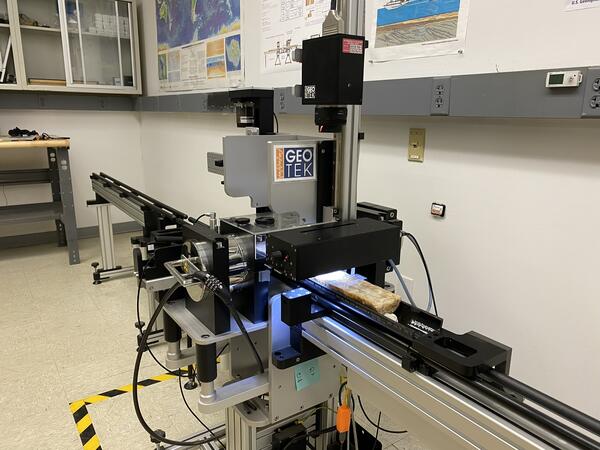
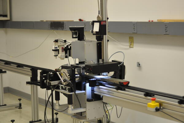
Imaging a split speleothem (stalagmite) section using the GeoScan V line-scan imaging system mounted on the GeoTek MSCL-S in the BASCORE Lab
Imaging a split speleothem (stalagmite) section using the GeoScan V line-scan imaging system mounted on the GeoTek MSCL-S in the BASCORE Lab
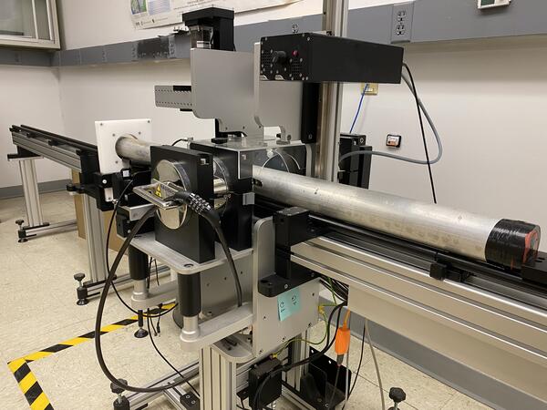
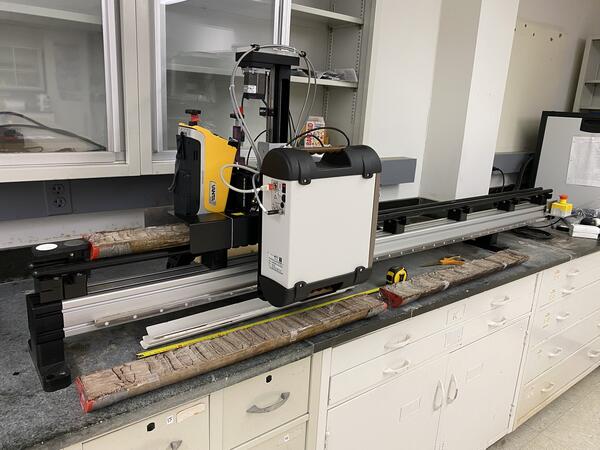
Scanning whole cores in aluminum liners on the GeoTek MSCL-S
Scanning whole cores in aluminum liners on the GeoTek MSCL-S
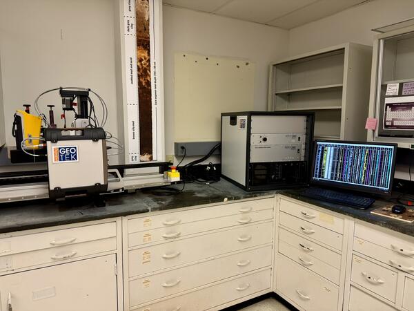
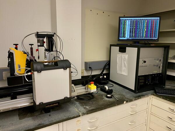
The GeoTek MSCL-XZ multi-sensor core logger (MSCL) housed in the BASCORE Lab is equipped with instrumentation for magnetic susceptibility, X-ray fluorescence (XRF), and color spectrophotometry.
The GeoTek MSCL-XZ multi-sensor core logger (MSCL) housed in the BASCORE Lab is equipped with instrumentation for magnetic susceptibility, X-ray fluorescence (XRF), and color spectrophotometry.
The GeoTek MSCL-XZ multi-sensor core logger (MSCL) housed in the BASCORE Lab is equipped with instrumentation for magnetic susceptibility, X-ray fluorescence (XRF), and color spectrophotometry.
The GeoTek MSCL-XZ multi-sensor core logger (MSCL) housed in the BASCORE Lab is equipped with instrumentation for magnetic susceptibility, X-ray fluorescence (XRF), and color spectrophotometry.
Will Odom is a Research Geologist at the Florence Bascom Geoscience Center. My work uses cosmogenic nuclide geochronology and AI-based mapping techniques to address geologic, tectonic, and geomorphologic questions.
Will Odom is a Research Geologist at the Florence Bascom Geoscience Center. My work uses cosmogenic nuclide geochronology and AI-based mapping techniques to address geologic, tectonic, and geomorphologic questions.
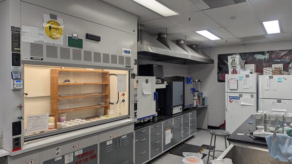
Inside view of the Peat and Sediment Processing Laboratory
Inside view of the Peat and Sediment Processing Laboratory
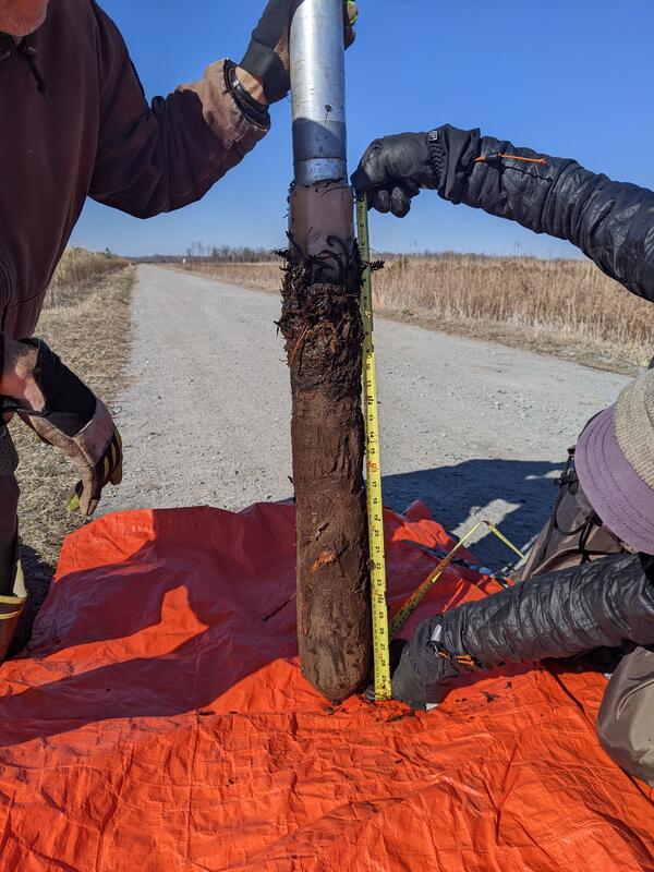
A freeze core sample extracted from wetland where fire had recently burned peat
A freeze core sample extracted from wetland where fire had recently burned peat
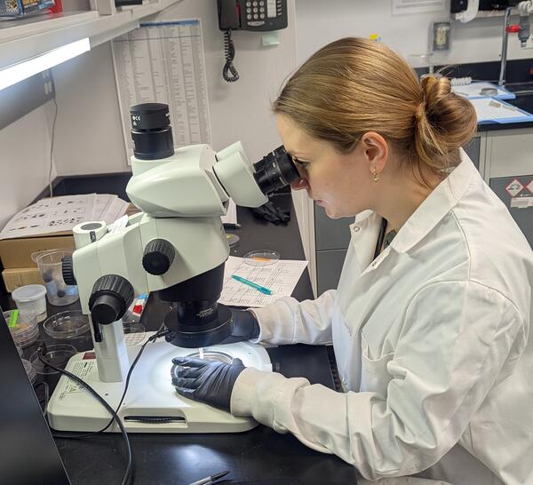
USGS Scientist Molly Huber analyzing macroscopic charcoal under a binocular microscope
USGS Scientist Molly Huber analyzing macroscopic charcoal under a binocular microscope
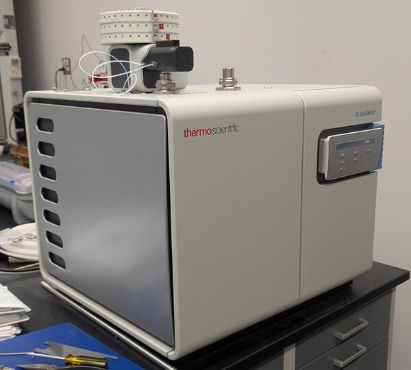
Measuring total carbon, nitrogen, and hydrogen in sediment samples
Measuring total carbon, nitrogen, and hydrogen in sediment samples
Greg Noe has been a Research Ecologist with the U.S. Geological Survey in Reston, VA, since 2002, where he leads the Wetland Ecosystem Ecology & Biogeochemistry Laboratory (WEEBL) in the Florence Bascom Geoscience Center. Dr. Noe’s research centers on wetland ecosystem ecology and watershed processes.
Greg Noe has been a Research Ecologist with the U.S. Geological Survey in Reston, VA, since 2002, where he leads the Wetland Ecosystem Ecology & Biogeochemistry Laboratory (WEEBL) in the Florence Bascom Geoscience Center. Dr. Noe’s research centers on wetland ecosystem ecology and watershed processes.
The GeoTek MSCL-XZ multi-sensor core logger (MSCL) housed in the BASCORE Lab is equipped with instrumentation for magnetic susceptibility, X-ray fluorescence (XRF), and color spectrophotometry.
The GeoTek MSCL-XZ multi-sensor core logger (MSCL) housed in the BASCORE Lab is equipped with instrumentation for magnetic susceptibility, X-ray fluorescence (XRF), and color spectrophotometry.
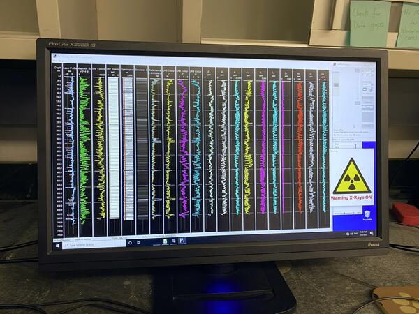
Real-time data output graphs (for a split sediment core) from the GeoTek MSCL-XZ multi-sensor core logger housed in the BASCORE Lab: laser profile (core surface height), magnetic susceptibility, X-ray fluorescence (XRF), and color spectrophotometry.
Real-time data output graphs (for a split sediment core) from the GeoTek MSCL-XZ multi-sensor core logger housed in the BASCORE Lab: laser profile (core surface height), magnetic susceptibility, X-ray fluorescence (XRF), and color spectrophotometry.
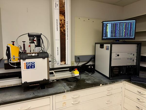
The GeoTek MSCL-XZ multi-sensor core logger housed in the BASCORE Lab, seen midway through a split-core scan. The logger contains instrumentation for magnetic susceptibility, X-ray fluorescence (XRF), and color spectrophotometry.
The GeoTek MSCL-XZ multi-sensor core logger housed in the BASCORE Lab, seen midway through a split-core scan. The logger contains instrumentation for magnetic susceptibility, X-ray fluorescence (XRF), and color spectrophotometry.
Split-core imaging with the GeoScan V line-scan imaging system on the GeoTek MSCL-S multi-sensor core logger in the BASCORE Lab.
Split-core imaging with the GeoScan V line-scan imaging system on the GeoTek MSCL-S multi-sensor core logger in the BASCORE Lab.
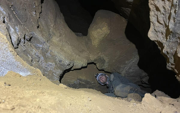
U.S. Geological Survey Geologist, Alexander Gray Alex Gray examines buried sediments at Butler Cave in Virginia.
Winter 2026 Photo Contest Winner: William Odom, Honorable Mention
U.S. Geological Survey Geologist, Alexander Gray Alex Gray examines buried sediments at Butler Cave in Virginia.
Winter 2026 Photo Contest Winner: William Odom, Honorable Mention

Scientists from the Florence Bascom Geoscience Center perform laboratory work in support of Task 3 of the Quaternary Geologic Mapping of the Glaciated Regions Project.
Scientists from the Florence Bascom Geoscience Center perform laboratory work in support of Task 3 of the Quaternary Geologic Mapping of the Glaciated Regions Project.
PRISM5 addresses how the world, and particularly the US east coast, is affected by change.
PRISM5 addresses how the world, and particularly the US east coast, is affected by change.

Nick Powell joined the Florence Bascom Geoscience Center in the fall of 2022 as a Geologist working in the Bascom 40Ar/39Ar Dating (BARD) Lab.
Nick Powell joined the Florence Bascom Geoscience Center in the fall of 2022 as a Geologist working in the Bascom 40Ar/39Ar Dating (BARD) Lab.

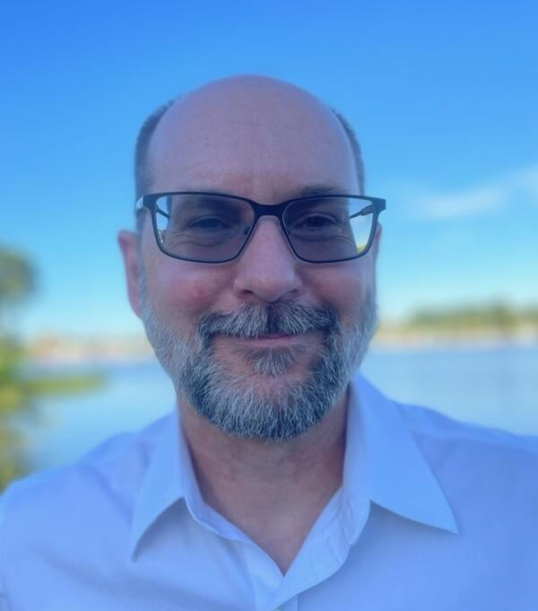
Robert Poirier is a Research Geologist at the Florence Bascom Geoscience Center of the U.S. Geological Survey.
Robert Poirier is a Research Geologist at the Florence Bascom Geoscience Center of the U.S. Geological Survey.