
Redistribution of debris-flow sediment following severe wildfire and floods in the Jemez Mountains
In this paper, USGS scientists and contractors documented locations of sediment erosion and deposition in catastrophic debris flows and floods following fire along Rito de los Frijoles in Bandelier National Monument, NM.
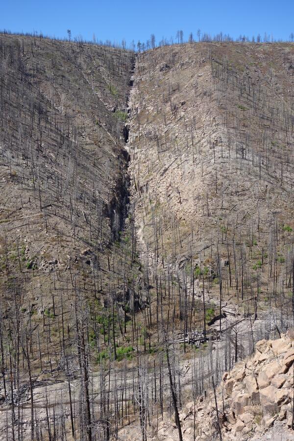
Intense fires reduce vegetation and other organic matter, resulting in higher levels of stormwater runoff and erosion, and an increased potential for runoff-initiated landslides known as debris flows. Predicting when a debris flow will occur and how it will impact rivers, however, is difficult, as numerous factors contribute to their initiation and size. In this study, researchers used topographic data from the Rito de los Frijoles Basin to test predictions of debris flow occurrence and calculate the downstream response.
They found that fire promoted debris flows and increased flood discharge by two orders of magnitude. Occurrence of debris flows was well predicted by debris-flow hazard models based on the topographic data. The riverbed rose in elevation as much as two meters at mouths of tributaries that experienced debris flows and dropped in elevation as much as two meters at mouths of tributaries that did not experience debris flows.
Publication: Friedman JM, Tillery AC, Alfieri S, Skaggs E, Shafroth PB, and Allen CD, 2024, Redistribution of debris-flow sediment following severe wildfire and floods in the Jemez Mountains, New Mexico, USA: Earth Surface Processes and Landforms, pp 1–12, https://doi.org/10.1002/esp.5964.
Data Release: Friedman, J.M., Skaggs, E., and Alfieri, S. 2024. Elevation change in the watershed of Rito de los Frijoles, Bandelier National Monument, New Mexico from 2010 to 2016: U.S. Geological Survey data release, https://doi.org/10.5066/P1RFRU9T.
Related

What is a debris flow? What is a debris flow?
Debris flows are fast-moving landslides that are particularly dangerous to life and property because they move quickly, destroy objects in their paths, and often strike without warning. They occur in a wide variety of environments throughout the world, including all 50 states and U.S. Territories. Debris flows generally occur during periods of intense rainfall or rapid snowmelt and usually start...

What should I know about wildfires and debris flows? What should I know about wildfires and debris flows?
Wildland fires are inevitable in the western United States. Expansion of human development into forested areas has created a situation where wildfires can adversely affect lives and property, as can the flooding and landslides that occur in the aftermath of the fires. There is a need to develop tools and methods to identify and quantify the potential hazards posed by landslides produced from...
Related
What is a debris flow? What is a debris flow?
Debris flows are fast-moving landslides that are particularly dangerous to life and property because they move quickly, destroy objects in their paths, and often strike without warning. They occur in a wide variety of environments throughout the world, including all 50 states and U.S. Territories. Debris flows generally occur during periods of intense rainfall or rapid snowmelt and usually start...
What should I know about wildfires and debris flows? What should I know about wildfires and debris flows?
Wildland fires are inevitable in the western United States. Expansion of human development into forested areas has created a situation where wildfires can adversely affect lives and property, as can the flooding and landslides that occur in the aftermath of the fires. There is a need to develop tools and methods to identify and quantify the potential hazards posed by landslides produced from...