
Anne C. Tillery
Anne Tillery is a desert geomorphologist serving as the Acting Deputy Director of the New Mexico Water Science Center. She supports staff in achieving the science priorities of the center and its cooperators.
Colorado Basin ASIST
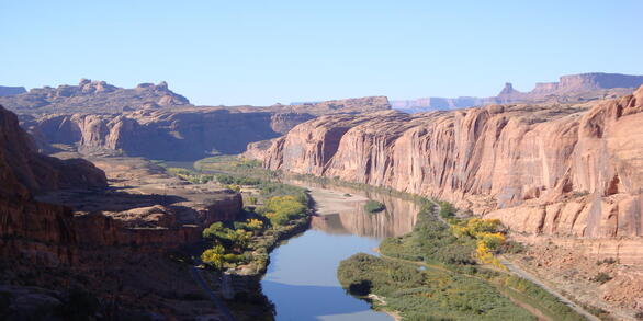
The USGS Colorado River Basin Actionable and Strategic Integrated Science and Technology (ASIST) initiative is a landscape scale project to accelerate interdisciplinary science and application of advanced technology for stakeholder-driven challenges in the Colorado River Basin.
New Mexico StreamStats
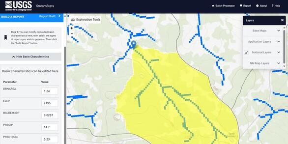
StreamStats for New Mexico was developed in cooperation with the New Mexico Department of Transportation and the U.S Forest Service.
Anne Tillery has 24 years with the Department of the Interior, starting as a Park Ranger with NPS and moving to the USGS as a student hydrologic aid while in college. She's been with the New Mexico Water Science Center since 2007, where she began as a project scientist and progressed into quality assurance and management roles. She has 20 years of experience studying surface water and geomorphic processes of the Southwest.
As a scientist, her research focused on the hydrology, hydraulics, and geomorphology of flooding in desert ephemeral channels and of debris flows following wildfires. During her 18 years with the USGS in New Mexico, she has authored dozens of publications on subjects related to desert geomorphic and hydrologic processes, including post-wildfire hazards, among other topics - some winning national awards.
As a manager, Anne has focused on building the profile of the NMWSC among partners throughout New Mexico and the Colorado River Basin. Anne strives for clear communication of science and the preservation of scientific integrity.
Science and Products

Implementing a Web-based Streamflow Statistics Tool for New Mexico (StreamStats)

Changes in Watershed Hydrologic Response Time with Post-wildfire Changes in Vegetation and Surface Fuels Along a Severely-burned, High-desert Canyon, Bandelier National Monument, NM

Prewildfire Assessments of Postwildfire Debris-Flow Hazards

Debris flows and Floods from Extreme Precipitation in September 2013, Gila National Forest, NM

Postwildfire Debris-Flow Hazards

Bandelier National Monument Postwildfire Flood Support

Floods Analysis

Analysis of the Magnitude and Frequency of Peak Discharge in the Navajo Nation and Surrounding Region, Arizona, Utah, Colorado, and New Mexico
Science and Products
Implementing a Web-based Streamflow Statistics Tool for New Mexico (StreamStats)
Changes in Watershed Hydrologic Response Time with Post-wildfire Changes in Vegetation and Surface Fuels Along a Severely-burned, High-desert Canyon, Bandelier National Monument, NM
Prewildfire Assessments of Postwildfire Debris-Flow Hazards
Debris flows and Floods from Extreme Precipitation in September 2013, Gila National Forest, NM
Postwildfire Debris-Flow Hazards
Bandelier National Monument Postwildfire Flood Support
Floods Analysis