
Hierarchical Units of Greater Sage-Grouse Populations Informing Wildlife Management
Wildlife management boundaries often lack biological context, including information on habitat resource availability and wildlife movements. To address this, we developed multiple levels of biologically relevant and hierarchically nested greater sage-grouse (Centrocercus urophasianus) population units to facilitate the management and conservation of populations and habitats.
Defining biologically relevant and hierarchically nested population units to inform wildlife management
Additional Framework Components
Explore other components of the Greater Sage-Grouse Monitoring Framework or return to the framework's homepage using the links below.
Background

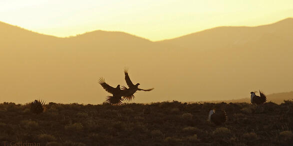
Wildlife populations are increasingly affected by local and regional landscape changes. These effects are direct (for example, habitat loss) and indirect (for example, noise, pollution, and traffic), potentially altering wildlife behavior or adaptability.
To improve wildlife management and conservation for sage-grouse, we developed methods that define hierarchically nested population units (Figure 1) based on habitat preferences and population connectivity. We worked closely with 11 western state wildlife agencies to generate population and management units that span political boundaries, enabling analyses of population-monitoring data collected at sage-grouse breeding sites (leks) across space and time.
The multi-scale approach supports the assessment of population changes at local and regional scales, thereby enabling managers to account for local and regional differences across connected populations.
Methods

We used information on potential connectivity (in other words, typical dispersal and movement distances) and functional connectivity (in other words, the willingness of individuals to move among preferred habitats) to describe the degree of subpopulation connectivity, defined as population structure (Figure 2; O'Donnell and others, 2021). Population structure was informed by proximity of neighboring leks and habitat preferences, such as elevation and sagebrush cover, and avoidance of rugged terrain, large water bodies and inundated salt flats, and tree canopy cover.
We then used these results, along with habitat conditions reflecting terrain indices (5), percent cover of shrubland vegetation communities (10), and bioclimatic variables (5), summarized at leks (distances of 30 m to 6,400 m), to inform biologically meaningful groupings of leks across the study region (O’Donnell and others, 2022). This lek aggregation requires consideration of population structure and conditions that maximize habitat similarities within population units and maximize habitat dissimilarities between population units.
Results
Based on a simulation that randomly removed leks when developing the population structure, we determined that retaining 50% of all leks still captured 75.5% of the original population structure, and retaining 10% captured 55.6%, suggesting the robustness and importance of population structure in defining hierarchical clusters (O'Donnell and others, 2022; refer to Figure 6 in the publication).
We developed 13 hierarchically nested sage-grouse cluster levels (Figure 3), each level representing a collection of subpopulations. The smallest population units (cluster level two) capture more than 92% of individual movements, where each individual is assigned to a single population. The evaluation of movements suggests that aggregating population demographic data at cluster level two best captured geographically closed population units and may increase the precision of sage-grouse population models that inform wildlife management.

Research implications
Our analysis of population structure identifies the relative importance of local populations and the areas to avoid landscape disturbances that may negatively affect population connectivity. Understanding wildlife population structure and connectivity can help managers identify conservation strategies, as population structure facilitates the study of population changes, and habitat connectivity provides information on dispersal and biodiversity.
The hierarchical population units support investigations of factors affecting population demographics across multiple scales while reducing the constraints imposed by artificially defined jurisdictional boundaries. Therefore, these products will greatly assist state and federal agencies in making informed, targeted, and cost-effective decisions within an adaptive management framework, allowing managers to make more real-time management decisions using population data.
Funders
U.S. Geological Survey (Ecosystem Mission Area, Status and Trends Program, Wyoming Landscape Conservation Initiative) and Bureau of Land Management.
Partners
State Wildlife Agencies (California Department of Fish and Wildlife; Colorado Parks and Wildlife; Idaho Department of Fish and Game; Montana Fish, Wildlife & Parks; Nevada Department of Wildlife; North Dakota Game and Fish Department; Oregon Department of Fish and Wildlife; South Dakota Department of Game, Fish and Parks; Utah Division of Wildlife Resources; Wyoming Game and Fish Department; Washington Department of Fish and Wildlife), Colorado State University, BLM, US Fish and Wildlife Service, US Forest Service, researchers who provided field data to evaluate results.
Wildlife management boundaries often lack biological context, including information on habitat resource availability and wildlife movements. To address this, we developed multiple levels of biologically relevant and hierarchically nested greater sage-grouse (Centrocercus urophasianus) population units to facilitate the management and conservation of populations and habitats.
Defining biologically relevant and hierarchically nested population units to inform wildlife management
Additional Framework Components
Explore other components of the Greater Sage-Grouse Monitoring Framework or return to the framework's homepage using the links below.
Background
Wildlife populations are increasingly affected by local and regional landscape changes. These effects are direct (for example, habitat loss) and indirect (for example, noise, pollution, and traffic), potentially altering wildlife behavior or adaptability.
To improve wildlife management and conservation for sage-grouse, we developed methods that define hierarchically nested population units (Figure 1) based on habitat preferences and population connectivity. We worked closely with 11 western state wildlife agencies to generate population and management units that span political boundaries, enabling analyses of population-monitoring data collected at sage-grouse breeding sites (leks) across space and time.
The multi-scale approach supports the assessment of population changes at local and regional scales, thereby enabling managers to account for local and regional differences across connected populations.
Methods
We used information on potential connectivity (in other words, typical dispersal and movement distances) and functional connectivity (in other words, the willingness of individuals to move among preferred habitats) to describe the degree of subpopulation connectivity, defined as population structure (Figure 2; O'Donnell and others, 2021). Population structure was informed by proximity of neighboring leks and habitat preferences, such as elevation and sagebrush cover, and avoidance of rugged terrain, large water bodies and inundated salt flats, and tree canopy cover.
We then used these results, along with habitat conditions reflecting terrain indices (5), percent cover of shrubland vegetation communities (10), and bioclimatic variables (5), summarized at leks (distances of 30 m to 6,400 m), to inform biologically meaningful groupings of leks across the study region (O’Donnell and others, 2022). This lek aggregation requires consideration of population structure and conditions that maximize habitat similarities within population units and maximize habitat dissimilarities between population units.
Results
Based on a simulation that randomly removed leks when developing the population structure, we determined that retaining 50% of all leks still captured 75.5% of the original population structure, and retaining 10% captured 55.6%, suggesting the robustness and importance of population structure in defining hierarchical clusters (O'Donnell and others, 2022; refer to Figure 6 in the publication).
We developed 13 hierarchically nested sage-grouse cluster levels (Figure 3), each level representing a collection of subpopulations. The smallest population units (cluster level two) capture more than 92% of individual movements, where each individual is assigned to a single population. The evaluation of movements suggests that aggregating population demographic data at cluster level two best captured geographically closed population units and may increase the precision of sage-grouse population models that inform wildlife management.
Research implications
Our analysis of population structure identifies the relative importance of local populations and the areas to avoid landscape disturbances that may negatively affect population connectivity. Understanding wildlife population structure and connectivity can help managers identify conservation strategies, as population structure facilitates the study of population changes, and habitat connectivity provides information on dispersal and biodiversity.
The hierarchical population units support investigations of factors affecting population demographics across multiple scales while reducing the constraints imposed by artificially defined jurisdictional boundaries. Therefore, these products will greatly assist state and federal agencies in making informed, targeted, and cost-effective decisions within an adaptive management framework, allowing managers to make more real-time management decisions using population data.
Funders
U.S. Geological Survey (Ecosystem Mission Area, Status and Trends Program, Wyoming Landscape Conservation Initiative) and Bureau of Land Management.
Partners
State Wildlife Agencies (California Department of Fish and Wildlife; Colorado Parks and Wildlife; Idaho Department of Fish and Game; Montana Fish, Wildlife & Parks; Nevada Department of Wildlife; North Dakota Game and Fish Department; Oregon Department of Fish and Wildlife; South Dakota Department of Game, Fish and Parks; Utah Division of Wildlife Resources; Wyoming Game and Fish Department; Washington Department of Fish and Wildlife), Colorado State University, BLM, US Fish and Wildlife Service, US Forest Service, researchers who provided field data to evaluate results.